This guide compares all seven east‑side entrance passes into Kings Canyon National Park, helping you choose the best route to the JMT based on distance, difficulty, permits, and trail conditions. It’s based on first‑hand experience on multiple Kings Canyon approaches, combined with detailed analysis of trail data, elevation profiles, and permit patterns.

Video overview: A visual comparison of all seven east‑side entrance passes into Kings Canyon — Kearsarge, Bishop, Lamarck Col, Piute, Baxter, Sawmill, and Taboose — including access to Rae Lakes, the JMT, and Evolution Basin.
Eastern Sierra Gateways Into Kings Canyon National Park
Though they are administered together by the National Park Service, Kings Canyon and Sequoia are two separate national parks. Other than access from Bubbs Creek via the Kings Canyon Scenic Byway in the west, most backcountry trips into Kings Canyon NP require an eastern approach over a high alpine pass before hikers can continue deeper into the park. Some of these passes are so substantial that they can take 1.5–2 days of hiking just to reach the park boundary.
How Pass Choice Affects Trip Length
Current NPS guidance strongly recommends that all campers carry all food, garbage, and toiletries in an approved bear‑resistant canister. These canisters are heavy, have limited capacity, and often become one of the biggest constraints when planning trip length. If your canister holds 6–10 days of food, but you spend 2–4 of those days simply getting into and out of Kings Canyon National Park, you’re left with far less time in the areas you actually want to explore — which makes your choice of entrance pass hugely important. Even on longer trips, resupplying usually requires exiting over a high Sierra pass before re‑entering the park.
Because of this, the choice of entrance pass matters — trailhead elevation, pass elevation, total gain, distance to the JMT or Kings Canyon boundary, trail difficulty, and permit competitiveness can be just as important as direct access to iconic destinations like Evolution Basin, Rae Lakes, or the southern routes toward Sequoia NP and Mount Whitney.
Entrance Passes Into Kings Canyon NP
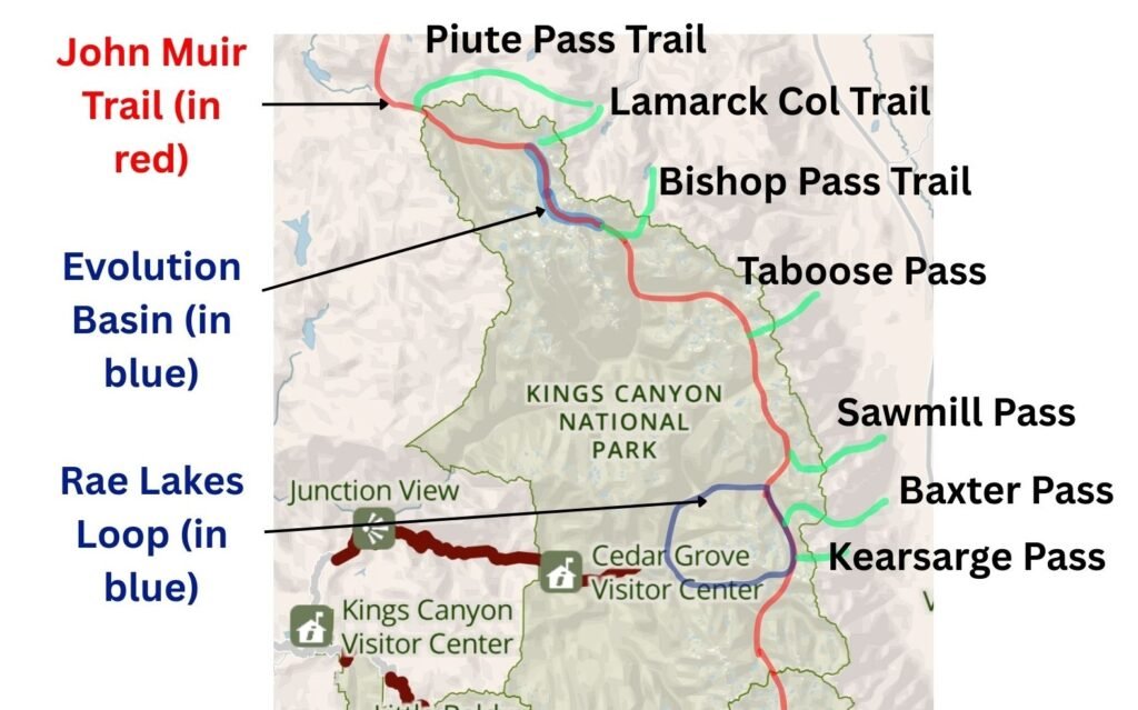
To access Kings Canyon NP directly from the east, hikers have a choice of six passes, from Kearsarge Pass in the south to Lamarck Col in the north. Piute Pass doesn’t enter Kings Canyon directly, but with 16.5 miles of hiking and just 2,450 feet of elevation gain, hikers can reach the John Muir Trail and the northern park boundary from the trailhead.
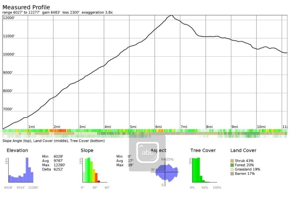
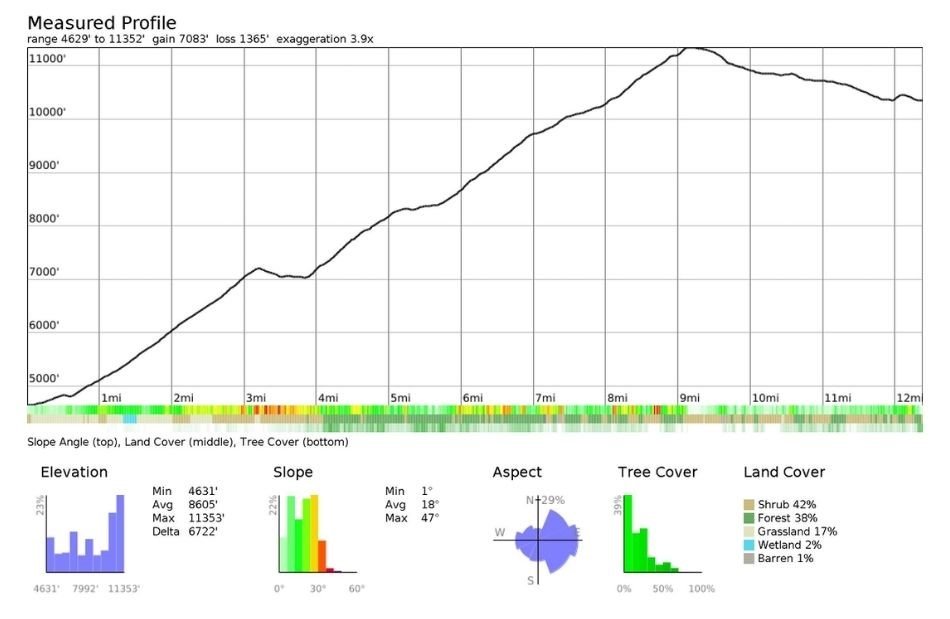
Although Piute Pass is farther from the Kings Canyon boundary than the other entrances, Baxter Pass, Sawmill Pass, and Taboose Pass all require a far more strenuous 6,000+ feet of elevation gain, making Piute Pass an attractive alternative at just 2,431 feet. Unsurprisingly, those three steeper passes are less popular and therefore have less competitive permits, which in turn increases competition for the remaining four.
Of the main passes into Kings Canyon NP, I’ve hiked three — Kearsarge Pass, Lamarck Col, and Piute Pass — and each offers a very different experience. I hope this guide helps you choose the right entrance for your trip.
Map of Eastern Sierra Passes Into Kings Canyon National Park and the JMT
Permit Competitiveness
How Permit Quotas Work for Kings Canyon
Permits for Kings Canyon entry points are available on Recreation.gov under Inyo National Forest – Wilderness Permits. From mid‑June onward, permits become extremely competitive as snow begins to melt from the high passes and hiking becomes more viable.
Bishop Pass and Kearsarge Pass Permit Demand
For Bishop Pass and Kearsarge Pass, summer permits often sell out immediately when released (60% of the quota is released six months in advance). You can still day‑hike these trails without a permit, but overnight trips require early planning or a willingness to choose a different entrance.
Early‑Release vs. Two‑Week Permits
The remaining passes — plus Piute Pass — stay available for longer, though many dates still fill as summer approaches. The final 40% of permits are released two weeks in advance, but in peak season they also disappear quickly. While two weeks’ notice works for some hikers, many need more time to arrange travel and time off, so you may need to choose trips with more predictable availability.
Real‑World Example: Securing Last‑Minute Permits
On my North Lake – Piute Pass – Lamarck Col Loop (via the JMT), I managed to secure summer permits for Piute Pass just 24 hours in advance after a last‑minute change of plans — though my first‑choice pass, Bishop Pass, was unavailable on such short notice.
Access to Popular Backpacking Destinations
Permit competitiveness is also shaped by where each pass leads. The more popular the destination, the more competitive the permit.
Kearsarge Pass connects to:
- Rae Lakes Loop
- JMT/PCT corridor
- Mount Whitney, 36 miles from the trailhead
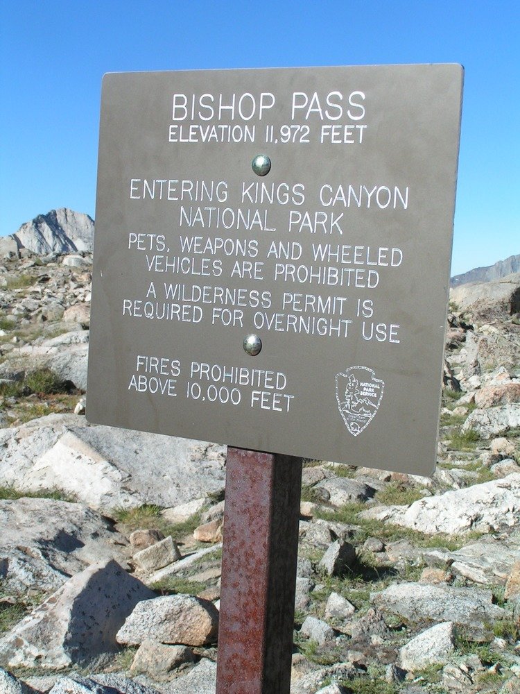
Bishop Pass connects to:
- Evolution Basin (via the JMT)
- North Lake–South Lake Loop
Baxter and Sawmill Passes
Both can reach Rae Lakes Loop, but with far more elevation gain than Kearsarge. Sawmill requires the most hiking to reach the loop.
Taboose Pass
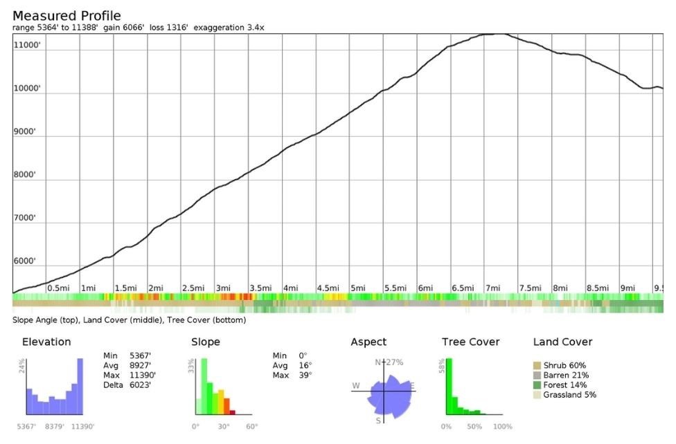
Doesn’t connect directly to a marquee destination, but it does join the JMT.
Piute Pass connects to:
- North–South Lake Loop (via the JMT)
- Humphreys Basin and Desolation Lake
- Piute Canyon
For a full breakdown of this approach, see my part 1 of my North Lake – Piute Pass – Lamarck Col Loop (via JMT) trip report.
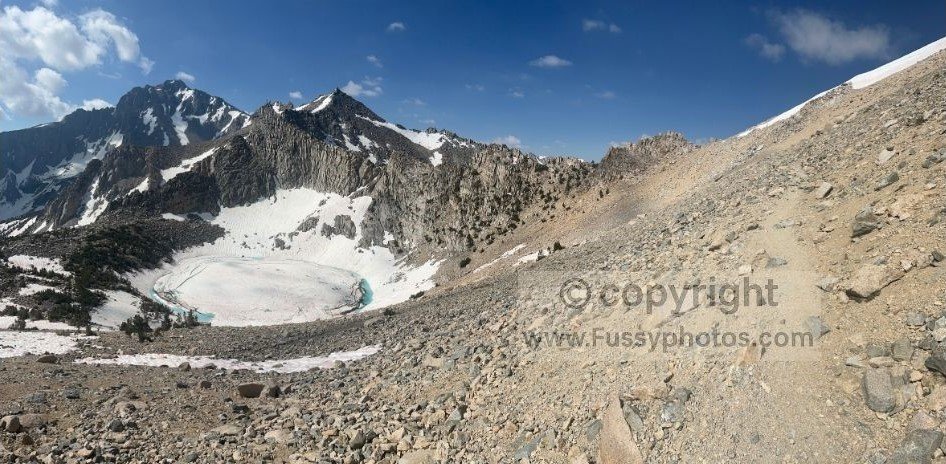
Lamarck Col connects to:
- Darwin Bench
- Darwin Canyon
- Evolution Basin and the JMT
If you want to see this terrain in the opposite direction — hiking west to east and climbing out of Kings Canyon over Lamarck Col — Part 3 of my North Lake – Piute Pass – Lamarck Col Loop (via JMT) trip report covers the full ascent from Evolution Basin through Darwin Canyon and Darwin Bench.
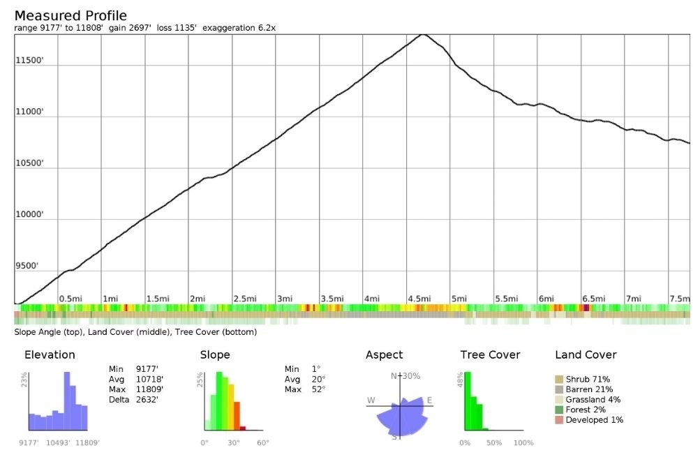
Difficulty and Trail Conditions
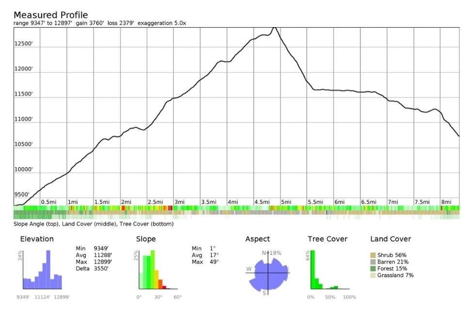
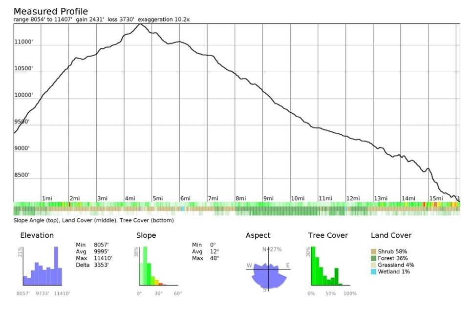
The elevation profiles below show each pass from trailhead to the JMT. Keep in mind that your destination may require leaving the trail before reaching the JMT. Source: Elevation profiles generated using Caltopo.
Elevation Profiles for Kings Canyon Entrance Passes to the JMT
Comparing the Seven Kings Canyon Entrance Passes
- Piute Pass is the farthest from the JMT at 16 miles, followed by Bishop Pass and Sawmill Pass.
- Kearsarge Pass is the shortest distance, closely followed by Lamarck Col.
- Piute Pass, Lamarck Col, and Bishop Pass have the gentlest gradients.
- Lamarck Col requires Class 2–3 scrambling on the west side, with no true trail.
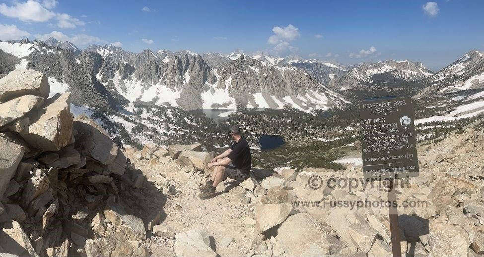
- Kearsarge Pass has the highest percentage of steep trail (>30°), but it’s well‑graded with excellent switchbacks. If you want to see what the approach actually looks like, my Kearsarge Pass trip report includes photos, timing notes, and a full breakdown of the climb.
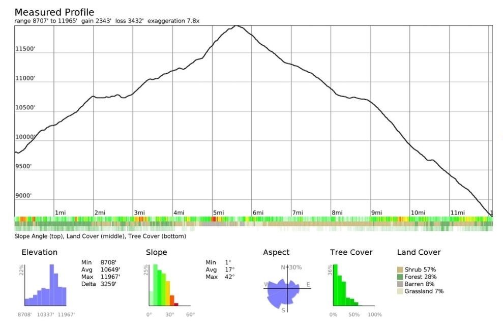
- Bishop, Piute, and Kearsarge have the least elevation gain (2,300–2,700 ft), which helps explain their popularity.
- Taboose, Sawmill, and Baxter all gain 6,000+ feet, making them extremely tough east‑to‑west entrances.
- Lamarck Col, Bishop Pass, and Kearsarge Pass trailheads all start above 8,700 feet, so hikers should consider altitude acclimatization, ideally by camping near the trailhead the night before.
Scenery Comparison
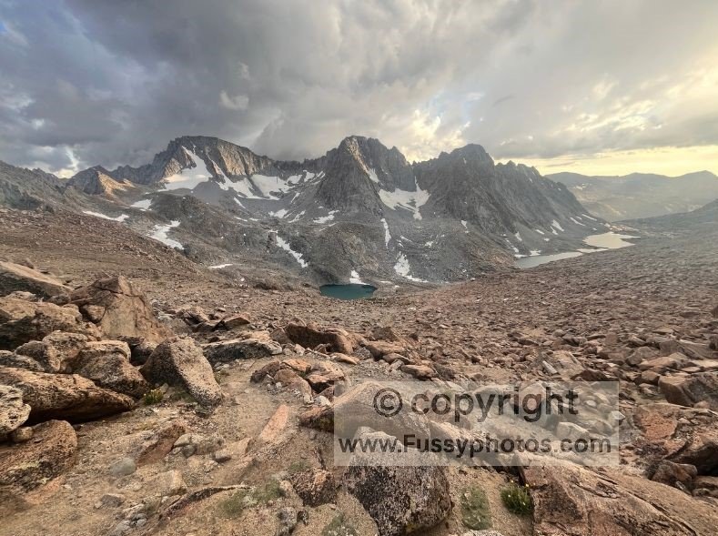
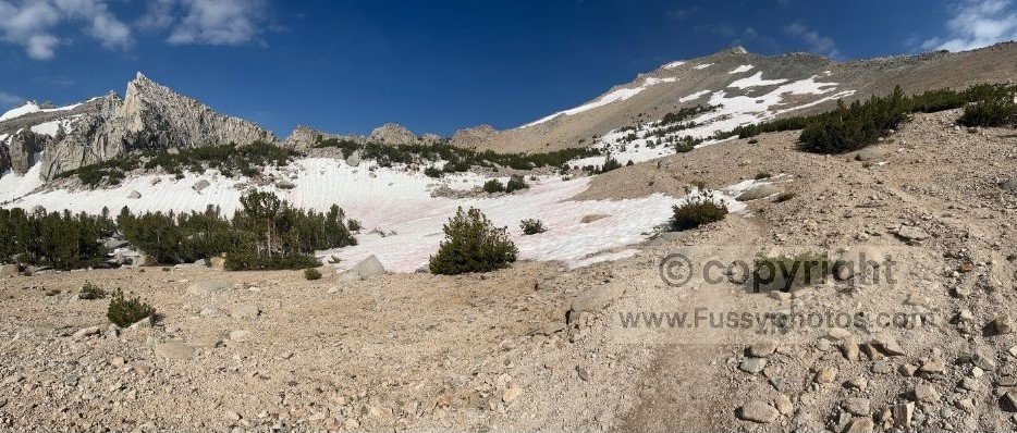
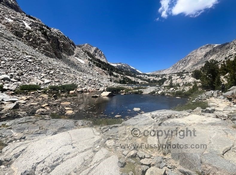
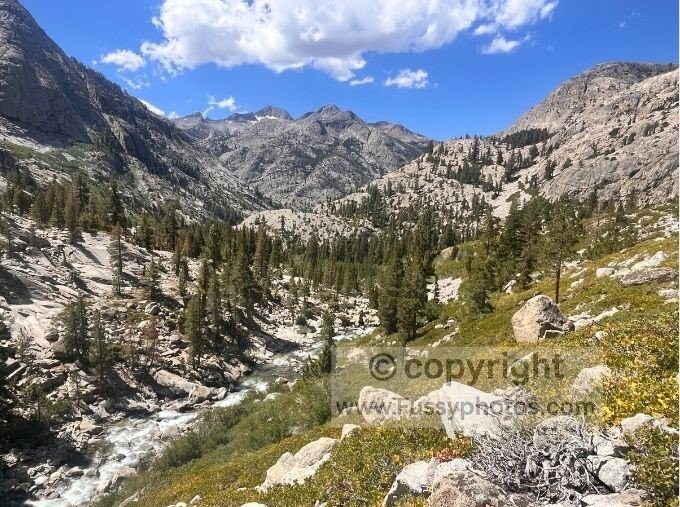
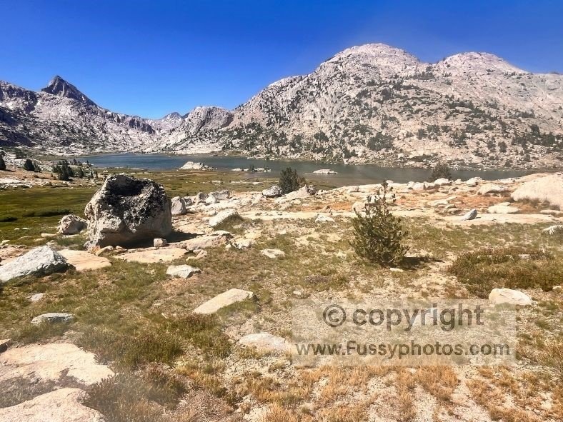
Beauty is subjective, but of the three passes I’ve hiked, Kearsarge Pass was my favorite. The trail passes four alpine lakes before a stunning descent into Kings Canyon. Piute Pass felt less dramatic, though Loch Leven made a perfect lunch stop. Lamarck Lakes looked worthy of a dedicated weekend trip, and Darwin Canyon was spectacular in a stark, high‑alpine way.
I haven’t hiked the remaining passes, so it wouldn’t be fair to judge their scenery directly. That said, photos and trip reports for each High Sierra pass are widely available online and give a reliable impression of the landscapes you’ll encounter.
Comparison Table: Eastern Sierra Passes Into Kings Canyon
| Pass name | Trailhead elevation (ft) | Pass elevation (ft) | Elevation gain (ft) | Distance to Kings Canyon boundary (miles) | Trail difficulty | How competitive are permits? | Access to major destinations |
| Kearsarge | 9177 | 11808 | 2697 | 4.5 | Moderate | V. Competitive | Rae Lakes |
| Baxter | 6027 | 12277 | 6483 | 6.5 | Hard | Usually Fine | Rae Lakes Loop but requires multi‑day access |
| Sawmill | 4629 | 11352 | 7083 | 9 | Hard | Usually Fine | Rae Lakes Loop but requires multi‑day access |
| Taboose | 5364 | 11388 | 6066 | 7 | Hard | Usually Fine | None |
| Bishop | 8707 | 11965 | 2343 | 5.5 | Moderate | V. Competitive | North Lake South Lake Loop Evolution Basin |
| Lamarck Col | 9347 | 12897 | 3760 | 4.5 | Hard | Usually Fine | North–South Lake Loop Evolution Basin |
| Piute | 8054 | 11407 | 2431 | 4.5 | Moderate | Plan Ahead | North–South Lake Loop Humphreys Basin |
Which Pass Should You Choose?
Choosing the right entrance into Kings Canyon National Park depends on how far you want to hike, how much elevation you’re willing to climb, and how many days of food your bear‑resistant canister can realistically hold. The shorter, more accessible passes — Kearsarge Pass, Bishop Pass, Lamarck Col, and Piute Pass — offer faster access to the JMT, Rae Lakes Loop, Evolution Basin, and the wider High Sierra, but they also have the most competitive permits. The steeper, less popular eastern approaches — Baxter Pass, Sawmill Pass, and Taboose Pass — demand over 6,000 feet of climbing but reward you with far easier permit availability.
If you want quick access to major destinations, Kearsarge Pass and Bishop Pass are the most efficient. For a quieter but still manageable approach, Piute Pass and Lamarck Col offer gentler gradients (though Lamarck Col requires Class 2–3 scrambling on the west side). If you’re comfortable with big elevation days and want to avoid permit pressure entirely, Baxter, Sawmill, and Taboose remain reliable options.
Ultimately, the best pass is the one that balances your fitness, your food capacity, your acclimatization needs, and how much time you want to spend in the heart of Kings Canyon rather than just getting there.
Best-for Flowchart
Do you want the fastest access into the heart of Kings Canyon National Park? → Choose Kearsarge Pass (shortest approach, excellent trail, very competitive permits)
Do you want quick access to Evolution Basin or the North Lake–South Lake Loop? → Choose Bishop Pass (well‑graded, popular, competitive permits)
Do you want a quieter but still moderate approach with gentle gradients? → Choose Piute Pass (longer distance, low elevation gain, easier permits)
Do you want a high‑alpine, dramatic route and don’t mind Class 2–3 scrambling? → Choose Lamarck Col (fast access to Darwin Bench, Darwin Canyon, and Evolution Basin)
Do you want to avoid permit competition entirely and don’t mind a huge climb? → Choose Baxter Pass, Sawmill Pass, or Taboose Pass (all gain 6,000+ feet, far less popular)
Do you want the easiest logistics for a last‑minute trip? → Choose Piute Pass, Baxter Pass, Sawmill Pass, or Taboose Pass (permits usually available)
Do you have limited food capacity in your bear canister and want to maximise time inside the park? → Choose Kearsarge Pass, Bishop Pass, or Lamarck Col (shorter approaches mean more days in the backcountry)
Frequently Asked Questions About Kings Canyon Entrance Passes
Do I need a permit to hike into Kings Canyon National Park?
Yes. All overnight trips entering Kings Canyon National Park from the east require a wilderness permit issued through Inyo National Forest on Recreation.gov. . Day hikes do not require a permit.
Which entrance passes into Kings Canyon are the easiest?
The easiest approaches are Kearsarge Pass, Bishop Pass, Piute Pass, and Lamarck Col. They have the lowest elevation gain (2,300–2,700 ft) and the shortest or most moderate approaches to the JMT.
Which passes have the steepest climbs?
Baxter Pass, Sawmill Pass, and Taboose Pass each gain over 6,000 feet from trailhead to crest, making them the most strenuous east‑to‑west entrances into Kings Canyon.
Which passes have the most competitive permits?
Kearsarge Pass and Bishop Pass are the most competitive, with many dates selling out immediately when the 60% early‑release quota opens six months in advance. Lamarck Col and Piute Pass are also popular but generally easier to secure.
How far is each pass from the JMT?
Kearsarge Pass and Lamarck Col offer the shortest approaches to the JMT. Piute Pass is the farthest at roughly 16 miles, with Bishop Pass and Sawmill Pass falling in between.
Which pass should I choose if I want the fastest access to major destinations?
For quick access to Rae Lakes, Evolution Basin, or the JMT, choose Kearsarge Pass, Bishop Pass, or Lamarck Col.
Which passes are best for last‑minute permits?
If you need flexibility, Piute Pass, Baxter Pass, Sawmill Pass, and Taboose Pass typically have better availability, including within the two‑week 40% quota release.
Is Lamarck Col a maintained trail?
Not fully. The east side is a normal trail, but the west side requires Class 2–3 scrambling with no constructed path.
How does my bear‑canister capacity affect which pass I should choose?
If your canister holds only 6–10 days of food, shorter approaches like Kearsarge Pass, Bishop Pass, and Lamarck Col maximise the number of days you can spend inside Kings Canyon rather than just hiking to reach it.