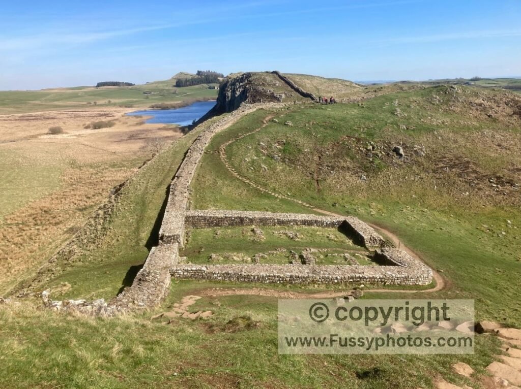
The Pennine Way is the oldest National Trail in the UK, a 268‑mile rollercoaster of some of the country’s most dramatic scenery. It winds through three national parks—the Peak District, the Yorkshire Dales and Northumberland National Park—and passes several of England’s most iconic landscapes, including Edale Valley, Malham Cove, Pen‑y‑ghent, High Force Waterfall, the upper course of the River Tees and Hadrian’s Wall.
Long-distance hiking is one of the best ways to get to know both your country and yourself. The Pennine Way is a challenging trail, often taking you up and over remote moorland, demanding fitness, resilience and solid route-finding skills.
Parts of the trail are inaccessible without careful planning, and unless you have the time and stamina to attempt the full walk in one go, logistics can be tricky. Full disclosure: I didn’t complete it in a single push. Instead, I tackled the entire length in five multi-day stages with a friend.
This approach brought its own challenges—we didn’t want to miss a single mile, so we had to plan carefully around public transport, seasonal accommodation, taxis and amenities.
If you’re planning the route in stages, my Pennine Way Train Access Guide shows every practical rail link from Edale to Kirk Yetholm.
Pennine Way: Britain’s Everest of Endurance
The National Trails website presents the Pennine Way as a 16‑day hike, with more elevation gain than climbing from sea level to the summit of Mount Everest. Attempted as a continuous journey from Edale to the Scottish Borders, it’s a serious test of endurance. We managed it in 15 days, but with the benefit of weeks of rest in between sections, walking across the seasons and around work and family commitments.
Rather than repeat the official route descriptions (you’d only get lost following mine!), I’ll share my own story, a few logistical tips, and just enough trail humour to keep the blisters bearable.
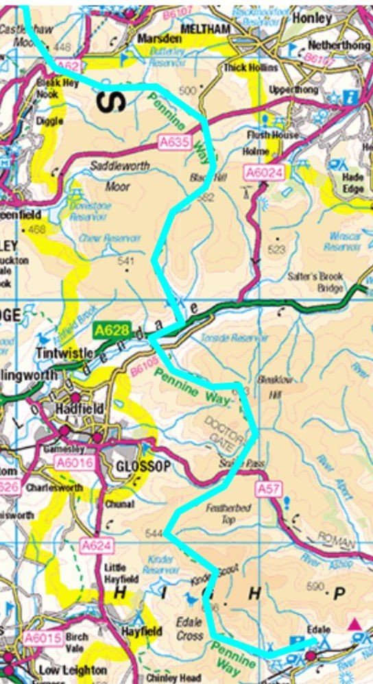
Day 1: Edale to Crowden (16 miles) — Baptism by Bog, Taxi by Evening
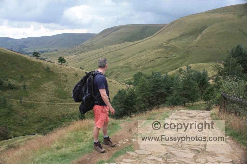
This was possibly my first ever long-distance walk. I’d done plenty of day hikes, but never more than a couple of hours at a time, and never with a multi-day backpack. With all the ups and downs, it probably wasn’t the easiest introduction, but my friend and I were eager to trade maps for mud and see what Britain really looked like beyond the car park.
My gear was far from ideal: worn three-season boots, a heavy, bulky pack with poor weight distribution, and little idea of what lay ahead. In hindsight, I was essentially dressed for a short stroll to the corner shop — if the corner shop were 20 miles away and halfway up a mountain.
The first challenge was Jacob’s Ladder, a steep stone staircase climbing over 100 metres in just a third of a mile. From there, the trail continued upwards to a junction at 533 metres, one of my favourite spots in the Peak District, with multiple options for day walks.
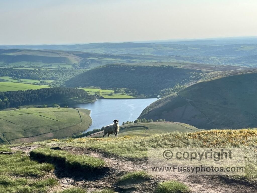
The climb carried on past rocky outcrops to the plateau near Kinder Scout (633 metres). The views westward blew me away—Kinder Reservoir framed by steep rock, with Manchester visible in the distance.
The stretch to Kinder Downfall felt endless, two miles of rocky hopping across slabs that were tough on the feet but preferable to bog-hopping. A short burst of rain reminded us how exposed the trail can be.
Detour into History: The B‑29 Crash Site
Beyond Snake Pass (A57), we detoured to the site of a B‑29 bomber crash, where wreckage still lies scattered across the moor. From there, the trail rolled on over Bleaklow, before a marvellous descent along Clough Edge with views of Torside Reservoir.
By this point, our legs had cramped badly under the weight of our packs and our lack of appropriate training. Limping into the road, we gave in and called a taxi to Glossop, trading the perfectly viable Crowden Camping and Caravanning Club Site for the comforts of a pub meal, hot shower and soft bed — because nothing says “hardy long-distance walker” quite like bailing out on Day One and ordering sticky toffee pudding with your boots off.
Day 2: Crowden to Marsden (11 miles) — Gritstone Glory and the Great Accommodation Mystery
This section remains one of my favourites on the Pennine Way. If you want to experience the most dramatic part of this stage as a standalone day walk, my Crowden–Black Hill circular route follows this same stretch before looping back via alternative paths. The trail makes no attempt to follow contours or minimise elevation gain—if anything, it often does the opposite—but here, the climbs are worth it.
The day began with a steep two‑mile ascent to Laddow Rocks, our calves still sore from the previous day. In wet weather, this climb can feel like an ice rink, with water flowing over the rocks, so good boots are essential. In late August, though, the cliffs were framed by blooming heather, a striking contrast to the Dark Peak’s more sinister appearance.
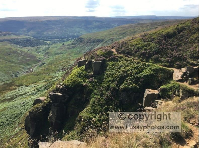
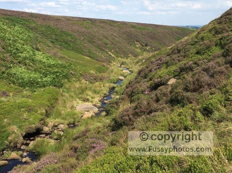
The ridge walk offered superb views before the trail dropped alongside Crowden Great Brook, a classic upland river valley with interlocking spurs and rapids. From there, the slabs led us up to Black Hill, the highest point of the day. Flat and unremarkable at the top, it’s notorious for bogs—I’ve never crossed it without having to detour around the trail to avoid sinking into at least three inches of water, even in summer. It’s the kind of terrain that makes you wonder if your boots were designed for hiking or for slowly marinating your feet.
Reservoir Views and Moorland Sunsets
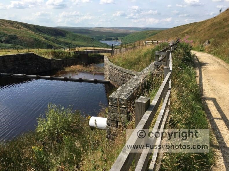
The descent to Wessenden Head was more rewarding, with views over reservoirs and moorland. The trail then undulated past Wessenden Reservoir and along exposed moorland near Black Moss Reservoir, where the wind can be brutal. On a good day, though, the sunsets here are unforgettable.
If you’d like to explore this northern stretch of Day 2 as a standalone day outing, my Pennine Way Day 2: Standedge circular walk covers the Wessenden Head–Standedge section as a dedicated day walk.
We took a train to Huddersfield for accommodation—not my booking, as I wasn’t to be trusted with trail logistics at this stage of my travels. It’s fair to say you’re not exactly blessed with options here, with traditionalists suggesting the day should end at Standedge, where there’s neither campsite nor B&B. Theoretically, your best bet would be to wild camp, but as that isn’t permitted in England, you’re more likely to arrange a taxi or bus, or even walk on to Diggle, depending on what you can find online — or simply lie down in protest and hope someone builds a Premier Inn around you.
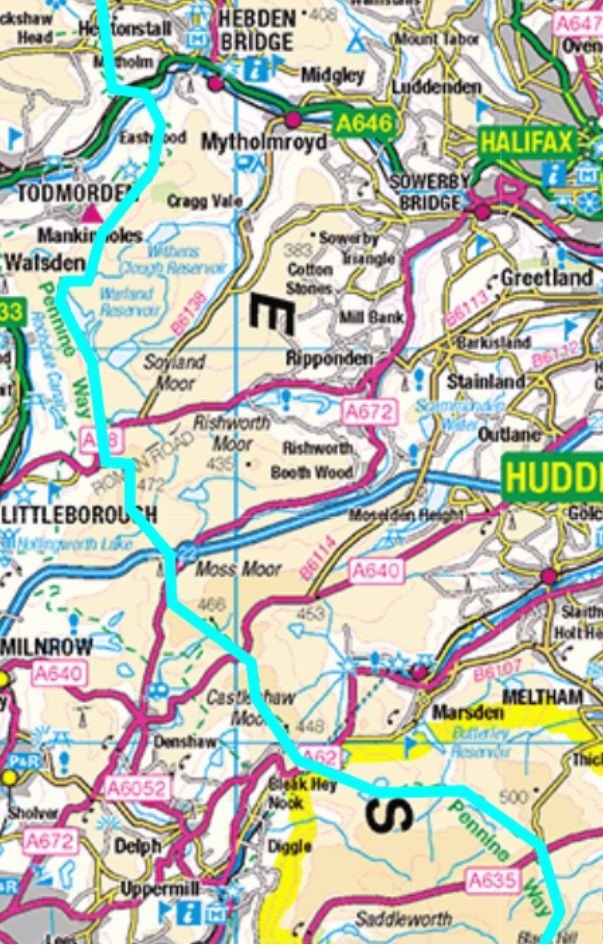
Day 3: Marsden to Hebden Bridge — Motorways, Moors and the Pike That Breaks the Monotony
This stage is less celebrated, and even the official descriptions don’t oversell it. Leaving the Peak District behind, the trail crosses moors and several roads — the sort of terrain that makes you wonder if the guidebook author simply ran out of adjectives.
The highlight is the narrow footbridge over the M62, built after the motorway to preserve the Pennine Way’s route. It’s a surreal moment: one minute you’re immersed in moorland solitude, the next you’re gliding above six lanes of traffic, wondering if you should be charging tolls to fund your next pair of boots. If you’d prefer the best of this section without the long, repetitive miles, my guide to the Blackstone Edge circular shows exactly how to turn this into a far more rewarding Day 3. Beyond this, the walking can feel monotonous—moorland, reservoirs, and long, flat stretches.
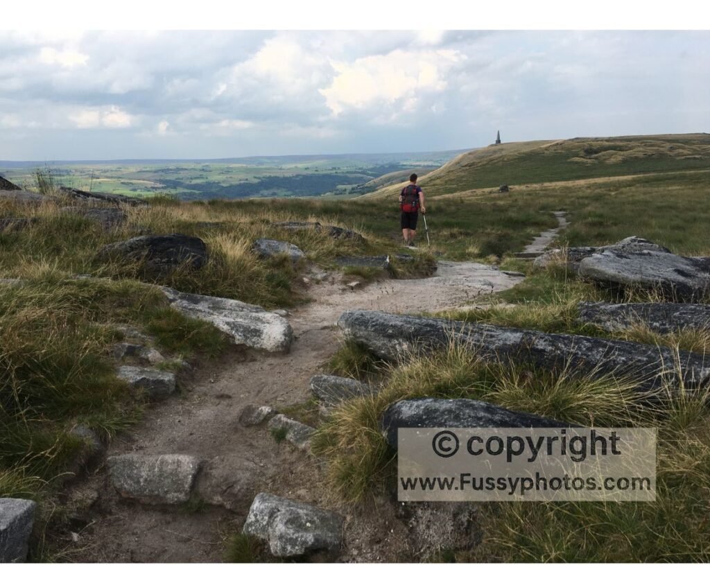
Relief comes at Langfield Common, where the imposing Stoodley Pike Monument rises above the moors. Its distinctive silhouette and sweeping views to the northwest make it a popular spot, so expect more company on the trail here.
From there, the path leads towards, but not directly into, Hebden Bridge. This quirky market town, with its independent shops and cafés, makes a logical place to end a section. Accommodation is easier to find here than in smaller villages, and the train links make it simple to return another day to continue north.
Pennine Way Days 1–3 | Edale to Hebden Bridge Route Maps
Pennine Way Days 1-3 FAQs
How difficult are the first three days of the Pennine Way?
They’re some of the toughest early miles on any UK National Trail: long ascents, exposed moorland, boggy sections, and rocky terrain. The distances aren’t extreme, but the combination of weather, navigation, and underfoot conditions makes them physically and mentally demanding.
What is the total mileage for Days 1–3 of the Pennine Way?
Roughly 43 miles:
- Day 1: Edale → Crowden (16 miles)
- Day 2: Crowden → Marsden (11 miles)
- Day 3: Marsden → Hebden Bridge (16 miles)
What weather should I expect on the Pennine Way in the Peak District?
Wind, rain, low cloud, and sudden changes are common year‑round. Even in summer, Kinder Scout and Bleaklow can feel cold and exposed. Clear days offer huge views, but you should always pack full waterproofs.
What gear do I need for the first three days of the Pennine Way?
Sturdy waterproof boots, a reliable waterproof jacket and trousers, warm layers, gloves, a hat, trekking poles, a map/GPS, and a pack cover. The terrain and weather demand proper hillwalking gear.
How do I get to the start of the Pennine Way in Edale?
Edale has a direct train line from Manchester and Sheffield, making it one of the easiest National Trail trailheads to reach by public transport.
Can I break the Pennine Way into multi‑day sections?
Yes — many walkers complete it in stages. Edale, Marsden, Hebden Bridge, Gargrave, and Bellingham all make logical section endpoints with transport links.
Is the Pennine Way safe for solo hikers?
Generally yes, but it’s remote in places and the weather can be severe. Good preparation, navigation skills, and letting someone know your plan are important. The Pennine Way passes through some hiking areas. At other times, you will experience solitude.
What are the best viewpoints on Days 1–3?
Jacob’s Ladder, Kinder Scout, Laddow Rocks, Black Hill, Wessenden Reservoir, and Stoodley Pike all offer standout views. If you’d like to visit some of these highlights as standalone day walks, my Crowden–Black Hill circular route covers the dramatic Laddow Rocks and Black Hill section, while my Pennine Way Day 2: Standedge circular walk explores the Wessenden Reservoir – Standedge stretch.
Are there places to buy food on the first three days of the Pennine Way?
Not on the trail itself (though there is sometimes a food truck near Wessenden Head (day 2). Stock up before beginning or detour to Glossop or Marsden. Many hikers will rely on accommodation for meals. Hebden Bridge has the best resupply options.
Can I refill water on the Pennine Way in the Peak District?
In theory, but treat all water. Streams, brooks, and reservoir feeder channels are common, but weather and livestock mean purification is essential. I preferred to carry water.
Continue the Journey — Pennine Way continued:
If you enjoy long‑distance routes like the Pennine Way, you might like my Coast to Coast series — starting with Day 1 from Robin Hood’s Bay.
Explore More of the Pennine Way
Discover multi‑day stages, circular day walks and detailed trip reports covering the full length of Britain’s most famous National Trail.
Best Peak District Walks
Find the most rewarding ridge routes, gritstone edges and riverside paths across the Dark Peak and White Peak.