An Underrated Corner of the Yorkshire Dales
Perhaps overshadowed by the fame and prestige of the Yorkshire Three Peaks Challenge and Malham to the west, Grassington was—until recently—unknown to me for its excellent walking. Sitting near the southern end of the Dales Way, an 80‑mile long‑distance trail linking the Lake District to the Yorkshire Dales (and home to a walk voted Britain’s 61st favourite in ITV Britain’s Favourite Walks), it’s an area that deserves far more attention.
Surrounded by rolling hills, old lead mines, and the beautiful River Wharfe, Grassington offers multiple options for a varied circular walk. This is the route I pieced together—along with the small tweaks I’d make with hindsight.
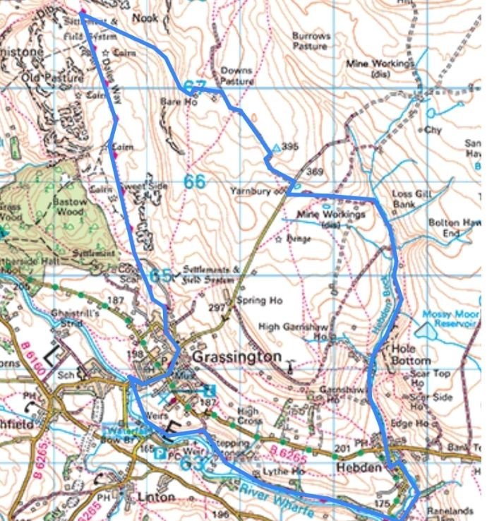
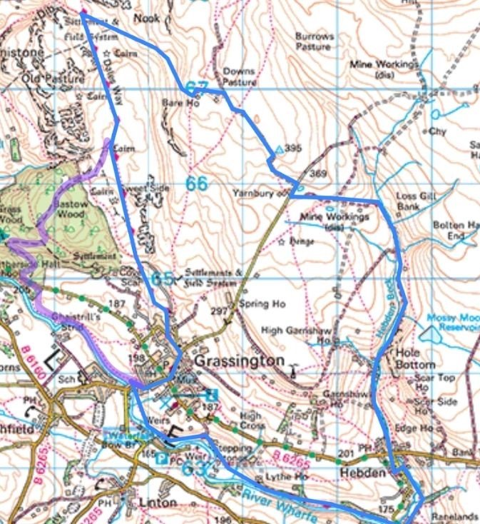
Grassington Circular Map – Recommended 10‑Mile Dales Way Route
Start: The Dales Way from Grassington
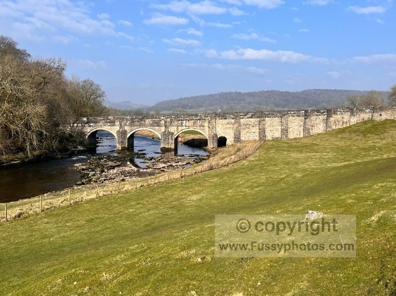
The good news is that Grassington has easy on‑street parking close to the river. The route begins with gentle miles on the Dales Way, following the River Wharfe southeast as it meanders through Wharfedale. Even the road bridge crossing the river is attractive—Grade II listed, with a series of small arches.
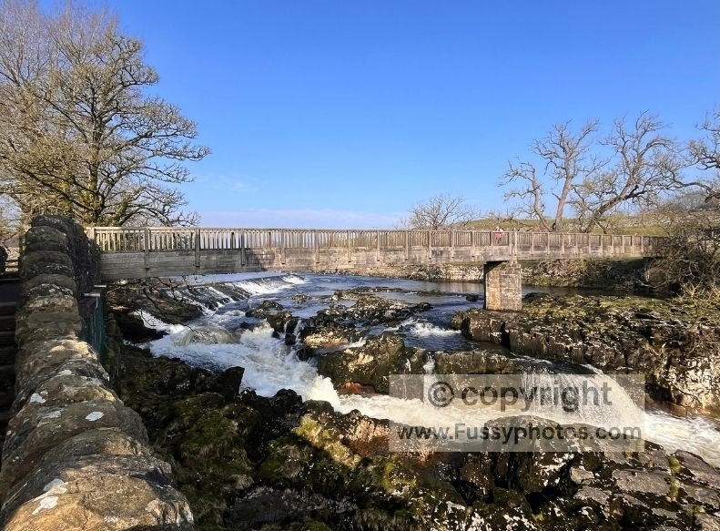
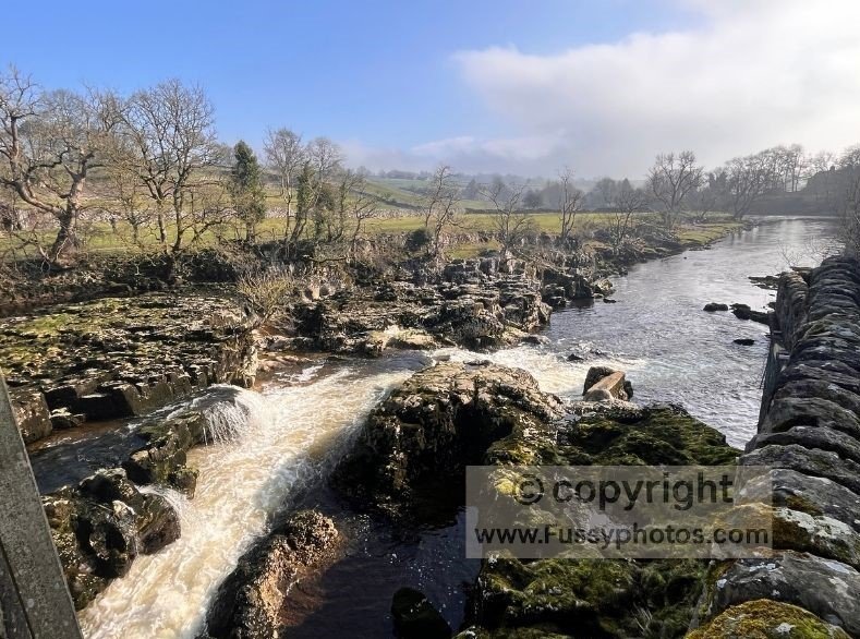
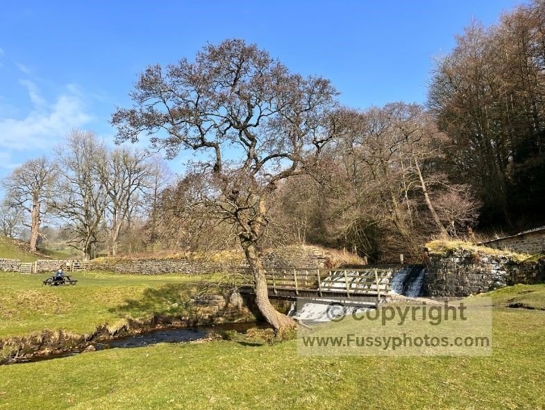
Linton Falls
Less than half a mile further lies Linton Falls, a wonderfully noisy set of cascades with excellent views from the footbridge and nearby viewpoint.
Grassington Circular Walk Video Guide

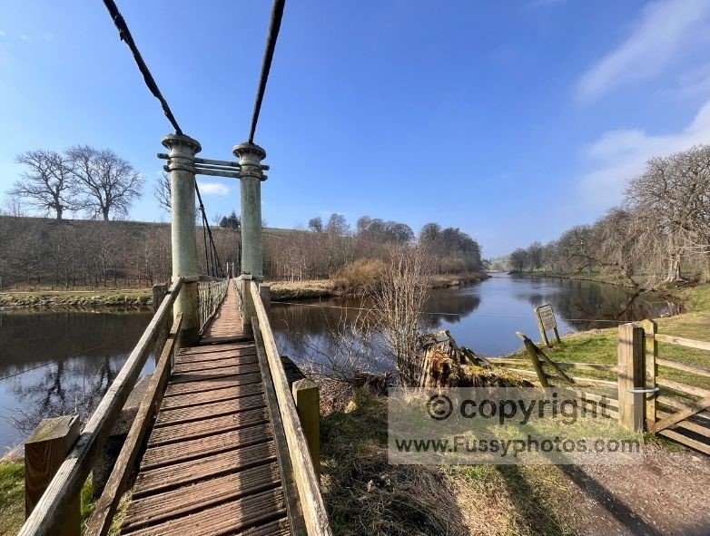
Hebden Suspension Bridge
Continuing east, the trail stays busy as it parallels the river towards Hebden Suspension Bridge, a narrow 19th‑century footbridge leading to the southern bank.
Even if you’re looping north towards Hebden and Hole Bottom, it’s quirky enough to justify a quick detour and a popular spot for photos.
Alternative Route Options via Burnsall
The Dales Way continues east towards Burnsall, another pretty riverside village with wide meanders and more opportunities for flat river walking. One alternative is to continue as far as Barden Beck, just east of Burnsall, and loop north from there—though this adds around 1.5 miles of road walking to rejoin the main route at Hebden. However, because the final section of this walk can be shortened by simply staying on the Dales Way back to Grassington, some extra distance added here can be offset later.
Grassington Circular Map – 14.5‑Mile Route with Burnsall Extension
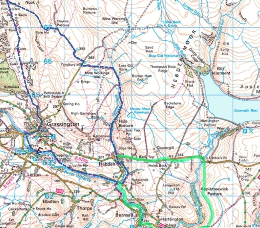
Grassington Circular Map – 11‑Mile Route with River‑Path Finish
Hebden to Hole Bottom
Beckside Paths
Hebden itself is a small village with several parallel trails. I took the lower route beside Hebden Beck, passing some excellent picnic spots—sadly all occupied.
The Old School Tea Room was open and busy, but I continued towards Hole Bottom, still searching for a quiet lunch spot.
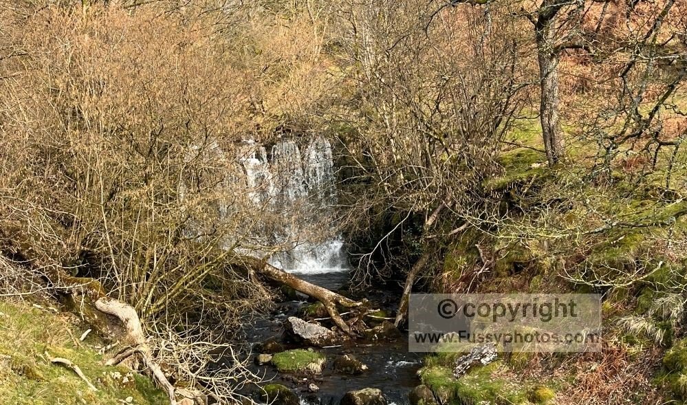
Scale Haw Force Waterfall
A muddy path east of the quiet road soon became impassable due to surface runoff, so I switched to the road. Half a mile later I reached Scale Haw Force, a short detour to a small waterfall partially hidden by trees.
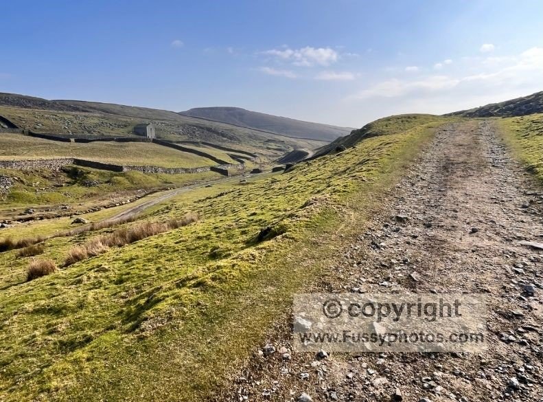
Ascending to Yarnbury and the Lead Mines
Moorland Scenery
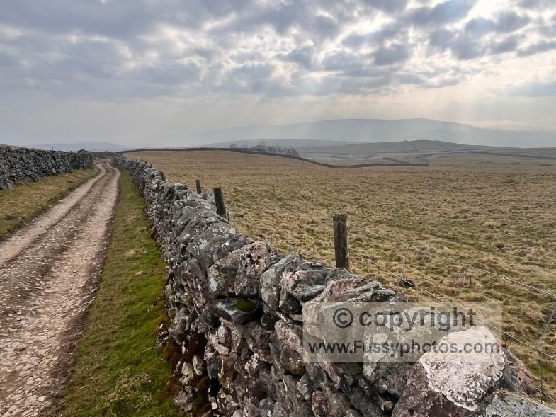
North of Hole Bottom, the terrain changes dramatically. A narrow valley winds upwards towards open moorland and the old lead mines—a stark but scenic landscape. The crowds thin here, and the ground levels out around 400m.
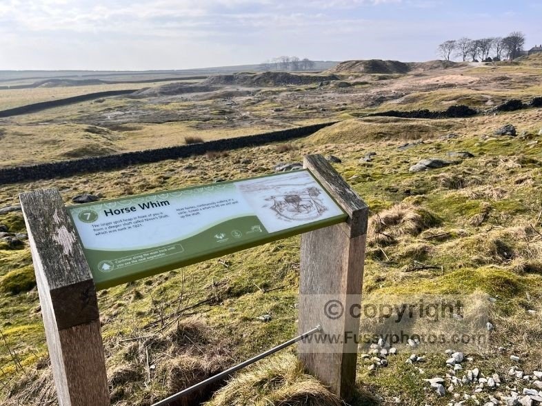
Industrial History
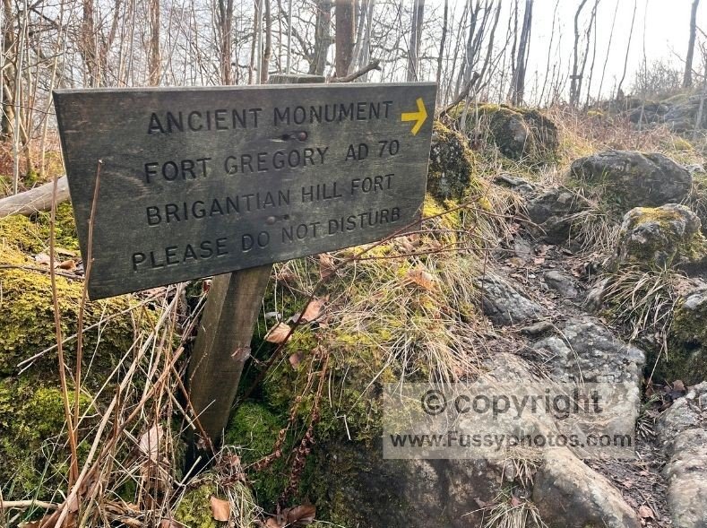
A farmer’s track leads past the old lead works, with informative signs explaining the area’s industrial history.
From Yarnbury, the Dales Way lies just two miles northwest. The trail begins pleasantly, if a little generic, with the highlight for me being the noisy birds swooping overhead.
Bare House to the Dales Way
Navigation Notes
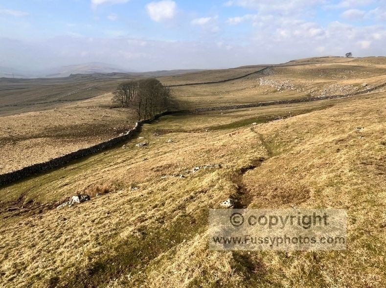
At Bare House, the land drops away to reveal classic Yorkshire Dales scenery: limestone outcrops, rolling hills, and the wide, open views I’d come for. There are no signs on this stretch, so good map‑reading skills or a GPS are essential—but if you head downhill and west, you can’t go far wrong.
Re-joining the Dales Way
A junction brought me back to the Dales Way. The ITV route follows it south–north before heading west towards Conistone, but the wide views and sense of freedom to the south were too tempting. I turned right, aiming to close the loop back to Grassington.
Returning to Grassington
Staying on the Dales Way
The simplest and most relaxed finish is to remain on the Dales Way all the way back to Grassington. This option also shortens the overall mileage slightly—useful if you’ve added extra distance earlier in the walk.
Optional Detour via Bastow Wood
Despite enjoying the Dales Way, I decided to head east towards the River Wharfe for a final stretch of riverside walking. While the river section was lovely, the approach via Bastow Wood was less enjoyable. With hindsight, I’d recommend staying on the Dales Way for easier navigation and a more satisfying finale.
Grassington Circular FAQs
How long is the Grassington circular walk via the Dales Way?
The total distance depends on which finish or extension you choose:
- 10 miles — staying on the Dales Way all the way back to Grassington (shortest option)
- 11 miles — finishing via the river path instead of the Dales Way
- 14.5 miles — adding the Burnsall extension mid‑route, then returning to Grassington
Is Linton Falls easy to reach from Grassington?
Yes — Linton Falls is less than half a mile from Grassington on a well‑maintained section of the Dales Way, making it one of the easiest and most popular highlights of the route.
Can you cross Hebden Suspension Bridge on a Grassington circular walk?
Absolutely. Hebden Suspension Bridge is a key feature of the riverside section and is open to walkers year‑round. It’s a short, worthwhile detour and one of the most memorable points on the early miles of the walk.
Are the old lead mines near Yarnbury safe to explore?
The Yarnbury lead mines area is safe to walk through on marked paths, and the interpretation boards make it an interesting route. Walkers should avoid entering old shafts or unstable structures and stick to the main track.
Is the Grassington circular walk suitable for beginners?
Yes — the riverside section along the Dales Way is very beginner‑friendly. The moorland and lead‑mine section is more exposed but still manageable for most walkers with basic fitness and good navigation.
More Walks in the Yorkshire Dales
If you’re exploring more of the Yorkshire Dales, you might enjoy my Pennine Way write‑ups through Malham, Horton‑in‑Ribblesdale and Hawes.