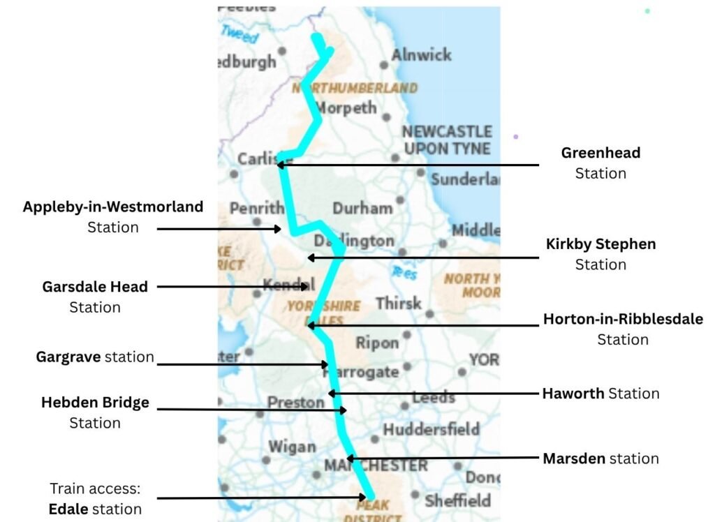
Although parts of the Pennine Way link neatly with the rail network, much of the trail is remote and not directly accessible by train. With some planning, however, it’s possible to walk the route in stages using a combination of train stations, short detours and occasional bus or taxi links. Below is a day‑by‑day breakdown of the most practical rail access points along the Pennine Way.
Pennine Way Transport FAQs
Can you access the Pennine Way at multiple stages using trains?
Partly. Several early and mid‑route stages link well with the rail network, but large sections of the trail are remote and have no train access.
What is the best train station to start the Pennine Way?
Edale is the classic starting point, with a station right at the trailhead.
Where is the last train station on the Pennine Way?
Greenhead is the final practical rail access point. Beyond this, the route becomes remote with no meaningful train links.
Can you break the Pennine Way into train‑friendly sections?
Yes. Edale, Marsden, Hebden Bridge, Gargrave, Horton‑in‑Ribblesdale and Appleby‑in‑Westmorland all work well for staged section hikes.
Are buses or taxis needed?
Sometimes. Haworth, Kirkby Stephen and Appleby‑in‑Westmorland all require short bus or taxi links depending on your route.
Is the northern section accessible by public transport?
Not easily. Days 12–16 are remote and best walked as a continuous final stretch to Kirk Yetholm.
Day‑by‑Day Train Access Guide
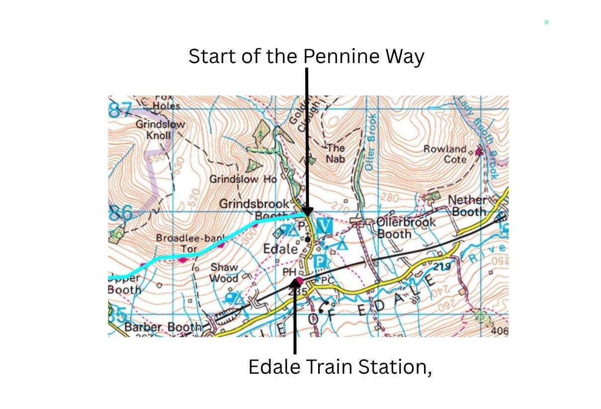
Day 1: Edale to Crowden
Train access: Edale train station
Edale is one of the easiest starting points on the entire Pennine Way, with a station right at the trailhead. For a full breakdown of this opening stage, see my Pennine Way Days 1-3 trip report.
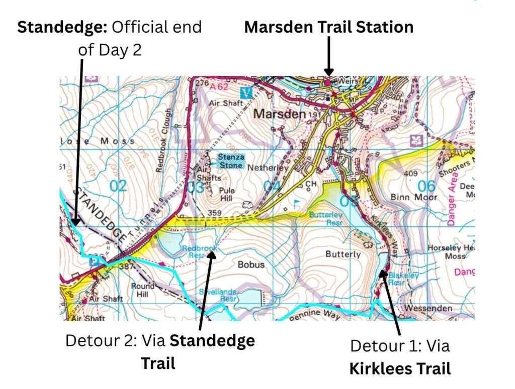
Day 2: Crowden to Standedge
Although not directly on the Pennine Way, a two‑mile detour near the end of the day (with easy navigation along the Kirklees Way) takes hikers to Marsden train station. For alternative ways to walk this section, see my Pennine Way Day 2 Crowden to Black Hill circular and my Standedge circular route.
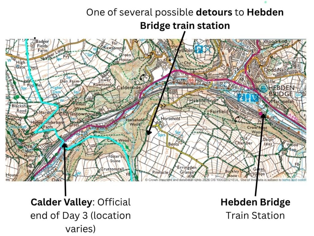
Day 3: Standedge to Calder Valley
Hebden Bridge is around a mile off‑route at the end of Day 3. Thankfully it has a train station, making a three‑day first stage from Edale to Hebden Bridge (Calder Valley) a great option. For a detailed look at this stretch, see my Blackstone Edge circular guide.
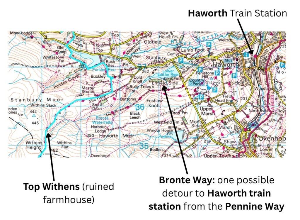
Day 4: Calder Valley to Ickornshaw
Haworth, around 1.5 hours’ walking beyond Withens Height, is a 2.5‑mile detour east of the Pennine Way. It’s a viable option if you want to complete a 3.5‑day Stage One from Edale, or a two‑day walk from Marsden via Standedge — ideal for a weekend. For a full overview of this section, see my Hebden Bridge to Malham Pennine Way trip report.
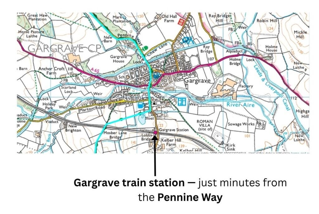
Day 5: Ickornshaw to Malham
Day 5 is a long 17‑mile stage. If you end early at Gargrave train station, it becomes an easy 10.5‑mile day. Alternatively, continue to Malham and use the bus service to Gargrave — just make sure you arrive before the last bus.
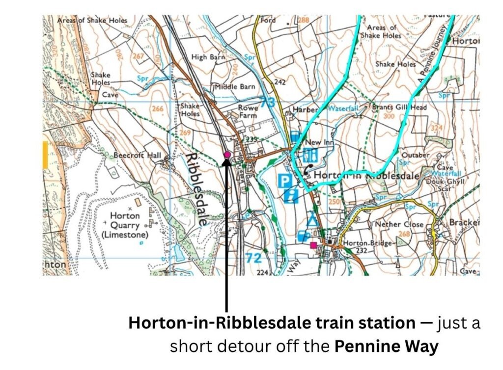
Day 6: Malham to Horton‑in‑Ribblesdale
Horton‑in‑Ribblesdale has a train station, making this one of the most convenient Pennine Way access points. For more on this limestone section, see my Malham Scenic Limestone to Britains Highest Pub trip report.
Day 7: Horton‑in‑Ribblesdale to Hawes
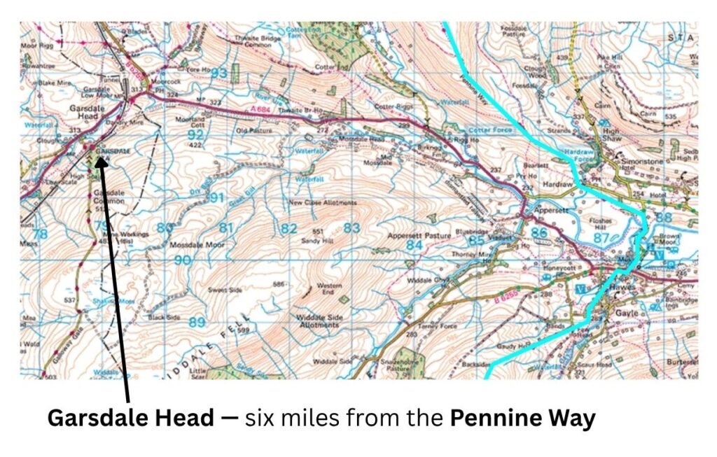
The nearest station to Hawes is Garsdale Head, six miles away. It’s not practical for ending a stage unless you’re prepared for a long road walk or a taxi. Best to continue your through‑walk.
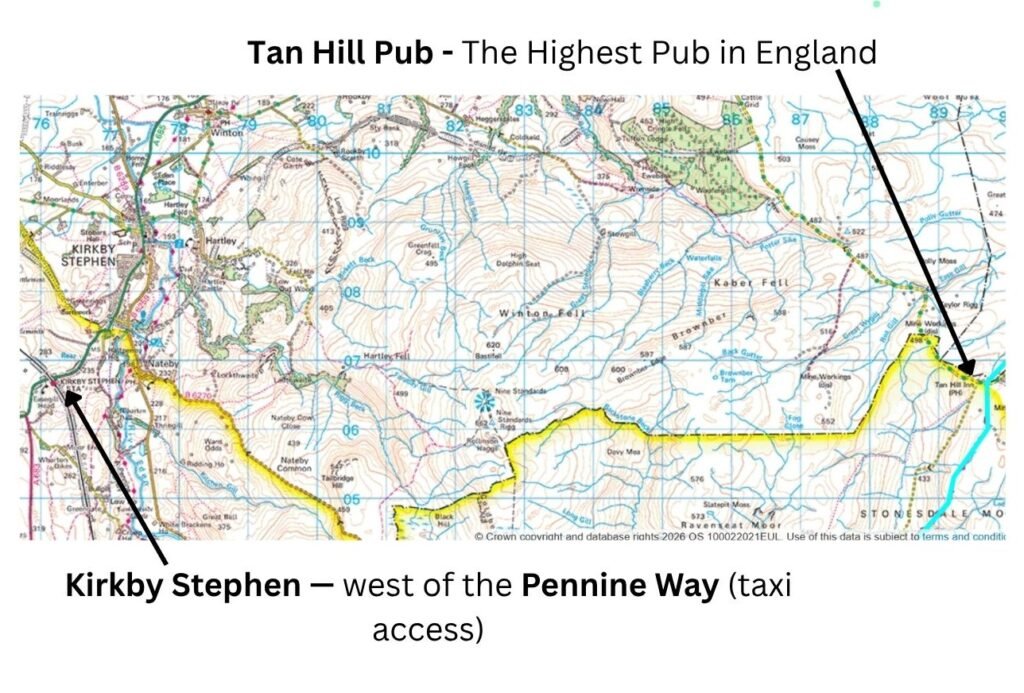
Day 8: Hawes to Tan Hill
One of the most remote end points on the Pennine Way. The nearest bailout option is Kirkby Stephen to the west — an expensive taxi ride if you can arrange one. Again, it’s best to continue your through‑walk rather than ending a stage here.
Day 9: Tan Hill to Middleton‑in‑Teesdale
Middleton‑in‑Teesdale has pubs and accommodation but is far from the rail network. It’s not ideal for starting or ending a stage, though we did — relying on a lift and an expensive taxi on our return.
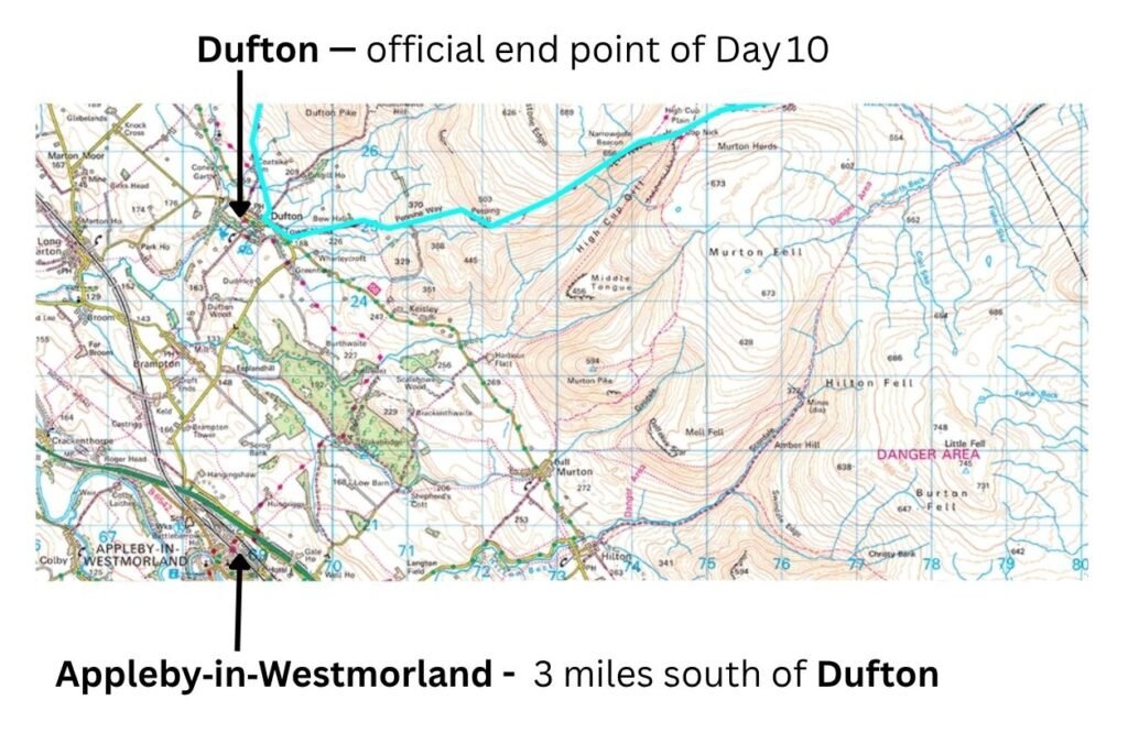
Day 10: Middleton‑in‑Teesdale to Dufton
It’s a 21‑mile walk to Dufton, followed by another three miles to Appleby‑in‑Westmorland, which does have a train station. Given the lack of options on Days 8 and 9, this is a sensible place to end and restart your Pennine Way journey. For more on this part of the route, see my Pennine Way High Force Waterfall to High Fell Scenery trip report.
Day 11: Dufton to Alston
Alston has a heritage railway station only — no mainline services. You’ll need to keep walking or rely on other transport.
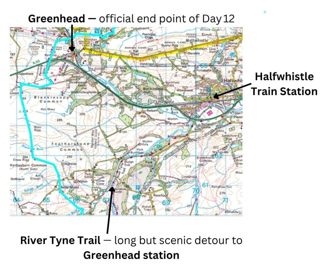
Day 12: Alston to Greenhead
There’s a station at Greenhead, around 3.5 miles off the Pennine Way. We used this option before returning to complete our final leg to Kirk Yetholm.
This is the last practical point on the Pennine Way where you can realistically access or leave the trail by train. Beyond Greenhead, the route becomes increasingly remote with no meaningful rail links.
Days 13–16: Greenhead → Bellingham → Byrness → Windy Gyle → Kirk Yetholm
From Greenhead onwards, the Pennine Way enters its most remote stretch.
- Bellingham has services but is far from any train connections.
- Byrness is tiny and, when we visited, had no services beyond a campground.
- Windy Gyle is a landmark on the ridge rather than a place with services
Because of the lack of transport options and the remoteness of the terrain, the best approach is to treat Days 12–16 as a continuous final section and walk them as one through‑journey to Kirk Yetholm.
For more on the northern end of the route, see my Pennine Way Hadrians Wall Great Grand Finale to Scotland trip report.