Coast to Coast (Reverse) — Stage Index
This guide is part of my reverse Coast to Coast series — you can follow every stage using the index below.
Day 1: Robin Hood’s Bay → Egton Bridge
Having set out on Day 1 of my east‑to‑west Coast to Coast walk with no idea where I’d sleep, starting Day 2 from a fixed point removed that uncertainty. Given the remote nature of the next 23 miles, the choices were simple: walk a short 11‑mile day to The Lion Inn and enjoy the warmth of a country pub (with camping in the beer garden), or continue 17 miles past the remote Bloworth Crossing (where the Coast to Coast rejoins the Cleveland Way) and a further 6 miles to Lordstones Country Park, Carlton Bank. Anything else would require wild camping — and despite favourable forecasts, the wind rarely plays by the rules on the North York Moors, making anywhere without a windbreak deeply unappealing. Stopping at The Lion Inn would turn this Moors section into a 3‑day walk; pushing on to Carlton Bank would keep it under three.
Key Facts
- Distance: ~23 miles
- Time taken: ~9.5 hours
- Terrain: Steep rocky ascents and descents (including the Wainstones), long exposed stretches on the Cleveland Way ridge, moorland tracks, and woodland paths approaching Glaisdale
- Difficulty: Hard — sustained effort required, especially on the exposed Cleveland Way ridge section
Watch the Full Walkthrough of my Coast to Coast Day 2

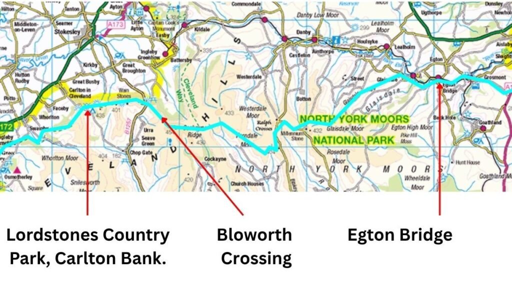
Leaving Egton Bridge and Climbing into Arnecliffe Wood
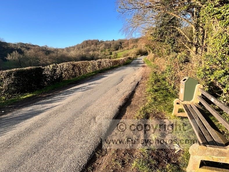
I left Egton Bridge early, hitting the trail in sunshine to the sound of birdsong and the River Esk. The route began with more road walking — thankfully only half a mile — before a right turn led into Arnecliffe Wood. An easy path rose gently, offering peaceful early‑morning solitude with the river to my right.
I kept an eye out for wild‑camping spots, curious what the alternative to the hotel might have been. Despite the privacy of the trees, I found only two vaguely flat areas, and concluded the springy hotel bed had still been the right call.
The trail descended to the valley floor, briefly hugging the river — an attractive stretch over far too quickly — before rising again and turning onto a single‑lane road.
Through Glaisdale and Onto Glaisdale Rigg
The route gained height as it passed through the linear village of Glaisdale, though nothing stood out to delay the average walker for long — unless you’re particularly passionate about benches. I took advantage of one anyway, predicting it might be the last before The Lion Inn.
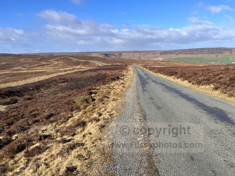
The road climbed to around 260m, the village giving way to panoramic views — and plenty of wind exposure. The next 1.7 miles felt slow, walking head‑on into yet more 40mph gusts. I was working far too hard for a pace that barely qualified as forward motion.
The ridge continued, Wainwright clearly not a fan of the Pennine Way habit of dipping into valleys before climbing out again. Personally, I’d have preferred it — the valley looked worth exploring — but in better weather this ridge and road section would offer fast miles. Today, I was cursing the wind and working far too hard for far too little speed.
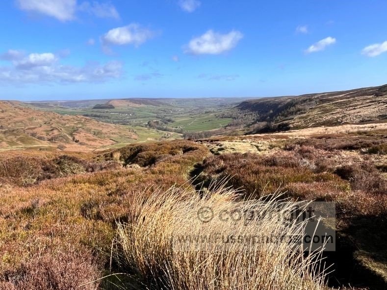
Great Fryup Dale and the Approach to The Lion Inn
Leaving the road and continuing southwest, Great Fryup Dale opened up below, its gentle U‑shaped valley becoming more apparent as the trail turned west. I passed a few walkers heading the other way, swapping trail stories. Bemoaning the wind, a local confirmed it’s a year‑round hazard — something east‑to‑west walkers should bear in mind, given the prevailing westerlies.
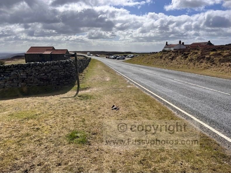
Three miles from The Lion Inn, the route joined another road. Aside from a short moorland section, the next stretch remained on tarmac. A more direct line would drop partially into the valley, and I was tempted, but I wanted to follow the traditional Coast to Coast route — and the guidebook had warned that cutting across wouldn’t save time due to the extra ascent.
Reaching the Lion Inn just in time for lunch, I stepped off the trail 11 miles into the day and entered the dark, low‑ceilinged world of the pub, demolishing a main and a pudding and attracting some interest and conversation from the locals, who noted my backpack and windswept appearance and might have questioned whether I’d walked from St Bees, not Egton Bridge.
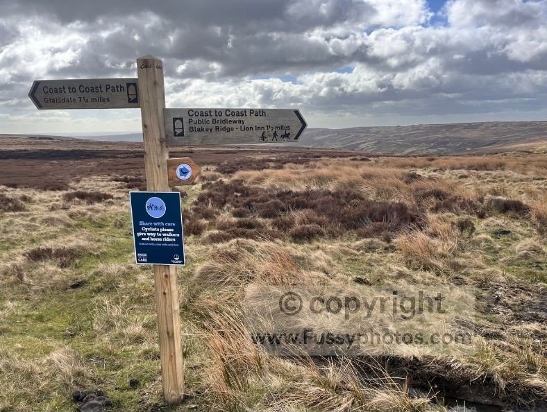
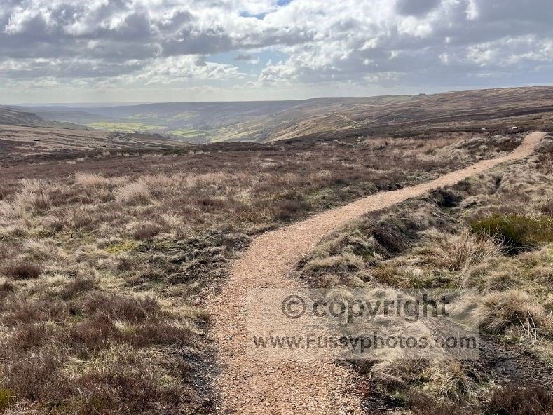
Lion Inn to Bloworth Crossing: The Old Railway Line
Leaving The Lion Inn early afternoon, I followed a farm track towards the old Rosedale Railway. The Farndale views were initially exciting — a new chapter before rejoining the Cleveland Way, where I’d be back on familiar ground having sampled the first few days of the route the year before.
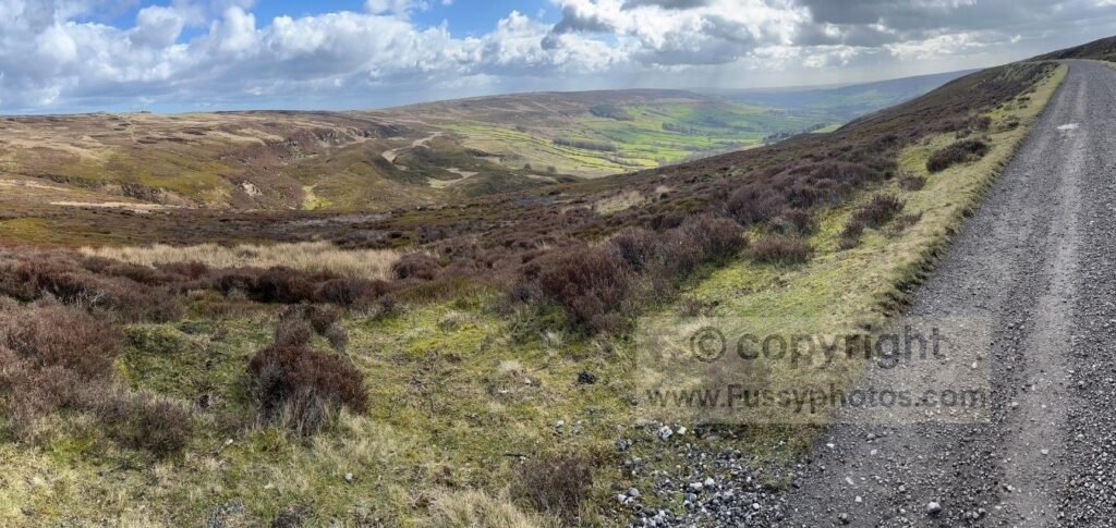
This five‑mile stretch is often written about favourably — though I assume those reviews were written on calmer days, or by people with a higher tolerance for straight lines. Route‑finding was so simple I briefly considered closing my eyes to make it more exciting.
Knowing the undulating terrain west of the Cleveland Way doesn’t lend itself to wild camping, I committed to reaching Bloworth Crossing, which effectively locked in the full 23‑mile day.
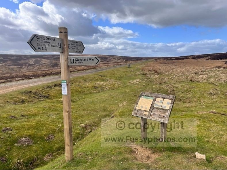
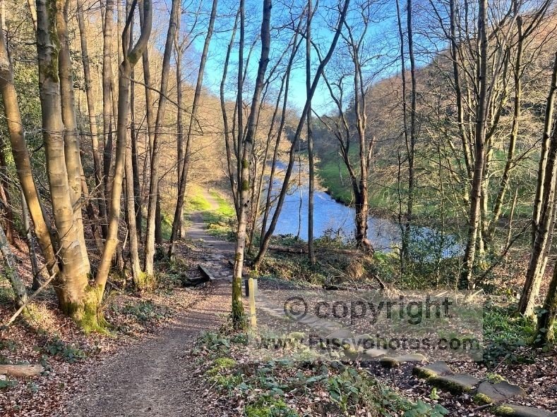
Joining the Cleveland Way at Bloworth Crossing and the High Moors
The Cleveland Way couldn’t come soon enough, and my enthusiasm rose when I finally reached it — though the dour, flatish moorland continued for another mile and a half past Round Hill (454m).
A gentle descent westwards eventually gave way to ridgetops and the dramatic drop‑offs into the Vale of Mowbray. More rain arrived; this time I threw on waterproof trousers and my pack cover immediately, though the rain was far less severe than yesterday’s blast.
A steady stream of runners passed in the opposite direction. One stopped to chat, revealing he’d left St Bees just two days earlier — putting my 23‑mile day into perspective, though in fairness his pack looked lighter than two of my tent poles.
Hail hit briefly on the descent to Clay Bank, but it was short‑lived.
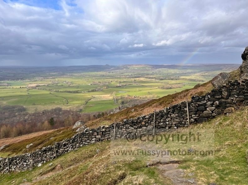
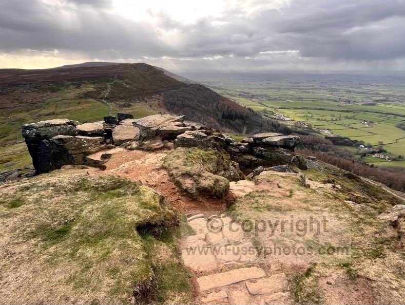
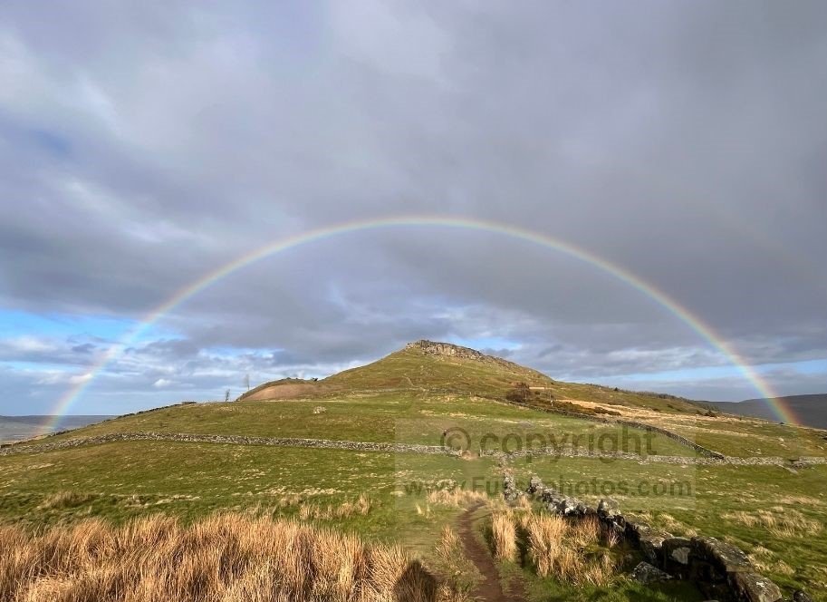
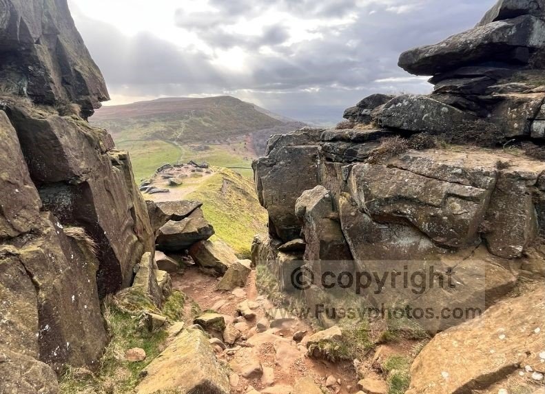
The Rollercoaster Summits and the Final Push to Carlton Bank
A unique part of the route, the trail rises and falls across three summits — a slow‑motion rollercoaster that burns your calves but rewards you with spectacular views, especially eastwards towards Roseberry Topping, Middlesbrough, and westwards towards the distant Yorkshire Dales.
The brooding weather and flashes of sunlight between grey clouds created superb photography conditions, and I caught a classic shot of a rainbow perfectly framing Hasty Bank and the Wainstones.
There are options to leave the trail here into tributary valleys, or even catch a lift to a nearby B&B via one of the roads that dissect the ridge. But my mind was made up, and it was a great feeling to finally reach Carlton Bank, light the stove and eat — the simple pleasures you appreciate more when the alternative was collapsing somewhere on the ridge in a huff.
Reflections on the Day
- A long but varied day with a real sense of progression across the North York Moors
- The highlight is unquestionably the Cleveland Way ridge walking, with wide, uninterrupted views across the Vale of Mowbray
- Take advantage of food at The Lion Inn — and don’t feel guilty about overindulging; you’ll want the fuel for the miles ahead
- If possible, time the moorland section for August, when the heather is in full bloom and the landscape is at its most spectacular
Practical Tips for the Day
- Book accommodation early — rooms at Lordstones Country Park and the Lion Inn fill up quickly in peak season
- Camping at Lordstones must be booked in advance
- Camping at the Lion Inn is allowed and does not require reservations, but check in with the pub on arrival
- Start early — this is a long, exposed day with few escape points, and weather can deteriorate quickly on the ridge
- Carry enough water for the moorland sections; refill at Lordstones, The Lion Inn, and Glaisdale
- Bring enough food to cover the gaps between Lordstones and Glaisdale, even if you plan to eat at the Lion Inn
- Expect strong winds on the Cleveland Way ridge — secure hats, maps, and anything that might blow away
- Use trekking poles if you have them; they’re especially helpful on the rocky Wainstones section and the long descents
- Download maps offline — phone signal is patchy across the moors
- Time your walk for August if possible; the heather bloom transforms the moorland and makes this one of the most memorable days of the entire Coast to Coast
FAQs for the Carlton Bank to Glaisdale Section
Is there any water available between Carlton Bank and Glaisdale?
There are no reliable natural water sources on the high moorland sections. However, you can refill water at Lordstones Country Park, The Lion Inn, and again in Glaisdale. Carry enough to cover the exposed ridge sections, especially in warm or windy conditions.
Are there any food or resupply points on this section?
Yes. You can get food at Lordstones Country Park, The Lion Inn, and again in Glaisdale. Between these points there are no additional shops or cafés, so carry enough snacks to cover the exposed moorland stretches.
Is the route easy to navigate?
Yes. This section is generally straightforward to follow, using a mix of road walking, well‑trodden paths, and the clearly waymarked Cleveland Way ridge. Signposting is abundant throughout. However, the moorland sections are exposed and can feel featureless in poor visibility, so carrying a GPS track or having basic map‑and‑compass skills is still strongly recommended.
What is the terrain like between Carlton Bank and Glaisdale?
Expect:
- Steep rocky climbs and descents (especially around the Wainstones)
- Long, exposed moorland tracks
- Stone slabs, gravel paths, and occasional boggy patches
- A final descent into woodland and farmland approaching Glaisdale
Is the Wainstones section dangerous?
The Wainstones involve a short rocky scramble. In dry weather it’s manageable for most hikers, but in rain or high winds it can feel exposed and slippery. Take your time and use hands where needed.
Silly FAQs
Is the Lion Inn visible from space?
Not officially, but given how many Coast to Coasters navigate by “just keep walking until you reach the pub,” it might as well be.
Will the heather be in bloom when I walk it?
If it’s August, yes. If it’s not August, no. If you’re not sure what month it is, the Coast to Coast may not be the walk for you.
Why is it always windy on the ridge?
Because the North York Moors like to remind you who’s in charge.
Can I wild‑camp on the moors?
You can, in the same way you can sleep on a trampoline during a gale. It’s technically possible, but you’ll question your life choices.
Is it normal to think about food for the entire day?
Yes. In fact, it’s encouraged. The Lion Inn relies on it.
Should I save room for pudding at the Lion Inn?
This is not a walk that rewards restraint.