Missed Days 1-5 of the Pennine Way?
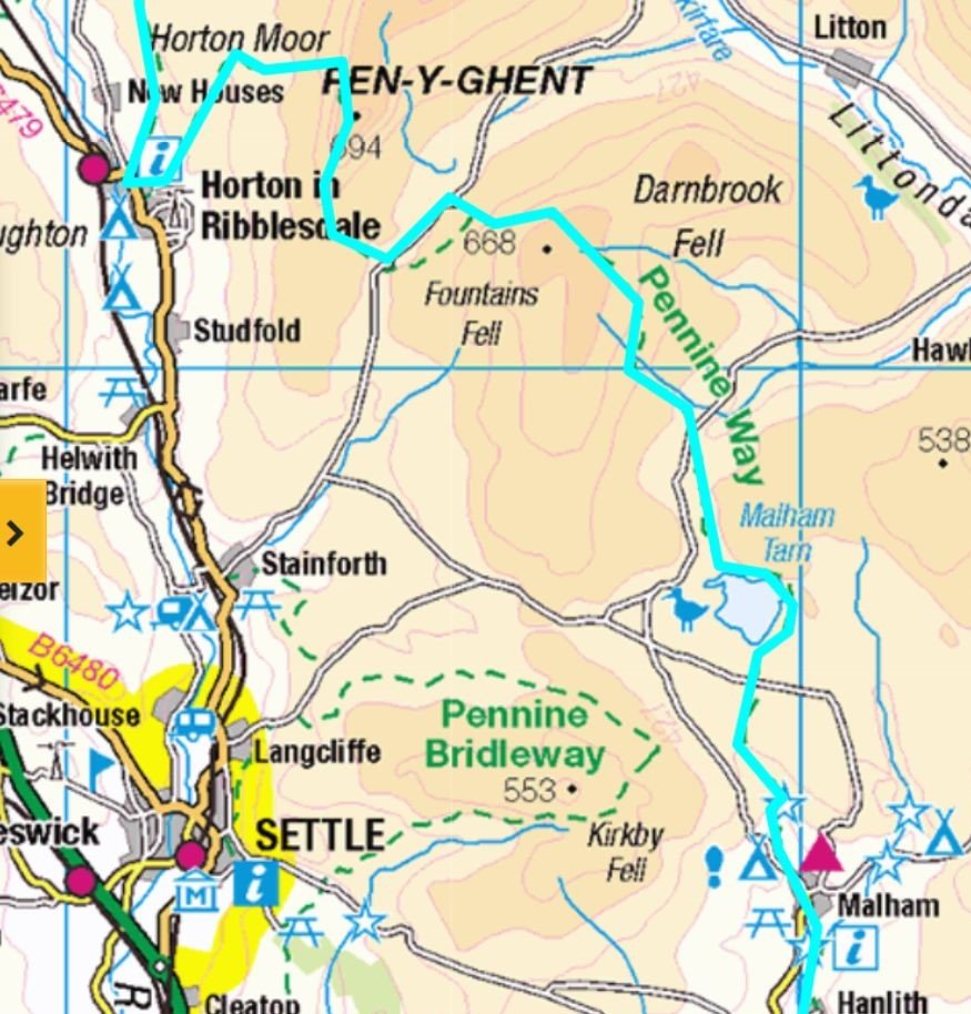
Day 6 Pennine Way: Malham to Horton-in-Ribblesdale (14.5 miles)
Malham Cove, limestone pavement, Malham Tarn, and Pen-y-Ghent headline this classic Pennine Way stage to Horton-in-Ribblesdale.
Returning to Malham in April, it felt like a long wait between Days 5 and 6. Work commitments and short winter days had kept us away, but this was the earliest chance to continue. We timed the train to Gargrave to coincide with the bus to Malham, beginning the Pennine Way: Malham — a scenic four‑day stretch north through the Yorkshire Dales to Middleton‑in‑Teesdale. If you’re spending an extra day in Malham, my Malham Circular route is a superb alternative to the classic village loop.
One of the charms of the Dales is its remoteness – few towns, fewer villages, and public transport that seems designed to test your patience. If you’re planning this stretch in stages, my Pennine Way Train Access Guide shows every practical rail link from Malham to Middleton‑in‑Teesdale and beyond.
Accommodation and food are often seasonal, and even our end point had no train station. Thankfully, my friend’s wife had kindly agreed to pick us up. Without her, we’d have been at the mercy of the once-a-day bus service.
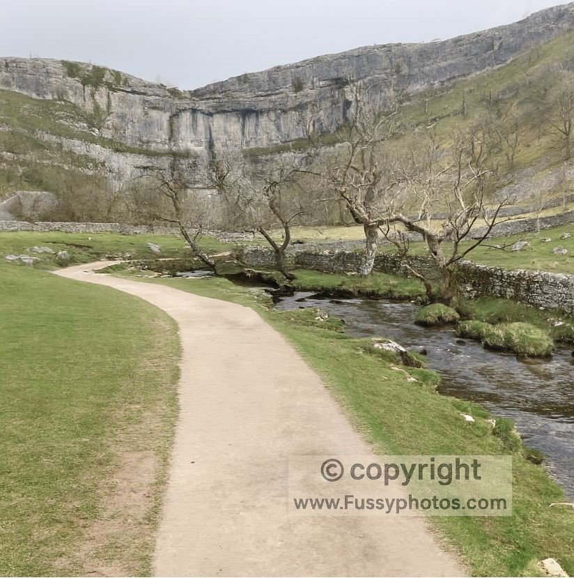
From Malham, the Pennine Way follows Malham Beck towards the dramatic Malham Cove – a 70-metre cliff carved in the last Ice Age. The underground river resurfaces here in a feature called a resurgence.
Expect crowds: several circular walks radiate from Malham, and the Cove is a magnet for day-trippers. If you’ve time, two nights in Malham would let you explore Gordale Scar (a hidden gorge 1.5 miles east) or squeeze in an extra three miles on a long summer’s day.
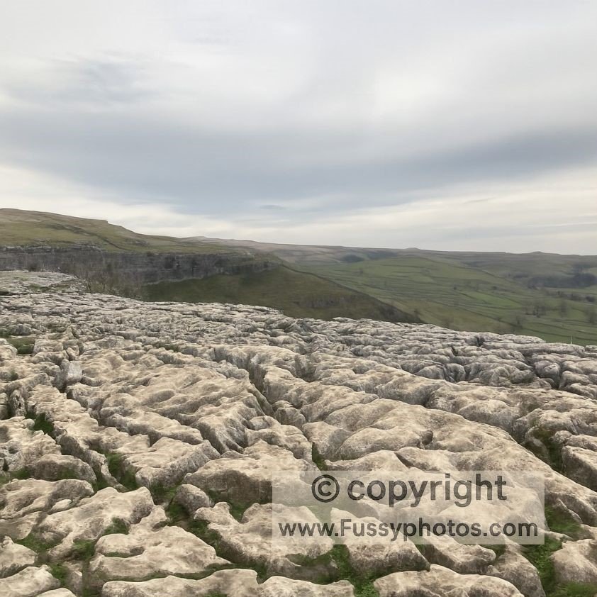
The trail climbs steeply to the top of the Cove, where a vast limestone pavement stretches out like nature’s chessboard.
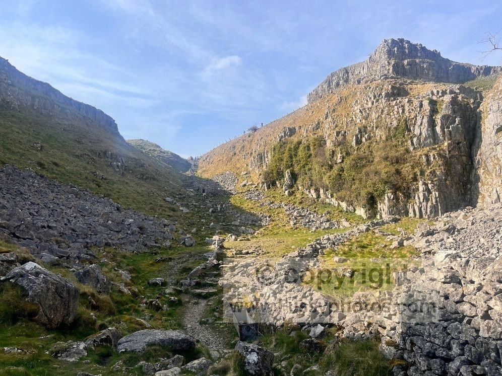
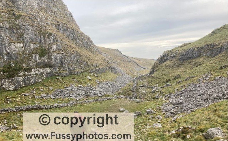
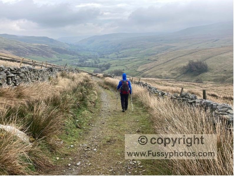
My favourite feature, though, was the narrow valley beyond, framed by dry stone walls.
After this, the landscape flattens towards Malham Tarn. The only real drama was a sheep wedged in a gate – we retreated to alert the farmer before pressing on.
Blown Off Course on Pen‑y‑Ghent
The day ended with Pen-y-Ghent, climbed via its steep northern slope. The wind was so fierce we had to shout to be heard, and I was literally blown off the trail every few metres.
If you’d prefer a shorter standalone route, my Pen y Ghent circular walk covers the summit with a scenic detour to Hull Pot.
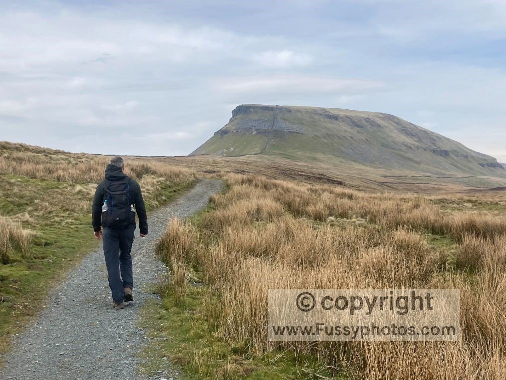
The descent is attractive, but don’t be fooled – it takes nearly an hour to reach Horton-in-Ribblesdale. We just made it to the village pub before the ovens were switched off (and it wasn’t even late).
If you’re looking for a shorter, beginner‑friendly way to experience this same stretch, my Try the Pennine Way: Beginner Weekend in the Dales guide covers Malham to Horton‑in‑Ribblesdale as a two‑day introduction.
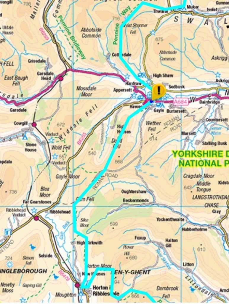
Day 7: Horton-in-Ribblesdale to Hardraw (16 miles)
Yorkshire Three Peaks Country, Ribblehead Viaduct and Hardraw Force
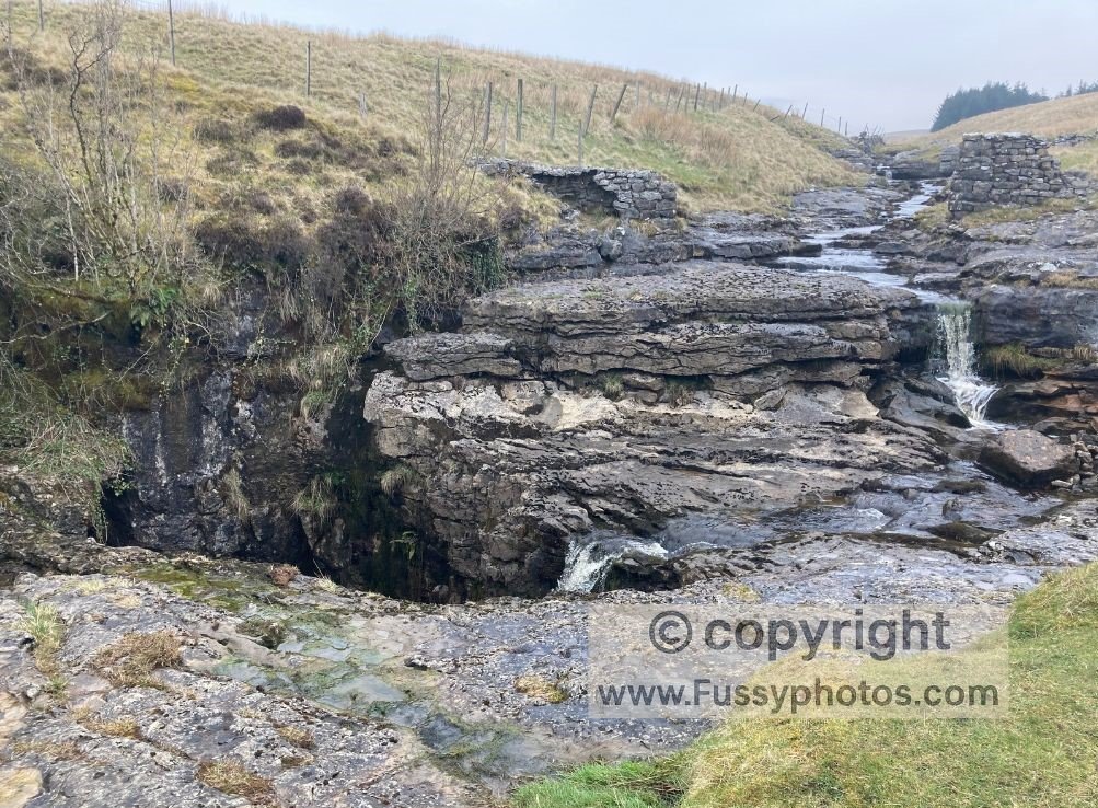
The guidebook suggests a shorter day to Hawes, but our accommodation dictated a longer push. Beginning in Yorkshire Three Peaks territory, the trail climbed gently before following the valley north past some impressive sinkholes.
Unfortunately, the weather had other plans. Gentle drizzle turned to torrential rain as we drew level with Ribblehead Viaduct, and it barely let up until Hawes. Visibility was so poor it felt like a never-ending treadmill session – except with mud, wind, and no option to press “stop.”
At Hawes, we squelched into the Wensleydale Creamery, turning heads like two damp sheep who’d taken a wrong turn at the gift shop. We dripped into the café like human sponges, to the point where the staff kindly handed us a towel — not so much to dry off, but to reassure other customers that the roof wasn’t about to cave in.
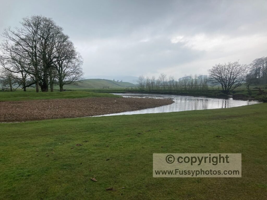
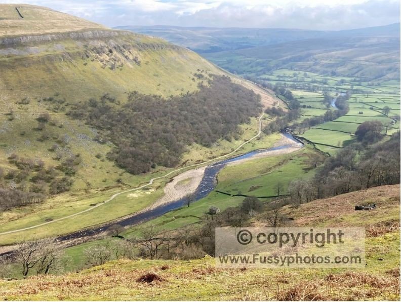
Mercifully, the rain had relented for the final two miles. We passed river meanders and glacial drumlins, and were even waved through to Hardraw Force for free (I suspect pity played a part when we explained we’d walked all day).
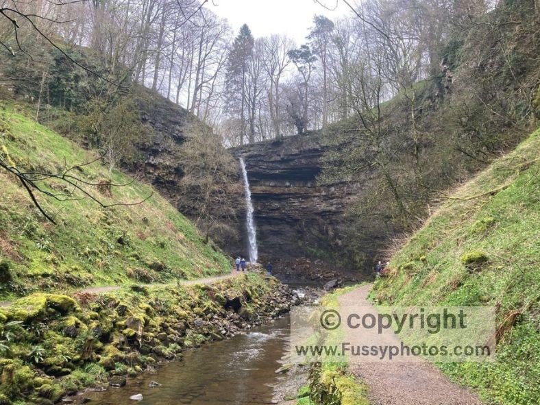
England’s largest single-drop waterfall was a fine reward. The Green Dragon Inn welcomed us warmly, and we devoured some much-needed comfort food.
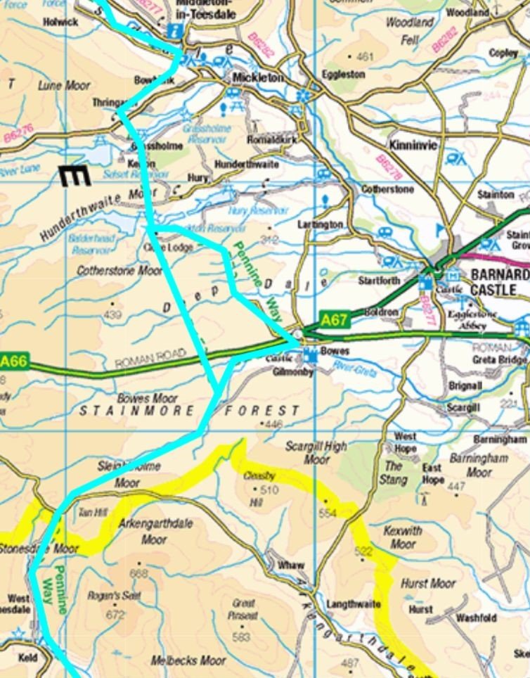
Day 8: Hardraw to Bowes (25 miles)
A monster 25-mile push: Great Shunner Fell, Swaledale views, Britain’s highest pub, and the boggy nightmare of Sleightholme Moor.
The guidebook splits Hawes to Bowes into two days, but we decided to squeeze it into one. By now, we’d realised that tackling the Pennine Way in segments was logistically tricky, and we were determined to make progress.
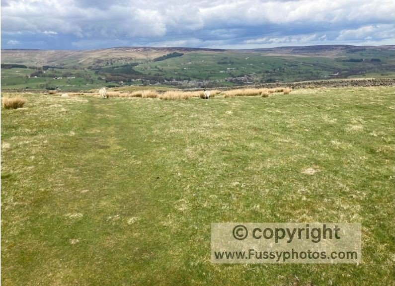
The weather, however, was back to its worst. Great Shunner Fell (716m) should have offered panoramic views, but fog and rain reduced it to a bog-dodging trudge. Descending into Thwaite, we finally dipped below the cloud and glimpsed Swaledale.
From here, the trail sharply climbed and dropped, though those less rigid about “sticking to the route” might prefer the valley floor for some excellent river walking.
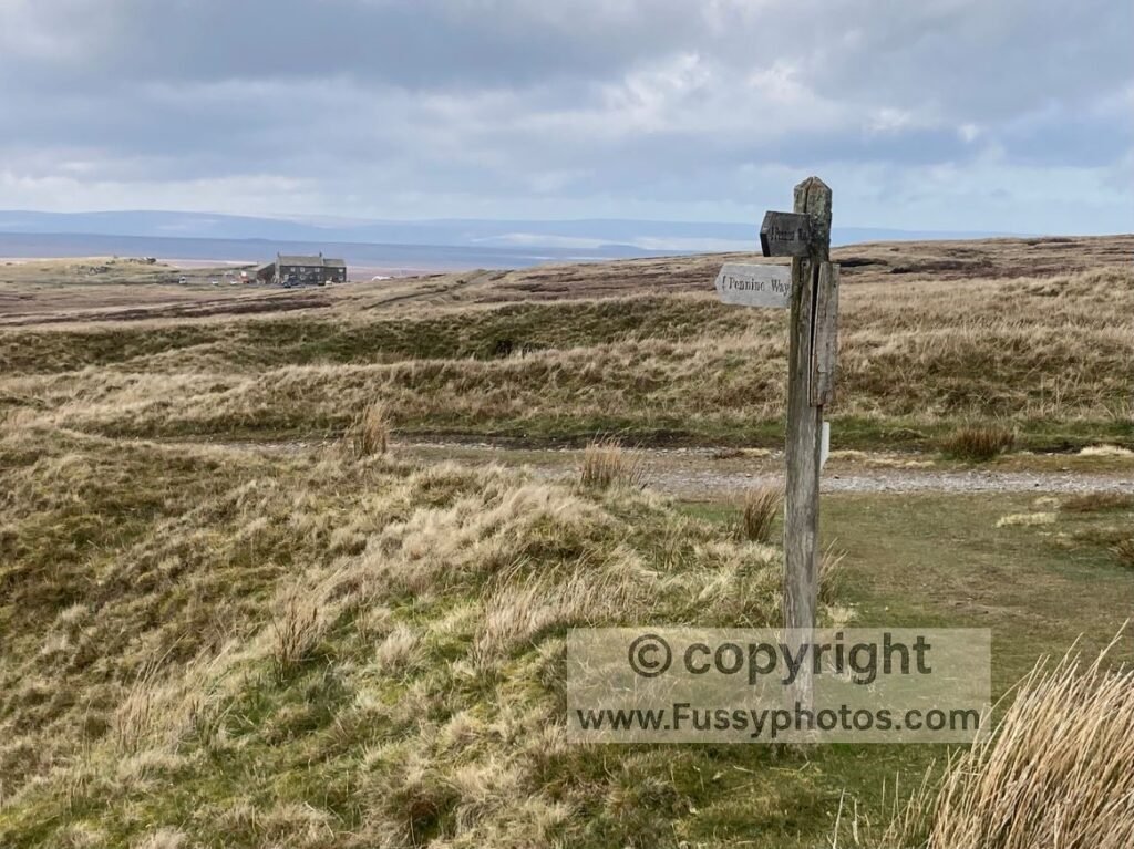
As visibility improved, the views were excellent: dry stone walls, tumbling waterfalls, and classic Dales scenery. Keld was a highlight, with waterfalls and – crucially – a café. Beyond Keld, the trail passed Britain’s highest pub (528m). Sadly, we had no time for a pint.
Then came Sleightholme Moor. There is no real trail, just an all-you-can-sink buffet of bog. Even the best boots won’t save you—ours had given up and were probably filing for early retirement. After sinking knee-deep one too many times, we lurched forward like drunks at closing time.
A warm sunset teased us with hope, but Bowes was still cruelly out of reach. We arrived at 8.30pm, only to be told the restaurant at our accommodation had closed. The receptionist promised takeaways would deliver. They wouldn’t. Not one. Apparently, Bowes is a place so remote even Deliveroo’s sat-nav just shrugs and gives up.
Day 9: Bowes to Middleton-in-Teesdale (12 miles)
On paper, this is a pleasant stretch: rolling farmland, big skies, and a fine descent into Middleton. In reality, we were shattered. The previous day’s 25 miles, combined with no evening meal (unless you count a cereal bar), had left us running on empty.
Despite demolishing breakfast, our energy levels never recovered. The fields felt endless, the stiles relentless, and the fences never-ending. Still, the scenery was enjoyable, and the descent into Middleton was a fitting close to our third – and longest – leg of the Pennine Way so far.
Pennine Way Route Maps | Days 6–9: Malham → Middleton‑in‑Teesdale
Pennine Way Days 6–9: FAQs
What is the total distance covered on Days 6–9 of the Pennine Way?
Together, Days 6–9 cover roughly 68 miles:
- Day 6: Malham → Horton‑in‑Ribblesdale (14.5 miles)
- Day 7: Horton‑in‑Ribblesdale → Hardraw (16 miles)
- Day 8: Hardraw → Bowes (25 miles)
- Day 9: Bowes → Middleton‑in‑Teesdale (12 miles)
Are Days 6–9 of the Pennine Way hard?
Yes — this is one of the toughest multi‑day sequences on the entire trail. Malham Cove and Pen‑y‑Ghent are steep, the weather around Ribblehead and Great Shunner Fell can be brutal, and Day 8’s 25‑mile push over Sleightholme Moor is notoriously draining but can be broken into two days making this a five rather than a four-day stage.
Are there food or accommodation options in Horton‑in‑Ribblesdale?
Yes — a pub, a café, and seasonal B&Bs. Options are limited outside peak season, so booking ahead is wise.
Is Ribblehead Viaduct on the Pennine Way?
No, but it’s visible. A detour would be long but possible. It’s one of the most photographed railway structures in the UK. If you wanted to attempt the Yorkshire Three Peaks, a second night in Horton-in-Ribblesdale (and possibly a 3rd following a rest day!) would be necessary.
Can you visit Hardraw Force on the Pennine Way?
Yes. The trail passes through Hardraw village, and Hardraw Force — England’s highest single‑drop waterfall — is a short detour away.
Is Great Shunner Fell difficult?
It’s a long, steady climb rather than a technical one. In good weather, the views are superb; in fog and rain, it becomes a featureless trudge.
Is Tan Hill Inn really the highest pub in Britain?
Yes — at 528 metres, Tan Hill Inn is the highest pub in the UK. The Pennine Way passes right by it.
Is accommodation easy to find on this stretch of the Pennine Way?
It exists, but it’s scattered and often seasonal. Booking ahead is essential, especially in Malham, Horton, Hawes, Keld, and Bowes.
What are the highlights of Days 6–9 on the Pennine Way?
Malham Cove, the limestone pavement, Pen‑y‑Ghent, Ribblehead Viaduct views, Hardraw Force, Great Shunner Fell, Swaledale, Keld’s waterfalls, Tan Hill Inn, and the final descent into Middleton.
Continue the Pennine Way (Days 10–12 and Beyond)
Read the Days 10–12 guide for the High Force section, Cross Fell ascent and the long push to Haltwhistle.
Return to the Pennine Way hub for stage guides, day circulars, logistics and route‑planning essentials.
For another iconic multi‑day trail, you can begin the Coast to Coast with Day 1: Robin Hood’s Bay to Egton Bridge.