Coast to Coast (Reverse) — Stage Index
This guide is part of my reverse Coast to Coast series — you can follow every stage using the index below.
Closing Out the Moorland Stage
Having made better‑than‑expected mileage over the first day and a half, I was able to plan the end of my moorland stage a day earlier than anticipated. The plan for today was simple: walk as far west along the Coast to Coast route as possible before turning south towards Northallerton, where I could take advantage of the main train line and return home. I’d rejoin the trail as soon as family life allowed.
Watch Day 3 Video Highlights (Charlton Bank → Danby Wiske)

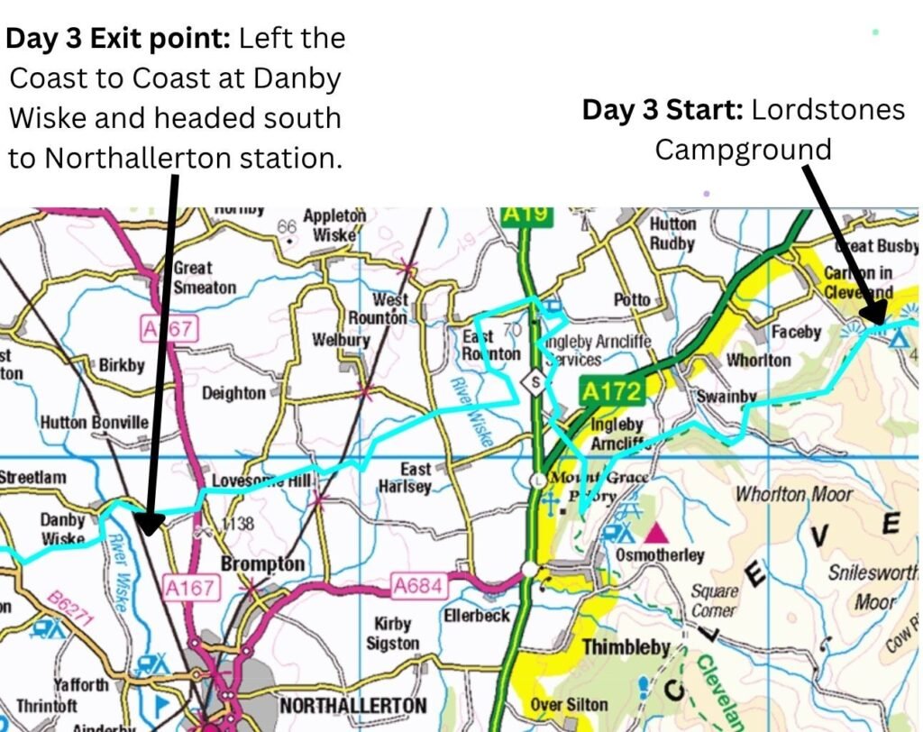
Despite rushing, packing up camp and cooking breakfast always takes longer than expected, but I was still on the trail by 7am. I ascended yet another ridge and caught the last of the morning sunrise as it illuminated Charlton Bank and the clouds to the east behind me. Apart from birdsong and the now‑dying wind, the trail was silent, and the going was noticeably easier than yesterday.
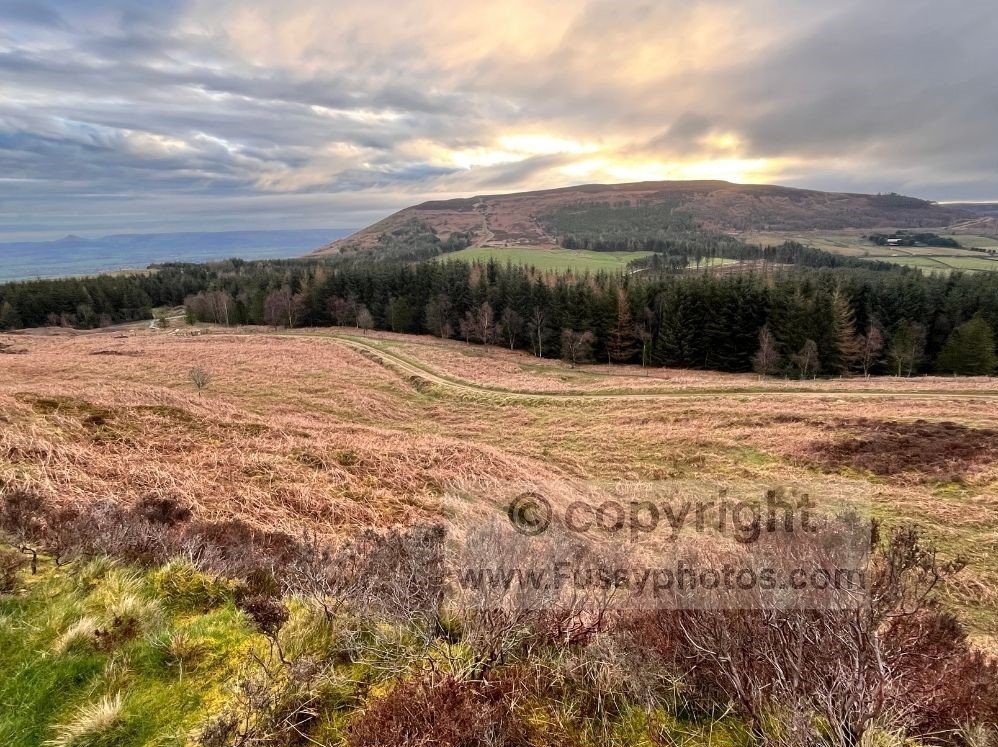
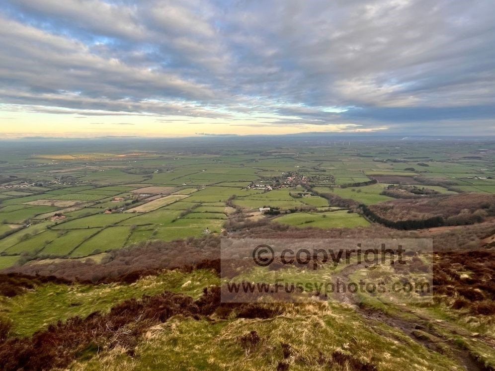
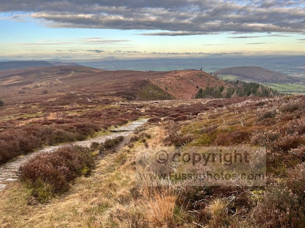
Peaking at 408m, I took in panoramic views at Charlton Bank. The trail then began a steady descent, following concrete slabs that were slippery in the morning dew, so I took care — I had no desire to fall and skid gracefully down the hillside like a dropped shopping trolley. I was ready for a change of scene; the endless heather was starting to drive me a little mad, the sort of madness where you begin negotiating with plants as if they might offer you a shortcut.
Knolls End to Round Hill
At Knolls End, I reached a sharp section of trail I remembered from my Cleveland Way exertions. The path drops steeply from 315m, bottoms out at 180m, then follows a short stretch of road before climbing again through a plantation to 230m.
At Round Hill, I came to a long series of steps — great for striding down at pace on a west‑to‑east walk, but hard work uphill. Halfway up I began to wonder if the steps had moved without me noticing, as if I was in one of those dreams where you run but never get anywhere, only with worse quad burn.
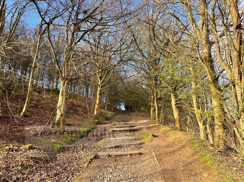
The ascent continued across Scarth Wood Moor towards Osmotherley, before the trail performs a literal 180‑degree turn and descends through Arncliffe Wood — presumably designed to test whether walkers are paying attention or simply following the person in front.
A Moral Crossroads on Scarth Wood Moor
The temptation at Scarth Wood Moor is to take the path to the right, which would cut off half a mile of walking and avoid the seemingly pointless elevation gain, as the path peaks at 300m before descending to Ingleby Cross. Presumably Wainwright kept this detour because he stopped in Osmotherley. Not wanting to cheat myself, I stuck to the official route, even if the alternative path looked like it had been created for people with a basic sense of self‑preservation.
Leaving the Cleveland Way
When the Coast to Coast finally left the Cleveland Way, I was excited to be on new ground, each turn offering a fresh view. Passing numerous walkers coming uphill, I briefly felt like I was winning at last. I exited the woodland and continued towards the rising road noise, eventually following the lane towards the A172.
The First Road Dash of the Day
This was the first of the day’s mad dashes across a 60mph road. I timed the crossing carefully — I had no desire to feature in the local news as “Over‑confident Hiker Misjudges Ford Focus”.
The Great Langton Bus Mirage
There’s a pub and café at Ingleby Cross, along with better 5G signal. I checked the bus timetables to see how far I could realistically walk before catching a bus to Northallerton. I was briefly excited to find a service from Great Langton, around ten miles west and just off the route. But with the last bus in 2.5 hours, it was unrealistic even on flat terrain. I resigned myself to the wasted miles walking to my train, reminding myself that long‑distance walking is often just character building with a backpack.
Crossing the A19 and Ploughing On
Signposting brought me to the A19 — this time two lanes of racing traffic in each direction. I doubted my ability to get across and gained a new empathy for badgers, pheasants, and hedgehogs. At least they’re not burdened with a pack or hamstrings that feel older than the National Trail system.
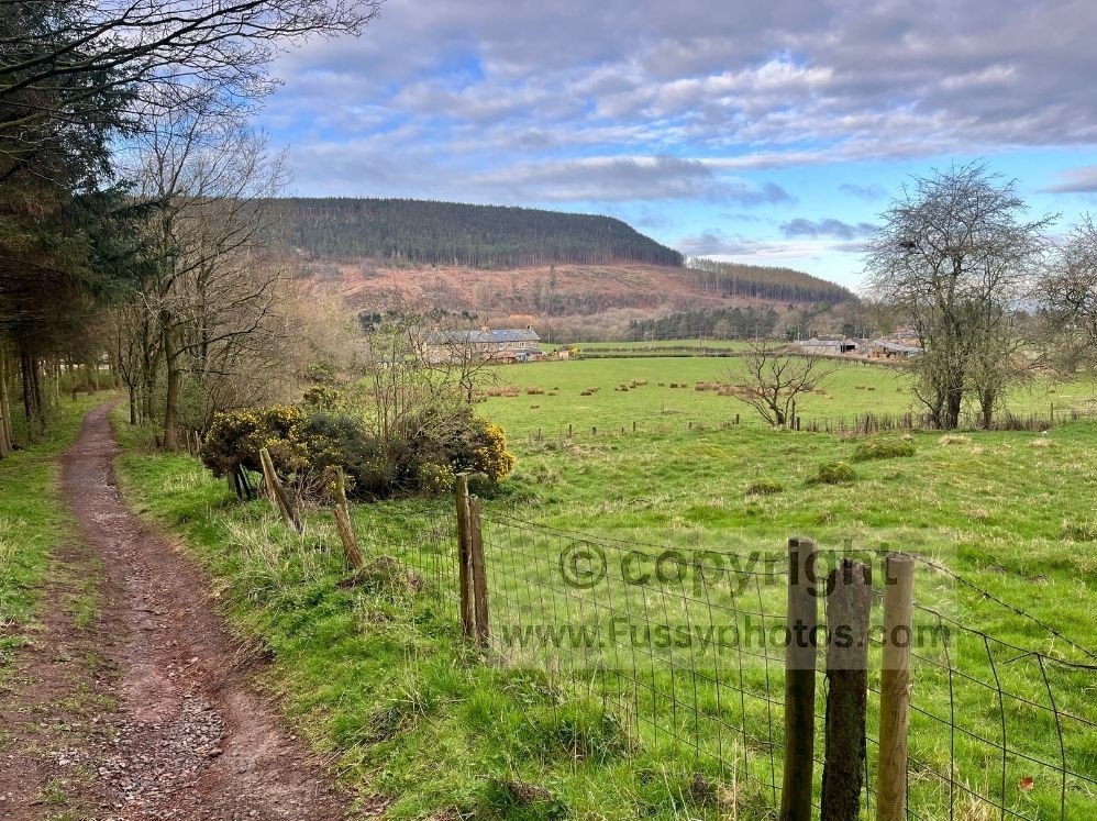
I survived the crossing, only to remember I’d seen a map suggesting the route had been moved northwards to a footbridge. Yet Coast to Coast signs surrounded me, leading me onto flat farm ground as the sun came out, making for pleasant walking reminiscent of the Yorkshire Wolds Way.
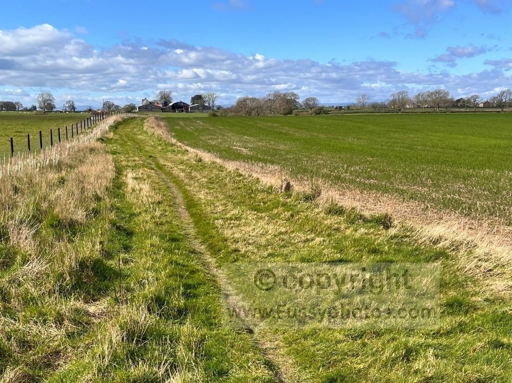
Initially I enjoyed the change of scene, but I soon realised why someone had warned me about this section the day before. The route followed monotonous farm track after farm track, and the thought of jumping on a bike entered my mind. Sadly, no second‑hand bike shops materialised — not even a suspiciously abandoned bike— so I trudged on.
My pace slowed as the cumulative effect of nearly 60 miles took its toll on my calves and hips, while my pack dug in with the enthusiasm of a terrier discovering a rabbit hole.
Reaching the End of the Line — Literally
The trail crossed the Darlington–Northallerton train line before continuing westwards, but sadly there was no station. Approaching Danby Wiske, I turned south and called time on Stage 1, just as the weather finally improved — a level of timing Northern Rail can only dream of.
Coast to Coast FAQ — Ingleby Cross to Clay Bank (Charlton Bank → Danby Wiske Section)
How does this section fit into the guidebook stage?
Guidebooks typically describe this area as part of the Ingleby Cross to Clay Bank stage. Walking in reverse, my segment from Charlton Bank to Danby Wiske forms the eastern half of that longer stage.
How difficult is the terrain between Ingleby Cross and Clay Bank?
The stage includes sustained moorland climbing, steep stepped sections near Round Hill, and long undulating stretches across Scarth Wood Moor.
Is the route easy to follow in this section?
Navigation is straightforward where the Coast to Coast overlaps the Cleveland Way. Waymarking remains clear through Arncliffe Wood and across Scarth Wood Moor.
Are there facilities between Ingleby Cross and Clay Bank?
Ingleby Cross has a pub and café. At the A19 crossing there is a petrol station where you can buy drinks and basic snacks. Further on, Lordstones offers a café, campsite and an outdoor tap for refilling water bottles. Beyond these points, there are no additional shops or reliable water sources on the ridge towards Clay Bank, so walkers should still carry enough food and water for the morning after.
Silly FAQs — Coast to Coast (Charlton Bank → Danby Wiske)
Why does the path climb all the way up Round Hill just to come back down again?
Because long‑distance paths are contractually obliged to include at least one climb that feels philosophically unnecessary.
Is there a shortcut across Scarth Wood Moor?
Yes, but only if you’re comfortable explaining to other walkers why you’re suddenly ahead of them.
Is the A19 crossing really that bad?
It’s manageable, but it does encourage you to empathise with hedgehogs on a deeper level.
Why does the farmland feel so long?
Because once you’ve crossed the A19, the trail assumes you’ve already proven yourself physically and now just wants to test your patience.