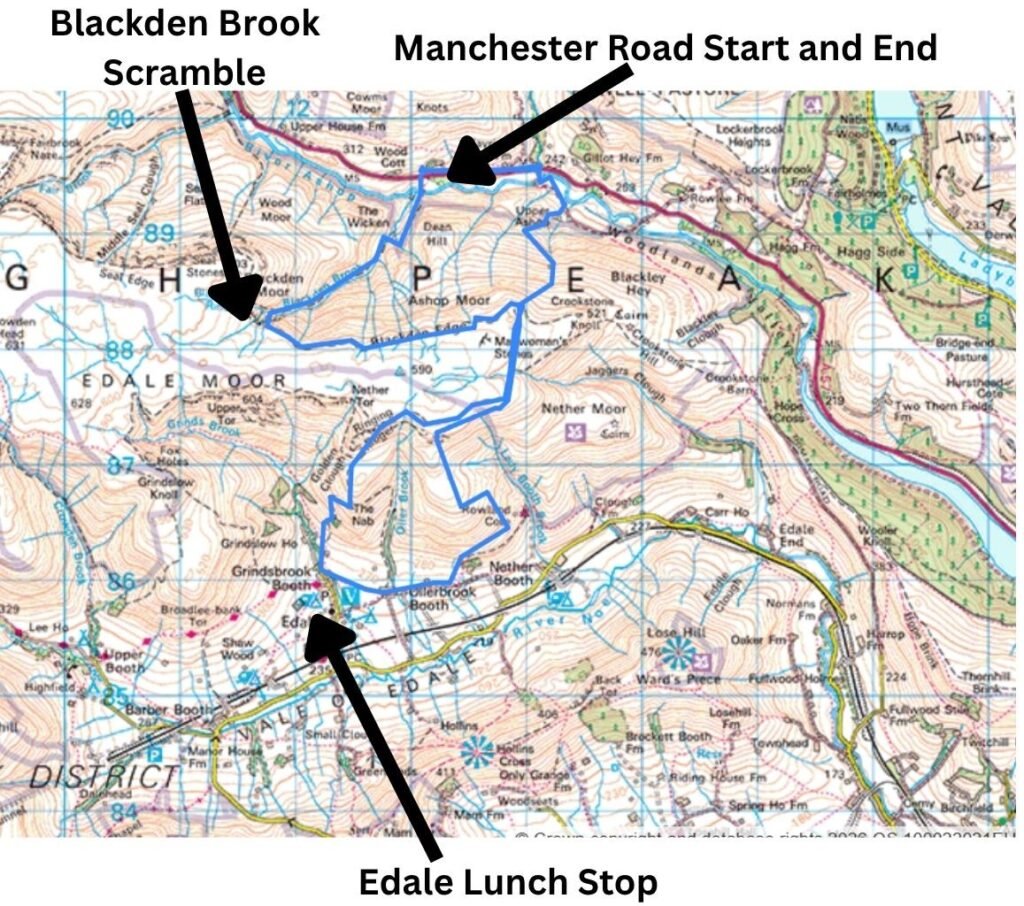
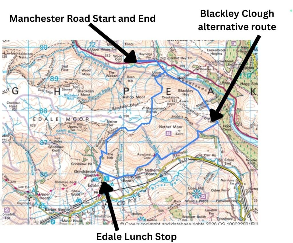
Meeting up with friends, we wanted a Peak District walk with big scenery but along a route none of us had taken before — no easy task for three avid walkers. We eventually settled on a route that would take us to Edale. Blackden Edge was mentioned, a route we’d each walked previously, but always from Ashop Clough or Hope. This time, we wanted a shorter approach from the limited off‑street parking on Manchester Road, and remembered a steep track we’d once seen heading into Blackden Brook. None of us had taken the Brook before.
Our plan was simple: climb to Blackden Edge, follow the contours east with wide views towards Bamford Edge, then loop south of Lose Hill, Hollins Cross, Mam Tor and the Vale of Edale, before descending via Golden Clough and The Nab into Edale for a mid‑walk break. From there, we would climb back onto Blackden Edge via a different line and return to Manchester Road — not an out‑and‑back, nor a perfect circular, but more of a figure‑of‑eight.
Route Map: Blackden Brook and Blackden Edge Circular
Key Facts
- Distance: ~10 miles (figure‑of‑eight loop)
- Total Ascent: ~750–800 metres, including two steep climbs
- Time Required: 5–6 hours with breaks
- Start/Finish: Informal parking lay‑bys on Manchester Road (A57)
- Key Features: Blackden Brook scramble, Blackden Edge ridge, Madwoman’s Stones, Golden Clough descent, Edale mid‑walk stop
- Difficulty: Moderate–hard — hands‑on scrambling, faint paths, steep descents
- Terrain: Muddy sheep trails, rocky scrambles, scree, ridge paths, steep valley tracks
- Navigation: Map, compass and GPS strongly recommended (faint paths on the brook and edge)
- Best For: Walkers wanting a quieter, more adventurous alternative to the classic Edale and Mam Tor routes
- Alternative Option: Blackley Clough and the Vale of Edale return route for a steadier, less scrambly finish
Video: See The Edale Loop You’ve Probably Never Tried (But Should)

Starting from Manchester Road
From our parking spot on Manchester Road, we followed a signposted trail down a steep slope, crossing a bridge over the River Ashop. The route then climbed the southern side of the valley from its 250‑metre low point.
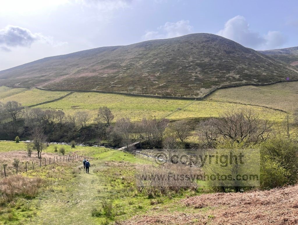
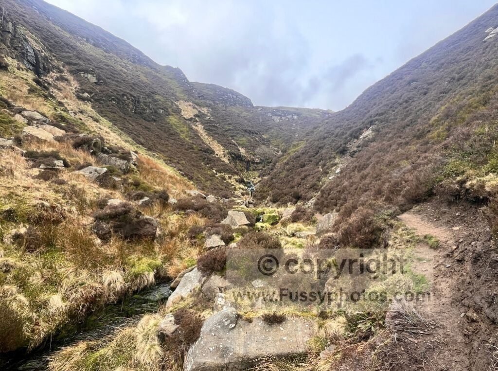
The path through Blackden Brook is more of a sheep trail than a formal footpath — and the sheep clearly weren’t taking responsibility for maintenance. Multiple stream crossings are required, all manageable with care. The sound of running water is constant as you pass small rapids and, eventually, small waterfalls feeding into the brook. It’s a muddy route even after dry weather and, with hindsight, one of the few where I’d have used hiking poles had I brought them.
Scrambling the Gorge in Blackden Brook
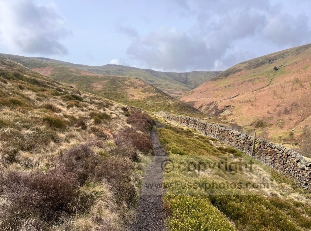
After around a mile, the valley appears to end abruptly at a waterfall roughly 8–10 metres tall, with a narrow gorge ahead — which felt unnecessarily dramatic for a walk we’d billed as “steady”. Another hiker heading the same way pointed out a steep, boggy route up the right‑hand side of the valley, but it looked slippery and almost guaranteed a fall – — the sort of line you only take if you’ve already made peace with the consequences.
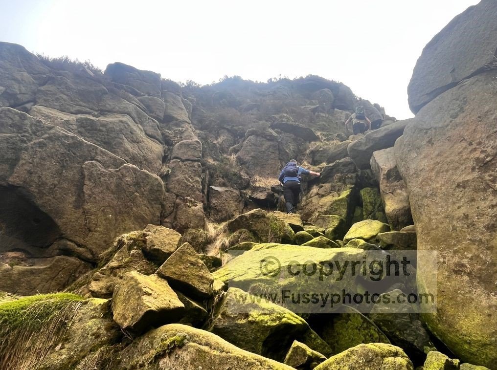
Instead, I approached the waterfall and spotted a possible line up the gorge — arguably the lower end of Grade 2 scrambling. Using protruding rocks and thick, stable roots, I pulled myself up and reached the trail above in under a minute. I beckoned the others, and we all made it up with a little exertion but no real difficulty.
Scrambling a Steep Scree Slope Above Blackden Brook
The uneven trail continued southwest, with insecure footing and occasional step‑ups. I fell once, and only a firm handful of heather prevented a second fall. Despite this, route‑finding was enjoyable as we hopped from rock to rock, seeking the driest line forward.
Progress was slow, and to the left I noticed a steep scree slope — shorter than the remaining valley but definitely steeper. The advantage was several large rocks offering more secure scrambling. A friend went first and confirmed it was fine, though some rocks were green with algae and best avoided. After 30 metres or so, I turned around to see the rocks perfectly framed by the V‑shaped valley — a superb photo spot, , assuming you weren’t too busy negotiating gravity to get your phone out.
The scramble continued for another five minutes before we emerged onto Blackden Edge, a flatter trail following the contours and inviting exploration east or west.
Ridge Walking Along Blackden Edge
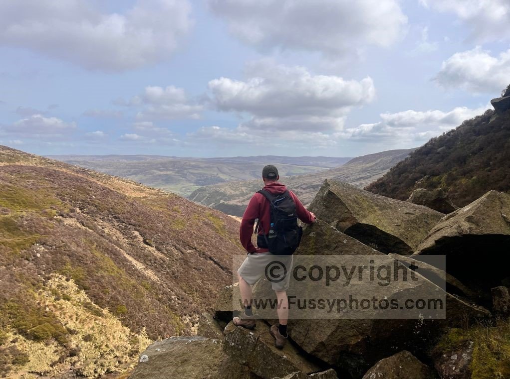
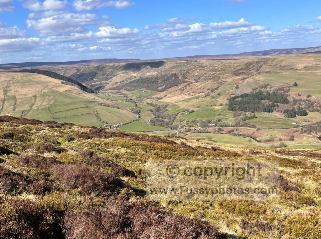
Our ridge walking began with excellent views to the north and northeast, with Alport Castles clearly visible across the valley — itself another superb ridge walk and fun area to explore. You can explore it in full on my Alport Castles Circular report, which follows a longer ridge and includes the dramatic landslip viewpoint.
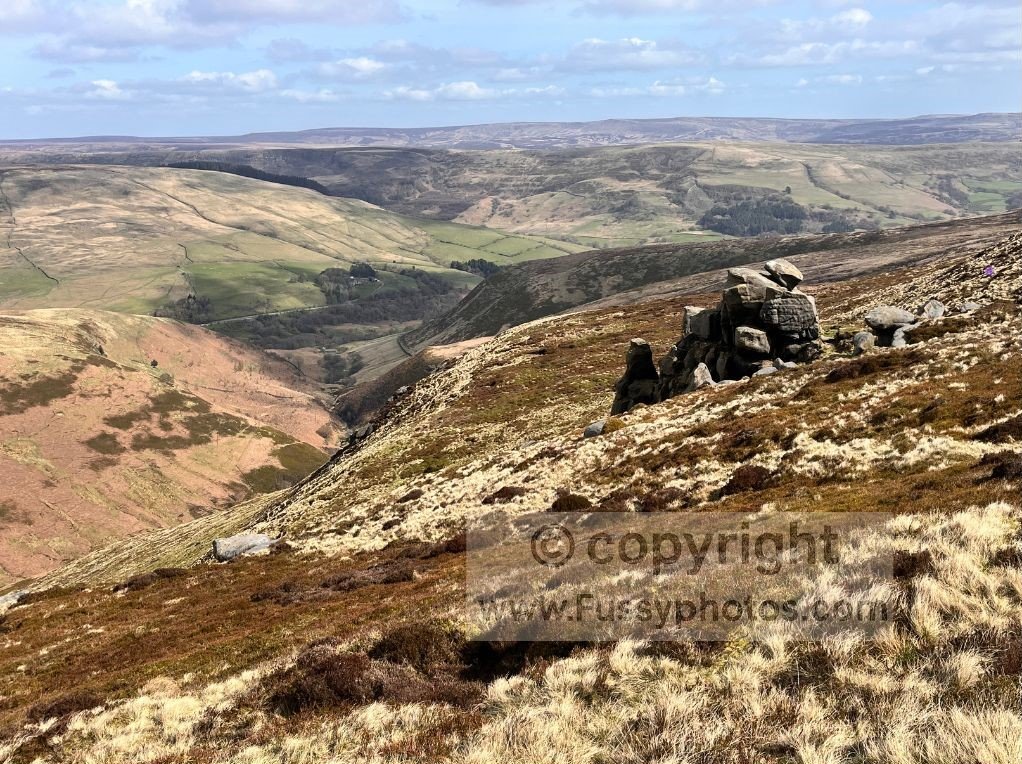
A mile along the ridge brought us to the bizarrely named Madwoman’s Stones, a small cluster of rocks around two metres tall. We crouched out of the wind and enjoyed a well‑earned snack break.
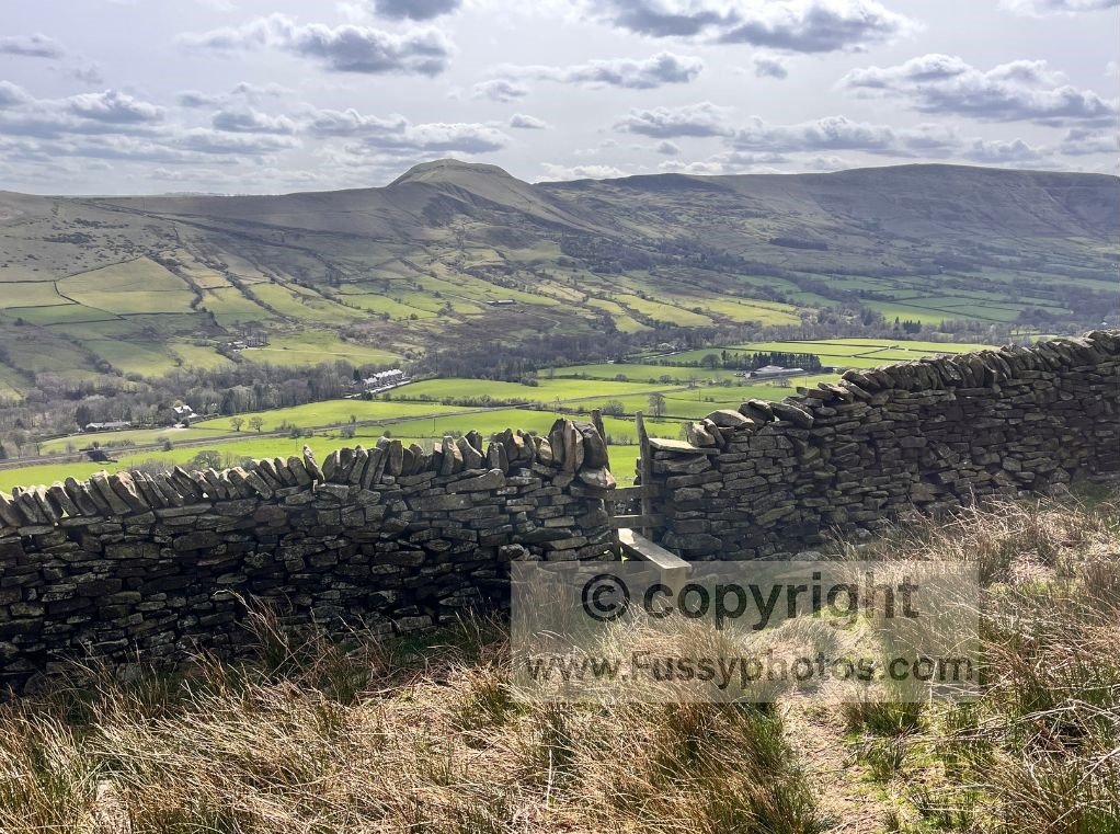
From here, the trail heads south over the eastern edge of Edale Moor towards Nether Moor, with increasingly impressive views of Lose Hill to the left, and Back Tor, Hollins Cross and Mam Tor to the right — superb scenery all the way down Edale Valley. You can explore that whole ridge in more detail on my Mam Tor Circular report, which links Mam Tor, Hollins Cross, Back Tor and Lose Hill in a full 9‑mile loop from Castleton or Hope.

Descending to Edale via Golden Clough
The ridge eventually loops west before the descent to Edale via Golden Clough. Good map‑reading and a GPS are useful here to avoid unnecessary detours. It’s a scenic descent, though steep — we dropped 300 metres in less than a mile along a rocky track, the kind of descent your knees remember long after your brain has moved on. I found myself dreaming of switchbacks and hiking poles.
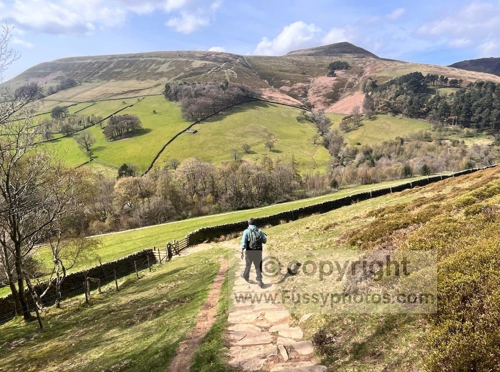
Edale was busy with walkers. Tempted by the Old Nag’s Head, we opted instead for Newfold Farm Café, knowing it would be quicker — and after the Blackden Brook ascent had taken far longer than expected, a faster option definitely appealed. Over lunch we agreed we’d enjoyed the scrambling, but an out‑and‑back would mean repeating similar views and increasing the risk of a fall on the slippery terrain.
If you’d prefer a classic Edale route with big scenery but less scrambling, my Edale to Kinder Downfall loop follows the Pennine Way to Kinder Low and Kinder Downfall before returning across Edale Moor.
Alternative Return Route Options
We studied the map for the best return route. I suggested the Blackley Clough and Vale of Edale option, but at first glance it looked longer than another possibility: heading east through the Vale of Edale before ascending a steep minor trail around Rowland Cote.
Alternative Route Map: Blackley Clough and the Vale of Edale
With hindsight, this was only a mile extra and a perfectly plausible alternative. Our chosen route, however, was a calf‑burner — a seemingly constant 35‑degree climb, long enough for all of us to go quiet in that very specific uphill way. Still, we ascended quickly and regained Blackden Edge sooner than expected.
By now the weather was excellent, with great light and visibility. The descent from Madwoman’s Stones to Upper Ashop and the river crossing was a joy, though my knees disagreed.
Reaching Manchester Road, all that remained was 15–20 minutes of road walking back to the car — the traditional Peak District cooldown — completing a fun 10‑mile circular with varied ridge views.
FAQs About the Blackden Brook & Blackden Edge Loop
How difficult is this loop to Edale?
It’s a moderately challenging route with a steep ascent through Blackden Brook, short hands‑on scrambling, and a long descent into Edale via Golden Clough. Confident walkers will enjoy it, but it’s tougher than the classic approaches from Hope or Mam Tor. If you prefer a steadier outing, the alternative map on this page shows a more moderate return route that avoids the steepest climbing.
Are navigation skills needed on this route?
Yes. The upper section of Blackden Brook and parts of Blackden Edge have faint paths, and the descent into Edale via Golden Clough can be confusing in poor visibility. A map, compass and GPS are strongly recommended.
How long does the loop take?
The figure‑of‑eight loop is roughly 10 miles, depending on the exact line taken on the return to Blackden Edge. Expect 5–6 hours with breaks.
Where do you park for the Blackden Brook / Blackden Edge route?
Parking is limited on Manchester Road, with only a few informal pull‑ins near the Blackden Brook access point.
Is the Blackden Brook scramble dangerous?
The scramble beside the waterfall in Blackden Brook is short and low‑exposure, but it does require using hands and choosing solid footholds. In wet or icy conditions it becomes more serious, and the alternative boggy bypass on the right can be slippery.
Can you avoid the scrambling sections?
Yes. The alternative return route shown on the map avoids the steepest scrambling and scree, making the loop more suitable for walkers who prefer a steadier outing. You’ll still enjoy the ridge views along Blackden Edge without the hands‑on sections.
How does this route compare to the classic Edale walks?
It’s quieter and more adventurous than the paths from Edale, Hope, or Mam Tor. The scenery along Blackden Edge is just as good — sometimes better — but the paths are fainter and the scrambling adds a bit of spice. It’s ideal if you want a less‑trodden line into Edale Valley.