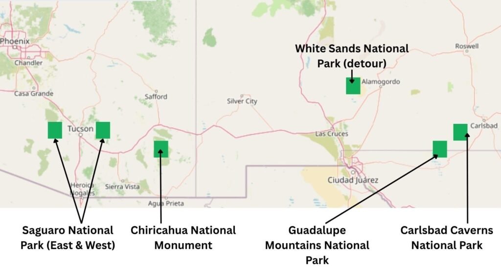
Saguaro National Park, Chiricahua National Monument, Guadalupe Mountains National Park and Carlsbad Caverns National Park are all desert parks, but each one feels completely different. A road trip linking the four takes you from more than a million towering saguaro cacti — one of the most iconic symbols of the American West — to dense fields of rhyolite pinnacles and balanced rocks at Chiricahua, then on to the stunning McKittrick Canyon and the highest peak in Texas at Guadalupe Mountains, before finishing beneath the Chihuahuan Desert exploring the strange and beautiful formations in the caverns Will Rogers once called “the Grand Canyon with a roof on it” at Carlsbad Caverns.
This road trip is shaped as much by logistics as scenery: long desert drives, remote trailheads, sparse services, and parks where early starts and careful planning make a real difference. Some places reward a full day on the trail (Chiricahua and Guadalupe), while others — like Carlsbad Caverns — can be explored in half a day with the right timed entry.
White Sands National Park isn’t included in this road trip. It’s a logical addition on the map, but I didn’t have the time to do it justice and didn’t want to spread the trip too thinly. This journey focuses solely on Saguaro, Chiricahua, Guadalupe Mountains and Carlsbad — four National Park Service sites filmed in a single, continuous eastbound route.
This guide brings together my reflections on each park, the decisions we made along the way, and what we’d do differently next time.
Explore the Entire Southwest NPS Road Trip on Video

Getting Started — Flying Into Phoenix, Tucson or El Paso
From the west, the most logical starting point is Tucson, a city of half a million people that sits between Saguaro National Park’s West and East Districts. Phoenix Sky Harbor International Airport is an equally practical option, though it’s more than 1.5 hours north of Tucson.
If you’re approaching from the east, El Paso International Airport works well. From El Paso, it’s a little over 1.5 hours east to Guadalupe Mountains National Park.
The route described below follows the journey west to east.
Starting the Trip — Phoenix to Tucson
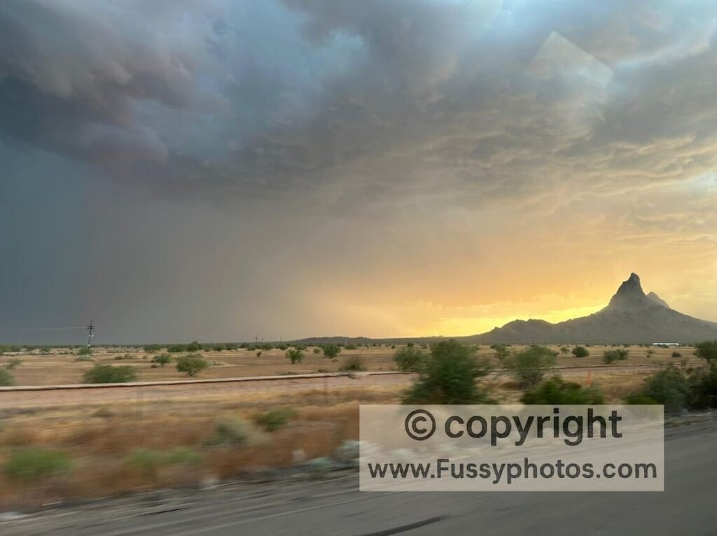
The drive from Phoenix to Tucson is straightforward, with the first stands of saguaro cacti appearing as you head south and long, open desert views on either side of the interstate. You pass Picacho Peak State Park on your right — a distinctive volcanic plug rising from the desert floor — and in our case, we drove through a huge storm rolling across the valley.
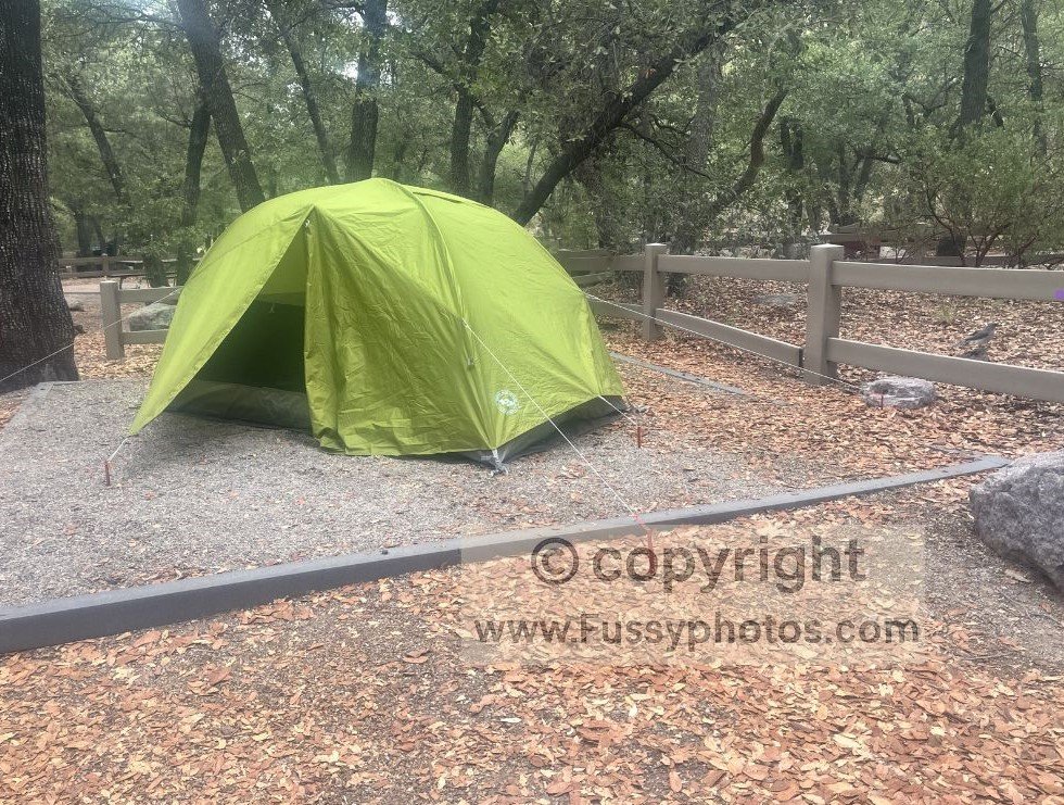
We didn’t camp the night before visiting Saguaro National Park. There’s no front‑country camping inside the park, and with daytime temperatures exceeding 100°F, we wanted access to air conditioning. Summer hotel prices in Tucson were extremely low, likely because it’s well outside peak season. It also made sense logistically: the following night at Chiricahua National Monument would be at Bonita Canyon Campground, which has no showers, so starting the trip clean and rested was a practical choice.
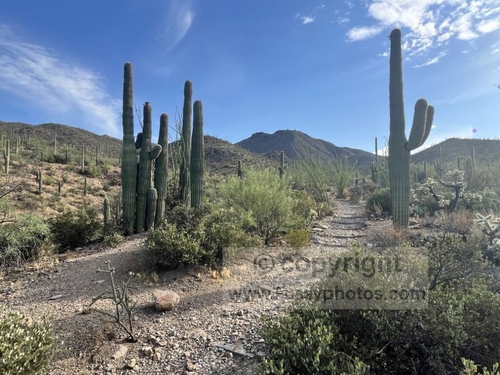
From Tucson, the drive to the King Canyon Trailhead in Saguaro National Park (West District) takes around 20 minutes. It’s a scenic approach, climbing gently in elevation and passing literally hundreds of saguaros lining the hillsides. Along the way, we passed signs for a remote campground just outside the park boundary — basic, no facilities — but we didn’t need it for this trip.
Saguaro National Park (West District)
Why We Focused on the West District
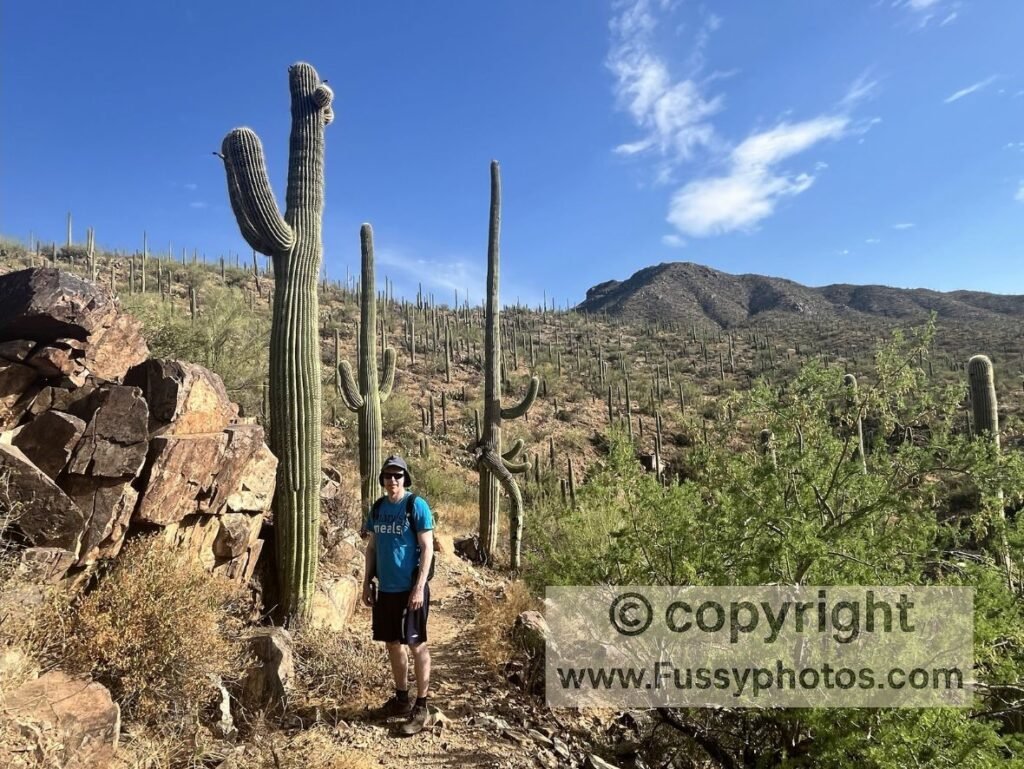
We only had a single day in Saguaro National Park, and with temperatures pushing 40°C, we focused on the West District (Tucson Mountain District). It’s closer to Tucson, more accessible, and delivers the classic Sonoran Desert scenery immediately — dense forests of saguaro cacti, rugged hillsides, and wide‑open desert views.
With no front‑country camping inside the park and the heat making backcountry travel unrealistic, staying in a Tucson hotel the night before made sense. Summer rates were extremely low, and having air conditioning before (and potentially after) a desert hike was a welcome luxury.
Driving to the King Canyon Trailhead
From Tucson, the drive to the King Canyon Trailhead takes around 20 minutes. It’s a scenic approach, climbing gently in elevation and passing hundreds of towering saguaros lining the slopes. We also passed a remote, no‑facilities campground just outside the park boundary — useful to know about, but not essential for this itinerary.
How to Plan a One‑Day Visit to Saguaro National Park
For most road‑trippers, a realistic day in Saguaro National Park looks like an early‑morning hike, followed by time to cool down during the hottest part of the day, and an optional return to the park in the evening once temperatures drop.
We chose to hike Wasson Peak via the King Canyon, Hugh Norris, Esperanza, and Gould Mine Trails — a loop that’s widely regarded as one of the best ways to experience the park. At around 7 miles with roughly 600 m of elevation gain, it’s a realistic early‑morning objective in summer, especially if you start at dawn and aim to be off the trail before the heat builds.

For a full breakdown of the route, see my guide to the best hike in Saguaro National Park.
After the hike, many visitors head to the Arizona‑Sonora Desert Museum or back to their hotel to escape the heat. We’d already seen coyotes, mule deer, and plenty of birdlife on the trail, so cooling off indoors felt like the right call.
We also considered the Rincon Mountain District (Saguaro East), but it sits farther from Tucson and would have added more driving. Unless you’re planning a backcountry trip, a full day in Saguaro West is usually enough to experience the park’s classic desert landscapes.
For a broader overview of both districts, see my Saguaro National Park guide.
For most road‑trippers, a realistic day in the park looks like:
- an early‑morning hike
- a cool‑down period (hotel or museum)
- an optional evening outing once temperatures drop
Unless you’re planning a backcountry trip, a full day in Saguaro West is plenty.
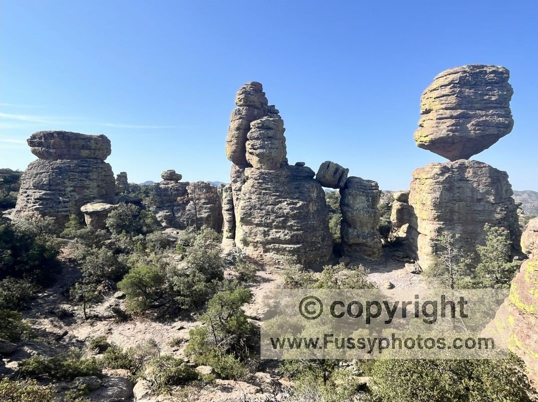
Chiricahua National Monument
Driving from Tucson to Chiricahua National Monument
The drive from Tucson to Chiricahua National Monument is long, remote, and not especially scenic. Once you leave the interstate near Willcox, there are few services and long stretches of straight desert road. It’s essential to fill up on fuel in Tucson and again in Willcox if you’re running low — there’s nothing reliable beyond that point.
We stopped at the Visitor Center on arrival to confirm trail conditions and finalise our plan for the next day.
Camping at Bonita Canyon Campground
We stayed at Bonita Canyon Campground, a shaded, peaceful site tucked among oak and pine trees. The birdlife here is exceptional — we had jays, woodpeckers and smaller songbirds hopping around our campsite within minutes of arriving. There are restrooms and water, but no showers, a factor to consider when booking your accommodation before and after Chiricahua National Monument.
The campground road crosses a small creek bed. It was dry during our summer visit, but it’s worth keeping in mind during wetter seasons.
Choosing a Route: Why We Hiked the Big Loop
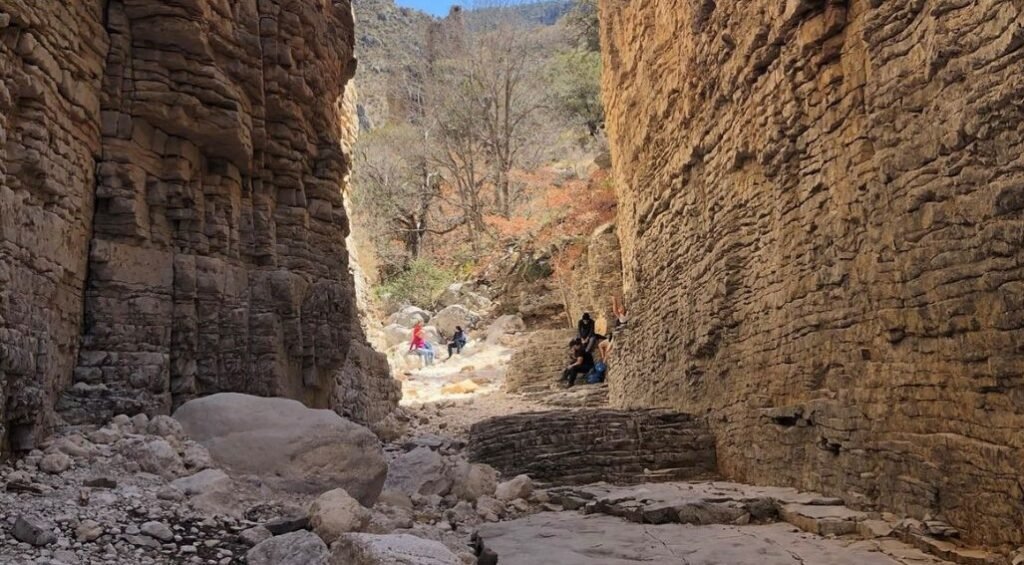
I’d spent a lot of time studying maps and photos before the trip, and I was tempted by the idea of starting from the Visitor Center via Lower Rhyolite Canyon. It would have given us a longer, more gradual approach into the hoodoos. But adding that to the full Big Loop felt like too much mileage in the heat, and a ranger’s advice the day before nudged us toward the more conventional option.
So we committed to the Chiricahua Big Loop and the Heart of Rocks Loop — the park’s showcase section, which combines:
- Ed Riggs Trail
- Mushroom Rock Trail
- Balanced Rock
- Heart of Rocks Loop
- Sarah Deming Trail
- Echo Canyon Trail
For a full breakdown of the route, see my report for the Chiricahua Big Loop hike.
Reflections on the Big Loop Route
We enjoyed the shaded, gentle start on the Ed Riggs Trail — it’s one of the cooler and more scenic stretches of the day, especially in summer. In contrast, we weren’t particularly taken with the Mushroom Rock Trail. With hindsight, it felt more like a functional connector than a destination in its own right, and it’s not a section I’d rush to repeat. Its main purpose is simply to get you closer to the Heart of Rocks Loop, which is where the landscape really becomes interesting.
Heat, Exposure and the Upper Rhyolite Ascent
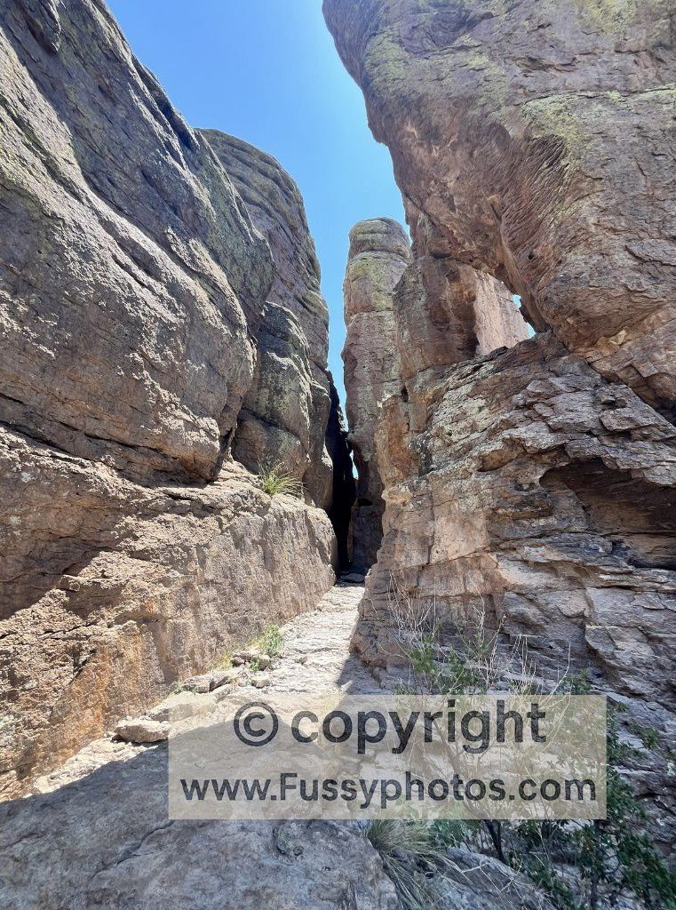
The climb on Upper Rhyolite Canyon was hot and exposed when we visited. It’s a noticeable shift from the shade of Ed Riggs, and by the time we reached the junction toward Echo Canyon, we were feeling the heat. Echo Canyon itself was a welcome change — more shaded and enclosed.
The Route We Wish Existed
In an ideal world, we would have loved a point‑to‑point hike starting at Echo Canyon, looping through Heart of Rocks, and then descending Lower Rhyolite Canyon all the way back to the Visitor Center. That would create a beautifully logical flow through the park’s best scenery. Unfortunately, there’s no shuttle service, and the distances make arranging a private one unrealistic for most visitors. For a clearer sense of how these trails connect, the official Chiricahua trail map is available from the National Park Service.
Considering Lower Rhyolite as an Out‑and‑Back
A possible alternative is to hike Lower Rhyolite Canyon as an out‑and‑back to reach the Heart of Rocks Loop. It’s a tempting option if you want to avoid the Mushroom Rock Trail, but it’s a long, strenuous day — probably too much for many road‑trippers, especially in summer heat.
How to Plan a One‑Day Visit to Chiricahua National Monument
For most road‑trippers, a realistic day in Chiricahua National Monument looks like:
- an early start from Massai Point
- a loop that includes Heart of Rocks
- finishing before the afternoon heat
- optional stargazing if the moon cycle cooperates
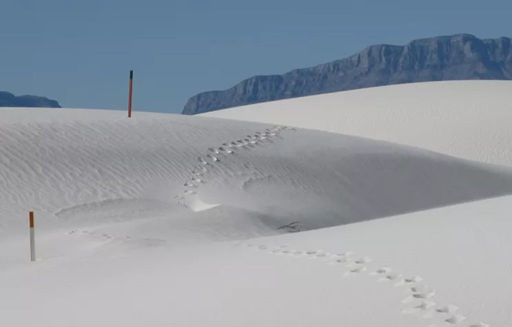
White Sands National Park — The Decision to Skip It
Linking Chiricahua to West Texas via El Paso and Las Cruces
Leaving Chiricahua National Monument, the natural way to continue east is to drop back to I‑10 and head toward El Paso. From there, you can either push straight on toward Guadalupe Mountains National Park or detour north via Las Cruces to reach White Sands National Park. On the map, it looks like an easy addition: a simple kink in the route rather than a major diversion.
Why White Sands Looked Like a Logical Addition
On paper, White Sands National Park fits neatly into a Southwest road trip. From Las Cruces, it’s only a short drive north to the dunes, and the Alkali Flat Trail is one of the most distinctive desert hikes in the region. We had even booked a hotel in Las Cruces with the intention of visiting White Sands and then continuing east toward Guadalupe Mountains National Park.
Practical Limitations: Opening Hours and Camping Closures
Once we looked more closely at the logistics, the plan became less appealing. White Sands NP closes at night, and the long‑standing closure of backcountry camping meant there was no way to start early from inside the park. With the gates opening at 7am, and another 20–30 minutes of driving from the entrance to the Alkali Flat Trailhead, we would have been starting the hike at a time when the desert was already warming up — not ideal for a completely exposed dune environment.
The Cost of Detouring Away from the Main Route
Visiting White Sands also pulls you away from the natural eastbound flow of this trip. It adds distance, adds driving, and shifts the focus away from the sequence of Saguaro → Chiricahua → Guadalupe Mountains → Carlsbad Caverns — a route that otherwise feels clean and continuous.
With more time, a two‑night base in Las Cruces would make sense: one night before visiting the dunes, one night after. But on a tight schedule, it risked diluting the rest of the trip.
Why We Ultimately Skipped It
In the end, we decided to skip White Sands National Park and spend the extra day in Guadalupe Mountains National Park instead. That choice gave us time to prepare for our McKittrick Canyon backcountry trip, rest properly at Pine Springs Campground, and potentially add shorter hikes like Devil’s Hall.
It also kept the road trip coherent — four desert parks in a single, continuous line, without a detour that would have stretched our time too thinly.
Guadalupe Mountains National Park
Driving to El Paso and Into West Texas
The run toward El Paso is functional rather than scenic, but it marks a clear shift in the trip: Arizona’s hoodoos and canyons give way to the wide, open basins of West Texas.
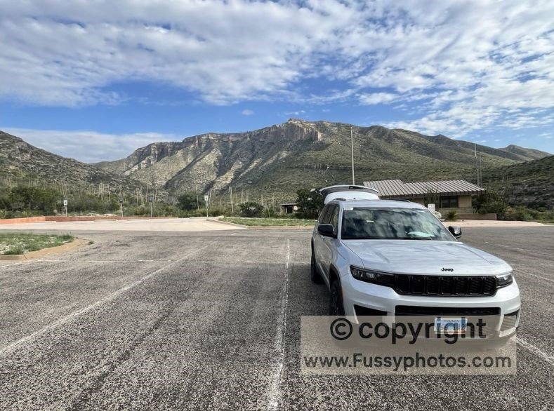
From El Paso, the latter part of the drive to Guadalupe Mountains National Park is dramatic. The desert stays flat for miles, then the Guadalupe Mountains rise abruptly from the plains — a sheer, unexpected wall of limestone that looks almost out of place after so much open country. It’s one of those approaches where you see the mountains long before you reach them, and the scale becomes clearer with every mile.
Arriving at Pine Springs: A Simple Base for Hikers
We based ourselves at Pine Springs Campground, which sits right at the foot of the mountains. It’s a simple, exposed campground — very little shade (until evening), no showers, and very little to do once you’ve spent half an hour in the Pine Springs Visitor Center. This is a park where the only real activity is hiking, and everything about the infrastructure reflects that.
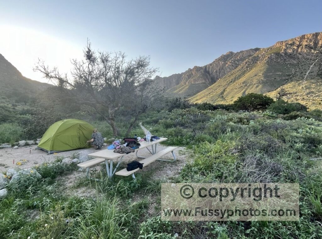
After the long drive from Las Cruces, having a full afternoon here was invaluable. It gave us time to reorganise gear, rest properly, and prepare for our McKittrick Canyon backcountry trip the following day.
Why We Prioritised Guadalupe Over White Sands
This was the point in the trip where we felt the benefit of skipping White Sands National Park. Instead of squeezing in a dune hike and arriving late and tired, we had the time to settle into Guadalupe, check conditions, and plan the next day without rushing.
If you want a full overview of the park’s trails, backcountry routes, and logistics, see my Guadalupe Mountains National Park guide.
Planning the McKittrick Canyon Backcountry Trip
Our main goal here was a backcountry overnight in McKittrick Canyon — one of the most striking landscapes in the park. The extra time gained by not detouring to White Sands meant we could:
- visit the McKittrick Canyon Visitor Center
- confirm water availability
- check weather and wind conditions
- repack food and gear without feeling rushed
It also left room for shorter hikes like Devil’s Hall if we wanted to stretch our legs before the main trip.
Early Evening Options: Devil’s Hall Trail
With hindsight, the Devil’s Hall Trail would have been a good early‑evening option. It’s close to Pine Springs, doesn’t require a huge time commitment, and gives you a taste of the canyon scenery without the intensity of the longer routes. If you arrive with a few hours of daylight, it’s a realistic way to stretch your legs after the drive.
Driving to McKittrick Canyon Visitor Center
The next morning, we planned to start from the McKittrick Canyon Visitor Center. On paper, it’s a quick 20‑minute drive from Pine Springs — but due to roadworks, it took us almost an hour. It’s worth checking conditions before you set off, especially in summer when road crews are active.
McKittrick Canyon (Backcountry Overnight)
I’ve written up the full backcountry trip on our dedicated page — see McKittrick Ridge Trail: Backpacking the Toughest Hike in Texas — but in short, it’s a logistically challenging route. The McKittrick Ridge Trail is steep, overgrown, and slow going, and because you can’t cache water along the ridge, you have to carry enough to reach Dog Canyon, which is at least a day and a half of hiking away.
For most road‑trippers, this is far more than they’ll want to take on.
Best Day Hikes in McKittrick Canyon for Road‑Trippers
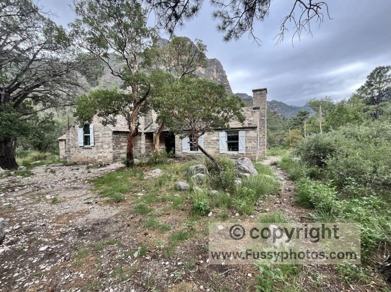
A more realistic option is to hike the McKittrick Canyon Trail to Pratt Cabin and The Grotto, or a little farther to The Notch for a high‑elevation view into the canyon. It’s a beautiful day hike and gives you a strong sense of the landscape without committing to the full backcountry route.
How Long to Spend in Guadalupe Mountains NP
With hindsight, 1.5 to 2 days is enough for most road‑trippers:
- Day 1: McKittrick Canyon to The Grotto or The Notch (or Devil’s Hall if you arrive late in the day)
- Day 2: Guadalupe Peak — the park’s signature summit hike
This gives you a balanced mix of canyon scenery and high‑elevation views without overcommitting to the backcountry — unless you’re specifically planning a backpacking‑focused trip.
Carlsbad Caverns National Park
Driving from Guadalupe Mountains to Carlsbad Caverns
The journey from Guadalupe Mountains National Park to Carlsbad Caverns is brief — a welcome change after the long desert drives earlier in the trip. The road cuts across open country with little development.
Where to Stay Near Carlsbad Caverns
There’s no developed camping at Carlsbad Caverns unless you’re doing a backcountry trip, but there is some primitive private camping along the route. We also noticed a small cluster of accommodation in White’s City. We hadn’t seen much of it online, but driving past made it clear that it’s a useful base in an area where accommodation, food, and fuel can be surprisingly hard to piece together. The other realistic option is Carlsbad (city), about 40 minutes northeast, which has far more hotels and services if you prefer a conventional base.
Booking a Ranger‑Led Tour
We booked our ranger‑led tour as soon as dates were released — they sold out in less than an hour that day. If you’re visiting in peak season, booking early is essential. The caverns themselves can be seen in half a day, but with hindsight, it would have been good to stay for the evening bat flight, when thousands of bats spiral out of the cave at dusk.
For a full breakdown of logistics, timed entry, and the Natural Entrance Trail, see my How to Visit Carlsbad Caverns guide.
Exploring the Caverns
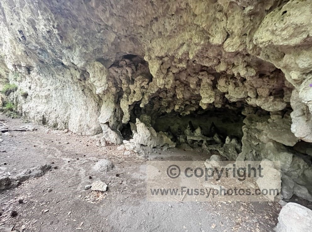
We entered via the Natural Entrance Trail, descending slowly as the daylight faded behind us and the temperature dropped. It’s a dramatic way to begin the visit — the colours shift, the air cools, and the sense of anticipation builds as you move deeper underground.
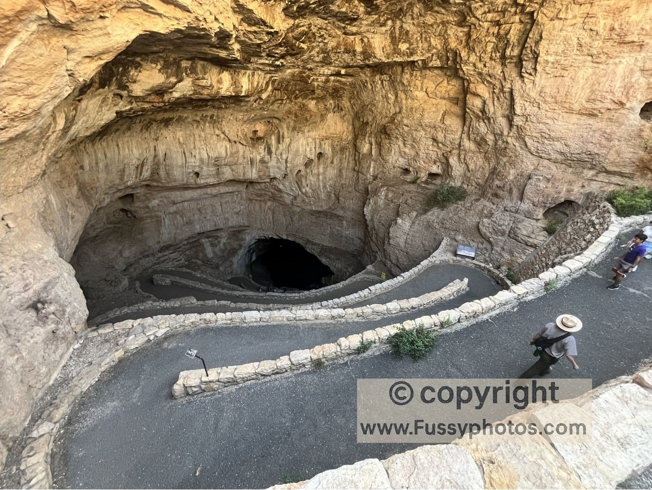
The Big Room is vast, but because the lighting is low and the formations rise from the floor, you don’t always grasp the scale until you see people in the distance. It’s an easy, flat walk, and the loop makes it simple to explore without missing anything.
How Long to Spend at Carlsbad Caverns
Most visitors can comfortably explore the caverns in half a day, especially if you’re doing a ranger‑led tour. If you want to see the bat flight, plan to stay into the evening — something we wish we’d done.
Suggested road trip itinerary: Saguaro, Chiricahua, Guadalupe Mountains, Carlsbad Caverns
Day 1 — Arrive in Arizona → Tucson base
- Start: Phoenix or Tucson airport.
- Drive: If you land in Phoenix, drive to Tucson and settle in.
- Stay:
- Tucson hotel (good showers, chance to reset after travel).
This sets you up for an early start in Saguaro without needing to think about logistics on arrival day.
Day 2 — Saguaro National Park (Tucson)
Morning–Midday:
- Explore Saguaro National Park (East or West).
- Short desert trails, scenic drives, and classic Sonoran Desert scenery.
Afternoon (optional):
- Visit the Arizona‑Sonora Desert Museum. Although it’s called a museum, around 85% of it is outdoors and primarily a walking experience, making it feel like a natural extension of Saguaro West rather than an indoor attraction.
Stay:
Tucson hotel again.
Day 3 — Tucson → Chiricahua National Monument
Drive:
- Tucson → Willcox (fuel + last reliable services).
- Willcox → Chiricahua National Monument (quiet, remote approach).
Afternoon:
- Stop at the Visitor Center to confirm trail conditions.
- Optional short hike: Lower Rhyolite Canyon Trail — a good warm‑up through hoodoos and rhyolite formations.
- Settle into Bonita Canyon Campground if camping.
Evening:
Stargazing in an International Dark Sky Park. Best viewing is at Faraway Ranch and Echo Canyon parking areas.
Day 4 — Chiricahua AM hike → PM drive to Las Cruces
Morning:
Hike the Chiricahua Big Loop including Heart of Rocks, starting early from Massai Point. Or choose a shorter loop that still includes Heart of Rocks.
Afternoon:
Drive Chiricahua → Las Cruces (long but straightforward).
Stay:
Las Cruces hotel.
Day 5 — White Sands National Park → Return to Las Cruces
Morning:
- Drive from Las Cruces to White Sands National Park.
- Hike the Alkali Flat Trail — a 5‑mile strenuous loop across steep dunes; expect around 3 hours of walking through open, shifting sand.
Optional:
Sledding on the dunes.
Stay:
Las Cruces hotel — showers, food, and easy logistics.
Day 6 — Las Cruces → Guadalupe Mountains NP (Pine Springs)
Morning:
- Drive Las Cruces → Guadalupe Mountains National Park.
- Stock up on food, water, and fuel before leaving Las Cruces or El Paso — services are sparse beyond this point.
Afternoon:
- Arrive at Pine Springs Campground.
- Optional hike: Devil’s Hall Trail — a good late‑day option after setting up camp.
Stay:
Pine Springs Campground.
Day 7 — One major hike → Drive to Carlsbad for Bat Flight
Morning–Afternoon:
Choose one major hike:
Option A — Guadalupe Peak
The park’s signature summit and the highest point in Texas.
Option B — McKittrick Ridge (out‑and‑back)
- Steep, demanding, and slow going; best for strong hikers.
- Backcountry‑focused road‑trippers may extend this into an overnight.
Late Afternoon:
Drive Guadalupe Mountains → Carlsbad Caverns.
Evening:
Attend the Bat Flight Program (April–October).
- Free, no reservations.
- Takes place at the Bat Flight Amphitheater near the Natural Entrance.
- Best flights typically occur August–September.
Stay:
- White’s City (closest), or
- Carlsbad (city) — more hotels and food.
Day 8 — Carlsbad Caverns → End of Road Trip
Morning:
- Enter via the Natural Entrance Trail.
- Walk the Big Room loop.
- Join your ranger‑led tour (book as soon as dates are released — they can sell out within an hour).
Afternoon:
Final drive to El Paso Airport or onward travel.
End of road trip.
Saguaro, Chiricahua, Guadalupe Mountains & Carlsbad Road Trip FAQs
How many days do you need to visit Saguaro, Chiricahua, White Sands, Guadalupe Mountains and Carlsbad Caverns?
7–10 days, depending on how much hiking you want to include. Chiricahua and Guadalupe Mountains benefit from early starts and full days, while Carlsbad Caverns and White Sands can be explored in half a day each.
What is the best starting point for this road trip?
Most visitors begin in Tucson or Phoenix, with Tucson offering the easiest access to Saguaro National Park
Is White Sands National Park worth adding to this route?
Yes — it fits naturally between Chiricahua and Guadalupe Mountains. The Alkali Flat Trail is the park’s signature hike, taking you across steep gypsum dunes to the edge of the ancient Lake Otero lakebed. Sledding is also popular using waxed plastic saucers.
Where should I stay when visiting White Sands?
Las Cruces, has hotels, food, and showers — useful after hiking or sledding in the dunes.
Where should I stay near Chiricahua National Monument?
The closest option is Bonita Canyon Campground (shaded, quiet, no showers). For hotels, Willcox is the most practical base with food, fuel and services.
Where should I stay near Guadalupe Mountains National Park?
The only in‑park option is Pine Springs Campground (no showers, exposed, very simple). For hotels, El Paso is the nearest major base, though it is almost 2-hours away.
What’s the best hike in Guadalupe Mountains for a short visit?
For a single day, choose either Guadalupe Peak (the highest point in Texas) or McKittrick Canyon to Pratt Cabin, The Grotto, or The Notch. Devil’s Hall works well as a late‑afternoon hike after setting up camp.
Do I need reservations for Carlsbad Caverns?
Yes — timed entry reservations are required and should be booked in advance. Ranger‑led tours sell out quickly when dates are released.
When is the best time to see the bat flight at Carlsbad Caverns?
The Bat Flight Program runs from April to October, with the largest flights typically in August and September when young bats join the colony. The program is free and first‑come, first‑served.
Is this road trip suitable for families?
Yes, with adjustments. Saguaro, White Sands and Carlsbad Caverns are family‑friendly. Chiricahua and Guadalupe Mountains involve longer hikes and remote trailheads, so pacing and heat management are important.
Is this route safe for solo travellers?
Yes, but the parks between Tucson and Carlsbad are remote. Fuel, food and water should be planned carefully, and mobile coverage is limited in Chiricahua and Guadalupe Mountains.