Zion Traverse Itinerary: 3 Days to Angel’s Landing
Kolob Canyons Zion National Park: Scenic Drive & La Verkin Creek Trail
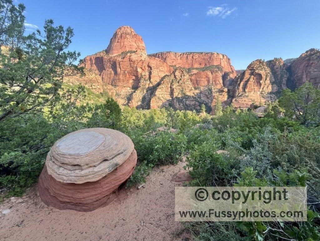
Kolob Canyons is a small but striking section of Zion National Park, tucked off Interstate 15 and far from the bustle of Springdale. It’s a quieter corner, better savoured at a slower pace. A scenic drive (located off Interstate 15 at exit 40) from the visitor centre winds up to about 5,400 ft, where a handful of out‑and‑back trails begin. The longest leads to Kolob Arch via La Verkin Creek — a tough day hike in summer, but far better as the opening leg of the Zion Traverse to Angel’s Landing, with overnight backcountry camps and a dramatic shift in scenery. If you’re still getting your bearings or planning a wider Zion trip, my Zion National Park: Complete Hiking & Planning Guide gives a full overview of the park’s regions, entrances, and best hikes.
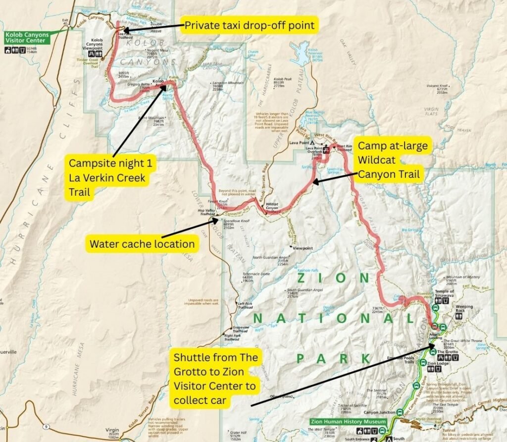
Rather than return to Kolob Canyons, we linked trails south and east to Zion Canyon, exiting at The Grotto — a 37‑mile journey. For a full overview of the route, maps, campsite options, and planning advice, see my Zion Traverse Guide: Route, Itineraries and Planning Tips.
The logistics aren’t too complicated, since Kolob Terrace Road separates Hop Valley Trailhead from the Connector Trail, and with planning and organisation you can cache water here beforehand. There are also toilets if you want a break from the whole digging‑and‑carrying‑your‑trash‑out routine.
Although we saw no one for over two days (possibly the whole hiking‑in‑the‑desert‑in‑summer thing!), this is presumably a popular backcountry trip, as there are a couple of shuttle companies that will take you from Springdale to Kolob Canyons/Kolob Terrace Road if you prefer a shorter hike.
Zion Traverse to Angel’s Landing: Annotated Trail Map
Watch Zion Traverse Backpacking Guide Part 1 | Kolob Canyons to Angel’s Landing

Zion Traverse to Angel’s Landing: Logistics & Water Strategy
- Permits: Pick up in Springdale.
- Water intel: Check with the rangers which springs are flowing — it changes with the season.
- Caching: Mark permit number/date on bottles, then cache water along Kolob Terrace Road (toilets available).
- Shuttle: Private transfer from Springdale to Kolob Canyons.
Water warnings: Do not drink from La Verkin Creek — cyanobacteria present; filtration/boiling won’t make it safe (NPS).
For detailed spring reliability, cache points, and seasonal water advice, see my How to Plan a Safe Zion Traverse Water Strategy guide.
Zion Traverse Water Sources: Springs & Cache Points
- Carry a day’s water from La Verkin Creek Trailhead to last until Beatty Spring. Resupply (boil and filter is best) at Beatty Spring.
- This water needs to last from Beatty Spring to Hop Valley Trailhead, where you can cache water. (No water tap/faucet here.)
- Wildcat Spring (~10 mi after Hop Valley TH)
- Sawmill Springs (1 mi detour near Campsite 9)
- Potato Spring (low and silty during our visit)
- Another 5 miles or so to West Cabin Spring (the last spring on the trail). We found this almost dry and struggled to get more than half a litre. Speak to the rangers at the permit station, though their information isn’t always up‑to‑date. Carry more water than you think you’ll need, even if it slows you down.
Final notes: Pass Angel’s Landing (our permit allowed us access), exit at The Grotto or Zion Lodge, and catch the free park shuttle back (Check the timetable beforehand — a late arrival could mean a long walk.) If you’re preparing to book your backcountry campsites and secure the right dates, my Zion Traverse Permit Guide: How to Book Campsites walks you through the Recreation.gov process step‑by‑step.
Day 1 Itinerary: La Verkin Creek on the Zion Traverse
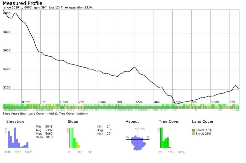
The day began with a long push from Las Vegas to Springdale — punctuated by water‑caching stops, permit pickup, and finally an hour‑long shuttle ride out to Kolob Canyons. By the time we arrived, late afternoon light was spilling across the hills. The heat had ebbed, and with only 6.5 miles to camp, the timing felt just right.
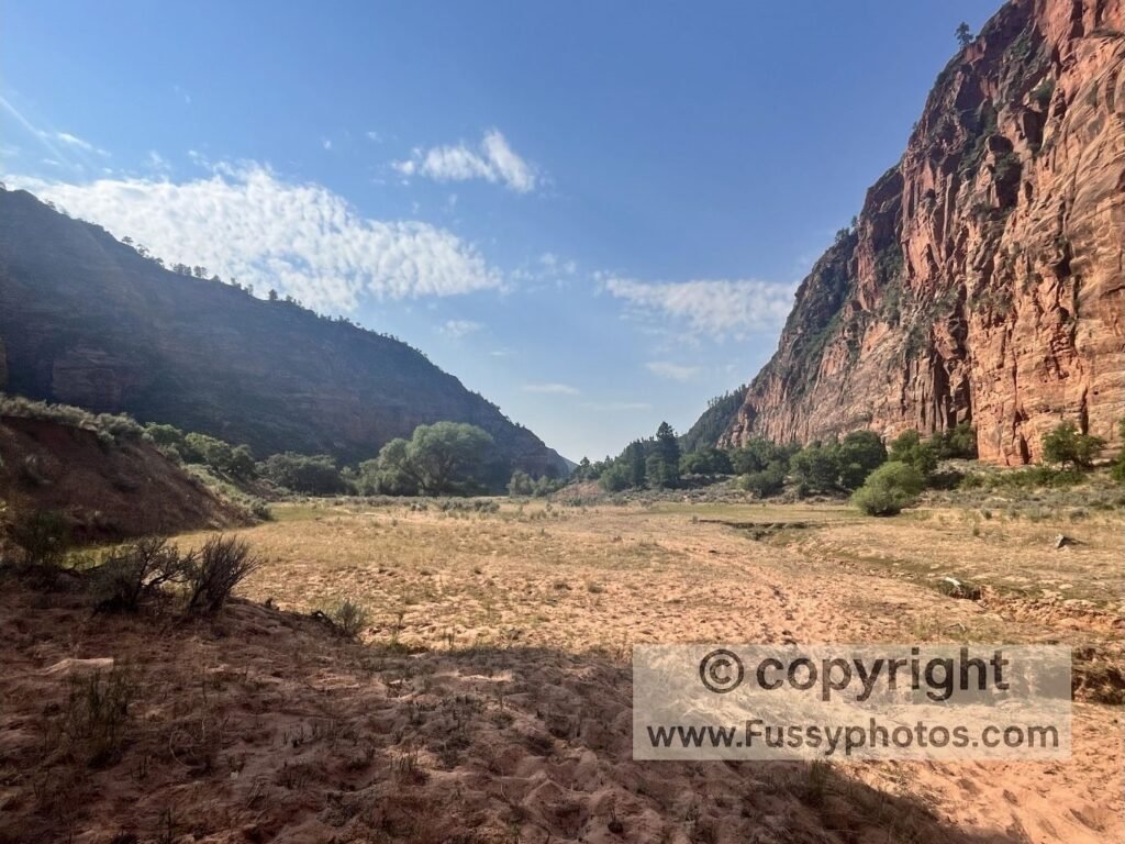
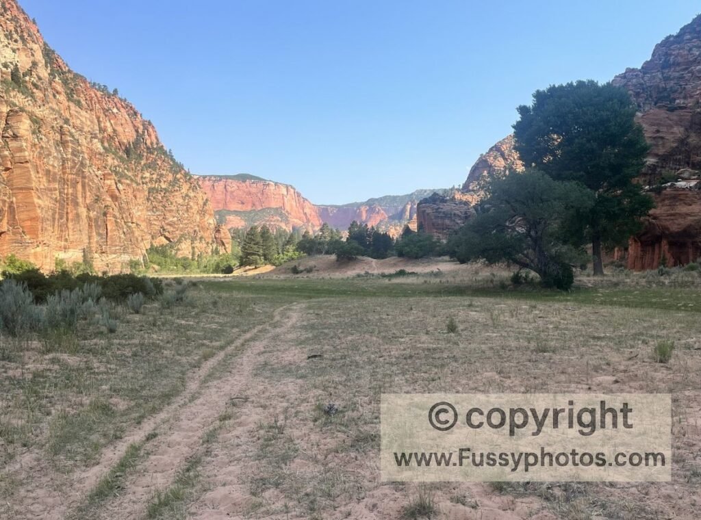
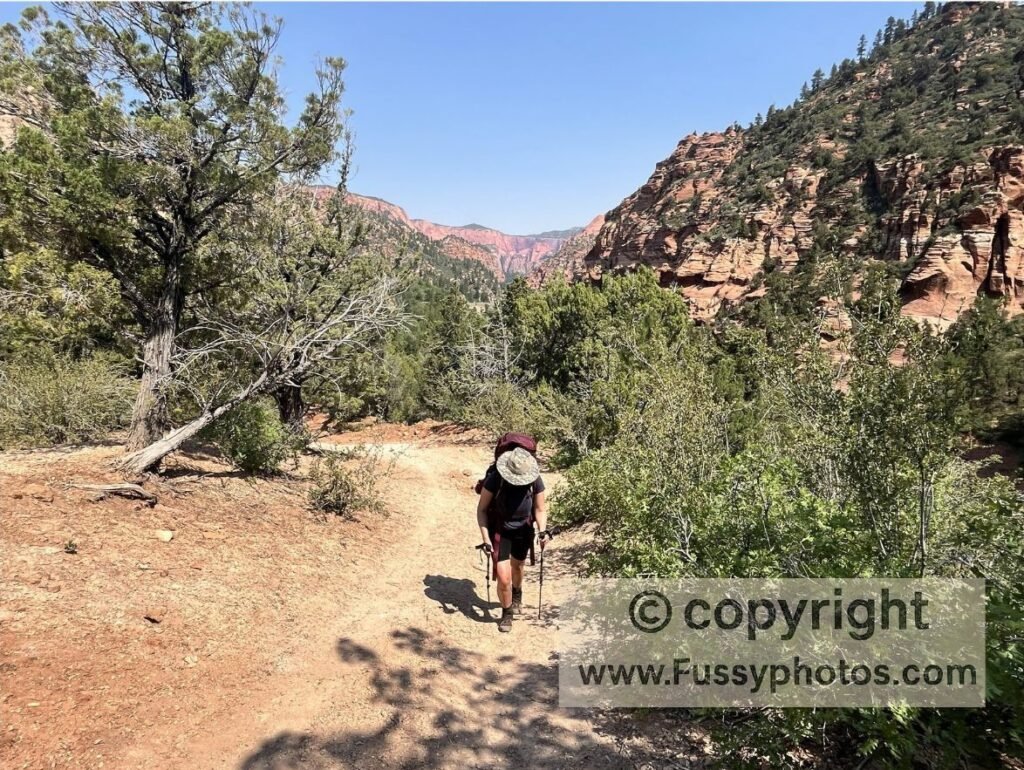
The trail traced La Verkin Creek downhill, at first winding across dry creek beds hemmed in by thick stands of trees. Then, as the path swung east, the views opened and the kind of scenery you picture when you think “Zion” came into focus: red‑rock walls, deep shadow, and long perspectives down the valley. Thirteen campsites line this route; we passed ten of them without spotting a single hiker. Our own, Site 10, proved a quiet perch by the water — its steady murmur a comfort, though it was maddening to be so close to a creek we couldn’t dip into or drink from.
Day 2: Zion Traverse to Angel’s Landing via Hop Valley & Wildcat Canyon
After an easy crossing of La Verkin Creek, we gambled on skipping Beatty Spring, confident our bottles would see us to the Hop Valley water cache. Technically, we weren’t wrong — we made it — but we paid for that choice later as other springs ran dry. In hindsight, I’d stash water at both Hop Valley Trailhead and West Rim Trailhead to mitigate the dry conditions.
If you’re planning this route yourself, my Zion Traverse Water Safety Guide goes into far more detail about each spring, cache point, and what’s realistically reliable in different seasons.
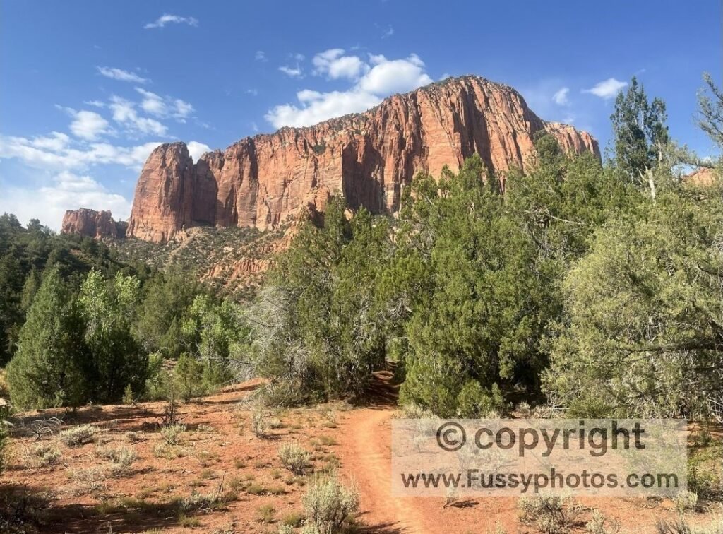
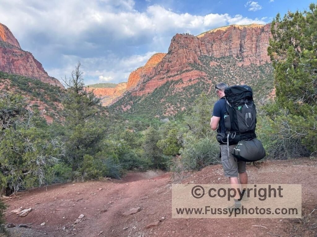
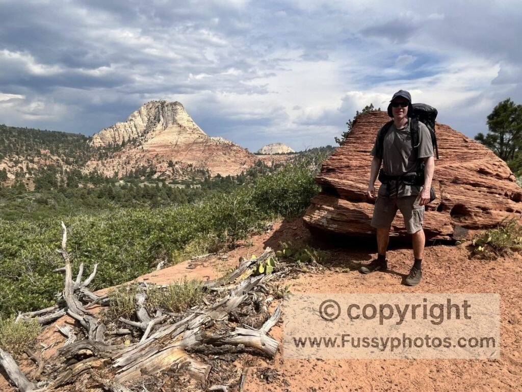
The climb out of La Verkin Creek was a beauty, unveiling for the first time the full sweep of the cliffs around us. The trail began innocently enough, its steady grade and early‑morning shade lulling us into a false sense of ease.
Then the floor changed — rock and gravel giving way to soft sand — and the valley widened, stripping away our shade. Hiking on hot sand with full packs and a day’s worth of water was its own quiet form of punishment.
Hop Valley Trail Difficulty: Sandy & Slow‑Going
Hop Valley added its own hurdles: endless shallow river crossings, each one requiring a pause to search for the driest route. Then came herds of muscular, curious cows in a ranch the trail passes through, their slow gaze tracking us as if we might have snacks. Detouring around them burned more time and more energy.
By the time we topped out, we were parched and overheating. Respite arrived in the form of a bench beneath a patch of small trees — what a pleasant surprise that was. Thank you to whoever put that there! We sat there for a blissful half‑hour, letting the shade cool us.
Connector Trail & Wildcat Canyon on the Zion Traverse
Once we reached our cached water and the welcome shade of the toilet block, we dropped our packs and we drank greedily. For a few hours we stayed put, stretched out and following that sliver of shade as it slowly moved, letting the glare and heat of midday burn itself out before we moved again. From there, the Connector Trail proved far more interesting than its online reputation: the reality was big skies, some wide views, and a landscape subtly shifting under our feet. A side-trip to Northgate Peaks beckoned from the distance, but storms circulated and kept us moving.
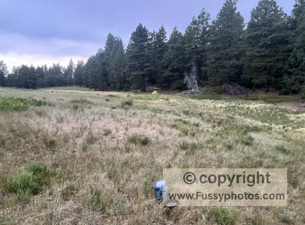
Wildcat Canyon Trail allows at‑large camping, and just when the path — flanked by steep slopes — seemed to go on forever and we thought we’d missed our chance, a broad meadow appeared to our right and we set up for a peaceful nights camp.
Continue the Zion Traverse: Day 3 to Angel’s Landing and the Grotto Trailhead
Discover More Zion National Park Adventures
Browse all Zion guides, including the Zion Traverse, West Rim Trail, Observation Point, Kolob Canyons routes, and practical planning advice for every region of the park.