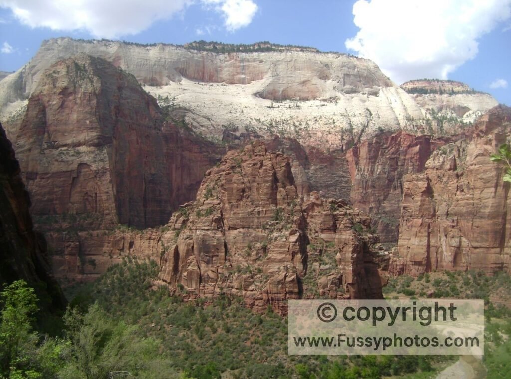
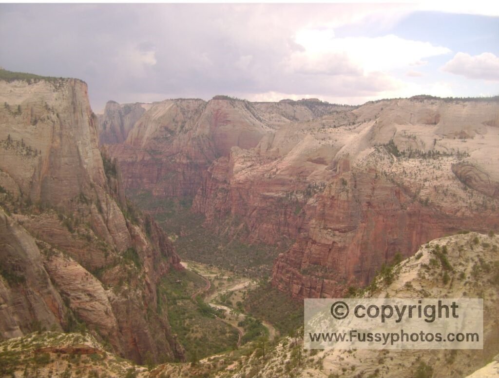
Observation Point, Zion as the name suggests, offers a commanding view of Zion Canyon. When I hiked it pre-2019, the trail began near the base of Angel’s Landing, heading east through Hidden Canyon before joining the East Rim Trail and looping west to the viewpoint. If you’re planning a wider Zion trip or want a full overview of the park’s regions, entrances, and best hikes, my Zion National Park: Complete Hiking & Planning Guide is a great place to start.
Observation Point Zion National Park: A Scenic Alternative to Angels Landing
Today, it’s a great alternative to Angel’s Landing, but access is limited to out-and-back routes from either Zion Ponderosa Ranch Resort or the more distant East Rim Trailhead (see map at the bottom of the page).
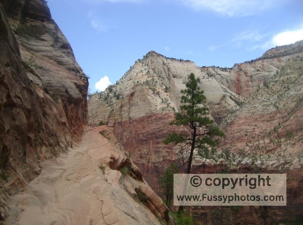
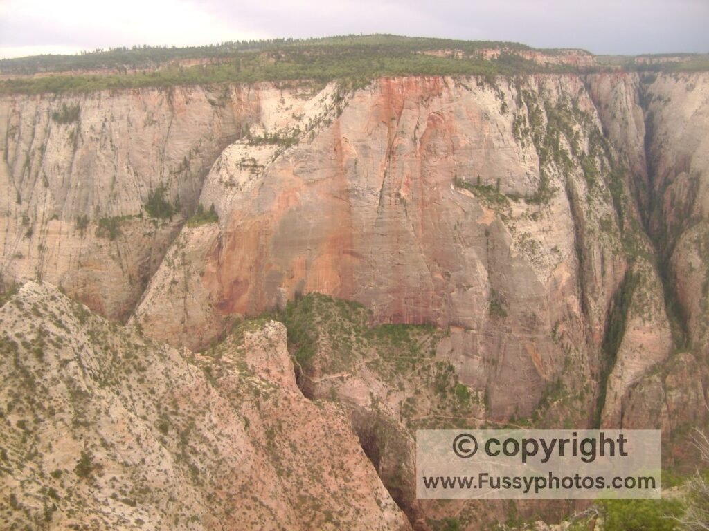
As you get higher, the views broadened and the switchbacks appeared. Looking west in the image. I believe this part of the trail remains open though this route to Observation Point is only accessible now from Ponderosa Ranch or a long walk from the East Rim Trailhead (off Utah State Route 9). As the trail continues, at times you feel like you are hiking along a thin ledge, though most hikers should be fine with the drop-offs.
Observation Point, Zion National Park — Route Map
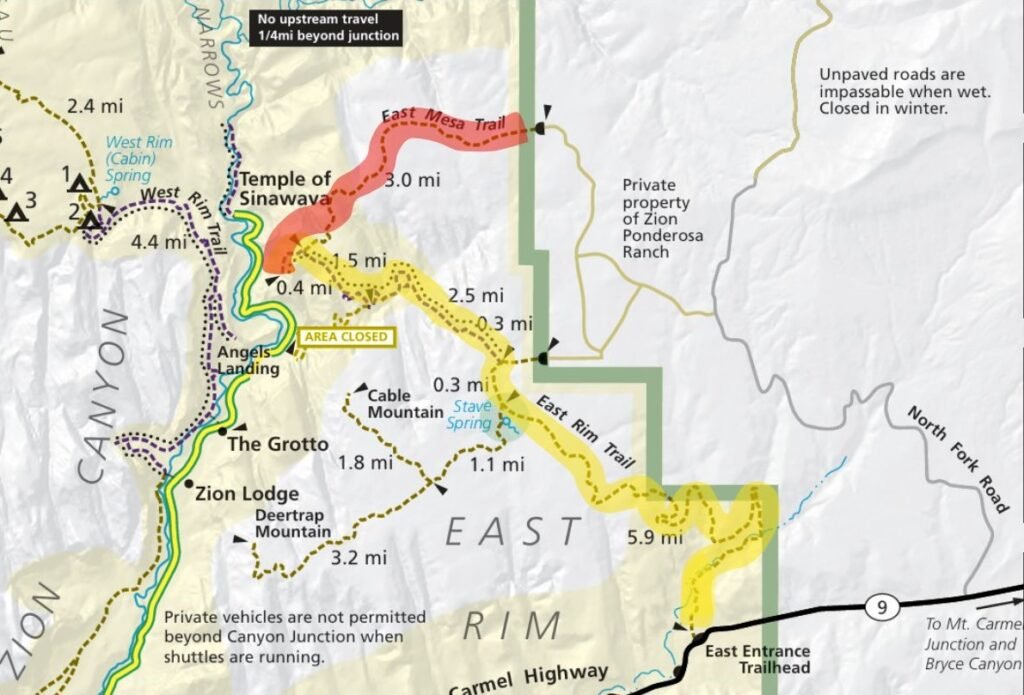
Map Attribution: This map is provided courtesy of the U.S. National Park Service and is publicly available via nps.gov/zion
. It is used here for informational and educational purposes only. All rights and trademarks remain with the National Park Service. For the most accurate and up-to-date maps, please visit the official Zion National Park website.
FAQs for Observation Point, Zion
Is the Weeping Rock trail to Observation Point open?
No. The Weeping Rock trailhead route has been closed since 2019 due to a rockfall. The route I document is closed but other routes exist (see below).
Where is the trailhead for Observation Point?
Most hikers reach Observation Point via the East Mesa Trailhead on Zion’s east side. The trail is a 6.8‑mile round trip, but access requires driving high‑clearance or 4‑wheel‑drive dirt roads off North Fork Road. These roads can become muddy and impassable in winter, spring, or after rainstorms, and visitors should be respectful of private property near the trailhead.
Observation Point can also be reached via a long hike from the East Rim Trailhead, located on the Zion–Mount Carmel Highway about 100 feet west of the East Entrance fee booths. Another option is the Stave Spring Trail, starting at the Stave Spring Trailhead. If you’re unsure which part of Zion to base yourself in for this hike, my Zion Canyon vs Kolob Canyons vs East Side Guide explains how the park’s three regions differ and which one suits different types of trips.
How long is the hike to Observation Point?
The East Mesa Trail to Observation Point is a 6.8‑mile round trip.
From the East Rim Trailhead, the route extends 21 miles out and back.
Do I need a permit to hike Observation Point?
No permit is required to hike Observation Point via the East Mesa Trail.
Alternatively, starting from the East Rim Trailhead on the Zion–Mount Carmel Highway, the route stretches 21 miles out-and-back. Although it can be attempted without a permit as a long, strenuous day hike, most hikers tackle it as a multi‑day trip — which does require a permit.
How difficult is the hike to Observation Point?
The East Mesa Trail offers a moderate hike, easier than Angels Landing and accessible to most visitors. The route winds through ponderosa pine and pinyon–juniper forest, with occasional glimpses into nearby canyons, before joining the East Rim Trail. From there, it’s a short 0.4‑mile continuation to reach the sweeping viewpoint at Observation Point.
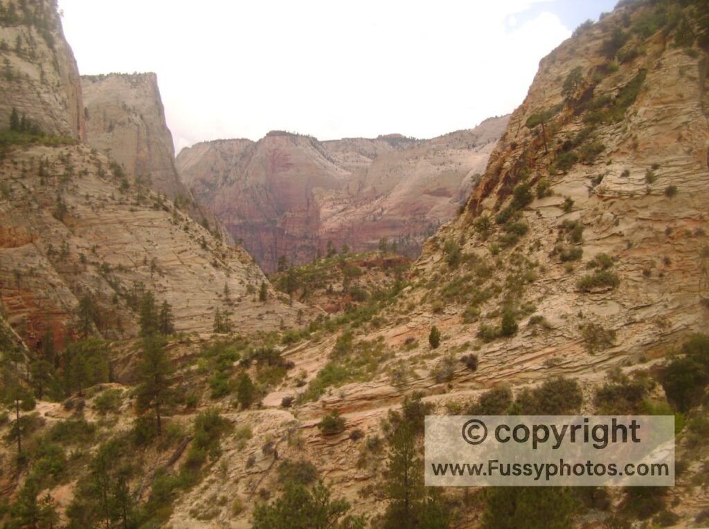
Approaching Observation Point from the East Rim Trail is a long and strenuous option. The path climbs steadily onto the plateau, opening up wide views of the surrounding sandstone cliffs. It winds through stands of ponderosa pine before reaching Stave Spring, where hikers can branch off toward Deertrap or Cable Mountain. Those continuing on the East Rim Trail descend into Echo Canyon, eventually arriving at the overlook at Observation Point.
Is Observation Point a good alternative to Angels Landing?
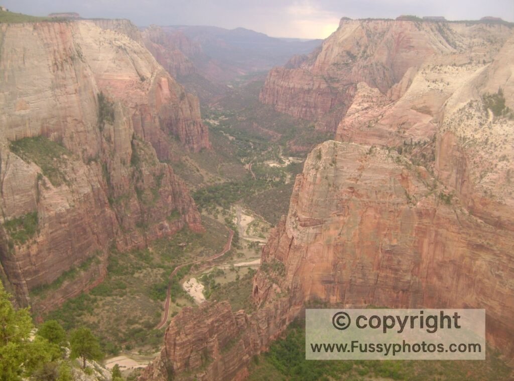
Yes. Observation Point delivers sweeping views across Zion Canyon, with Angels Landing visible far below. Unlike the chain‑assisted climb to Angels Landing, this overlook avoids the extreme exposure and the competitive permit system that often discourages visitors. And if you’re looking for an alternative way to experience Zion’s most spectacular backcountry without the crowds, a two‑night backpacking trip on the Zion Traverse offers equally breathtaking scenery while staying far from the congestion around Angels Landing. If the Traverse is on your radar, my Zion Traverse Water Safety Guide breaks down every spring and cache point so you can plan the route safely and realistically.
And finally, if you want something longer and more adventurous than Observation Point — but far shorter and simpler than the full Zion Traverse — the West Rim Trail makes an outstanding standalone hike, covering the final 14 miles into Zion Canyon. My West Rim Trail: Top‑Down vs Bottom‑Up guide explains the route in detail.
How Zion National Park Fits into a Southwest Road Trip
Zion National Park is a natural hub for exploring the American Southwest, with easy access to both iconic Utah parks and neighboring states:
- Bryce Canyon National Park is the closest of Utah’s “Big 5,” located just 2 hours northeast. From there, the natural route continues to Capitol Reef National Park, followed by either Arches National Park or Canyonlands National Park, both around 4.5 hours northeast of Zion.
- Heading southwest, Las Vegas is just over 2 hours away, making it a convenient entry or exit point for your trip.
- The Grand Canyon is about 3 hours away—though reaching the South Rim takes longer depending on your route.
- Heading northwest, Great Basin National Park in Nevada is approximately 2.5 hours away, offering a quieter contrast to Zion’s dramatic cliffs.
Whether you’re chasing red rock vistas or crafting a full Utah Big 5 itinerary, Zion slots perfectly into a multi-day adventure across the Southwest.