Alport Castles is a dramatic feature at the top of a steep valley, accessed from the valley itself or from above via a ridge that runs parallel to the valley, some 230 metres below. Just 1.5 miles west of Ladybower, Derwent and Howden Reservoirs, this 9.5‑mile Alport Castles circular walk avoids the short out‑and‑back approach and instead combines the best of both worlds: scenic reservoir walking, peaceful valley paths and a spectacular ridge approach. Coniferous forests, rivers, steep valleys and the dramatic landslip make this one of the most varied Peak District walks.
Where to Start the Alport Castles Circular
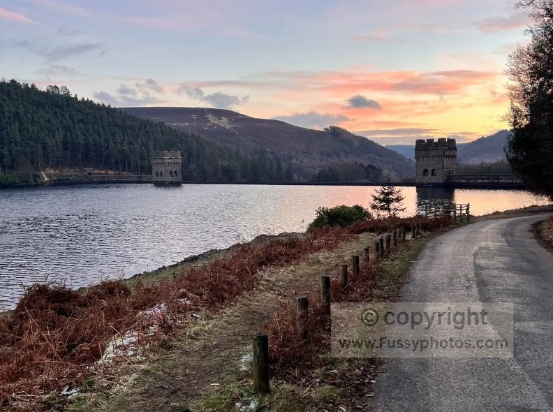
Parking is exclusively to the east of Alport Castles, parallel to Ladybower Reservoir just off Snake Road. There are multiple pay‑and‑display car parks along this stretch, all the way to Fairholmes where you’ll find toilets and simple food and drink. This area also connects with other Ladybower‑based routes, including the Derwent Reservoir Circular. We walked clockwise, reaching Alport Castles later in the day and finishing on the flatter stretch along Derwent Reservoir (see route map below).
Woodcock Coppice: Choose Between Two Route Options
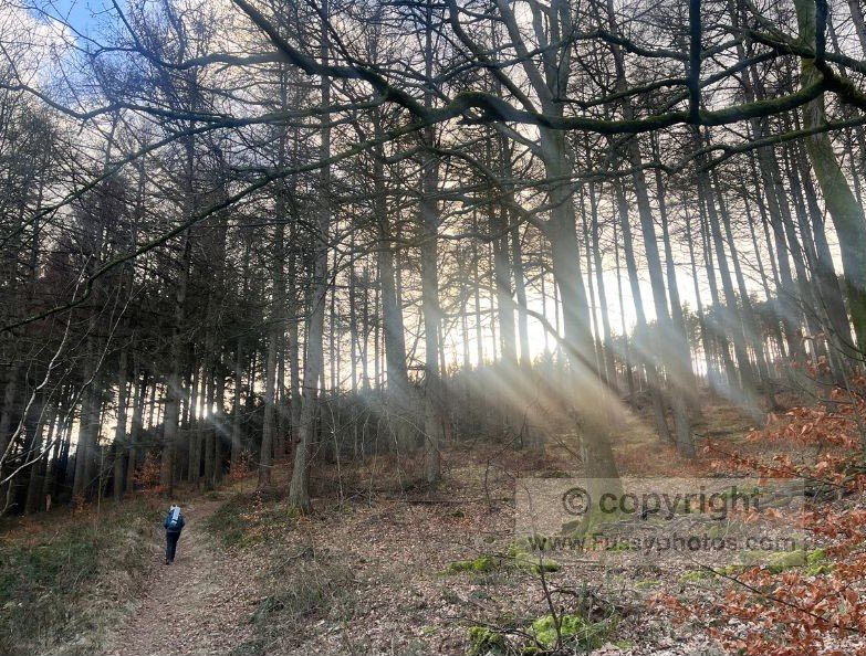
Beginning just south of Fairholmes, we ascended the steep and often muddy trail toward Woodcock Coppice.
Option 1: Direct Ridge Route (Shorter)
Once here, it’s easy to cut miles off the route by heading directly for the ridge. For a more accessible ridge walk, many hikers choose Mam Tor, which offers similar views but with easier access from the road.
Option 2: Rowlee Farm Valley Route (Longer & More Scenic)
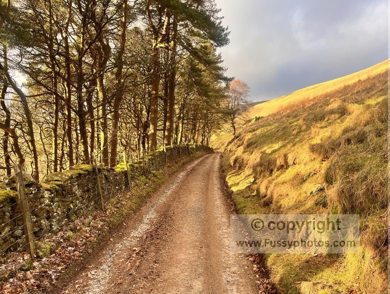
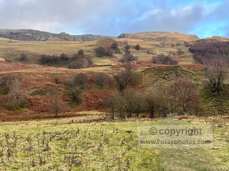
The longer alternative is to lose all the elevation you’ve just gained, walking past steep tors and rugged scenery towards Rowlee Farm — one of my favourite stretches of this walk.
Ashop Valley and the Second Ascent
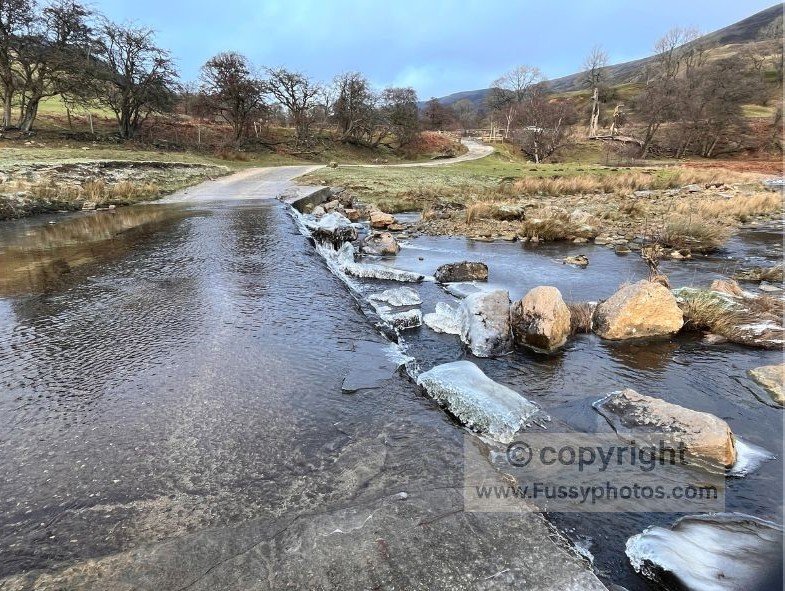
Continue all the way to the A57, crossing the road and the River Ashop twice for a mile of gentle river and valley walking. Navigation is relatively easy: stay on the footpath and head for the adjacent valley and the ridge ahead, crossing the A57 a second time where the day’s second ascent begins.
Climbing to the Ridge Above Alport Castles
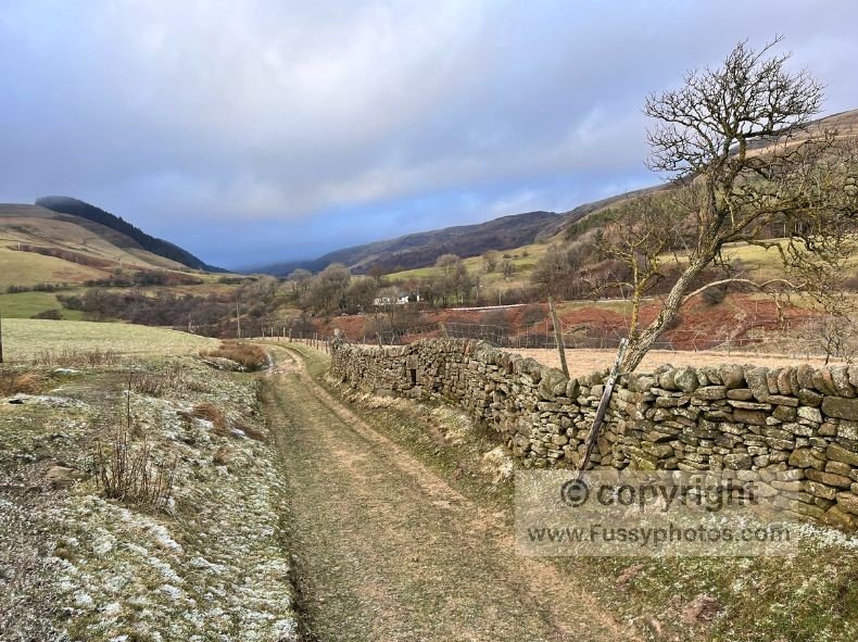
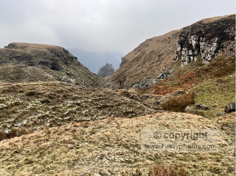
It’s a mile to Alport Farm before turning east (right if walking clockwise) and beginning the steep climb to the ridge above. I’ve done this walk three times across the seasons and always had cloud here — hopefully you’ll have better luck. The 230‑metre ascent will leave you breathless at times, but the scenery is worth it. Near the top of the ridge, Alport Castles comes into view.
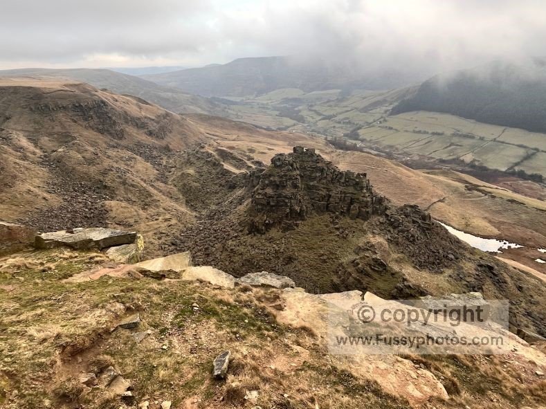
Alport Castles Viewpoint and Ridge Options
It’s possible to follow a faint trail parallel to the ridge directly to Alport Castles, and some walkers choose to climb onto the formation itself.
I prefer continuing to the top of the ridge, then turning left and heading northwest to the best viewpoint — arguably once you’ve passed Alport Castles by at least 50 metres.
If you love classic Peak District edge walking, the nearby Stanage Edge route offers sweeping gritstone views just a short drive from here.
From here, you can shorten the walk by following the ridge southeast back to Woodcock Coppice and descending to Howden and Ladybower Reservoirs.
Crossing the Moorland Plateau to Howden Reservoir
If you’re completing the full loop, continue northeast as the path heads across open moorland, past grouse hides and through conifer plantations. This stretch across open moorland has that same wild, big‑sky feeling you get on the Crowden to Black Hill section of the Pennine Way, though here the navigation is much simpler. A steep descent then brings you to Howden Reservoir.
Finishing the Loop Along Howden Reservoir
As the trail meets Howden Reservoir, a road bridge offers a beautiful viewpoint — the water was frozen on our winter walk, making it especially striking.
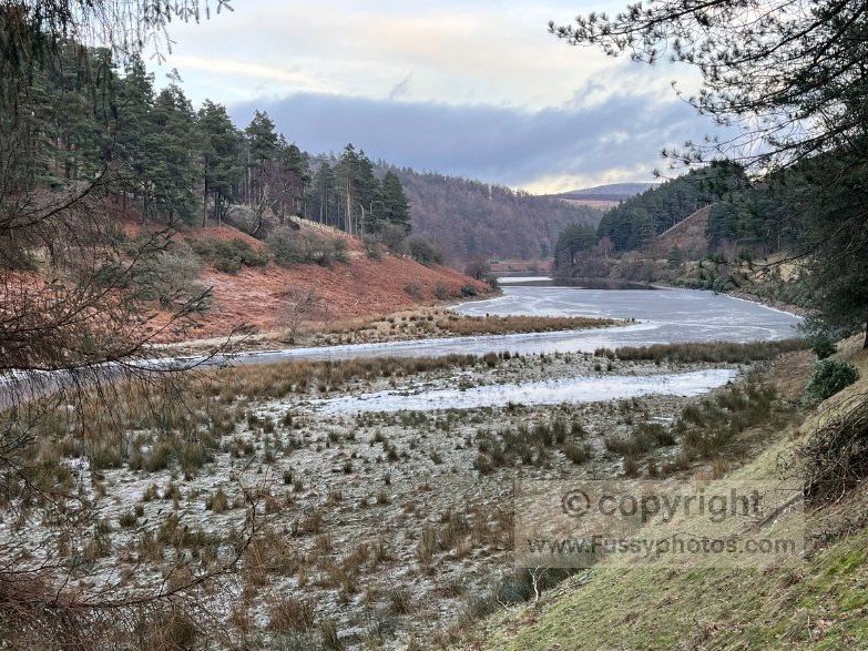
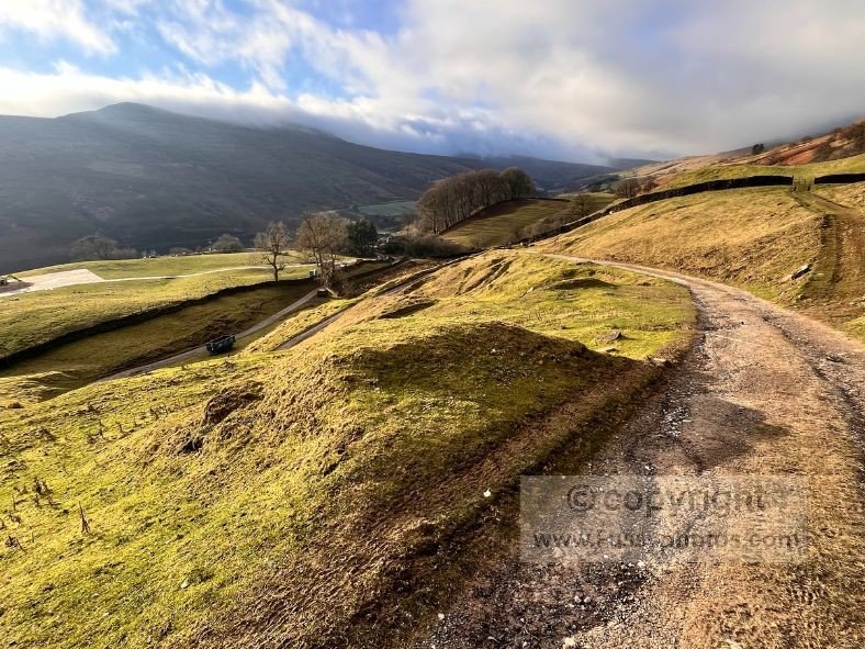
Now close the loop by following the quiet road south along Howden Reservoir and past Derwent Dam back to your car.
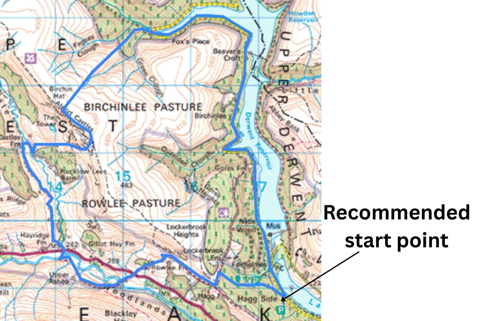
Map of the Alport Castles Circular
See the Alport Castles Circular in Action

Alport Castles FAQs
How long is the Alport Castles Circular Walk?
The full loop is roughly 9.5 miles, but can be shortened depending on which route you take at Woodcock Coppice and again at the ridge above Alport Castles.
How difficult is the walk?
Moderate to hard. Expect two steep ascents, some muddy woodland sections, and a long but gentle finish along Howden and Derwent Reservoirs.
Where do you start the walk?
Parking is along Ladybower Reservoir, just off Snake Road, with several pay‑and‑display car parks leading up to Fairholmes (toilets, snacks, information).
Can you climb onto Alport Castles itself?
Some walkers do, but it’s not an official path and the terrain is steep, loose, and exposed. The best viewpoint is actually on the ridge about 50 metres beyond the formation.
What makes this circular route better than the short out‑and‑back?
You get reservoir scenery, peaceful valley walking, two contrasting ascents, and a spectacular ridge approach — far more variety than the direct route.
How long does the walk take?
We completed it in just under 4 hours, but it depends on pace, weather, and how long you spend at the viewpoint.
Is the walk suitable for dogs?
Yes, but be aware of livestock, steep drops, and seasonal restrictions during bird‑nesting season on the moorland.
Are there facilities on the route?
Only at Fairholmes (toilets, snacks). The rest of the loop is remote, so bring food, water, and layers.
How high is the climb to the ridge?
The final ascent from Alport Farm is around 230 metres, steep in places but rewarding with huge views at the top.