Missed Days 1-3? Backpack the High Sierra Trail Now: 5‑Day Loop
Day 1: Lodgepole – Bearpaw Meadow.
Day 2: Bearpaw Meadow – Hamilton Creek Basin
Day 3: Hamilton Creek Basin – Cliff Creek Campground
Note: This trip report was originally published as the High Sierra Trail Loop. I now use the name Hamilton Basin Loop—an unofficial but more accurate description of this 5‑day circuit, which only overlaps part of the High Sierra Trail. The H1 titles remain unchanged for continuity, and readers planning their own variation of the route can find practical guidance in my Hamilton Basin Loop trip‑planning guide.
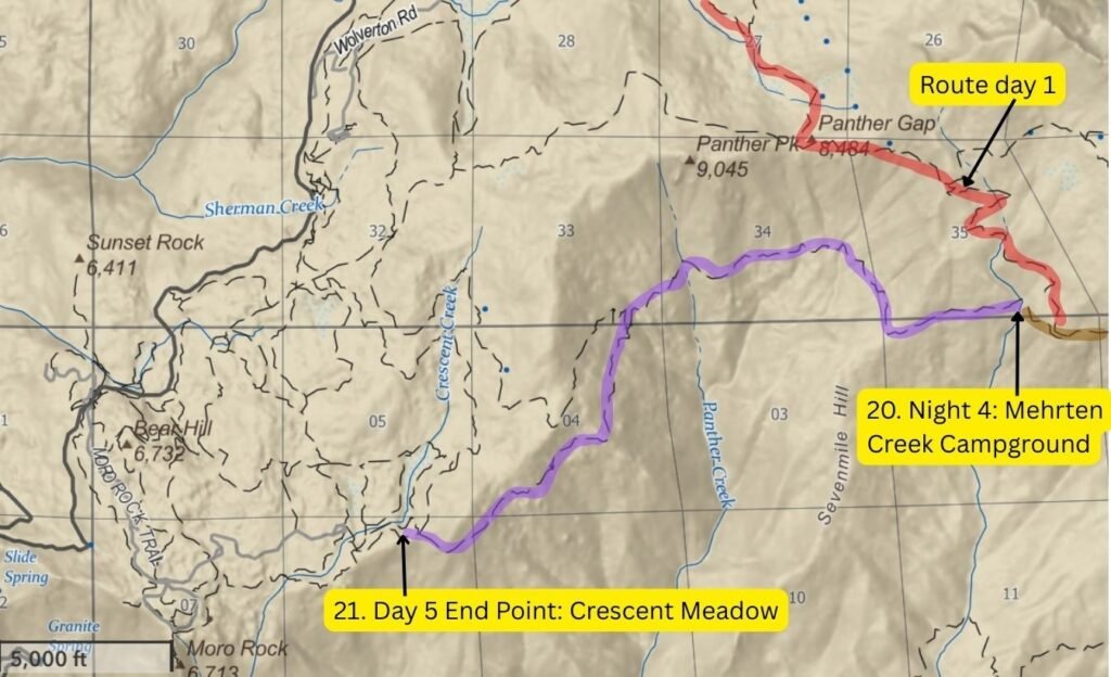
Hamilton Basin Loop Route Map
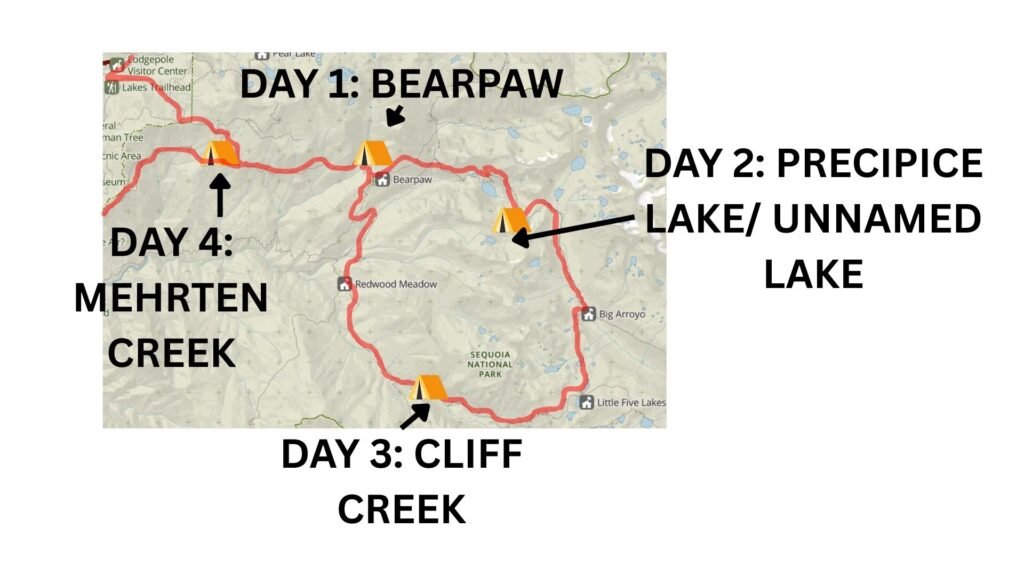
Base map courtesy of the National Park Service (NPS), annotations by Fussyphotos (Jack).
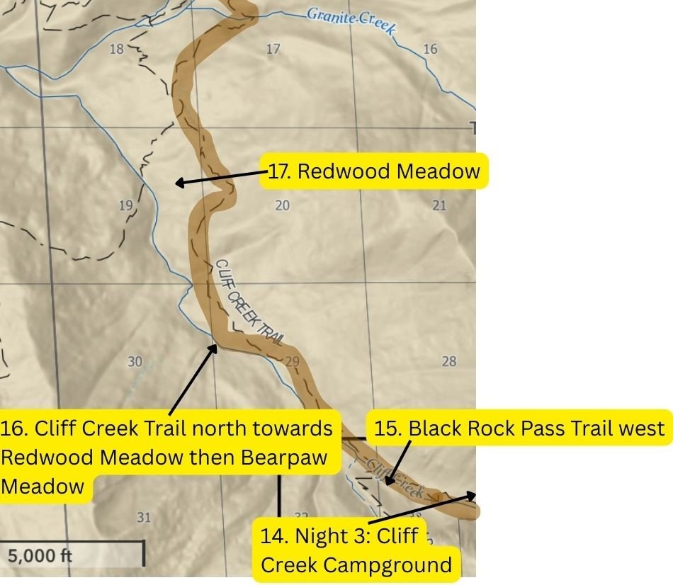
Hamilton Basin Loop Map: Days 4–5 (Cliff Creek to Crescent Meadow)
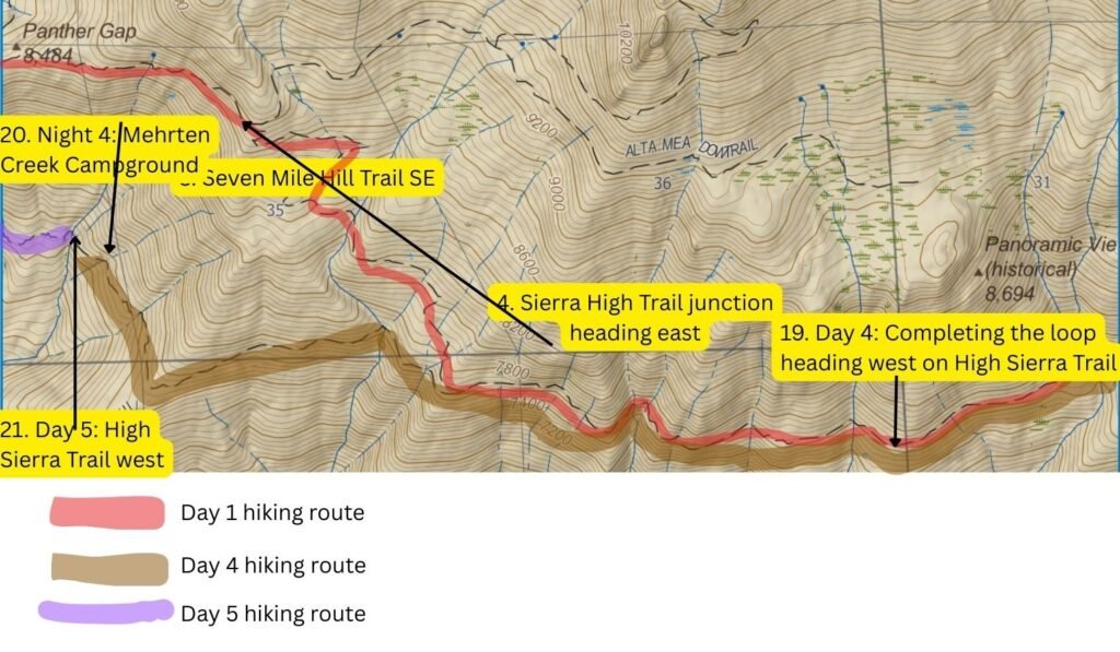
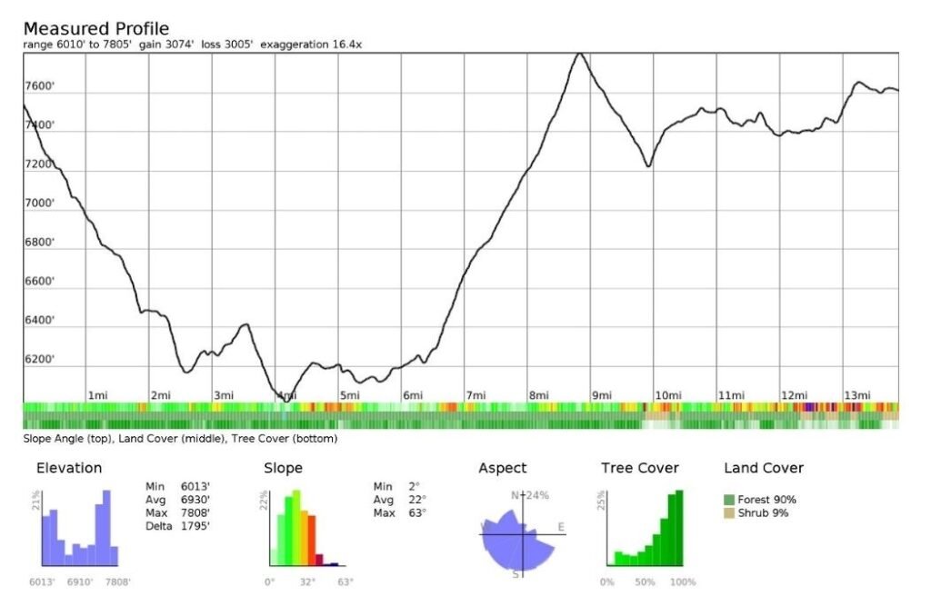
Day 4 Elevation Profile
Backpack the Hamilton Basin Loop Map: Part 4
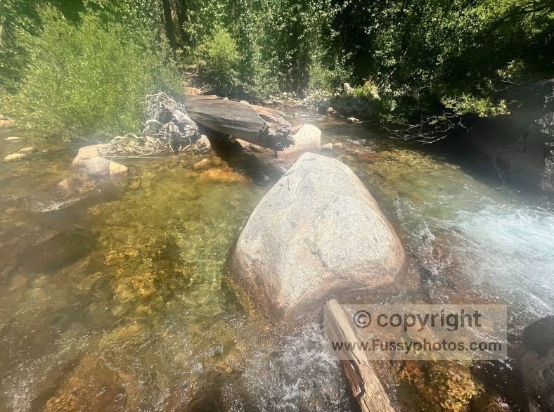
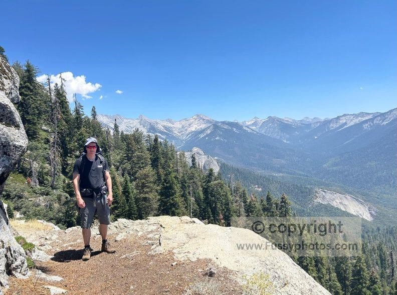
Cliff Creek Camp in First Light
After arriving in the dark the night before, first light showed our campsite to be a small area of flat land in an otherwise large valley, with Cliff Creek running no more than meters to our left and a small clearing in an otherwise wooded part of the park. We commented on how relaxing it would have been to sit with our feet in the creek the evening before, had we arrived earlier.
With 14 miles to Mehrten Creek—back on the High Sierra Trail and the closest backcountry campsite to Crescent Meadow—and 3,100 feet of elevation gain, we wouldn’t be taking it easy after yesterday’s marathon. This trip, with its high‑altitude trails and huge elevation gains, taught us that 10–12 miles a day is our comfort zone, but sometimes we push for more depending on time pressure, and we always want to see as much as possible. If you’re planning your own trip, my Guide to High Sierra Trail permits, loop hikes, and alternatives explains how to book permits and outlines two excellent loop options, including the Hamilton Basin Loop.
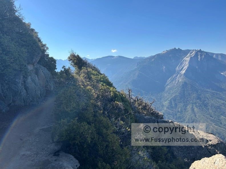
Black Rock Trail Descent and the Connector to Redwood Meadow
Heading west, somehow the Black Rock Trail had more descent to come, taking us just under a mile to the junction with Cliff Creek and Timber Gap Trails. It’s worth noting that here there’s a campsite with a bear box—the only one we saw on our four‑night stay.
On route, we passed through a burnt‑out area of forest, trying all the time to keep a good pace but struggling with the never‑ending decline and the constant jarring of our knees. The occasional opening in the trees revealed a distant granite peak, but overall the trail was uneventful.
At times a little overgrown, the trail continued yet another 1,300 feet downhill as it broadly followed the route of Cliff Creek.
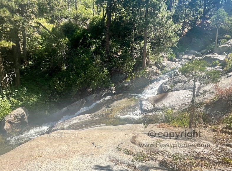
Despite glimpses of the blue creek through the trees, this trail is best described as a connector trail rather than one you’d go out of your way to walk, offering little drama—just a quiet, steady rhythm of boots on dust—until we reached Redwood Meadow, a small sequoia grove with a ranger hut.
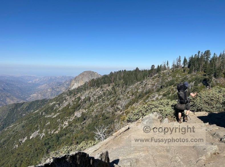
Redwood Meadow Arrival: Sequoias, Moro Rock, and the Ranger Cabin
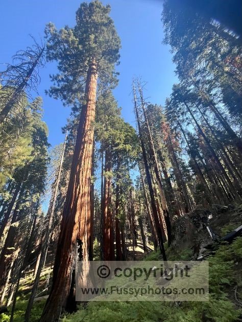
Close to Redwood Meadow, the first sequoias came into sight and we marveled at these giants. If you’d like a deeper look at what makes these groves so extraordinary, my What’s So Special About Sequoia National Park? guide explores the giant sequoias, the history behind their protection, and why iconic places like Giant Forest and Moro Rock are so significant.
The trail then climbed a ridge and Moro Rock came back into view before dropping again, and an attractive log cabin signaled our arrival at Redwood Meadow.
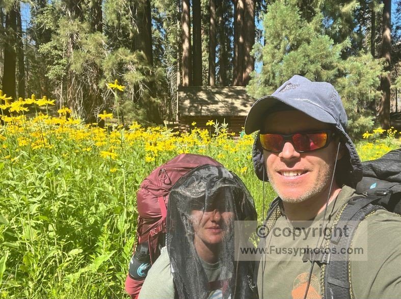
Slightly confused about the route, we wandered into a boggy meadow, thousands of yellow wildflowers blooming all around us. The mosquitoes were back, nibbling away as we realized we were off the trail and turned around.
Still heading north, we passed multiple trees burnt at the base, some resiliently living on, their green crowns defiant against the scars below.
Claustrophobic Heat and Little Bearpaw Meadow
Now the trail was really heating us—a claustrophobic heat you don’t associate with the mountains. Water on the trail soon became scarce and we struggled to fill our bottles as we hiked parallel to Little Bearpaw Meadow. This felt like bear territory, yet we didn’t see anything, initially choosing to hike on despite our hunger and fatigue.
A little further on, a breeze blew over a nearby ridge—that was enough to make our decision. This was our lunch spot.
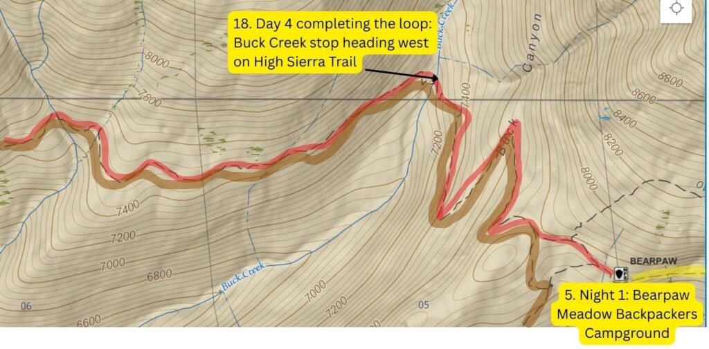
Return to Bearpaw Meadow and Cooling Off at Buck Creek
By 3 p.m., we finally made it again to Bearpaw Meadow, glad to be heading toward a flatter trail and with much of the day’s elevation gain now done. Now retracing old ground, this five‑mile stretch would be the only trail we’d repeat in the whole 53‑mile hike.
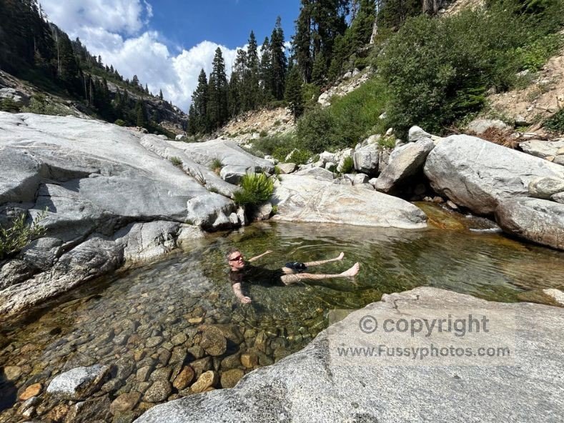
Heading west and back on the High Sierra Trail, with already 10 miles of hiking done today, we took the opportunity to cool off at Buck Creek—refilling our bottles and lying in the cool water like playful children. Undoubtedly the highlight of the day, we didn’t want to leave, again noting that the nearby campground would’ve been a great stop.
Golden Light at Mehrten Creek
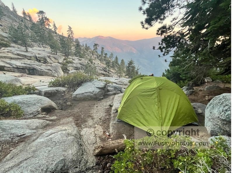
As we neared Mehrten Creek, we were in new territory. Arriving as the sun was setting, it cast a golden blaze across the distant peaks, igniting their ridgelines in amber and rose. But this time, with at least an hour’s light remaining, we picked a spot just meters from the trail where running water would sing us to sleep. We watched the sun illuminate the mountains opposite us in a warm glow as we pitched our tent in beautiful surroundings. For planning your own loop, see myBackpack the Hamilton Basin Loop: Route Guide.
Backpack the Hamilton Basin Loop now: The Final Day
Morning Light at Mehrten Creek
Needing a rest day or two—not to mention a good meal and a warm shower—we left the beautiful Mehrten Creek Campground early. Again, the valley below was awash with color in the morning sun.
With six relatively easy miles to Crescent Meadow, we still had plans to continue to Giant Forest from there—an extra 2.5 miles of hiking—which we could opt out of if we chose to get the shuttle back from Crescent Meadow instead. If you’re planning a front‑country day around this area, my How to Spend One Unforgettable Day in Sequoia NP guide covers Crescent Meadow, Giant Forest, Moro Rock, and the surrounding highlights in a single, easy itinerary.
On route, Eagle View more than lived up to its name—we caught an eagle riding the mountain currents with effortless grace, scanning the valley below for its next meal.
By the time we reached Crescent Meadow, the first scattered sequoias emerged like sentinels, quietly marking the threshold back to the frontcountry.
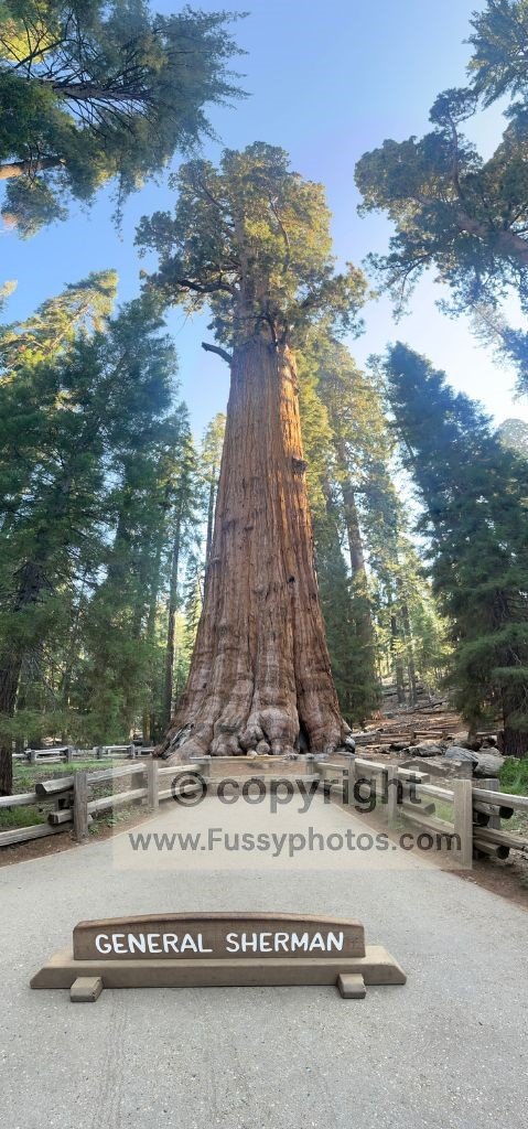
Reflecting on our epic hike, we both knew we’d reached our limit. Having already wandered among the giants of Giant Forest before our backcountry journey, the call of civilization was too strong to ignore. From Crescent Meadow, we boarded the shuttle—first to Giant Forest, then onward to Lodgepole—trading dusty boots and trail grit for the promise of comfort and a hot meal, but first, ice cream!
Ending with Ice Cream at Lodgepole Village
All good backcountry trips end with some form of over‑indulgent eating, and we found the ice cream on sale in Lodgepole Village hit the spot!
See the Conclusion of Our Hamilton Basin Loop

Backpack the Hamilton Basin Loop — Part 4 FAQs
Is Redwood Meadow a large sequoia grove?
No — it’s a small, quiet grove with a handful of impressive giants, offering a peaceful break from busier areas like Giant Forest, and it’s only accessible by strenuous trails that reward you with real solitude on arrival.
Can you camp at Redwood Meadow?
There is no designated campground at Redwood Meadow, but nearby backcountry sites exist along the main trail.
Are mosquitoes bad at Little Bearpaw Meadow?
In early summer, yes. Meadows along this stretch can be mosquito‑heavy until late season.
Where is Mehrten Creek Campground on the High Sierra Trail?
It’s the closest backcountry campsite to Crescent Meadow, located west of Bearpaw Meadow.
Is there reliable water at Mehrten Creek?
Yes — the creek typically flows throughout the hiking season, making it a dependable water source.
How many campsites are at Mehrten Creek?
It’s a dispersed backcountry area with several flat spots, not a formal campground with numbered sites.
Is Mehrten Creek a good final night on the Hamilton Basin Loop?
Yes — it’s close enough to finish the loop the next morning while still offering a quiet wilderness setting, and if you’re hiking east from Crescent Meadow, it’s a great place to camp when starting the High Sierra Trail late in the day.
Sequoia Hamilton Basin Loop Gear Guide:
Why This Gear List Matters
From cliffside ledges and bear encounters to stove failures and mosquito swarms, this 4.5-day loop through Sequoia National Park tested every piece of gear we carried. With over 10,000 feet of elevation gain, alpine lakes, and remote passes like Black Rock (11,600 ft), this route demands thoughtful packing. Here’s what we brought—and what we wish we had—for our 53-mile journey from Lodgepole to Bearpaw Meadow, Hamilton Lake, Nine Lakes Basin, Cliff Creek, and back.
Navigation & Trail Essentials
- GPS app (Gaia, AllTrails or Maps.me) – Crucial for locating Cliff Creek camp and navigating off-trail junctions
- Paper topographic map – Backup for electronic failure
- Compass – Useful in low visibility or forested sections
- Permit printout – Required for overnight travel in Sequoia-Kings Canyon Wilderness
- Route notes or GPX file – Preloaded with campsites, elevation profiles, and water sources
Footwear & Traction
- Sturdy hiking boots – With ankle support for scree descents and granite switchbacks
- Wool socks – Moisture-wicking and warm
- Gaiters (optional) – For dusty trails and snow patches. My partner loves them!
Clothing for Sierra Nevada Conditions
- Insulated jacket/jumper – For cold nights above 10,000 ft
- Base layers (top and bottom) – Merino or synthetic for moisture control
- Rain jacket – Afternoon storms are common
- Sun hat and sunglasses – For intense UV exposure at altitude
- Bug net or head covering – Mosquitoes were relentless in Big Arroyo and Bearpaw
Sleep System
- Tent rated for alpine conditions – Lightweight but wind-resistant
- Sleeping bag (15–30°F rating) – For frigid nights at Precipice Lake and Cliff Creek
- Sleeping pad (insulated) – Comfort and warmth on granite slabs
- Pillow or stuff sack with clothes – Optional but appreciated
Cooking & Hydration
- Lightweight stove – Ours failed—bring a backup ignition source
- Fuel canister – Bring more than you think you’ll need
- Pot and utensils – Compact and easy to clean
- Water purifier or filter – Essential for lakes, creeks, and high-flow crossings
- Backup lighter or waterproof matches – A fellow hiker saved our trip—don’t rely on luck
Safety & Extras
- Bear canister (required) – We carried two (our own and a rental from Lodgepole Visitor Center) for five days of food.
- First aid kit – Include altitude meds, blister care, and antihistamines
- Headlamp with extra batteries – For late camp setup and forest navigation
- Sunscreen and lip balm – High UV exposure
- Bug spray (DEET or Picaridin) – Absolutely essential around Big Arroyo!
- Trekking poles – Useful for switchbacks, river crossings, and downhill scree
- Multi-tool or knife – For gear repairs and food prep
- Quick-dry towel – For creek dips and drying gear
- Trash bag – Pack out all waste—no bins in wilderness zones
Route Overview & Planning Tips
- Trailhead: Lodgepole (via Wolverton and Panther Gap)
- Route: Lakes Trail → Panther Gap → Alta Trail → Seven Mile Hill → High Sierra Trail → Hamilton Lake → Nine Lakes Basin → Black Rock Pass → Cliff Creek → Redwood Meadow → Bearpaw → Buck Creek
- Distance: ~53 miles over 4 days
- Elevation gain: ~12,800 feet total
- Best season: July–September
- Permit required: Yes (Sequoia-Kings Canyon Wilderness). If you’re planning your own trip, my guide to High Sierra Trail permits, loop hikes, and alternatives explains how to book permits and outlines two excellent loop options, including the Hamilton Basin Loop.
- Bear safety: Use lockers at trailhead and carry bear canisters
Water sources: Buck Creek, Hamilton Creek, Lone Pine Creek, Cliff Creek, alpine lakes and many more. We rarely carried more than 1L each