Walking the Coast to Coast East to West: Starting in Robin Hood’s Bay
Although the Coast to Coast path is traditionally walked west to east, I chose to walk it east to west, so my journey began in Robin Hood’s Bay. After a few hours of trains and buses — and a forecast promising a strong weather front at some point in the afternoon — I decided to keep my plans flexible.
Carrying a tent, stove and camping gear in my multi‑day pack, my aim was simple: cover as many miles as possible without getting drenched on Day 1. There were a handful of places to take cover — the shops and pubs in Robin Hood’s Bay, a pub at High Hawsker, and possibly the woodland around Falling Foss. Between these lay wide open moorland – not least Sneaton Low Moor and Sleights Moor – where getting caught in a storm would be… memorable.
Watch The Coast to Coast East→West: Day 1 Storms, Moors & Robin Hood’s Bay Start

Arriving in Robin Hood’s Bay and Beginning the Coast to Coast
Arriving just before lunch, the clouds looked manageable. The bus dropped me at the north end of Robin Hood’s Bay, and I earned a few curious glances as I walked downhill towards Wainwright’s Bar — the official end point (or, for me, the start).
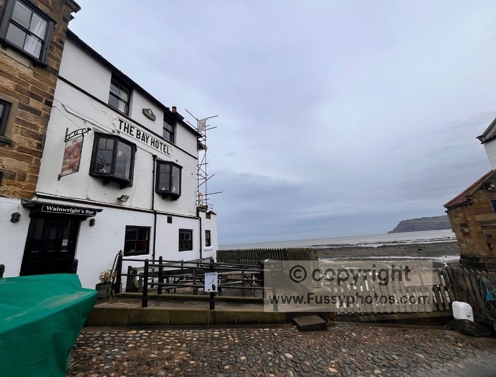
After resisting an early fish‑and‑chips dinner, I took the obligatory photos and climbed back up the steep hill I’d just descended. Nothing like a warm‑up ascent before a 190‑mile trail.
Why I walked the Coast to Coast in Sections
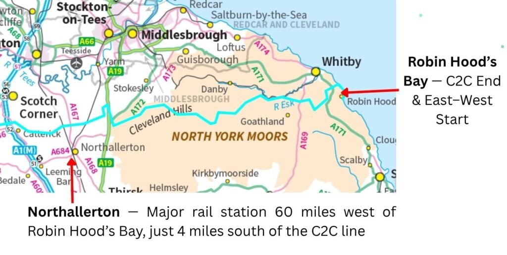
I’d already decided not to walk the entire Coast to Coast in one go. I prefer completing long‑distance routes in sections, planned around public transport and the main train hubs along or near the route. My rough plan was to reach Osmotherley (just off the Coast to Coast, where it leaves the Cleveland Way) and stick to the route as long as possible before detouring south to Northallerton for a train home. I’d given myself three days to complete this 60‑mile North York Moors and initial Vale of Mowbray section. With a decent load in my backpack, a strong first day was crucial.
Planning for Wild Camping on the North York Moors
Low Rigg Farm campsite was fully booked, so I expected to rely on wild camping — preferable to losing precious walking time detouring to accommodation or, worse, paying for a taxi. I wasn’t sure where I’d camp, but that uncertainty was oddly exhilarating: walking without limitations, hoping to find somewhere secluded, suitable and sheltered. A romantic idea, provided the weather cooperated.
Key Facts for Coast to Coast Day 1
- Distance: 16.5 miles
- Time taken: 7 hours + lunch
- Terrain: Coastal paths, paved sections, moorland
- Difficulty: Moderate
- Direction walked: East → West
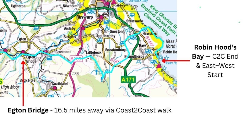
Robin Hood’s Bay to High Hawsker — Coastal Walking on the Coast to Coast via the Cleveland Way
Leaving Robin Hood’s Bay, the path heads east, hugging the headland with views back towards the village and out across the North Sea. Passing several benches in the first hour, I immediately noticed a different feel from the Pennine Way — another, much remoter trail I’ve walked extensively.
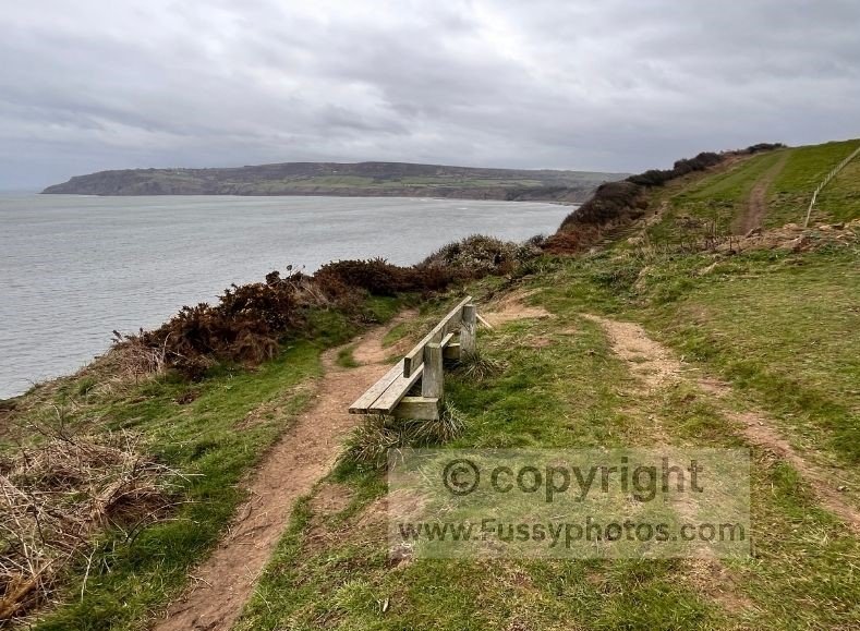
The broom shrubs were in full flower, a bright yellow contrast to the grey skies. Wave‑cut platforms were visible below the cliffs, and the coastline curved into small bays, my favourite being Normanby Stye Batts — a steep, dramatic cliff face.
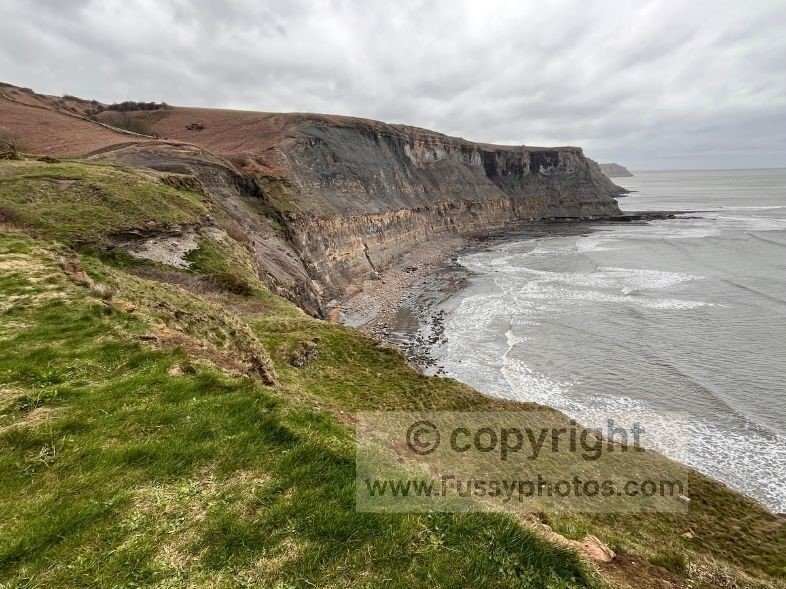
The day’s second ascent began here, but it was gentle enough, following the coastline before rising to give distant views of Maw Wyke. This three‑mile stretch of coastal walking was over too quickly — a great taster of the Cleveland Way’s coastal section.
High Hawsker to Sneaton Low Moor — Pub Stop and the First Taste of Moorland
The Hare and Hounds (and the First Weather Front)
The trail then heads inland and uphill through a caravan site, before following the road towards High Hawsker. The road walking wasn’t great — fairly busy — and this was where the dry weather ended. Rain and the forecast strong winds arrived, confirming that a trip to the pub would provide both shelter and an early chance to sample one of the many local establishments along this North Yorkshire Moors section.
Some miles from both Whitby and Robin Hood’s Bay, I worried the pub might be closed — an all‑too‑common experience on UK national trails outside peak season. In fact, the opposite was true: The Hare and Hounds was heaving. They initially had no room for me, but after a little persuasion they squeezed me onto a table reserved for later, giving me an hour before the rightful owners arrived. Plenty of time for food and a drink, but not long enough to escape the building winds. Lunch was excellent, if a little pricey, and soon I was back outside in 40mph gusts — a swift reminder from the British weather that any comfort enjoyed indoors must be immediately balanced out.
Of all the arguments for and against walking east to west, no one had reminded me that the prevailing wind in the UK is from the west — and today, the southwest. Naturally, that was the direction I was heading.
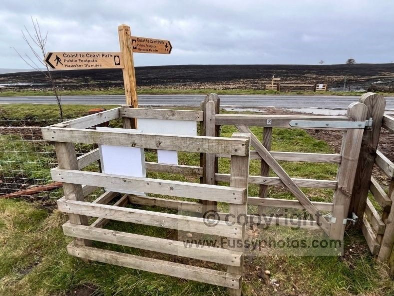
Crossing Sneaton Low Moor After the 2025 Wildfire
The route followed a single‑lane road past Low Rigg Farm and onto the first of many moors I’d cross over the next 35 miles. This one was particularly bleak, though with distant views of Whitby Abbey.
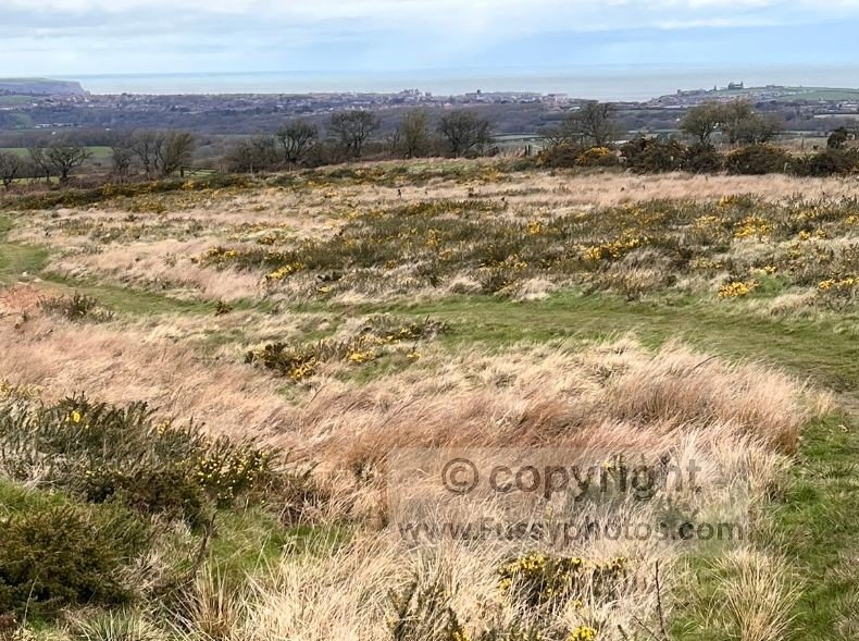
Despite the showers, the moorland wasn’t too boggy, though signs explained the barren feel: a wildfire in 2025 had left a blackened landscape, not unlike a cooled lava field.
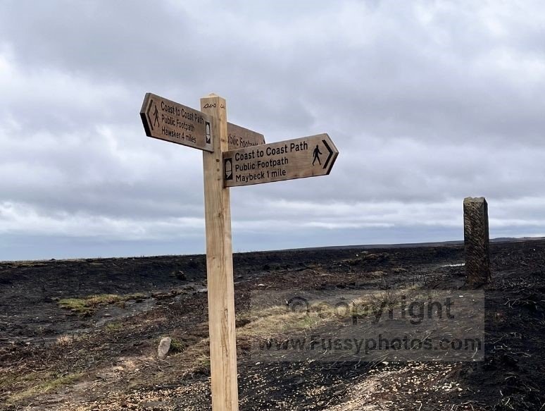
Posts marked the route across an early contender for “least scenic part of the Coast to Coast”. I tried to power on, but while my legs were pushing into sixth gear, the headwind kept me firmly in second. At one point I’m fairly sure I was moving backwards — as if the wind had taken it upon itself to enforce Wainwright’s preferred direction of travel.
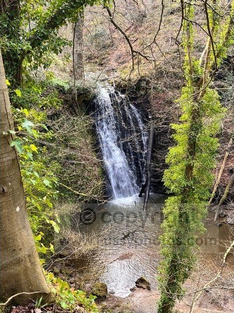
Falling Foss to Littlebeck — Waterfalls, Woodland and Closed Cafés
The Falling Foss Detour
With hindsight, I’m not sure I’d wild camp here even in perfect weather. I continued across boggier, blacker ground before eventually reaching the road to Falling Foss. The paved path followed a large stream, then boardwalks led to a bridge and a café. After powering across the moors, I was keen to take my pack off and sit down, but despite it being only late afternoon, the café was shut — and I wasn’t even allowed to sit on the outside benches. Apparently even the outdoor seating had clocked off early. A little miffed, I continued northwest.
Falling Foss itself is a 30‑foot waterfall — pleasant, though perhaps not quite worth Wainwright’s enthusiasm. A more direct route to Grosmont would have been equally justifiable.
The Hermitage and the Climb to Littlebeck
The trail climbed the wooded valley to The Hermitage, a quirky stone shelter, though not one I fancied sleeping in — despite an earlier suggestion from a well‑meaning walker who clearly had a different threshold for comfort.
Half a mile later, the path emerged at Littlebeck, a tiny village with no amenities but, crucially, a bench. I took a snack break in the emerging sun, sheltered from the wind, and fielded questions from west‑to‑east walkers about my direction and where I planned to sleep. No one had any suggestions.
Littlebeck to Egton Bridge — Sleights Moor, Storms and a Last‑Minute Hotel Win
Booking a Bed (and Saving £19)
Climbing out of Littlebeck on yet another single‑lane road, the idea of escaping the wind and rewarding myself with a bed began to grow. A quick online search showed a room at The Horseshoe Inn for £81, so I phoned to book it rather than wrestle with moorland Wi‑Fi. They quoted £100. When I mentioned the online price, they would only come down to £90. They refused to match it — apparently on principle, though the principle seemed to be punishment for attempting the courtesy of phoning. So I hung up and booked online anyway, saving £19 for two minutes’ work. A small victory for common sense, though with hindsight I should probably have haggled further, given the springy bed and the mouldy toast at breakfast.
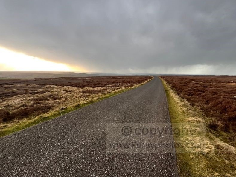
Sleights Moor in a Hailstorm
Reaching 250m and the A169, the wind rose again. I was cursing the headwind, hoping this wouldn’t be a theme for the entire walk. Gusts blew me off course and I lurched along with the balance of a toddler learning to walk on a polished floor.
A brief path led from the A169 to another road, peaking at 284m. A weather front appeared ahead — grey streaks of rain sweeping across the moor. I should have put my waterproof trousers on immediately, but didn’t. Suddenly it went from dry to driving rain and hail. I put my backpack rain cover on, but the wind repeatedly ripped it off. I was soaked, and so was my pack. The storm lasted less than five minutes, but I congratulated myself on the hotel booking. Sleights Moor will not be appearing on my list of “Top 10 Wild Camping Spots” any time soon.
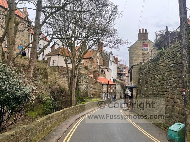
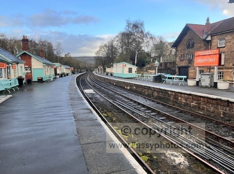
The Descent to Grosmont and the path to Egton Bridge
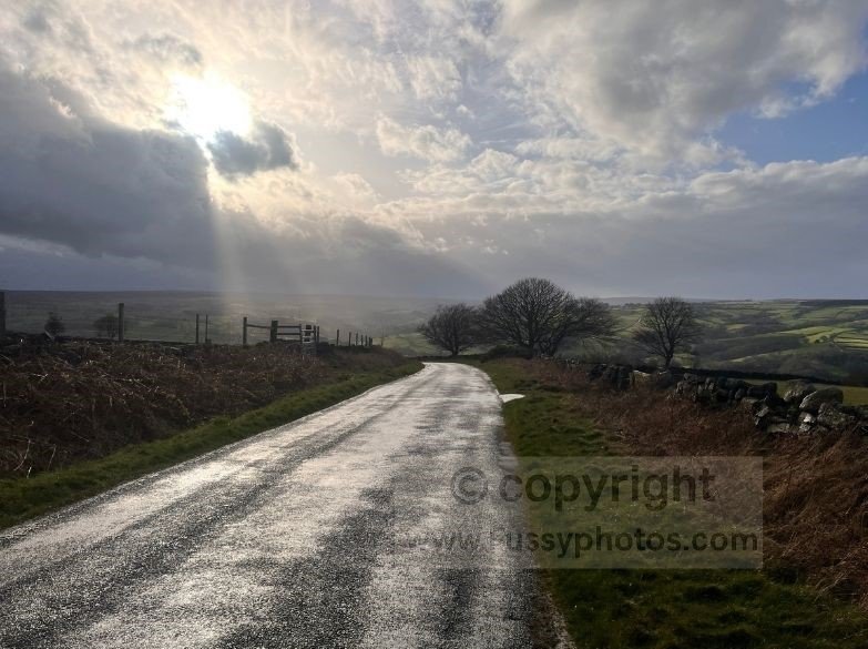
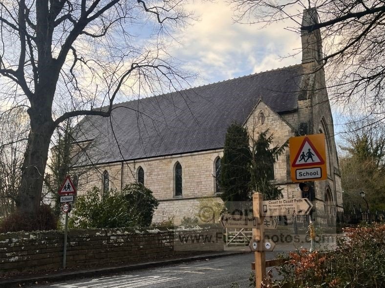
The route continued via Fair Head Lane towards Grosmont, dropping over 200 metres at times along a 1:3 gradient. My knees voiced their objections with the sort of drama usually reserved for Shakespearean death scenes. There were no steam trains running in Grosmont, but the Station Tavern had a sign advertising accommodation — and in a kinder timeline, I chose it and was rewarded with toast that didn’t require a tetanus shot.
I continued westwards, the route swapping the main road for a quieter private road with permissive access. It was a pleasant, if unspectacular, end to the day — but I was ahead of schedule and looking forward to more.
Reflections on the Day
- There’s a large amount of food choice at both the start and end of the day.
- The coastal scenery north of Robin Hood’s Bay is excellent and worth savouring before turning inland.
- If you’re happy to sacrifice flexibility, it’s worth booking ahead for dinner — this stretch gets busy.
- The day offers a good variety of terrain: coastal paths, woodland, streams, and open moorland.
Practical Tips for This Day
- Book ahead for food at the popular Hare and Hounds Pub.
- There are pubs on‑route at High Hawsker, Grosmont, and Egton Bridge.
- Wear proper winter boots if it’s wet — Sneaton Low Moor can soak your feet in minutes.
- The steepest climb east‑to‑west is from Littlebeck to Sleights Moor (the opposite direction is worse).
- The route passes close to multiple campsites between Low Moor and Northcliffe & Seaview Holiday Park.
- There are hotels in Grosmont and Egton Bridge without needing to deviate from the route.
FAQs for Day 1: Robin Hood’s Bay to Egton Bridge (East → West)
How do I get to the Coast to Coast Path?
For this section, the easiest access is Robin Hood’s Bay.
- Bus: The X93/X94 from Scarborough or Whitby drops you at the north end of the village.
- Train: The nearest stations are Whitby and Scarborough, both with bus connections. Once in Robin Hood’s Bay, simply walk downhill to Wainwright’s Bar, the official end/start point.
Can I camp along the trail?
Yes, but options are limited on this specific leg.
- Low Rigg Farm (near High Hawsker) exists but book ahead.
- The moors — Sneaton Low Moor and Sleights Moor — are technically possible for wild camping but exposed, boggy, and in poor weather, deeply unappealing.
- Woodland around Falling Foss looks promising on a map but is steep, uneven, and not ideal. Most walkers either camp near the coast or push on to Grosmont or Egton Bridge for accommodation.
Can I get my bags carried or my accommodation booked?
Yes. Several baggage‑transfer companies cover the Coast to Coast, including this eastern section. They will:
- Move your bag from Robin Hood’s Bay to Grosmont or Egton Bridge
- Arrange accommodation if you want a fully supported trip This is especially useful if you don’t fancy hauling a full pack across Sneaton Low Moor in a headwind.
What should I take with me?
For this specific leg:
- Waterproofs (the moors don’t negotiate)
- Good boots — Sneaton Low Moor can soak trail shoes instantly
- Snacks — Falling Foss café may be closed even when it looks open
- A power bank — signal is patchy on the moors
- Trekking poles for the steep descent into Grosmont
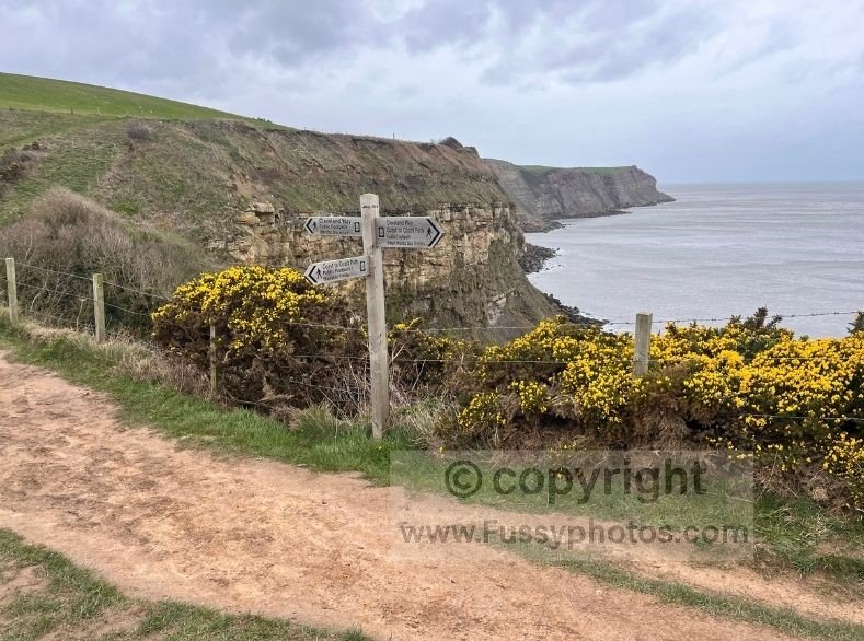
Is there signage on the Coast to Coast Path?
Yes — the signage on this section is excellent.
- The Cleveland Way coastal stretch is very well waymarked.
- Inland, the route is consistently signed through High Hawsker, Falling Foss, Littlebeck and Grosmont.
- Across Sneaton Low Moor, tall posts clearly mark the line of the path.
What is the fastest time to complete the Coast to Coast Path?
The full trail record is around 39 hours, but that’s for the entire 190 miles. For this section:
- Fit walkers often complete Robin Hood’s Bay → Egton Bridge in 6–8 hours.
- With a full pack, weather, and pub stops, 7–10 hours is more realistic.
Silly FAQs
Can I camp along the trail?
Yes, if you enjoy:
- wind
- bog
- sloping ground
- and the constant suspicion that a better campsite exists somewhere else
Can I get my bags carried or my accommodation booked?
Absolutely. Several companies will carry your bag, book your room, and generally remove all hardship from your adventure — leaving you free to focus on the important things, like fighting the wind and regretting toast.
What is the best time of year to walk the trail?
Any time when:
- the wind is below 40mph
- the moors are not impersonating a swamp
- and the Falling Foss café is actually open This narrows it down to approximately three afternoons per year.
Which direction should I walk it in?
Walk east → west if you enjoy:
- headwinds
- uphill sections
- and the feeling that Wainwright is somewhere laughing
Walk west → east if you prefer tailwinds and dignity.