Hike the Wonderland Trail’s east side past Indian Bar, Panhandle Gap & Summerland. A 3‑4 day loop with glaciers, waterfalls & epic alpine views.
Wonderland Trail Mount Rainier: Permit Tips, East Side Route & Burroughs Mountain Add‑On
Wanting to backpack the east side of the Wonderland Trail past Indian Bar, Panhandle Gap, and Summerland—but having failed to secure early-access permits—we found a way to backpack east Wonderland Trail without competitive permits by reserving sites at Glacier Basin and Tamanos Creek, two backcountry camps just off the main trail. This would allow us to complete a two-night, three-day loop from Stevens Canyon Entrance to White River and back. If you’re still deciding which entrance, region, or trail system to focus on, my Mount Rainier Hikes — Best Trails, Backcountry Routes & Permit Tips guide gives a full overview of the park’s layout, entrances, and the most iconic hikes to help you plan your trip.
This was ambitious in itself, but wanting to squeeze as much into our stay as possible, we also hoped to include a hike on the Burroughs Mountain Trail on day two.
Wonderland Trail East Side Map & Elevation Profile
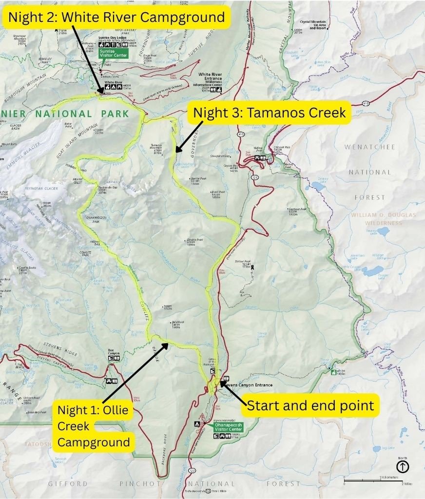
Map courtesy of the U.S. National Park Service (NPS), sourced from the official NPS Media Gallery. Public domain image. Used respectfully for educational and informational purposes. No endorsement implied. Annotations made independently.

Day 1: Silver Falls Trail to Olallie Creek (East Wonderland Permit‑Friendly Route)
Even without Burroughs, a ranger confirmed the loop would still be a mad dash over just two nights. We cancelled our planned rest day at Ohanapecosh Campground and instead decided to complete the first 2.8 miles and 900 m elevation gain that day by changing our permits at the Ranger Station to add a night at Olallie Creek.
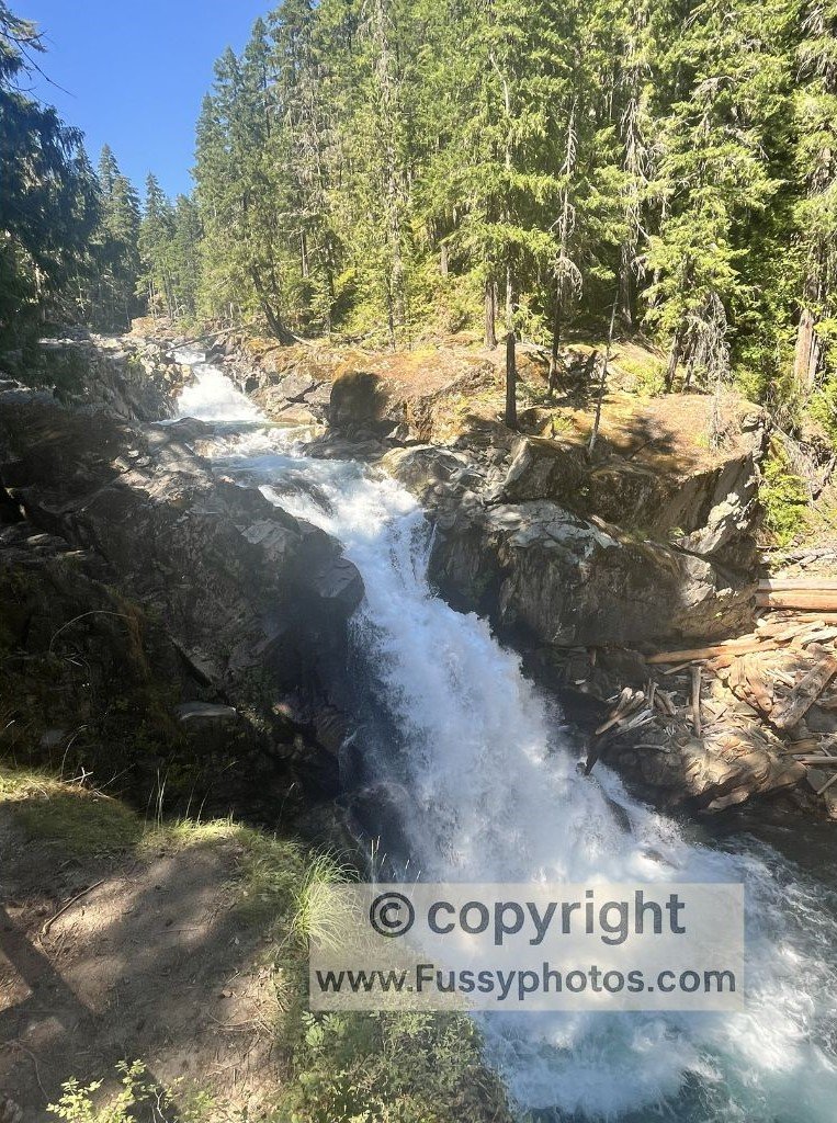
Warned but not deterred, we detoured to Silver Falls to see one of the park’s highlights.
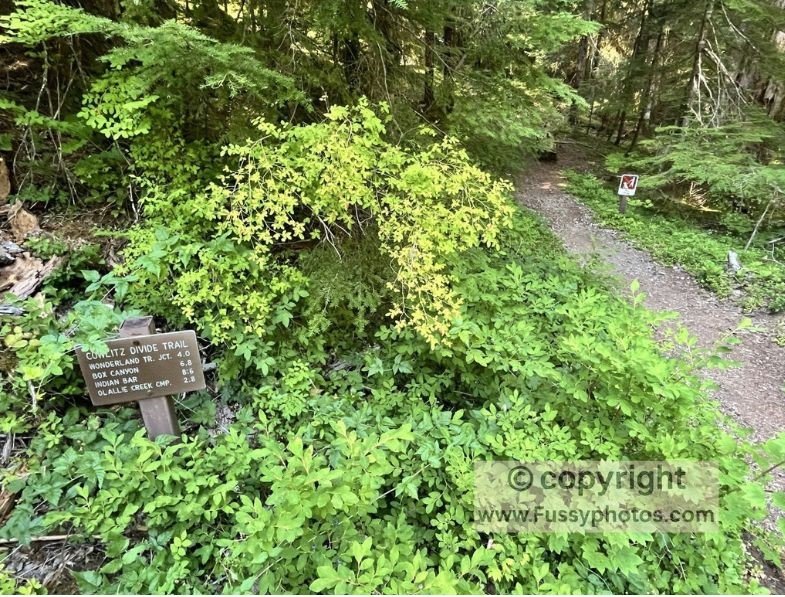
North of Stevens Canyon Road, the Cowlitz Divide Trail was a strenuous forest hike—while there were some impressive trees, the payoff wasn’t worth the effort at this stage. Still, we knew day two would bring what many call the best stretch of the Wonderland Trail.
Day 2: Mt Rainier’s Most Magical Valley — No Lottery Needed to Backpack East Wonderland Trail
Olallie Creek Campground was pleasant, and after swapping notes, weather reports, and stories with fellow campers, we slept well.
Despite shaving a few hours off the route the evening before, a massive day awaited us. We had permits for Glacier Basin, some 18–19 miles away, though the popular White River Campground (112 walk-in sites, first-come, first-served) was on-route and would shave 2.4 uphill miles off the final day.
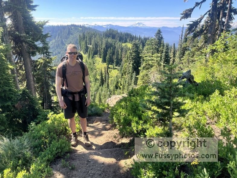
Olallie Creek is just 1.4 miles off the Wonderland Trail, so while permits aren’t as competitive as Indian Bar or Summerland, it’s still well-placed for a circular loop. As soon as we rejoined the Wonderland Trail, we were greeted by a swarm of mosquitoes. Thankfully, the shade soon gave way to distant views, and the mosquitoes disappeared. The trail climbed steadily until our first view of Mount Rainier’s peak came into sight.
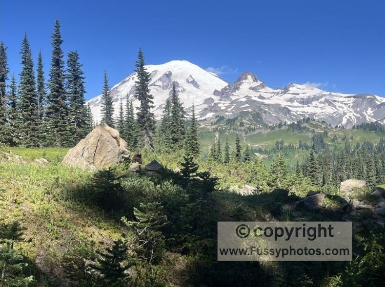
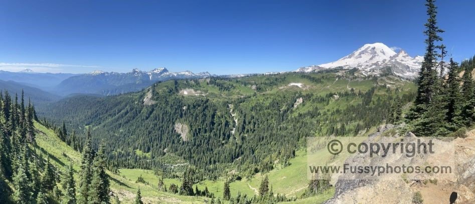
Even in July, Mount Rainier is overcast 39% of the time (WeatherSpark), so we were lucky to enjoy increasingly panoramic views under clear blue skies. As we approached Indian Bar, views of another volcano—most likely Mount St. Helens—added to our excitement.
When we reached a vantage point with both Rainier and St. Helens visible, and a sunlit U-shaped valley (Nickel Creek) below, we knew we’d found our lunch spot.
Indian Bar: A Wonderland Highlight
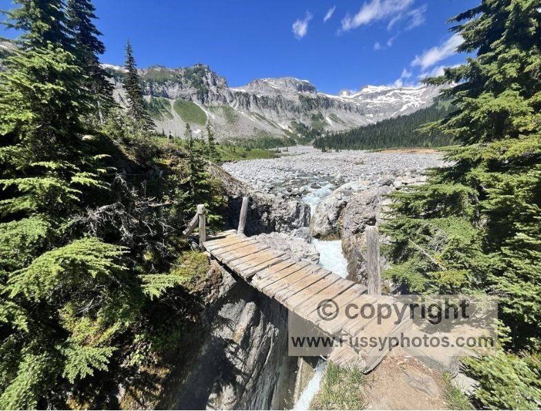
After more undulating terrain, the path dropped quickly to reveal our first views of Indian Bar—a radiant stretch of the Wonderland Trail. Descending into the valley felt like stepping into a dream.
The Indian Bar Trail Shelter came into view, accompanied by the sound of rushing water. The trail crossed a small rope bridge over a narrow gorge, passed the Indian Bar Campsite on the right, and skirted a large outwash plain to the left.
We lingered as long as we dared, envious of those lucky enough to camp here.
Continue to Part 2: Indian Bar, Panhandle Gap, and Summerland — the most spectacular stretch of the East Wonderland Trail.
Watch on YouTube: Backpack East Wonderland Trail Without Competitive Permits — Indian Bar & Summerland Loop
