Backcountry Adventure: How to Explore Guadalupe Mountains NP
Preparing for Guadalupe Mountains National Park: Water, Food, and Visitor Essentials
McKittrick Ridge Trail is one of the toughest hikes in Texas, combining steep climbs, overgrown desert terrain, and remote backcountry camping. This guide covers everything you need to plan the route, manage water, and navigate the challenges of Guadalupe Mountains National Park.
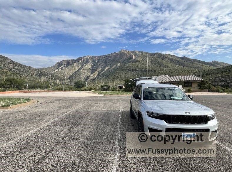
Guadalupe Mountains National Park sits in the far western reaches of Texas, 100 miles from the nearest city and a world away from convenience. This is not a park for the unprepared. Before arriving, we filled the car with gas, packed every bite of food we’d need, and double-checked our water strategy. The only reliable refill points were the park’s three visitor centers—Pine Springs, McKittrick Canyon, and Dog Canyon—with miles of trail between them and no water available along the way.
If you’re looking for a full overview of the park before diving into this backcountry route, my main Guadalupe Mountains National Park Guide: Start Here covers the best hikes, logistics, and essential planning tips.
Planning a wider US hiking trip? My full US Hikes hub brings together all my national park and wilderness guides in one place.
Pine Springs Campground: First Night in Guadalupe Mountains NP
After a quiet drive from El Paso, we spent our first night at Pine Springs Campground, a developed site with secluded pitches, benches, and flush toilets—but no showers. We chose Campsite 1, tucked a minute and a half’s walk from the nearest parking spot. The payoff? Charm, solitude, and a view worth the extra steps. Though close to Highway 180, traffic noise faded into silence by nightfall.
From Pratt Cabin to The Notch and McKittrick Wilderness Ridge
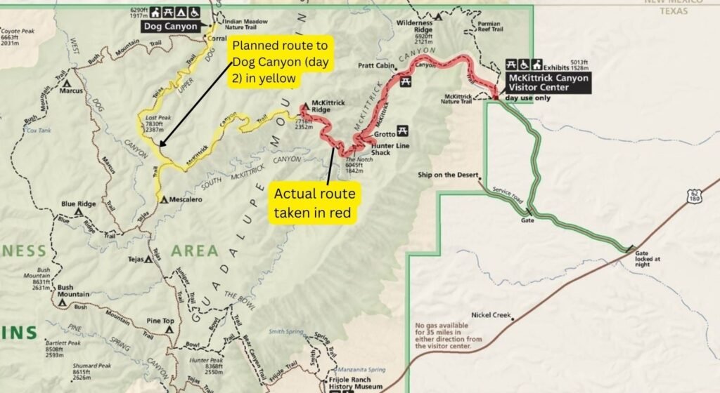
The next morning, we drove 30 minutes to McKittrick Canyon Visitor Center, with ambitious plans: hike west along McKittrick Canyon Trail, past The Notch, and spend the night at McKittrick Ridge Wilderness Campground. As with many of our summer hikes in the desert, we’d cached water for our return journey on day three, aiming to spend a second night at Mescalero Wilderness Campground via a long detour to Dog Canyon Ranger Station, where water was available for day two. On day three, we’d retrace McKittrick Ridge and Canyon Trails to our start point.
Despite meticulous planning, the logistics were complex. Even after hours of research, photos and trail reports were scarce. This hike remained a mystery—one we were eager to unravel.
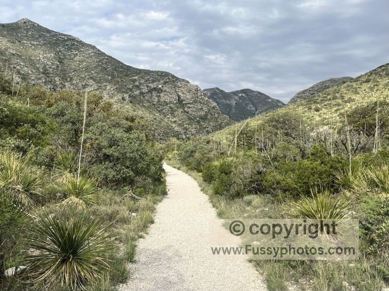
The trail began gently: wide, flat, and well-maintained. Our packs were heavy, but the walking was easy.
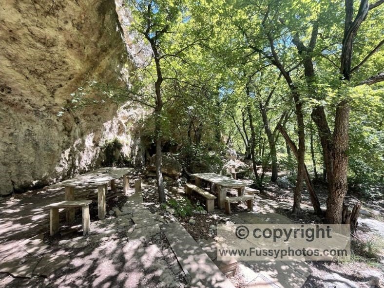
Pratt Cabin and The Grotto: Scenic Stops on the McKittrick Canyon Trail
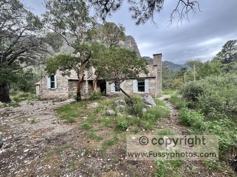
We detoured to Pratt Cabin, then continued to the surreal limestone formations of The Grotto, where picnic benches made for a perfect lunch stop. Along the way, we met just one other hiker—bound for Wilderness Ridge via the Permian Reef Trail, chasing views into McKittrick Canyon.
How to Explore Guadalupe Mountains NP: McKittrick Ridge Trail’s Beauty, Brutality, and Bushwhacking
Why This Trail Earns Its “Toughest in Texas” Title
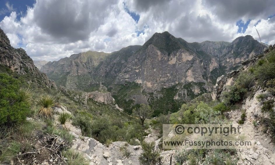
After lunch, the real ascent began. South of The Grotto, the trail launched skyward—steep, relentless, and overgrown. The National Park Service calls McKittrick Ridge Trail “the toughest hike in Texas,” and we quickly understood why. With 2,700 feet of elevation gain and scorching heat, it was a test of endurance and navigation.
At times, the trail vanished beneath a blanket of sharp Chihuahuan Desert vegetation. We relied on GPS to stay on course, bushwhacking through thorns and scrub.
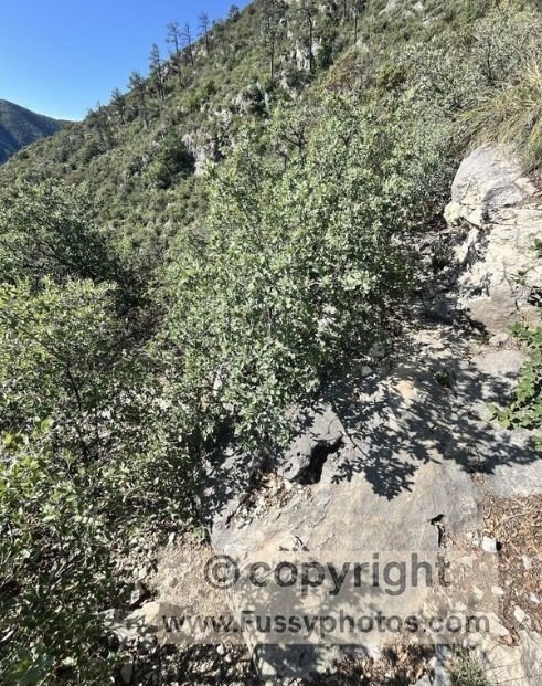
Strip away the desert flora, and the landscape resembled a pale version of Zion National Park—towering cliffs, blasted steps, and sweeping vistas.
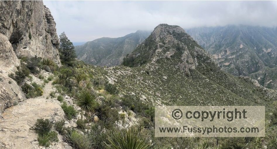
Approaching The Notch, the trail seemed to dead-end into rock. But a narrow snicket—just three meters wide—led us through to a whole new view. Breathless, we paused, snacking and drinking, soaking it all in. Beyond The Notch, the path became clearer, looping around South McKittrick Canyon, a research area closed to visitors but tantalizingly beautiful from above.
McKittrick Ridge, Guadalupe Mountains NP: The Notch, Hawks and Dog Canyon Challenges
Storm clouds rolled in but held their fury, leaving the mountain tips visible and our views intact. An hour past The Notch, a nameless ridge unfolded before us, stretching north across the canyon. From here, we could see back toward The Notch and forward into tomorrow’s wilderness. Red-tailed hawks screamed overhead, swooping close—reminding us to move on quickly.
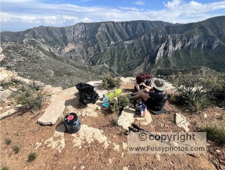
As the trail flattened, we found a perfect dinner spot: flat rocks for seats and panoramic views. But the day’s pace had been punishing—just one mile per hour through dense brush. We reconsidered our plan. Reaching Dog Canyon and returning would be a stretch, difficult even under ideal conditions. With no reliable trail intel, we decided to sleep on the ridge and reassess in the morning.
Mule Deer Mischief and a Midnight Visitor – Camping at McKittrick Ridge Wilderness Campground
McKittrick Ridge Campground was easy to find, with multiple sites and no other hikers in sight. We had the pick of the place. A mule deer wandered into camp—at first a welcome companion, but soon a persistent nuisance. She circled our tent all night, likely begging for food. Despite repeated shooing, she returned again and again. I barely slept, listening to her hooves thudding around the site, at one point seemingly inches from our tent.
Retracing McKittrick Canyon Trail: The Grotto Lunch Stop and Pine Springs Campground Return
By morning, we agreed: the smart move was to retrace our steps. With less water and a downhill route, we made good time back to The Grotto, stopping for lunch and feasting on two days’ worth of food.
With time to spare, we cooled our feet in a creek crossing and booked another night at Pine Springs Campground before continuing on our adventures.
Final Thoughts on Hiking the McKittrick Ridge Trail
- Plan for self-reliance: Fuel, food, and water plans must be sorted before arrival.
- Expect trail challenges: Overgrowth, heat, and elevation gain are will slow you down.
- Plan your water strategy: Especially in summer, your return depends on it. Look at backcountry maps and the location of the three visitor centers. Water caching may be necessary.
- Be flexible—conditions change, and route-finding can be unpredictable. Listen to your body and your instincts. We cut our trip from three days to two once it became clear that the trail conditions made our original plan too ambitious, with water sources too far to reach within our permitted time and designated campgrounds.
- Enjoy the solitude: This is one of the wildest, quietest corners of Texas.
If this trip report has inspired you to explore more of the park, my Guadalupe Mountains National Park Guide: Start Here has everything you need to plan the rest of your visit.
Best of McKittrick Canyon — Pratt Cabin, The Grotto, The Notch & Ridge Views

Annotated Trail Map: Planned vs Actual Route on the McKittrick Ridge Trail
Backpacking Gear Guide for the McKittrick Ridge Trail
Why This Gear List Matters
Guadalupe Mountains National Park is remote, arid, and unforgiving—perfect for solitude, but brutal without the right gear. With no water on trail, steep climbs like McKittrick Ridge, and unpredictable desert weather, this 2-day route demanded full self-reliance. Here’s what we packed (and what we learned) for our out-and-back to McKittrick Ridge Wilderness Campground:
Navigation & Trail Essentials
- GPS app (Gaia, AllTrails or Maps.me) – Crucial for bushwhacking and locating The Notch
- Paper topographic map – Backup for electronic failure
- Compass – Useful in overgrown or washed-out sections
- Permit printout – Required for wilderness campsites like McKittrick Ridge and Mescalero
- Route notes or GPX file – Preloaded with elevation profiles, water cache points, and camp locations
Footwear & Traction
- Sturdy hiking boots – With ankle support for limestone steps and desert scree
- Gaiters (optional) – For thorny brush and cactus-heavy terrain (though I don’t use them)
- Trekking poles – Useful for steep ascents and descents
Clothing for Desert Conditions
- Lightweight long-sleeve shirt – For sun protection and brush defense
- Hiking pants – Adaptable for heat and thorny overgrowth
- Insulated jacket (lightweight) – Optional depending on time of year. For cold nights at elevation. It was not cold, even at elevation in summer, though McKittrick Ridge Campground was sheltered from winds.
- Rain shell (optional) – For summer storms and wind
- Sun hat and sunglasses – For intense UV exposure
Sleep System
- Tent rated for desert wind – Lightweight but sturdy
- Sleeping bag – For potentially cool nights at altitude
- Sleeping pad – Comfort and warmth on rocky terrain
- Pillow – Optional but appreciated
Cooking & Hydration
- Lightweight stove – For boiling water and cooking dehydrated meals
- Fuel canister – Take more than you need
- Pot and utensils – Compact and easy to clean
- Water purifier or filter – Not useful on this route—no natural water sources (you are not allowed to drink from McKittrick Canyon Creek)
- Hydration bladder or bottles – take more than you need and cache water if your route allows.
- Water cache containers – Pre-filled and stashed for return leg
- Electrolyte tablets or powder – Useful for desert hydration
Safety & Extras
- First aid kit – Include blister care, antihistamines, and electrolytes
- Headlamp with extra batteries – For late camp setup and night navigation
- Sunscreen and lip balm – High UV exposure
- Multi-tool or knife – For gear repairs and food prep
- Trash bag – Pack out all waste—no bins in wilderness zones
Route Overview & Planning Tips
- Trailhead: McKittrick Canyon
- Route: McKittrick Canyon → The Grotto → McKittrick Ridge →McKittrick Ridge Wilderness Campground → return via The Notch
- Distance: ~15 miles over 2 days. Can be extended e.g. to Dog Canyon Campground. Expect to cover less distance than normal. This route is steep, the trail is unmaintained with thorny desert vegetation and temperatures are hot in summer, though cool off with altitude.
- Elevation gain: 3050 feet total
- Best season: October–April (we hiked in summer, but heat is more extreme)
- Permit required: Yes (Guadalupe Mountains Wilderness)
- Water strategy: Cache water or plan stops e.g. at, Dog Canyon Campground
- Wildlife: Mule deer, hawks, and persistent insects—store food securely
Guadalupe Mountains FAQs
Do I need a wilderness permit for backcountry camping in Guadalupe Mountains National Park?
Yes. Overnight trips in the Wilderness require a permit year‑round, obtained in person at the Pine Springs Visitor Center. Permits are easier to secure in summer but more competitive in spring and fall.
Is water available on trails in Guadalupe Mountains National Park?
No. Water is not available along trails. The only reliable refill points are the three visitor centers: Pine Springs, McKittrick Canyon, and Dog Canyon. Consider caching water where possible before starting.
Why is McKittrick Ridge Trail considered the toughest hike in Texas?
It gains over 2,700 feet in just 2 miles, with steep, overgrown terrain, thorny desert vegetation, and extreme summer heat. The trail is unmaintained, requiring some bushwhacking and careful navigation.
Are there bears in Guadalupe Mountains National Park?
Black bears are occasionally reported, but sightings are rare. The park ranger told us not to worry about seeing any (summer). More common encounters include mule deer, hawks, and smaller mammals.
Is there a shuttle service in Guadalupe Mountains National Park?
No. The park does not operate a shuttle system. Visitors must use their own vehicle, and point‑to‑point hikes are difficult to arrange without a second car due to the park’s remote location.
If you enjoy demanding desert and canyon routes like McKittrick Ridge, you might also like my Grand Canyon Rim‑to‑River‑to‑Rim guide — a huge, unforgettable day hike with serious elevation and heat. For a multi‑day point‑to‑point challenge, my Zion Traverse trip report covers one of the most iconic long‑distance routes in the Southwest. If you prefer rugged, hoodoo‑filled terrain, my Chiricahua Big Loop guide offers a spectacular full‑day adventure in southeastern Arizona. And for another remote, high‑desert experience, my 2‑day Capitol Reef Backcountry Loop explores slot canyons, domes, and wide‑open wilderness in one of Utah’s quietest national parks.