Day 2 – Lower Golden Trout Lake to Piute Canyon and the John Muir Trail
Missed Day 1? Start the loop from the beginning here: North Lake to Lower Golden Trout Lake — Day 1
Morning at Lower Golden Trout Lake
Even though it was mid‑summer, the high elevation made for a crystal‑clear, bitterly cold night — and not even my 30°F comfort‑rated sleeping bag kept me warm. We had a long day ahead: 14.5 miles to reach Evolution Creek. Anything less would put a side trip to Evolution Basin out of reach the following day. Thankfully, the elevation gain was a manageable 1,600 feet, though most of it came at the end of the day, when we’d be grinding along at a slow pace.
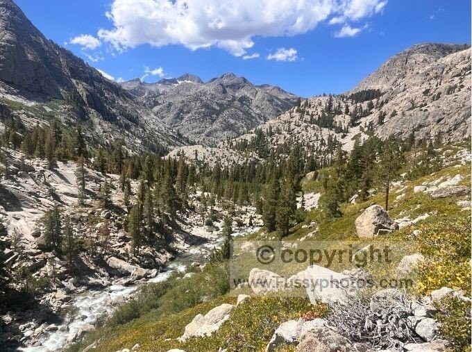
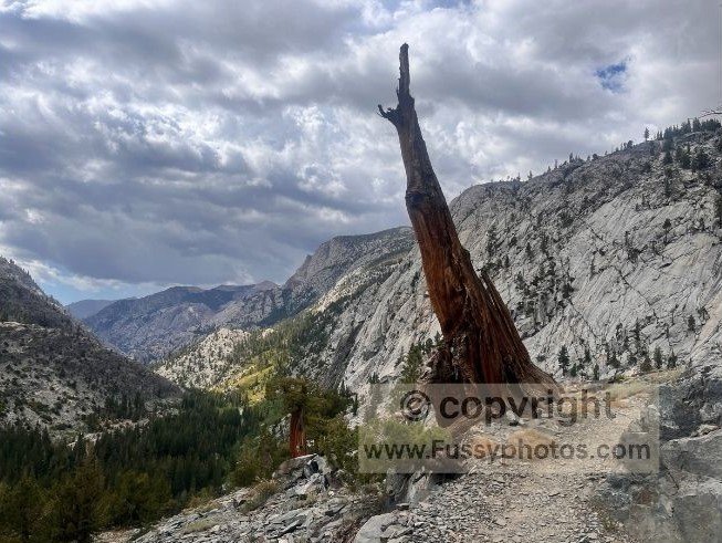
Descending Toward Piute Canyon
We began by descending into Piute Canyon, heading toward the John Muir Trail (JMT) and our entry point into Kings Canyon National Park. Our decision to camp at Lower Golden Trout Lake the night before proved wise — the trail dissected through boulders and tree roots, and it was clear that staying put had given us the best chance of a good night’s sleep.
A Fast, Buggy Morning Along Piute Creek
Roared on by Piute Creek, we aimed for a quick start before the heat set in, walking briskly downhill and trying to stay ahead of the mosquitoes that plague this stretch of trail. Nearly three hours of forest walking followed, with occasional breaks teasing us with glimpses of what lay ahead — open views of the steep gorge shaped by Piute Creek, a dramatic corridor we’d soon be following along the Piute Canyon Trail.
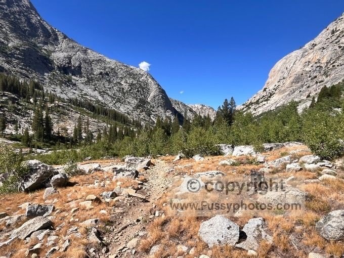
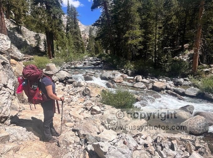
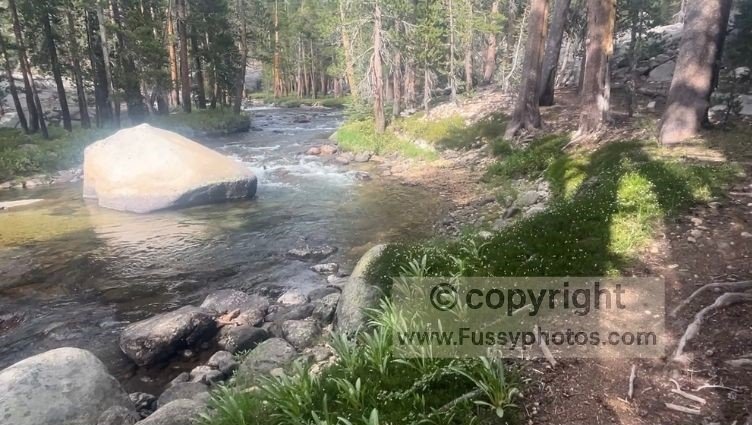
Creek Crossings, Waterfalls, and the Final Descent Down Piute Canyon Trail
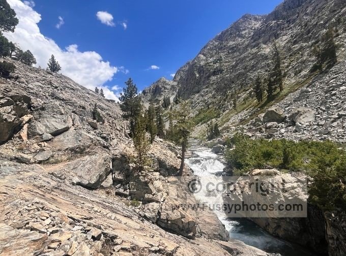
The trail crossed the creek repeatedly, and at times the best route across wasn’t obvious. Pausing to think made us easy targets for the mosquitoes. As we headed southwest, the trail dropped sharply, with cascading waterfalls often within reach and never out of earshot. We stopped for photos but rarely lingered, hoping to make progress as the sun and temperatures rose in tandem.
Soon, views back up the canyon were as spectacular as those ahead. Pilot Knob rose dramatically above the valley floor, and the final miles of the descent brought a steeper gradient, evoking memories of the High Sierra Trail. Having missed our chance to eat by the river, we pressed on, hoping for shade and water further down.
A Late Lunch Near the End of Piute Canyon Trail
A little later than hoped, the trail finally leveled out just before the junction with the John Muir Trail (JMT). Piute Canyon had been wild and beautiful, but we were eager to hit the JMT and officially enter Kings Canyon National Park. Earlier in the day we’d passed a perfect waterfall lunch spot but chose to push on for a few more miles. By the time we finally stopped, we settled for a shaded spot beneath a large tree near the end of Piute Canyon Trail — peaceful enough, but without the water access or views we’d skipped earlier.
Joining the John Muir Trail: Entering Kings Canyon National Park
The JMT felt different — busier, better graded, and more comfortable underfoot. We began climbing again, regaining some of the elevation we’d lost earlier in the day, now walking parallel to the South Fork San Joaquin River as it thundered past us. If you’re curious about the different east‑side routes into Kings Canyon, my Kings Canyon Entrance Passes (east): Which One to Choose guide compares all seven major approaches, including Piute Pass.
Upstream of the latest waterfall, having made good time, we took off our shoes and rested by the river, grateful for a break from the morning’s fast pace.
John Muir Trail to Evolution Meadow
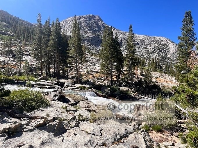
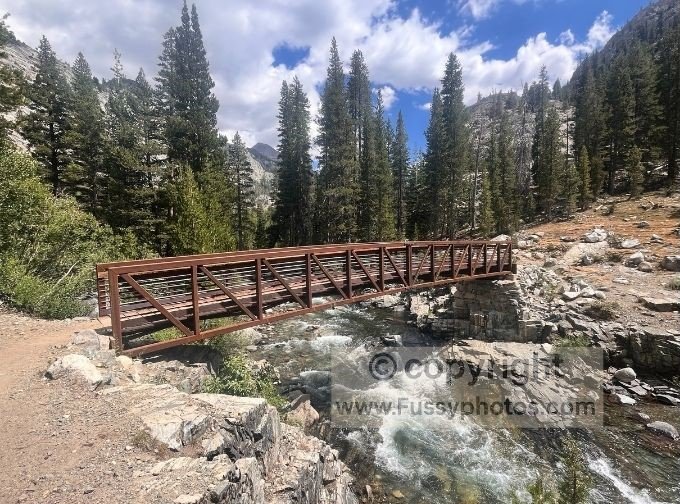
Following the JMT Beside the South Fork San Joaquin River
The JMT hugged the river for 3.5 miles before our trail junction with the Goddard Canyon Trail. We continued east over the footbridge on the JMT.
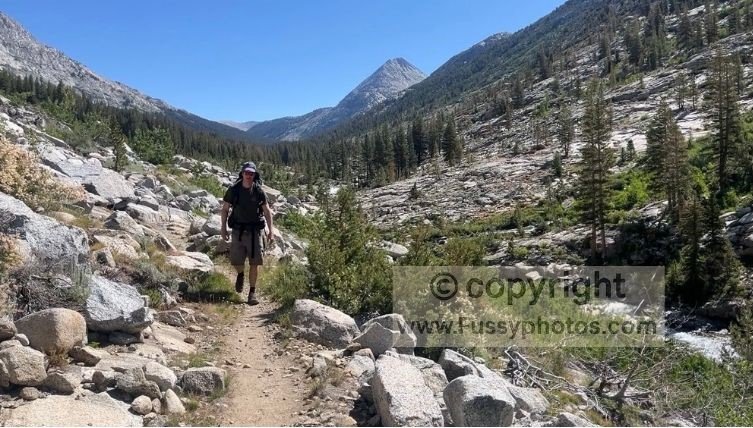
Campsites tempted us to stop, but doing so would have left us two miles and over 800 feet elevation gain short of our goal. Wearily, we hit the switchbacks, the day’s mileage catching up with us.
Climbing Toward Evolution Creek
Higher now, the trail followed Evolution Creek as it meandered one way and we climbed another. Arriving at Evolution Meadow, the mosquitoes returned with a vengeance. We found an available spot but chose to continue, hoping that pushing on would reward us with a more comfortable campground.
Crossing Evolution Creek in a Buggy Meadow
Having stayed right to scout for a campsite, we now had to cross Evolution Creek — taking our boots off in a buggy meadow, mosquitoes took full advantage of our slow pace as we carefully waded through the water, cursing them as we went. But ultimately, it was worth it. We found a quiet spot just before McClure Meadow Ranger Station, all to ourselves — perhaps due to the lack of nearby running water, but peaceful, private, and blissfully bug‑free.
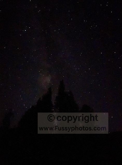
A Quiet Night Beneath the Milky Way
We enjoyed an early night, though I woke halfway through to take in yet another stunning, unblocked view of the Milky Way.
Watch North Lake – Piute Pass – Lamarck Col Loop | Day 2: Golden Trout Lake to Evolution Meadow
