Day 3 – Evolution Creek (JMT) to Evolution Basin, Darwin Canyon and Lamarck Col
Missed Day 1? Start the loop (with the map) from the beginning here: North Lake to Lower Golden Trout Lake — Day 1
Missed Day 2? Start the loop from the day 2 here: Lower Golden Trout Lake to Piute Canyon and the John Muir Trail
Evolution Creek to Evolution Lake
Today’s hike began with high anticipation. We were still over five miles and 1,500 feet of elevation gain from Evolution Lake—the northernmost gem of Evolution Basin. Our goal was to explore as much of the basin as possible, realistically reaching Evolution Lake and Sapphire Lake before doubling back north. From there, we’d leave the John Muir Trail (JMT) and head northeast toward Darwin Bench and Darwin Canyon.
With a flight scheduled the next day, our camping plans were flexible but strategic. We aimed to get as close to Lamarck Col as possible without compromising our return route to North Lake. It was a delicate balance: maximize scenic exploration while minimizing risk of delay.
Following the JMT Through McClure and Colby Meadows
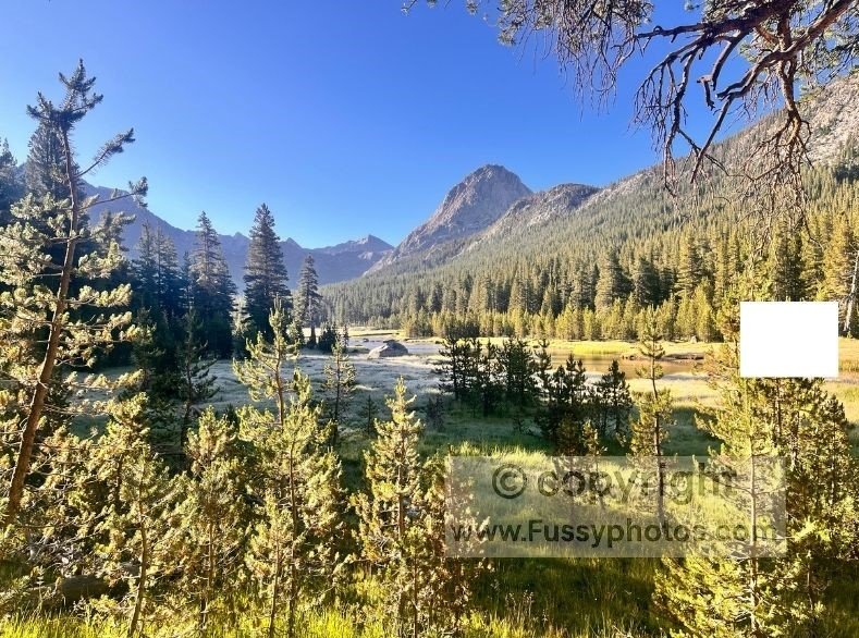
The JMT began gently, tracing the edges of McClure Meadow and Colby Meadow—vast, flat expanses that defy their 9,800‑foot elevation. A hard frost confirmed another cold night, and our early start helped us reach Evolution Valley before the day’s heat set in.
Climbing Toward Evolution Basin
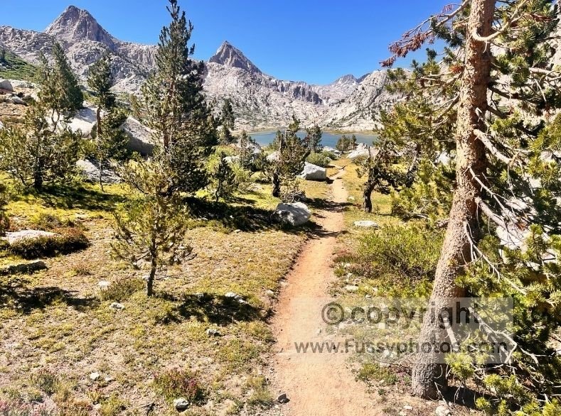
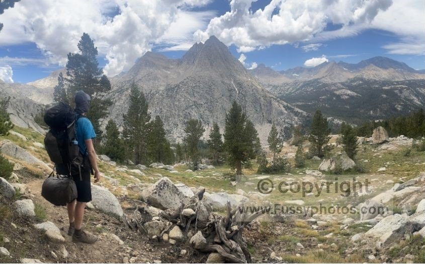
The switchbacks climbing out of the valley were tough but rewarding. The Hermit, a striking mountain with twin triangular peaks, came into view. Trees thinned and shrank, signaling our return to high altitude. The outline of Evolution Basin emerged, and we knew we were close.
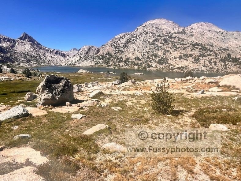
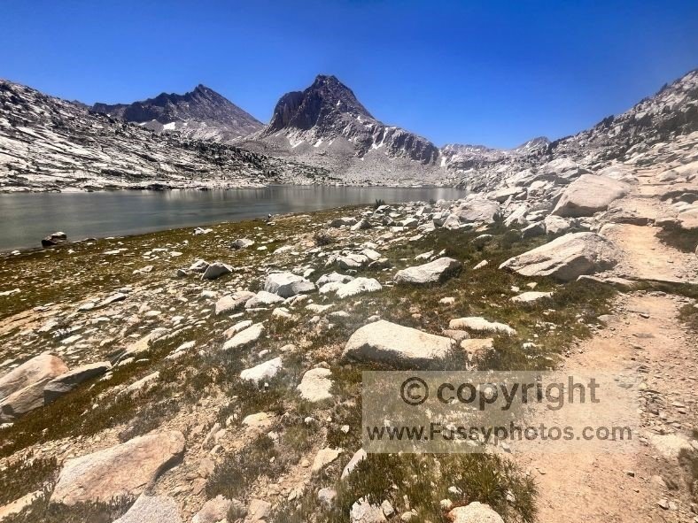
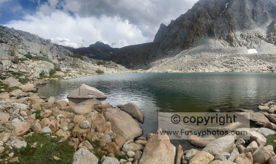
Two small lakes appeared first, followed by a rocky outcrop. Behind it, Evolution Lake shimmered in the morning light. The JMT skirts the lake’s northeast edge, weaving through scree and offering elevated views. A large rock formation divides the lake’s north and south ends, obscuring the full view until you’re deeper into the basin.
Exploring Evolution Lake and Sapphire Lake
Once past the outcrop, the trail flattens and reveals postcard‑perfect views—Evolution Lake framed by towering granite walls.
My partner, fatigued from our recent pace, chose to rest and soak in the scenery. She encouraged me to continue solo on our out‑and‑back leg. I dropped my pack and hiked the next few miles with just my water purifier. For two hours, my camera was in constant use.
Crossing the creek at Evolution Lake
At the south end of Evolution Lake, stepping stones led across the creek feeding the lake. The trail climbed gently, unveiling more alpine beauty with each step.
Sapphire Lake felt more remote but equally stunning. I sat quietly, absorbing the solitude and grandeur. My emotions were mixed—grateful for the experience, wistful for the time constraints. I knew I’d return someday. Reluctantly, I turned back and rejoined my partner after midday.
Lunch at the north end of Evolution Lake
Feeling refreshed, she was ready to hike again. We retraced the trail to the lake’s northern edge, where a flat campground offered the perfect lunch spot. It was one of the most scenic meals I’ve ever had—feet cooling in the lake, wind-blown waves lapping against the rocks.
Leaving the JMT for Darwin Bench
Eventually, we packed up and headed north, retracing our steps to the morning’s switchbacks. Here, we left the JMT, taking an unnamed trail toward Darwin Bench. If you’re following this route, be warned: the junction is unmarked and easy to miss. A GPS is essential.
Into Darwin Bench: Rugged Terrain and Waterfall Views
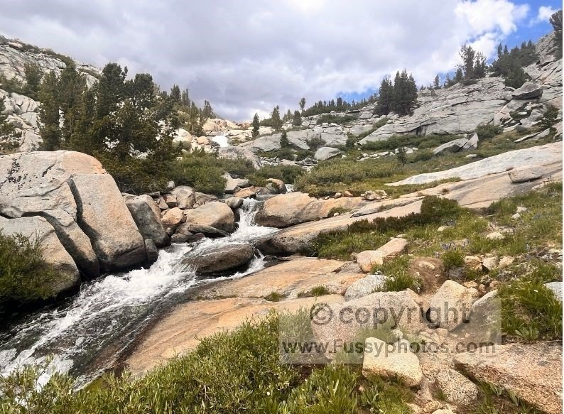
The trail quickly changed character—unmaintained, steeper, and more rugged than the JMT. It followed noisy waterfalls and offered renewed views of The Hermit as we climbed.
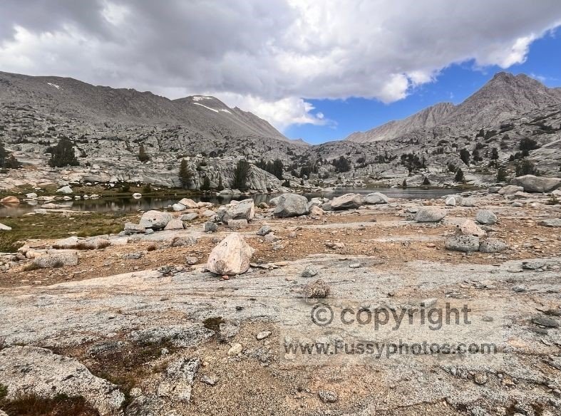
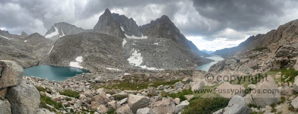
The terrain flattened, signaling our arrival at Darwin Bench, a boulder‑strewn granite plateau well above the treeline.
Camping here would’ve been memorable, but we pressed on. We were still 1.5 miles from the eastern edge of Darwin Canyon, where our topographic map suggested potential flat camping spots.
Navigating Darwin Canyon: Scrambling, GPS, and the Push to Lamarck Col
By midafternoon, clouds gathered over Mount Lamarck. We stayed alert but confident. The trail faded into a scramble across rocks and boulders. Even with GPS, route‑finding was tough. We often climbed only to descend again, doubting the GPS—until the trail reappeared, etched faintly into sparse grass. Without GPS, we’d have been lost. The canyon offered little visibility, and the lakes were our only guides. Progress was slow, and we eventually paused for an early tea break.
Committing to the Ascent: The Final Push Toward Lamarck Col
Choosing to Cross Lamarck Col Before Nightfall
We decided to tackle Lamarck Col today—not because of the remaining distance to North Lake (less than seven miles) or elevation gain (1,400 feet), but because of the trail’s condition and uncertainty at the pass. Lamarck Col, one of the highest passes in the Sierra Nevada at 12,900 feet, demanded everything from our legs and lungs. Rest was tempting, but with a flight looming, we pushed on. The terrain immediately turned into a boulder field—requiring full concentration, agility, and perseverance.
Scrambling Toward Lamarck Col: Boulder Fields and Glacier Views
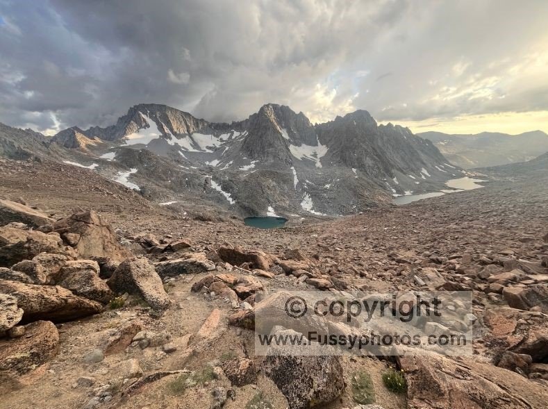
We were stunned to meet a couple carrying a baby across this precarious stretch. Progress was slow, hands and feet needed for every move. At 11,600 feet, we reached the end of Darwin Canyon but saw no trail. GPS guided us up five‑foot rock faces—no longer just hiking, but climbing too. At times, we found a clear trail—only to lose it again almost immediately. Still, we pressed upward, rewarded with sweeping views over Darwin Canyon and the Mendel and Darwin Glaciers.
A wall of rock still loomed ahead, and progress was hard‑earned. It wasn’t until 7:00 p.m. that the top of Lamarck Col came into view.
By then, my partner was suffering from a headache—likely brought on by exertion and thin air. Despite several days at altitude, this was by far the highest point of our trip. Looking west, Darwin Canyon looked magnificent: all its lakes now visible, the sky a mix of brooding clouds and sunset hues.
Crossing Lamarck Col: Snowfields, Narrow Gaps, and the First Steps Down
The trail led us through a narrow gap in the rock, revealing a stark eastern landscape and a beautiful cirque tarn. Our excitement at finally hiking downhill was short‑lived—a snowfield enveloping the north face of the pass came into view. With no way around, we donned crampons and carefully navigated this final obstacle.
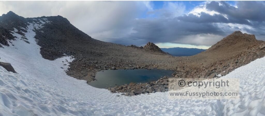
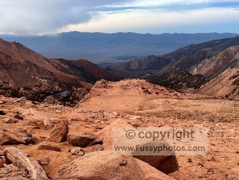
Our goal now wasn’t so much to cover mileage, but to lose elevation before darkness. The Lamarck Col Trail winds through a gentle U‑shaped valley, glowing vivid sandstone color in the deep sunset—a stark contrast to the brooding granite and lakes of Darwin Canyon just a mile behind.
Lamarck Col Trail Descent and High‑Altitude Camp
The wind picked up and storm clouds materialized, though safely in the distance over Bishop. By 8:15 p.m.—13 hours into our day—we agreed it was time to set up camp on a flat section of rock. It was our best chance at a good night’s sleep rather than descending further and losing the light.
With the tent pitched and the light fading to almost nothing, we enjoyed a silent but frigid night at 11,800 feet. Our final views of the Milky Way marked the end of our wilderness adventure before tomorrow’s return to civilization.
Watch Day 3: Evolution Lake, Sapphire Lake & Darwin Canyon
