Pennine Way Day 2 Circular Walk: Wessenden and Standedge
Many walkers lack the time or inclination to complete all 268 miles of the Pennine Way. The logistical challenges alone deter many.
Read my How to Walk the Pennine Way trip report and guide pages foradvice on overcoming these challenges. They explain how to successfully complete a Pennine Way point‑to‑point walk.
Standedge Circular: A Pennine Way Day 2 Alternative
This Standedge circular is an excellent time saver. It offers a great way to sample the Pennine Way in a single day.
The route includes Pennine Way Day 2 highlights: a scenic descent past Wessenden Reservoir and sweeping views at Redbrook Reservoir and Standedge. If you’re looking for a shorter Day 2 sampler further south, my Crowden–Black Hill circular walk covers the dramatic Laddow Rocks and Black Hill section — another superb way to experience Pennine Way Day 2 without committing to the full stage.
It is a stretch I first discovered on my own Pennine Way walk. I return to it again and again.
Parking and Accessibility at Wessenden and Marsden
There is ample parking at Wessenden Head, Marsden, Hey Green, and the Pennine Way Car Park (Oldham HD7 6NL).
This makes the circular walk accessible, with flexibility to extend or shorten miles. For example, follow the Standedge Trail from Marsden back to the Pennine Way to shorten the walk.
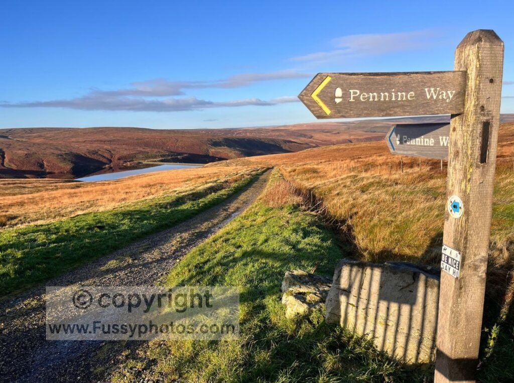
Starting the Circular Walk at Wessenden Head
Begin at Wessenden Head, less than two miles north of Black Hill. The walk opens with impressive views of Wessenden Head Reservoir, framed by the dark, brooding Wessenden Moor.
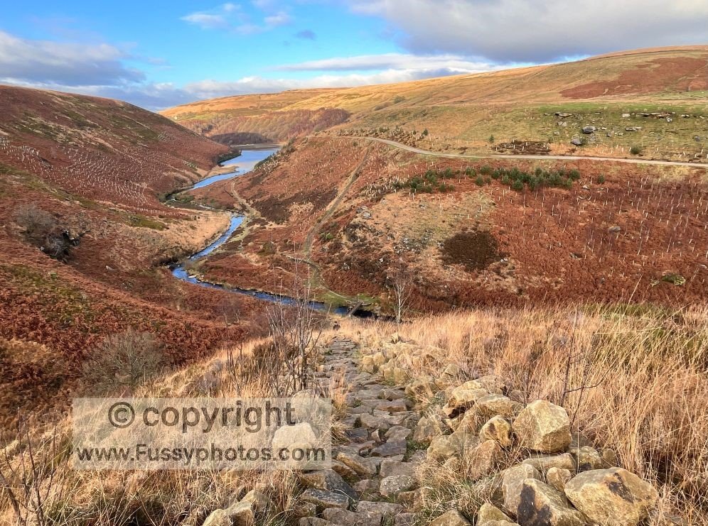
The first miles are easy. You descend along a wide stony trail through a valley of dry stone walls, reflective reservoirs, and undulating terrain.
The Pennine Way dissects the valley until Blakeley Reservoir. Here it veers west, descending and then climbing a steep v‑shaped valley.
Pennine Way Day 2: Scenic Detour above Wessenden Reservoir
It is easier to continue anticlockwise to Marsden via The Kirklees Way. However, I chose a high trail at Leyzing Clough.
This parallel path offered elevated valley views and bird’s‑eye perspectives of Wessenden and Butterley Reservoirs.
The trail winds past several inlets and two small but enjoyable waterfalls.
If this navigation sounds complex, simply stay on the Pennine Way past Wessenden Reservoir, then continue on The Kirklees Way to Marsden.
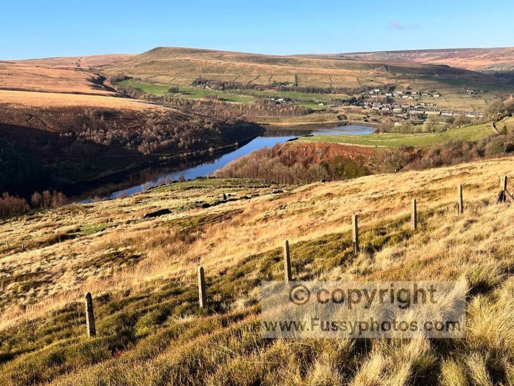
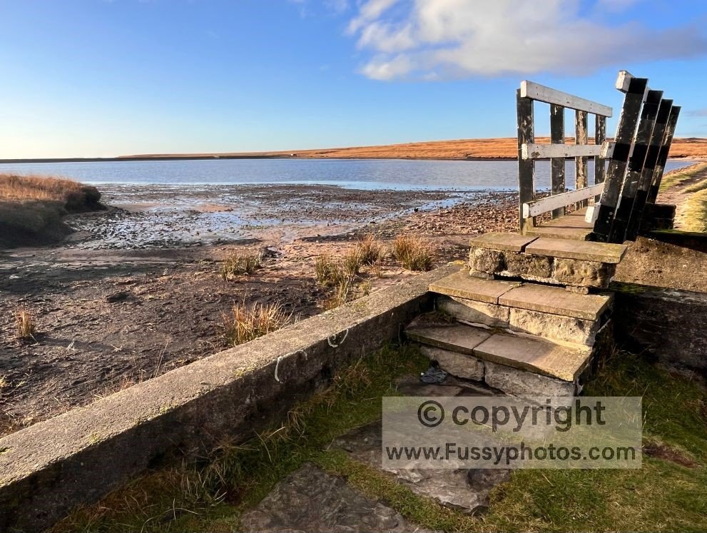
Marsden and Standedge Tunnel
There are multiple routes into Marsden. I walked past Bank Bottom Mill, where woollen cloth was produced as early as 1824.
I continued past St Bartholomew’s Church and west along the River Colne. These gentle miles lead to Standedge Tunnel, the longest and highest canal tunnel in Britain.
More importantly, there is a café and toilets here. If you’re the sort of walker who plans their next escape while still eating a flapjack, the Blackstone Edge Day 3 circular is waiting to reward you with big views and absolutely no reservoir déjà vu.
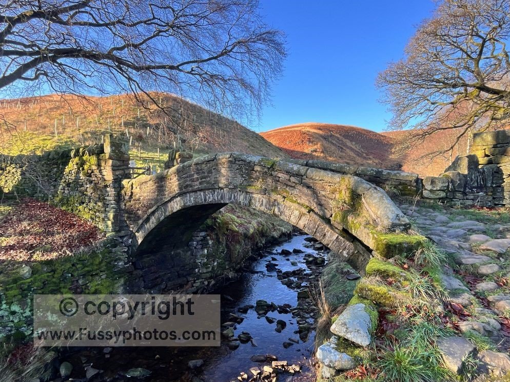
Standedge Trail and Eastergate Bridge
Continue west along Standedge Trail past Hey Green. Choose one of several trails to reach the Pennine Way Car Park (A640).
I took the most direct route, crossing Eastergate Bridge, a Grade II listed packhorse bridge.
The trail climbs briefly through another valley before a mile of stone slab walking across moorland brings you back to the Pennine Way.
Alternatives for Shorter Navigation to Standedge
If this sounds complicated, a shorter option is available. Walk along Mount Road after Butterley Reservoir, then join the Standedge Trail.
Follow it southwest to rejoin the Pennine Way just before Standedge.
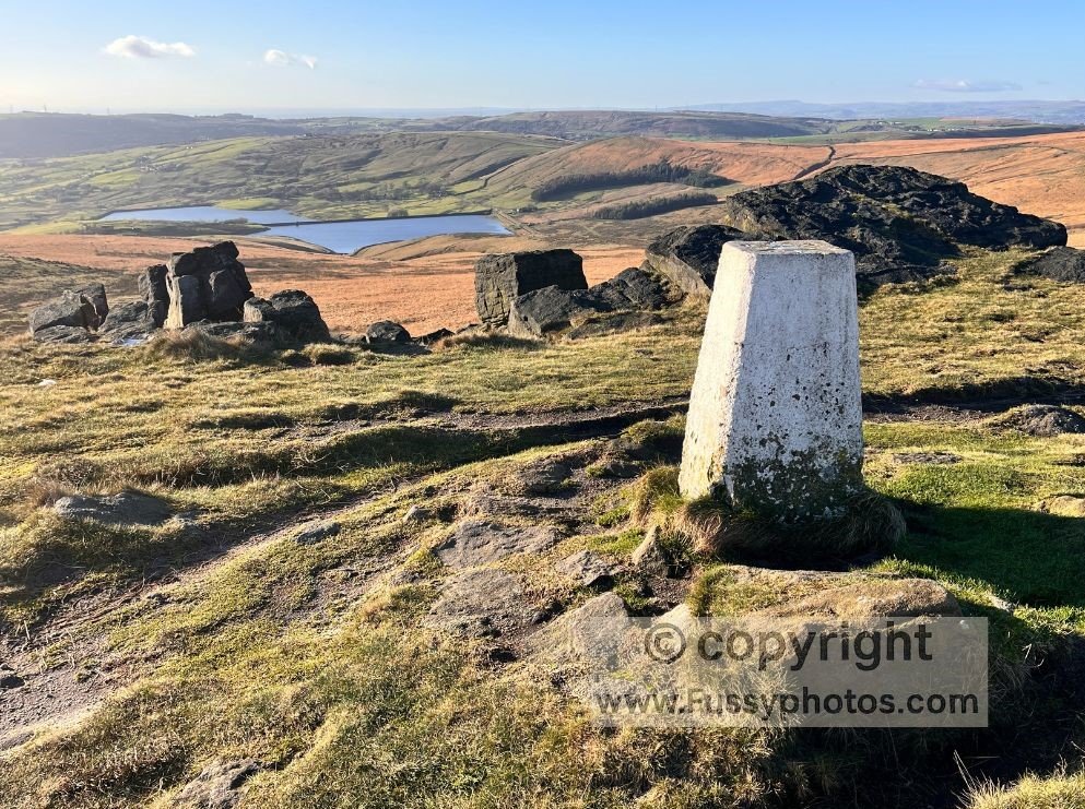
Standedge: The End of Pennine Way Day 2
Standedge is the official end point of Pennine Way Day 2. It offers expansive views of reservoirs, rolling hills, and Manchester to the west.
Logistically, it is awkward. There is no campsite, no obvious wild‑camping spot, and accommodation requires a 1.5‑mile detour to Diggle.
Standedge lies near a main road, so taxis are possible. However, estimating finish times on a long point-to-point walk is difficult.
Wessenden Brook Crossing and completing the Loop
From Standedge, the loop passes Redbrook and Black Moss Reservoirs, then a severe stretch to Blakeley Clough with dramatic valley scenery.
The crossing at Wessenden Brook is well known to Pennine Way walkers. It requires a steep descent and immediate ascent of a v‑shaped valley.
There is a ‘cheat’s alternative route’ around a tributary valley, crossing at Wessenden Reservoir Dam, though I am unsure about the right of access. See my YouTube clip below for further details.
Once the Brook is crossed, it is uphill through the valley where the day began. This tiring stretch leads back to the car.
Parking at one of the alternative spots mentioned earlier can shorten the return. If you’d like to explore the southern half of Pennine Way Day 2 on another outing, my Crowden–Black Hill circular walk offers a rewarding loop over Laddow Rocks and Black Hill.
Watch: Pennine Way Day 2 Circular Walk via Wessenden & Standedge
Pennine Way Day 2 Circular Route Map
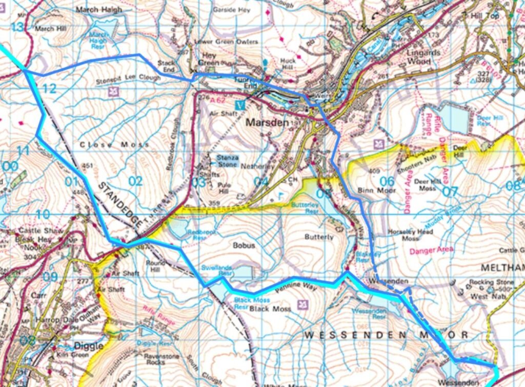
Light blue: Pennine Way. Dark blue: circular route. Overlap = circular route follows Pennine Way.
Pennine Way Alternative Day 2 Circular Route Map
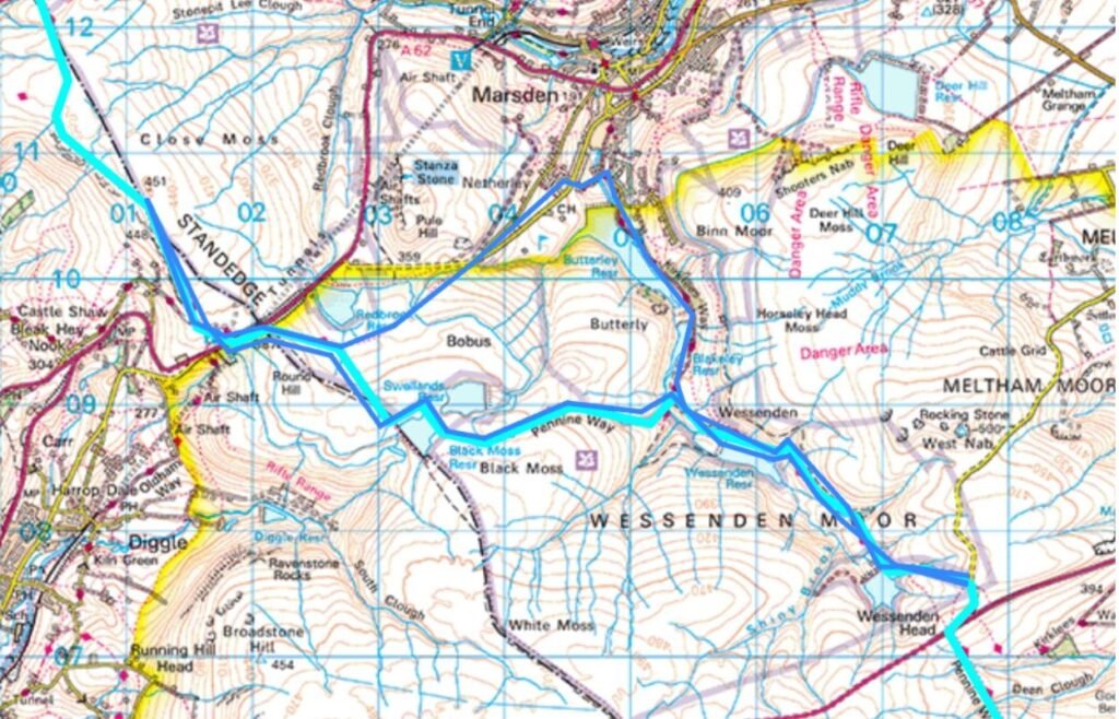
Light blue: Pennine Way. Dark blue: circular route. Overlap = circular route follows Pennine Way.