Saguaro National Park surprised us more than we expected. We only had time for the West District, but even that single side felt far richer and more varied than we’d imagined — dense cactus forests, rugged hills, and those classic Sonoran Desert views in every direction. If you’re planning a visit, the West District is incredibly accessible and delivers the iconic Saguaro experience right away.
Best Time to Visit Saguaro National Park
Cooler months (November–March) are ideal for hiking and photography. Summer temperatures often exceed 100°F, making early starts essential.
Saguaro National Park East vs West
The West District (Tucson Mountain District) is closer to downtown Tucson and offers dramatic desert landscapes filled with dense stands of saguaros. It’s ideal if you’re short on time or want iconic sunset views among towering cacti.
The East District (Rincon Mountain District) is larger, higher in elevation, and better for longer hikes with mountain scenery. Many visitors choose West for accessibility and classic cactus photography, while East appeals to those seeking solitude and backcountry trails.
Saguaro East (Rincon Mountain District)
- Lush desert, longer hikes
- Higher elevation
- Rincon Mountain Visitor Center
Saguaro West (Tucson Mountain District)
- Denser cactus forest, petroglyphs and classic Sonoran Desert scenery
- Lower, more rugged
- Red Hills Visitor Center

Saguaro National Park: Visitor Essentials
- Entrance Fee: $25 per vehicle (valid for 7 days)
- Camping: Backcountry only — permits required. Otherwise Tucson is close by.
- Facilities: No food or water on trails; bring plenty and plan ahead
Saguaro Facts
- Saguaros can live up to 200 years and grow over 40 feet tall
- They only grow in the Sonoran Desert, making this park a global rarity
- The name “saguaro” is pronounced suh-WAHR-oh
How to Get to Saguaro NP West from Phoenix
From Phoenix, drive south on Interstate 10 for about 110 miles (roughly 2 hours). Take Exit 236 (Marana Road/Avra Valley Road) and head east, then turn right onto Sandario Road. Continue south for about 9 miles, then turn left on Kinney Road, which leads directly to the Red Hills Visitor Center.
Our Journey to Saguaro National Park: The Picacho Storm
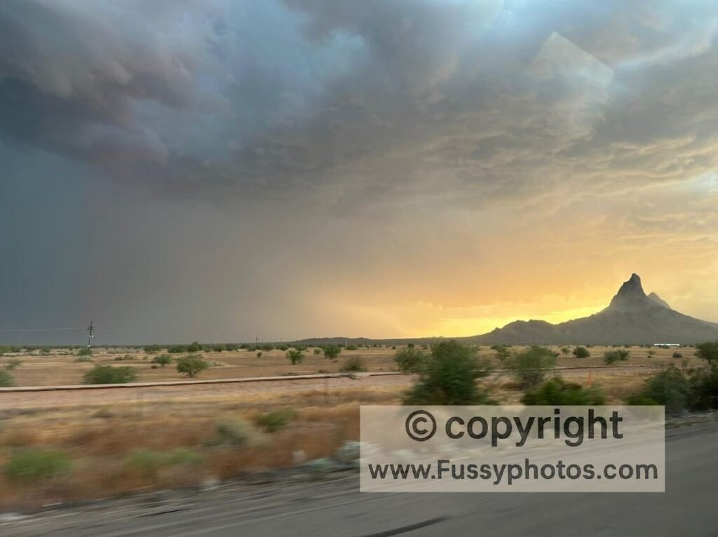
Heading southeast on Highway 10, somewhere around Picacho, the mother of all storms appeared to our right. It looked like a sandstorm straight out of Mission Impossible. There was nowhere obvious to pull over, and I wasn’t sure that was the best idea anyway—fearing a 30-tonne lorry might hit us out of the blue.
So we kept driving… Everyone else seemed to have the same idea. My partner was freaked out when we received rapid-fire Emergency Alerts for flash flooding and tornadoes!
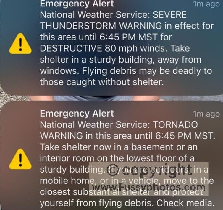
When we reached Tucson, the roads were passable but ankle-deep in water. By morning, all trace of the storm had vanished.
Popular Hikes in Saguaro West
Popular trails include the Valley View Overlook Trail, a short walk with sweeping desert vistas, and the Signal Hill Trail, where you can see ancient petroglyphs carved into boulders. For a longer adventure, the Hugh Norris Trail climbs into the Tucson Mountains with panoramic views from the summit of Wasson Peak. The Bajada Loop Drive also provides access to several easy, family‑friendly hikes.
How Saguaro National Park Fits into a Southwest Road Trip
Saguaro National Park, with its iconic desert landscapes and towering cacti, is perfectly positioned for a broader Arizona and Southwest itinerary:
- Tucson is just 30 minutes east, making Saguaro an easy day trip or overnight stop.
- Chiricahua National Monument, known for its dramatic rock formations and hiking trails, lies about 2 to 2.5 hours southeast.
- Phoenix, Arizona’s capital and a major travel hub, is roughly 1.5 hours northwest.
- Grand Canyon National Park is farther afield—around 5 hours north—but well worth including in a longer itinerary.
- Heading east, Guadalupe Mountains Park in Texas is approximately 6.5 hours away, offering a striking contrast in terrain and elevation, but close proximity to another national park, Carlsbad Caverns NP.
Whether you’re looping through desert parks or building a multi-state adventure, Saguaro NP offers a scenic and accessible anchor point in the heart of the Sonoran Desert.
Final thoughts
Saguaro National Park is one of those places that stays with you long after you’ve left — not because it’s dramatic or overwhelming, but because its beauty is so quietly distinctive. Whether you’re stopping in on a wider road trip or planning a dedicated day out from Tucson, Saguaro NP offers an experience that’s easy to reach, easy to enjoy, and surprisingly unforgettable.
If you’re exploring more of Saguaro West, my Wasson Peak loop guide covers one of my favourite trails from the trip — rugged, scenic, and well worth the climb.