Stanage Edge Circular Walk (Featured in ITV’s Britain’s Favourite Walks: Top 100)
A short out‑and‑back along Stanage Edge was voted the UK’s 35th favourite walk in ITV’s Britain’s Favourite Walks: Top 100. This Stanage Edge Circular Walk is, in my view, an improvement on that classic stretch. As well as the famous Stanage Edge views, it includes a peaceful riverside section along the River Derwent, a crossing of Ladybower Dam and Reservoir, the attractive village of Hathersage (with food and drink options), and the section of Stanage Edge that includes Robin Hood’s Cave.
At just over 10 miles, it’s comfortably walkable in 4–5 hours, and can easily be shortened or extended depending on your preference. If you enjoy classic Peak District ridge walks, my Mam Tor circular guide offers another dramatic escarpment route just a short distance south of Stanage.
Where to Start the Stanage Edge Circular Walk
Parking Options Around Hathersage, Ladybower and Stanage Edge
Parking is available across the breadth of the circular route. We began in Hathersage, taking advantage of free off‑street parking. Free parking is also available along the A6013 near Ladybower and on New Road between Ladybower and Stanage Edge.
There are also several pay‑and‑display car parks closer to Stanage Edge, including Dennis Knoll and Hooks Carr Car Park.
Hathersage to the River Derwent
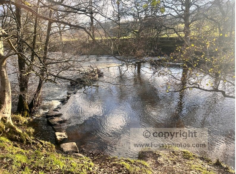
Beginning in Hathersage, head south‑west to join the Derwent Valley Heritage Way. This gentle section follows the River Derwent as it meanders across the floodplain towards Hope Valley. It’s easy walking until you reach the stepping stones that cross to the river’s south bank.
In dry conditions, these stepping stones are straightforward. After heavy rain, as we discovered, they can be submerged. If so, simply follow the path north back to the A6187 and walk along the pavement beside the road. Both routes converge around a mile further west.
Walking Towards Ladybower Reservoir
Derwent Valley Heritage Way & Thornhill Trail
Just west of Bamford Station, cross the A6187 and head north towards Ladybower, remaining on the Derwent Valley Heritage Way, which becomes the Thornhill Trail at this point.
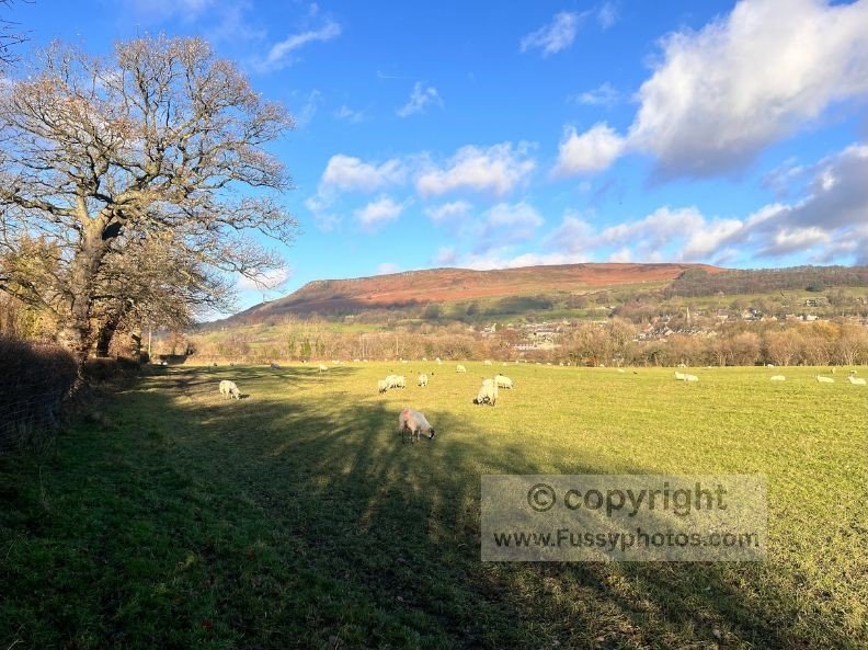
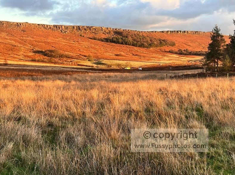
The path climbs steadily on a wide, well‑maintained track with excellent views east towards Bamford Edge. As you approach Ladybower, the sound of water rushing off the hills becomes a constant backdrop, and the footfall increases—always a sign you’re nearing the reservoir.
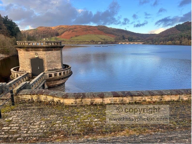
Crossing Ladybower Dam and Reservoir
Cross the dam heading east to enjoy waterside views with Bamford Edge rising behind you.
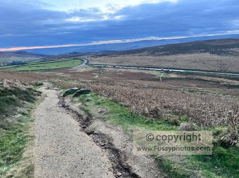
From here, there is a short section of road walking: first along the pavement past the Yorkshire Bridge Inn, then on a quieter road as the gradient increases. For a wilder Upper Derwent experience, my Alport Castles circular walk explores one of the Peak District’s most dramatic landslip formations just north of Ladybower.
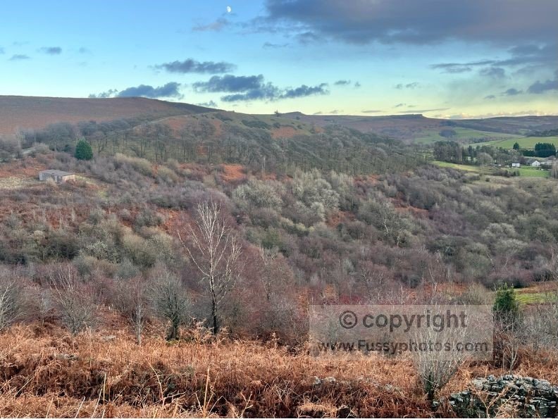
This climb reaches around 336 metres, offering expansive views across Hope Valley. If you have the time and energy, you can substitute some of this road walking for quieter trails along Bamford Edge, though this will add mileage.
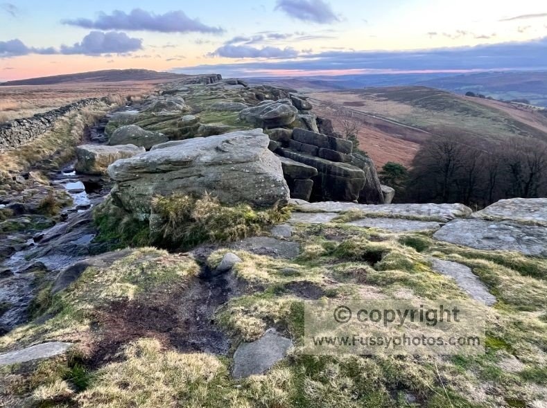
Climbing to Stanage Edge
After roughly an hour of scenic road walking, you’ll reach Dennis Knoll Car Park (pay and display). From here, a trail leads north away from the road, climbing to over 400 metres and delivering you onto the top of Stanage Edge.
It’s a popular stretch, so solitude is unlikely, but the views are superb. We were lucky enough to see paragliders drifting above the ridge.
Visiting Robin Hood’s Cave (Stanage Edge)
If you’re short on time, you could descend directly to Hathersage from here. However, it would be a shame to miss Robin Hood’s Cave—a flat, sheltered ledge tucked around three metres below the ridge.
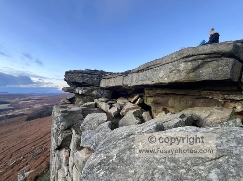
It’s a fun detour, especially for children, though there are steep drop‑offs, so supervision is essential. We paused here for a drink out of the wind before continuing east along the edge.
Hooks Carr Car Park and potential Burbage Rocks detour
A muddy trail leads down to Hooks Carr Car Park. This section is easily extended, as Stanage Edge continues for another mile or so towards Burbage Rocks, another popular short‑walk destination.
The return to Hathersage
As this was a winter walk, we began losing the light on our descent to Hathersage, missing some of the views on the final stretch.
You can see the full route unfold in my YouTube clip below.
Stanage Edge Circular Walk: Highlights in Under 5 Minutes

Stanage Edge Circular Walk Route Map
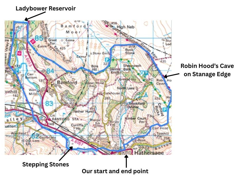
Route in blue. Annotations added to illustrate route.
FAQs About the Stanage Edge Circular Walk
Is there an alternative if the stepping stones are underwater?
Not directly at the crossing point. When water levels are high, avoid the crossing altogether and choose a different route variation as we did (along the pavement by the A6187, for example.
Are there trails around Ladybower Reservoir?
Yes. Ladybower is large, with multiple walking options ranging from short, accessible paths to full loops of several miles
How difficult is the walk up to and down from Stanage Edge?
The ascent and descent are short but can be muddy. Once on top, the walking is straightforward along the gritstone edge.
Why is Stanage Edge so popular?
If you enjoy these big gritstone edges, my Crowden–Black Hill circular route gives you a superb Dark Peak alternative along the dramatic Laddow Rocks and Black Hill section of the Pennine Way — a stretch I cover in full in my Pennine Way Days 1–3 guide.
Is Stanage Edge good for viewing sunset?
Yes, it’s widely known as one of the best sunset spots in the area thanks to its west‑facing views.
Where is Robin Hood’s Cave on Stanage Edge?
It’s tucked into the cliff face along the edge, a tiny detour from the main path. It’s considered a hidden gem and can be easy to miss without directions or a GPS.
Is there really a link to Robin Hood?
The connection is legendary rather than proven, but the area is rich in Robin Hood folklore—Little John’s grave is in nearby Hathersage.
What is Hathersage known for?
The village is famous for its outdoor culture, literary links to Jane Eyre, and its Robin Hood connections—Little John is said to be buried in the churchyard.
Are there facilities in Hathersage?
Plenty. The village has cafés, pubs, shops, and accommodation, making it ideal before or after a long walk.