Yorkshire Wolds Way: Choose Your Pace — Four to Six Days on Foot
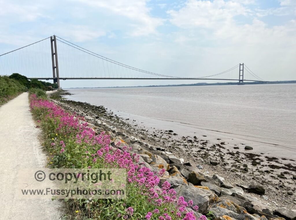
Starting Beneath the Humber Bridge
Beginning in the shadow of the Humber Bridge, the Yorkshire Wolds Way sets off from a spectacular setting for any long‑distance hike. Once the world’s longest single‑span bridge at 2,220 metres, I often wonder if it would be as famous as the Golden Gate Bridge if they’d painted it red. Hull — or rather Hessle — may not be as glamorous as San Francisco, but the Humber Bridge remains an iconic symbol for East Yorkshire (or Humberside, if you were born between 1974 and 1996).
The Wolds Way is a relatively short National Trail at 79 miles. It’s serene, walkable in an ambitious four days, or six if you follow the official route descriptions. As with many UK trails, the biggest challenge is logistics and amenities — the population density here is low. My advice: take advantage of the relatively high number of country pubs between Hessle and South Cave, as they become fewer further north.
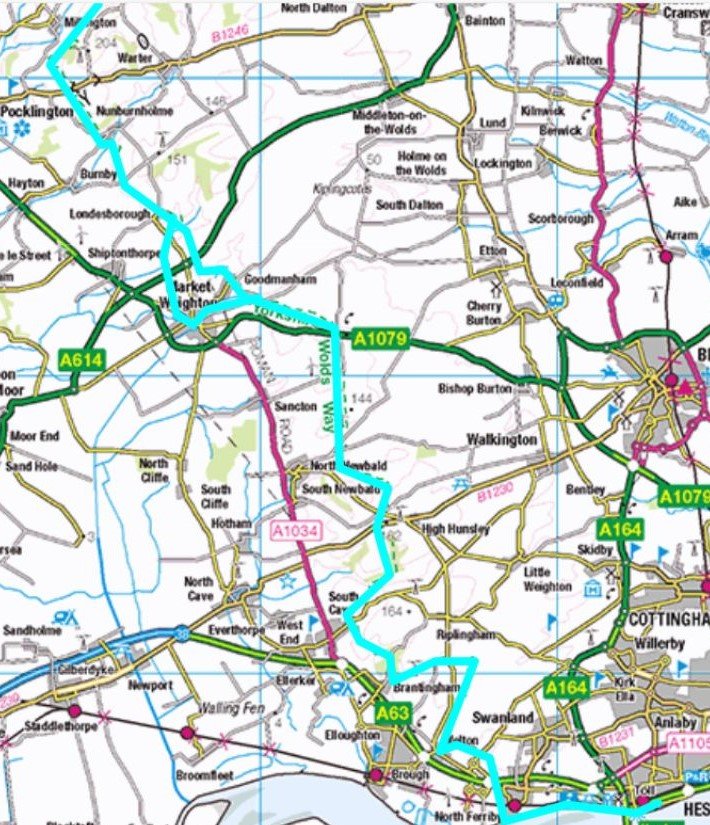
Yorkshire Wolds Way Day 1: Hessle to North Newbald — Humber Bridge Views, Dry Valleys & Wildlife
We walked the Way as a series of four day‑hikes rather than overnight stays, but I know the area well and often explore circular routes that branch off the trail.
On our first day, we used the two‑car system — one left at our destination in North Newbald, the other at our start point in Humber Bridge Country Park. It was a balmy 26°C — perfect hiking weather.
From Riverside Paths to Quiet Valleys and Minster Views: Highlights from the First Days on the Wolds Way
- A flat riverside start along the Humber, with the bridge visible behind us the whole way.
- Distant views of Beverley Minster, a vast Gothic‑style church larger than many cathedrals.
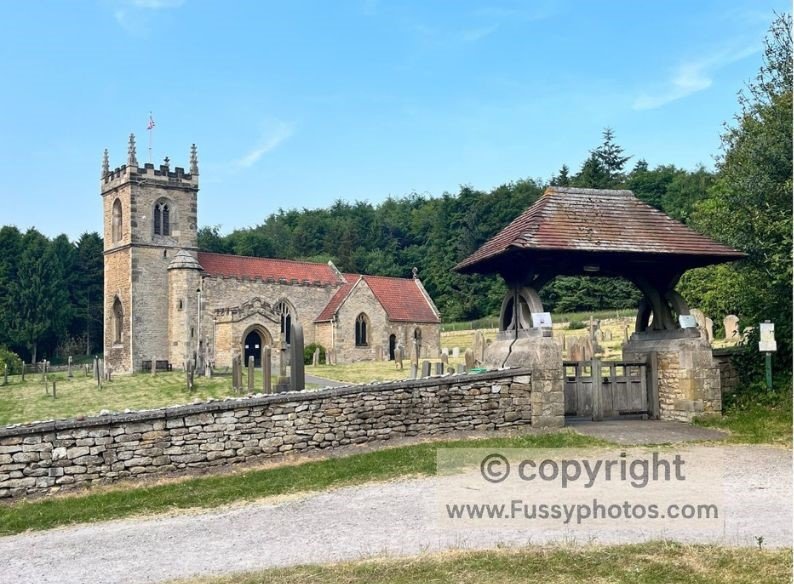
- Quaint churches and increasing solitude as we left the commuter belt.
- The downhill stretch into Brantingham — my recommended picnic spot.
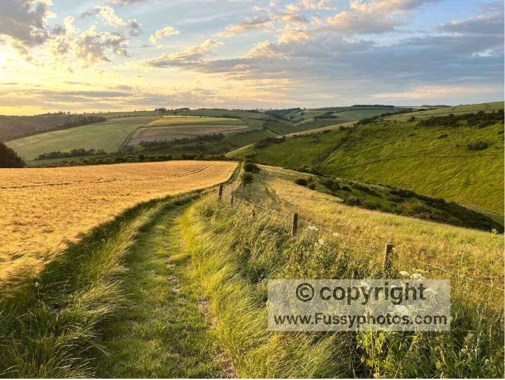
- Swindale, a dry valley near North Newbald. This is also one of my favourite spots for a day hike, and stunning if you can time your visit with the wildflowers.
- Wildlife: a beaver, multiple deer, and a beautiful sunset.
Yorkshire Wolds Way Day 2: North Newbald to Huggate — Goodmanham Pub, Dry Valleys & Summer Sunsets
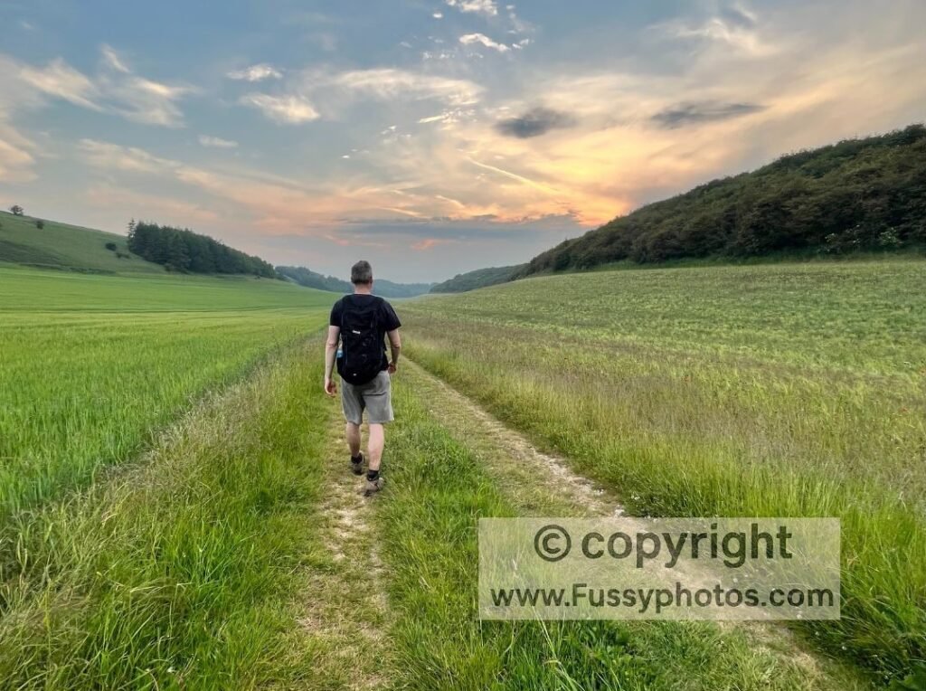
A week later, with long summer evenings on our side, we picked up where we left off, using the two-car system to do a another point-to-point hike . The route climbed over Newbald Wold and past wind turbines before we stopped at The Goodmanham Arms — perfectly timed to shelter from a passing storm. By evening, thunderclouds and low sun made for dramatic photography, the colours blending with the thriving crops.
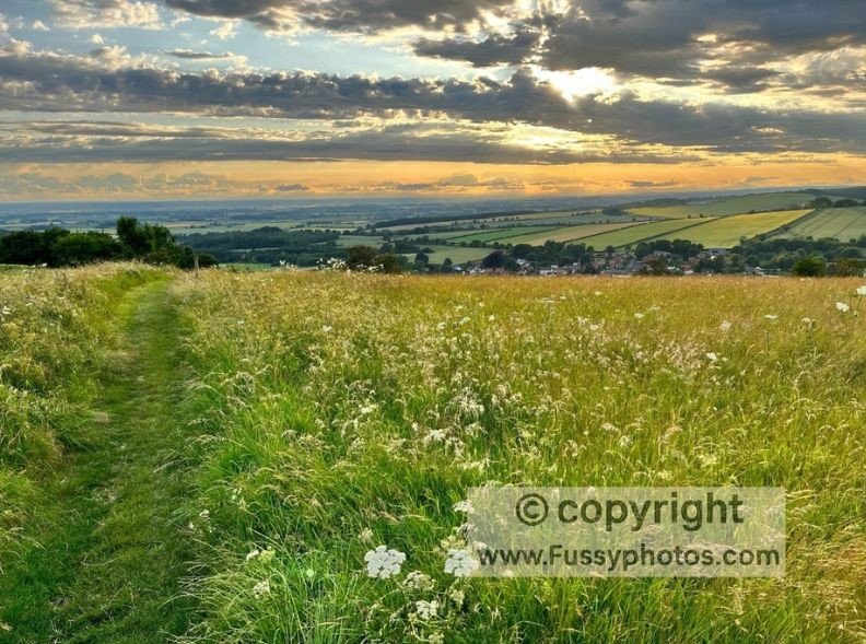
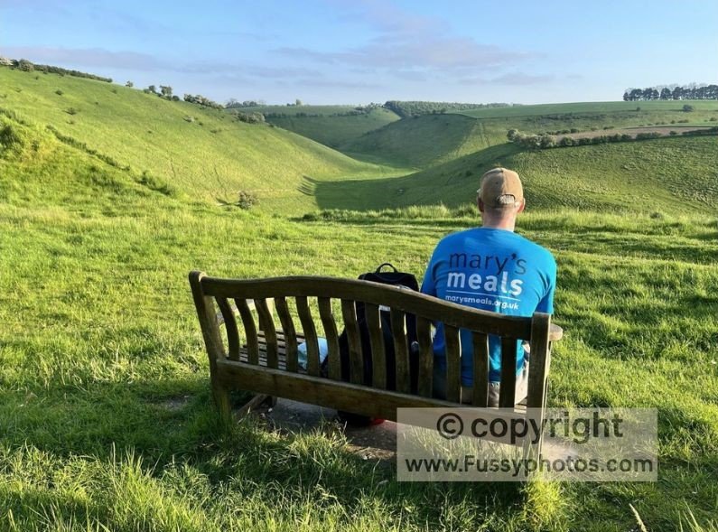
This stretch meanders from farm to farm and through Londesborough Park, so the time of year makes a big difference to the scenery. Summer is the obvious choice. After several miles, the trail reaches Millington, where multiple dry valleys and well‑placed benches invite you to linger. To experience these Millington views on a standalone loop, I’ve written a full Millington Circular Walk guide.
We reached Huggate too late for a pub stop, but in the glow of late‑night summer light.I f you enjoy this landscape, my How to sample the Wolds Way: Serene Huggate Circular explores several of these dry valleys in a shorter, more relaxed loop starting and finishing in Huggate.
Highlights from the Valley Glow to Goodmanham Pub: A Sunset-Streaked Stretch to Huggate
- Goodmanham Pub.
- Millington to Huggate — several miles of dry valleys and spectacular sunsets.
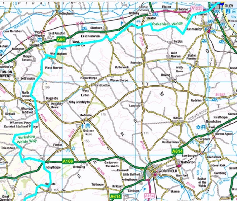
Yorkshire Wolds Way Day 3: Huggate to Sherburn — Epic 25‑Mile Walk via Wharram Percy & Scenic Dry Valleys
After a hiking holiday and some high‑altitude walks, we ambitiously tackled Huggate to Sherburn in one go — 25 miles with just day packs. The advantage: Sherburn is large enough for parking, and this left us a lighter final day to Filey.
If you love dry valleys, this is your stretch. From Huggate to Wharram Percy, they’re everywhere — an area I often return to. For a dedicated day walk in this area, my How to sample the Wolds Way: Wharram Percy Circular offers a scenic loop through some of the most dramatic dry valleys on the entire Wolds Way. In hindsight, a 25‑mile day wasn’t the best time to break in new boots, but my old pair’s worn tread had been causing too many trips.
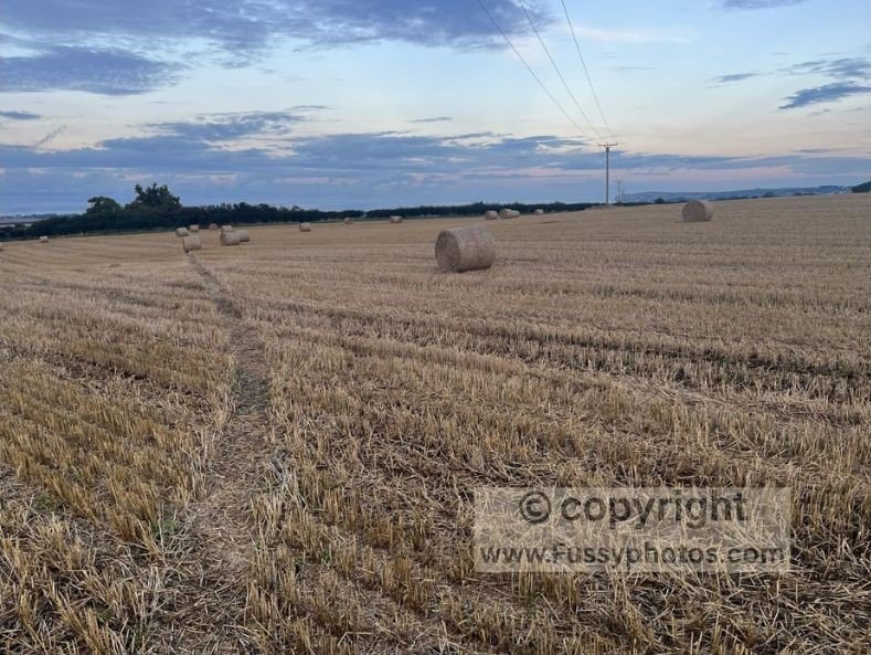
After Wharram Percy, the dry valleys fade, replaced by long‑distance views, notably from the edge of South Wold Plantation.
Despite being as fit as we’d ever been, 22 miles was a slog, and we limped into Sherburn relieved to see the car.
The Wolds at Their Most Dramatic: Dry Valley Highlights
Some of the UK’s best dry valleys at Huggate, west of Fridaythorpe and Thixendale
Yorkshire Wolds Way Day 4: Sherburn to Filey — Chalk Escarpments, Flamborough Cliffs & Coastal Finish
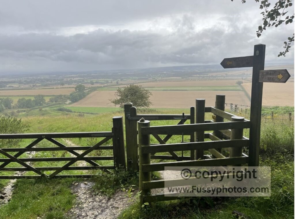
By now, you’ve left the Wolds proper, though the chalk escarpment continues to the headland at Flamborough. The trail zig‑zags up and down the escarpment, adding effort and mileage. There are fewer highlights here, but the white cliffs of Flamborough, visible for miles, are memorable.
If you’re feeling ambitious, the Cleveland Way also finishes at Filey. Walk it in reverse and you can continue to Helmsley, North Yorkshire, or follow the King’s Coast Path for more coastal miles.
Day’s highlights
- Views of Flamborough Head.
- Reaching the finish!
Yorkshire Wolds Way FAQs
How long is the Yorkshire Wolds Way?
The Wolds Way is a relatively short National Trail at 79 miles, running from Hessle near the Humber Bridge to Filey Brigg on the North Yorkshire coast.
How many days does it take to walk the Yorkshire Wolds Way?
I did my own walk as a series of point-to-point walks with rest between each, allowing me to walk it in just 4 days. Most walkers complete the trail in 5 to 7 days, depending on pace and overnight stops. The guide book suggests an itinerary for 6 days.
Is the Yorkshire Wolds Way difficult?
It’s considered one of the easier National Trails. The route features gentle rolling hills and dry valleys rather than steep climbs, making it accessible to most walkers. The highest point of the trail is just 215 metres above sea level.
Where does the Yorkshire Wolds Way start and finish?
The trail starts at Hessle, beside the Humber Bridge, and finishes at Filey Brigg, a dramatic coastal headland.
Where can you stay along the Yorkshire Wolds Way?
Accommodation includes B&Bs, inns, and small hotels in villages along the route. Camping is possible at designated sites, but options are limited and require advance planning. The following places along the route have B&Bs/hotels:
South Cave
Market Weighton
Millington
Huggate
Filey
Can you camp on the Yorkshire Wolds Way?
Yes, but facilities are limited. Walkers often combine camping (for example, at Wolds Way Caravan and Camping) with occasional B&B stays. Wild camping is not officially permitted.
What are the highlights of the Yorkshire Wolds Way?
Highlights include the Humber Bridge start, rolling chalk landscapes, secluded dry valleys (the stretch between Millington and Thixendale is my favourite), wildlife, country pubs and the coastal finish at Filey Brigg.
What is the best time to walk the Yorkshire Wolds Way?
You’ll want to ensure there’s enough daylight to walk each stage (remember, stages can be lengthened or shortened to suit your needs). Some stages are short enough to complete even in winter, but it’s best to plan a 6–7 stage walk at that time of year. In spring, summer, and autumn, a 4–5 stage walk is usually possible. As the name suggests, the dry valleys don’t become heavily waterlogged, but winter conditions will still be cold and muddy.
How do you get to the Yorkshire Wolds Way trailhead?
The trail begins at Hessle, which is accessible by train from Hull and then local transport onward. Hessle also has its own train station, making continued travel from Hull straightforward. The route finishes at Filey Brigg, close to Filey town, which offers convenient rail connections.
Are maps available for the Yorkshire Wolds Way?
Yes. Official National Trail maps and guidebooks are available, and the route is well waymarked with acorn symbols. The trail map shown below is taken from the National Trail website (Yorkshire Wolds Way Map and Information – National Trails), annotated and used with permission
What wildlife and scenery can you expect on the Yorkshire Wolds Way?
Expect chalk grasslands, dry valleys, farmland, and coastal views. Wildlife includes skylarks, hares, and occasional deer — for example at Swindale (see my story above). We also spotted a badger here, but were too slow to capture it on camera!
How does the Yorkshire Wolds Way compare to other National Trails like the Cleveland Way and the Pennine Way?
The Yorkshire Wolds Way is known for its gentle character, following 79 miles of rolling chalk hills, dry valleys, and quiet farmland. It’s one of the easier National Trails, making it a good choice for walkers who want a peaceful, less demanding route.
By contrast, the Cleveland Way stretches for about 110 miles and offers more variety: it crosses the North York Moors, with wide heather landscapes, before turning to dramatic coastal cliffs from Whitby to Filey. It’s more challenging than the Wolds Way, but rewards walkers with diverse scenery.
The Pennine Way is the toughest of the three. At 268 miles, it runs from the Peak District to the Scottish Borders, crossing rugged moorland, steep climbs, and exposed upland terrain. It’s considered a classic endurance trail, best suited to experienced walkers ready for long, demanding days.
Yorkshire Wolds Way Route Maps
Looking for a coastal walk nearby?
If you’d like to swap the quiet dry valleys of the Wolds for dramatic sea cliffs, my Bempton Cliffs & Flamborough Head Circular Walk is just a short distance from Filey — the northern end of the Yorkshire Wolds Way. It’s one of the best places in the UK to see puffins, gannets and kittiwakes, with huge chalk cliffs, bays and a spectacular lighthouse.