The Pennine Way is a 268‑mile multiday trail – England’s oldest National Trail. It’s iconic, but it comes with several logistical challenges: unreliable weather, remote stretches with limited accommodation, and long gaps between resupply points. In the colder months, things can get even harder as some pubs and accommodation close for the quieter season. It’s enough to put you off the trail before you’ve even started.
A Manageable Way to Sample the Pennine Way
This guide offers a practical, manageable way to sample the Pennine Way in a single weekend – a two‑day stretch with a train station at both the start and the finish, plus a campsite just half a mile off the trail at the end of Day 1. It’s a 27‑mile section that showcases classic Pennine scenery while giving you the chance to practise the essentials: walking with a multiday pack, carrying two days’ worth of food, and building the confidence to decide whether the remaining 241 miles are for you.
A Beginner‑Friendly Two‑Day Pennine Way Plan
Why This Section Works for First‑Timers
- Train stations at both ends
- A campsite and youth hostel at the end of Day 1
- Straightforward navigation
- Escape points if needed
- A realistic distance for a weekend
Starting at the official Pennine Way trailhead in Edale, it’s logistically simple to walk Day 1 to Crowden and Day 2 to Marsden, rather than the official Stage 2 endpoint at Standedge.
For a fuller look at these first miles — including Jacob’s Ladder, Kinder Scout and the climb to Laddow Rocks — my Pennine Way Days 1–3 report covers this entire section in detail.
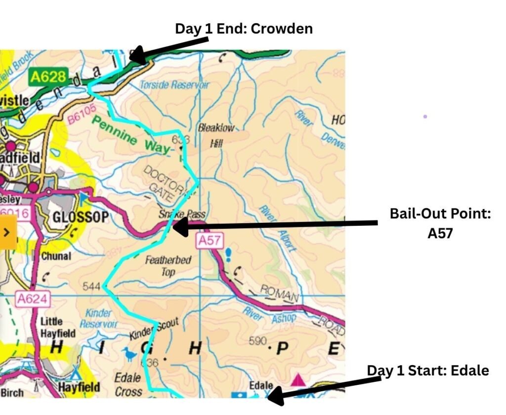
Pennine Way Day 1 Map: Edale to Crowden Route Overview
Getting There: Stress‑Free, No‑Car Logistics
There’s a train station on the Manchester–Sheffield line at Edale, and another at Marsden at the end of Day 2. Marsden Station sits on the Huddersfield Line between Huddersfield and Manchester. With rail access at both ends, this becomes a stress‑free point‑to‑point walk with no car shuttles or complicated planning.
If you want to explore other access points along the trail, my Pennine Way Train Access Guide covers every practical station from Edale to Kirk Yetholm.
Watch the Pennine Way Edale–Crowden–Marsden Route Overview
This short video walks you through what to expect on the Edale → Crowden → Marsden stretch before you dive into the full route guide.

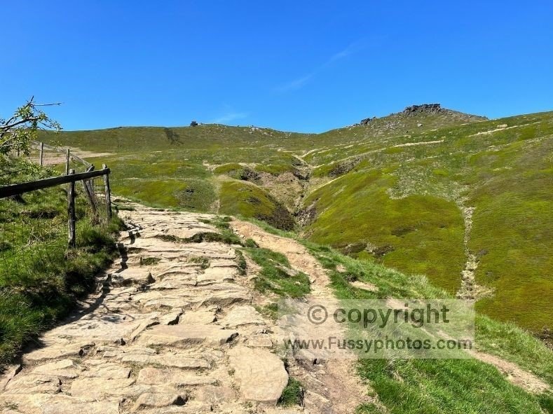
Day 1: Edale to Crowden (16 miles)
It’s a tough but extremely rewarding introduction to the Pennine Way. Crowden has both a campsite and a youth hostel. The village itself is tiny and has no other facilities, so you’ll need to be self‑sufficient for two days – ideal practice before the trail becomes more remote further north. As a back‑up, Glossop is a 15‑minute taxi ride away and offers B&Bs, pubs and supermarkets.
Straightforward Navigation on the First Miles
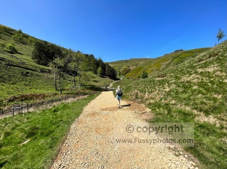
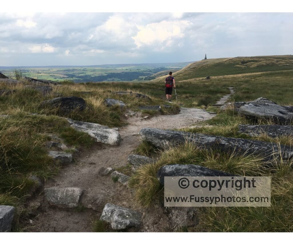
From Edale, the first few miles rise gently as the trail dissects Edale Valley. Expect to be breathless by the time you’ve ascended Jacob’s Ladder.
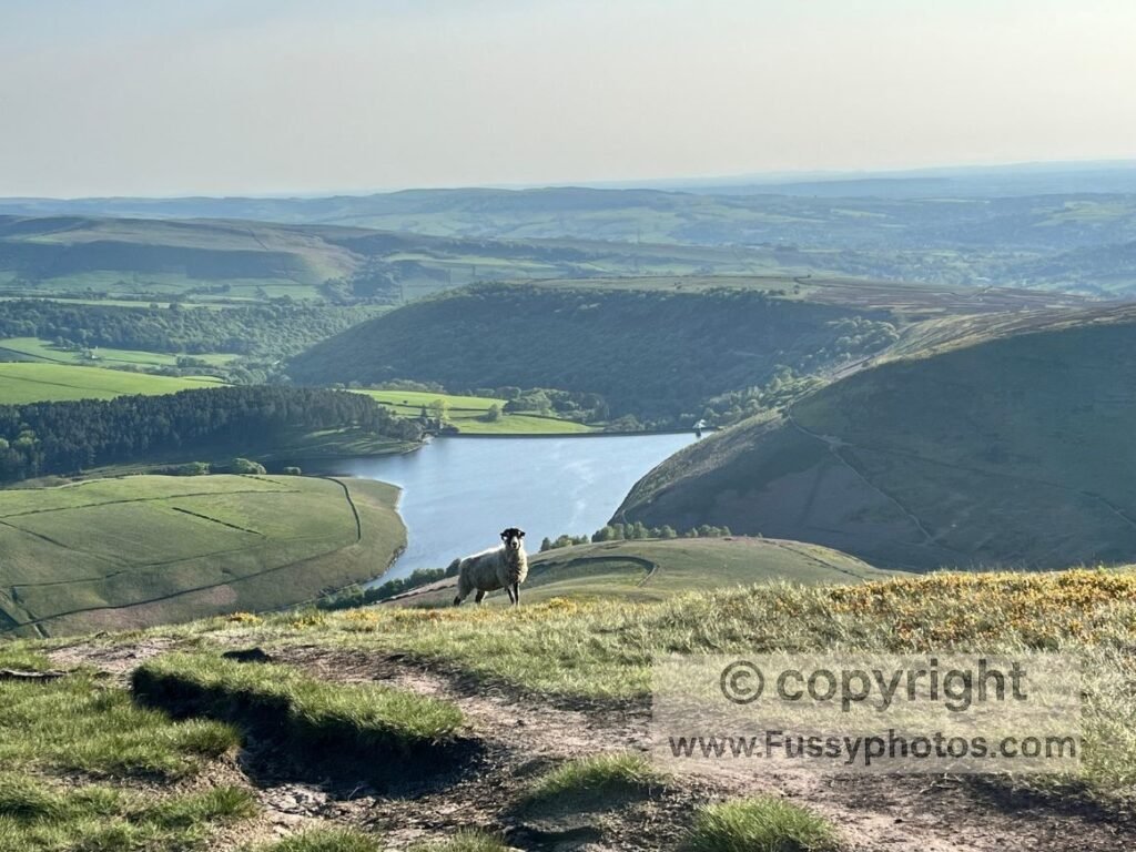
The trail then turns northwards, following a dramatic ridge with Kinder Reservoir below. Navigation is straightforward here.
If you’d prefer to explore this terrain as a single day route, my Edale to Kinder Downfall loop covers the same early Pennine Way miles in a dramatic 8‑mile circuit.
The descent towards the A57 is paved, making route‑finding simple. Otherwise, cross the road and continue along a muddy footpath towards Bleaklow – a good opportunity to practise map‑reading and using your GPS.
Bail‑Out Points and No‑Guilt Options for Beginners
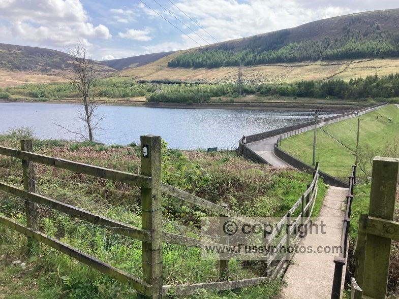
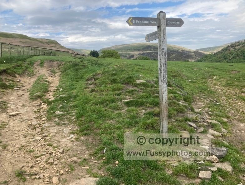
If you needed to bail out for any reason, the A57 provides a safe escape option. And if you’re exhausted by the end of the day, don’t feel guilty about arranging a taxi – on my own first day on the Pennine Way, we did exactly that from a lay‑by on the B6105. Ideally, continue another 1.6 miles, leaving the Pennine Way for the final half‑mile along a farm track to Crowden Campsite.
If you’d prefer to experience the dramatic Laddow Rocks and Black Hill section as a standalone day loop, or to read about it in more detail, my Crowden–Black Hill circular walk covers this same stretch as a dedicated day route.
Pennine Way Day 2 Map: Crowden to Marsden Route Overview
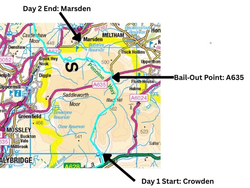
Pennine Way Day 2 Route Options Map: Crowden to Marsden
Day 2 offers no amenities until you leave the Pennine Way to detour to Marsden, though there is often a refreshments van where the trail crosses the A635 at Wessenden Head. It’s perfect for an ice cream, but don’t rely on it for your day’s food.
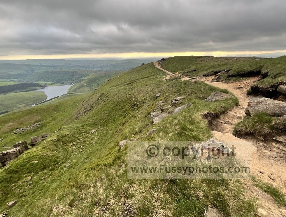
Straightforward Navigation and Steady Climbing
Fuel up well in Crowden before tackling the ascent to Laddow Rocks – around 2 miles and 300 metres of elevation gain, typically an hour’s walking with a multiday pack.
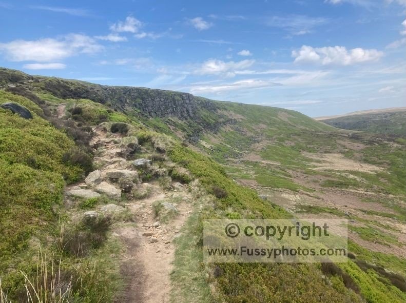
Navigation remains straightforward, with more paving stones leading to Black Hill before descending to the road.
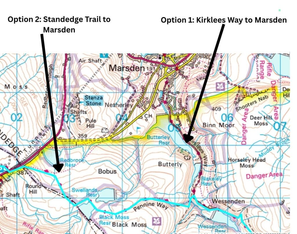
Option 1: A Gentle, Confidence‑Building Finish into Marsden
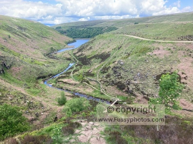
From Wessenden Head, it’s downhill towards Marsden, passing two reservoirs before leaving the Pennine Way and following the Kirklees Way into the village. It’s a relaxed, rewarding finish.
If you’d prefer a day-loop option that focuses on the Wessenden Head–Standedge stretch, my Standedge Circular walk explores this northern half of Day 2 as a rewarding loop.
Option 2: Add a Few More Pennine Way Miles
If you prefer to sample more Pennine Way miles, continue on the trail past Black Moss Reservoir, before turning northeast and descending via the Standedge Trail to Marsden.
Optional: A Three‑Day Taster with More Amenities
If you want to go further and have longer than a weekend, continue on the trail past Stoodley Pike before leaving the trail for Hebden Bridge – another small town with amenities and a train station.
This would allow you to carry a three‑day bag and three days’ worth of food, or you could take advantage of the more generous amenities on this stretch – a food bar just before the M62 bridge and the White House Pub. See my Blackstone Edge day walk for more details.
Try the Pennine Way: FAQs
How long does it take to walk the full Pennine Way?
Most walkers complete the full 268‑mile Pennine Way in 14–16 days, depending on fitness, weather and daily mileage. This guide focuses on a two‑day beginner‑friendly sampler covering the Edale → Crowden → Marsden stretch.
What is the route for Pennine Way Day 1 from Edale to Crowden?
Day 1 climbs Jacob’s Ladder, crosses the Kinder plateau, passes Kinder Downfall, crosses Snake Pass (A57) and continues over Bleaklow before descending to Torside Reservoir and Crowden.
What is the route for Pennine Way Day 2 from Crowden to Marsden?
There are two ways to walk Day 2, depending on whether you want the standard beginner‑friendly finish or a longer Pennine Way extension.
Option 1: The standard route to Marsden From Wessenden Head, it’s downhill towards Marsden, passing two reservoirs before leaving the Pennine Way and following the Kirklees Way into the village. It’s a relaxed, rewarding finish.
Option 2: The longer Pennine Way extension If you prefer to sample more Pennine Way miles, continue on the trail past Black Moss Reservoir, before turning northeast and descending via the Standedge Trail to Marsden.
Is the Edale → Crowden → Marsden section a good first part of the Pennine Way for beginners
Yes. This stretch has:
- Train stations at Edale and Marsden
- A campsite and youth hostel at Crowden
- Straightforward navigation
- Escape points at the A57 and A635
- Realistic weekend mileage
Do I need to carry all my food between Edale, Crowden and Marsden?
Yes. There are no shops on the trail between Edale and Marsden, and Crowden has no facilities beyond the campsite and hostel.
Are there bail‑out points on this part of the Pennine Way?
Yes. The A57 (Snake Pass) on Day 1 and the A635 at Wessenden Head on Day 2 both offer safe exit points. Taxis to Glossop or Marsden are valid fallback options.
Can I walk the Edale → Crowden → Marsden section as a circular instead of a point‑to‑point?
Yes — if you prefer loops, you can walk:
- The Crowden–Black Hill Circular (covers the Day 1 highlights)
- The Standedge Circular (covers the northern half of Day 2)
These offer the same scenery without committing to a full two‑day point‑to‑point.
Is wild camping allowed between Edale, Crowden and Marsden?
No — wild camping isn’t permitted in this part of England. Crowden Campsite is the best legal overnight option.
How difficult is the Edale → Crowden → Marsden section?
It’s challenging but achievable for beginners with reasonable fitness. Expect steep climbs (Jacob’s Ladder, Laddow Rocks), exposed moorland, rocky paths and some boggy sections.
Can I extend the Edale → Crowden → Marsden section into a three‑day trip?
Yes — continue past Black Moss Reservoir and Stoodley Pike before leaving the trail for Hebden Bridge, which has accommodation, cafés and a train station. This creates a beginner‑friendly three‑day itinerary with easier resupply.
How do I access the Edale → Crowden → Marsden section of the Pennine Way by train?
The route is one of the easiest parts of the Pennine Way to reach by public transport. Edale has a station on the Manchester–Sheffield line, and Marsden sits on the Huddersfield Line between Huddersfield and Manchester. With train stations at both ends, the Edale → Crowden → Marsden stretch works perfectly as a no‑car, point‑to‑point weekend walk.
For more options along the trail, see my Pennine Way Train Access Guide.
Is there another beginner‑friendly Pennine Way weekend I can try?
Yes. If you’d prefer a Yorkshire Dales version of this idea, my Gargrave → Malham → Horton‑in‑Ribblesdale weekend guide offers an equally manageable two‑day introduction with clear paths, good logistics and train stations at both ends.
If you’re new to the Pennine Way, you’ll also find a clear, beginner‑friendly introduction in my simple guide to starting the trail.