The Pennine Way is Britain’s most iconic long‑distance trail, following 268 miles of rugged upland moorland, gritstone edges, limestone country and historic landscapes from the Peak District to the Scottish Borders. This hub brings together everything you need to explore the trail, whether you’re planning a full thru walk, walking a single stage, or trying a shorter circular route that samples the best sections. There are simple introductions to help you understand what to expect, how to prepare, and how to break the trail into manageable sections.
Having completed my own thru walk, I understand the beauty and challenges of the route — the highlights, the solitude, the frustrations of the weather, the boggy ground, and the official stages that end in the middle of nowhere. I’ve returned to walk stages of the Pennine Way again and again, enjoying the best of the trail whilst noting logistical solutions to the various problems thrown up by the trail — something I look to share with first‑hand experience and clarity. Each guide is written to help you shape the Pennine Way around your time, fitness and interests.
Find Your Content
- Start Here — Essential Pennine Way Guides
- Pennine Way Video Guides
- Pennine Way by Region — Explore the Trail in Sections
- Classic 16‑Day Pennine Way Stages
- Pennine Way Planning, Logistics & Route Choices
- Pennine Way Highlights & Ranked Lists
- Pennine Way Circular Walks & Weekend Routes
- Pennine Way Circular Walks Video Playlist
Start Here — Essential Pennine Way Guides
If you’re new to the Pennine Way and want a confidence‑building introduction, start here. These guides show you exactly what the trail feels like — how hard it is, how easy it is to follow, two beginner‑friendly weekend samplers in the Peaks and Dales, and the opening miles of my full end‑to‑end trip report from Edale to Hebden Bridge. It’s the ideal first step before exploring the detailed stage guides, planning advice, logistical solutions and regional sections further down the page.
Pennine Way for Newbies: A Simple Guide to Starting
A clear, beginner‑friendly introduction to the Pennine Way, breaking down common fears and showing how to try the trail in short, manageable sections before committing to the full route.
Is the Pennine Way Hard? (How to Make It Easier)
A realistic look at the difficulty of the Pennine Way, breaking down the weather, moorland terrain and long days — and the simple strategies that make the trail far more achievable than its reputation suggests.
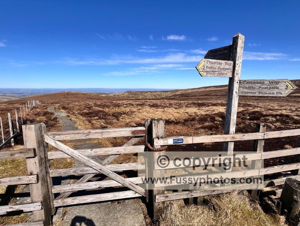
Is the Pennine Way Easy to Navigate?
Find out how easy the Pennine Way really is to follow — from consistent National Trail acorns to clear fingerposts, flagstones, and the natural lines that guide you across places like the River Tees and Windy Gyle.
Try the Pennine Way: Beginner Weekend in the Peaks
Sample the Pennine Way the easy way with a two‑day Edale → Crowden → Marsden weekend that gives you classic scenery, straightforward navigation and train stations at both ends.
Try the Pennine Way: Beginner Weekend in the Dales
Experience the Pennine Way at its most beginner‑friendly with a two‑day Gargrave → Malham → Horton‑in‑Ribblesdale weekend packed with classic Dales scenery, clear paths and train stations at both ends.
How to Walk the Pennine Way: Complete Trip Report & Guide
The opening miles of my full end‑to‑end Pennine Way walk — a detailed, honest trip report covering Days 1–3 from Edale to Hebden Bridge, with links to every stage all the way to Kirk Yetholm.
Pennine Way Video Guides
A short collection of planning videos covering stages, logistics and what the trail feels like in real conditions.
Pennine Way by Region — Explore the Trail in Sections
Explore the Pennine Way in five distinct regions — from high moors to deep dales — and use these section‑by‑section trip reports to understand how the trail unfolds as you head north. Looking for day walks instead of full sections? See my Pennine Way circular routes further down the page.
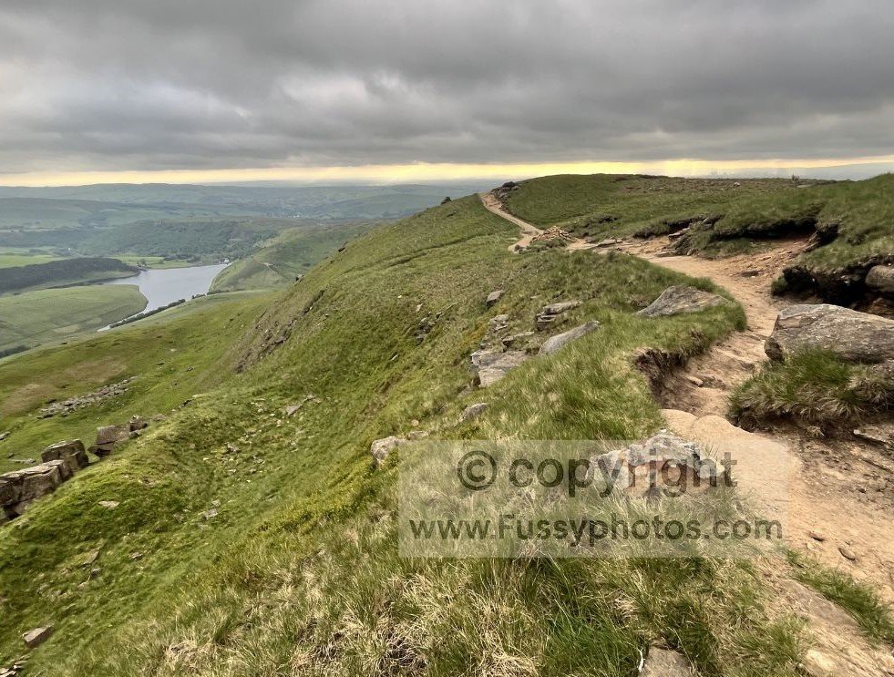
Peak District Section (Edale to Standedge)
Follow the opening miles of the Pennine Way from Edale over Kinder Scout, across Bleaklow and Black Hill, and out towards Standedge — a dramatic, high‑moor introduction to the trail.
This section is covered in my Edale → Hebden Bridge trip report.
Peak District Section (Edale to Standedge)
Walk the rolling moors and old mill‑town edges between Hebden Bridge, Ponden and Ickornshaw, finishing with the first big limestone shift as the trail approaches Malham.
This section is covered in my Hebden Bridge → Malham trip report.
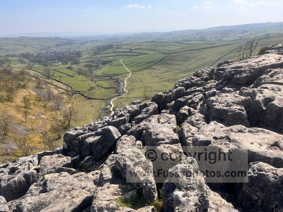
Yorkshire Dales Section (Malham to Keld)
Cross classic Yorkshire Dales scenery from Malham Cove and Pen‑y‑Ghent to Hawes, Great Shunner Fell and the descent into Keld — some of the most varied miles on the entire Pennine Way.
This section is covered in my Malham → Middleton‑in‑Teesdale trip report.
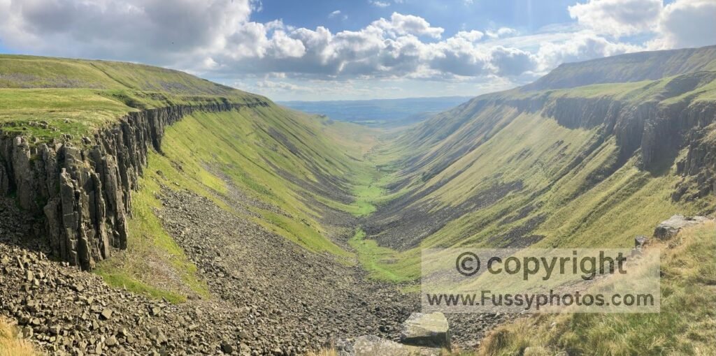
North Pennines Section (Teesdale to Hadrian’s Wall)
Follow the wildest stretch of the Pennine Way through Teesdale, past High Force, Cauldron Snout, High Cup Nick and over Cross Fell, before dropping towards Hadrian’s Wall.
This section is covered in my Middleton → Greenhead trip report.
The Cheviots Section (Bellingham to Kirk Yetholm)
Start with the final northern miles from Hadrian’s Wall through Bellingham and Byrness, then follow the broad ridges of the Cheviots over The Schil to the finish at Kirk Yetholm.
This section is covered in my Greenhead → Kirk Yetholm trip report.
Classic 16‑Day Pennine Way Stages
A clear overview of the official 16‑day Pennine Way itinerary, showing how the trail unfolds from Edale to Kirk Yetholm. These short stage summaries help you understand the daily rhythm of the route and link directly to the trip reports that cover each section in more detail.
Day 1: Edale to Crowden – 16 miles
A classic opening day over Kinder Scout and Bleaklow, with big gritstone scenery, exposed moorland and the long descent into Crowden.
Day 2: Crowden to Standedge – 11 miles
Wild, open miles across Laddow Rocks, Black Hill and the Wessenden Valley, with long moorland crossings and wide views towards the South Pennines.
Day 3: Standedge to Hebden Bridge – 11 miles
Rolling moors, reservoirs and old mill‑town edges leading towards Stoodley Pike, finishing with the descent into Hebden Bridge — a natural break point before the South Pennines.
Days 1–3 are covered in my Edale → Hebden Bridge trip report.
Day 4: Hebden Bridge to Ickornshaw / Cowling – 16 miles
A linking day across Heptonstall Moor, past a chain of reservoirs, and on to Top Withens, mixing farmland, moorland and old literary landmarks before descending towards Ickornshaw and Cowling.
Day 5: Ickornshaw to Malham – 17 miles
A long, muddy farmland stretch through Gargrave before the scenery improves along the River Aire, finishing with a far more uplifting approach into Malham and the start of the limestone country.
Days 4–5 are covered in my Hebden Bridge → Malham trip report.
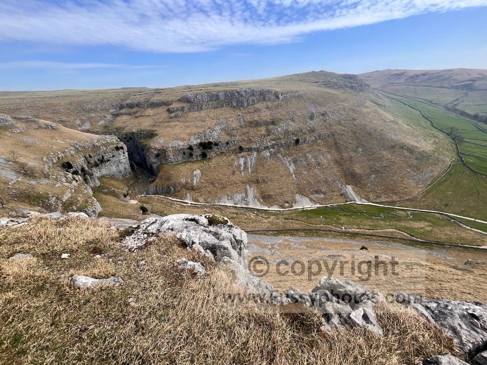
Day 6: Malham to Horton‑in‑Ribblesdale – 14.5 miles
A classic Dales stage over Malham Cove, the limestone pavement, Malham Tarn, and the steep northern ascent of Pen‑y‑Ghent, finishing with the long descent into Horton‑in‑Ribblesdale.
Day 7: Horton‑in‑Ribblesdale to Hawes/Hardraw – 14 miles
A varied day through Yorkshire Three Peaks country, passing sinkholes and views of Ribblehead Viaduct, before continuing to Hawes and finishing at Hardraw Force, England’s highest single‑drop waterfall.
Day 8: Hawes/Hardraw to Tan Hill / Bowes – 16.5 miles/25 miles
A demanding stage over Great Shunner Fell, through Swaledale, past Keld and Tan Hill Inn (Britain’s highest pub), before tackling the bog‑heavy expanse of Sleightholme Moor en route to Bowes.
Day 9: Tan Hill / Bowes to Middleton‑in‑Teesdale – 17miles
A gentler day of rolling farmland and big skies into Middleton‑in‑Teesdale, whether you start from Tan Hill (the standard stage) or from Bowes after a huge previous day; some walkers also split Tan Hill → Bowes → Middleton into two shorter stages.
Days 6–9 are covered in my Malham → Middleton‑in‑Teesdale trip report.
Day 10: Middleton‑in‑Teesdale to Dufton – 21 miles
A superb day following the River Tees past Low Force, High Force, and Cauldron Snout, before climbing gently to the dramatic U‑shaped valley of High Cup Nick and descending into Dufton.
Day 11: Dufton to Alston – 20 miles
A big mountain day over Great Dun Fell, Cross Fell (the highest point on the Pennine Way), and down the long track to Garrigill, before following the River South Tyne into Alston.
Day 12: Alston to Greenhead / Haltwhistle – 16.5 miles
A quieter linking stage through Slaggyford, over Blenkinsopp Common, and along field paths and old railway lines, finishing near Hadrian’s Wall with easy access to Haltwhistle for those ending their section walk here.
Days 10–12 are covered in my Middleton‑in‑Teesdale → Haltwhistle trip report.
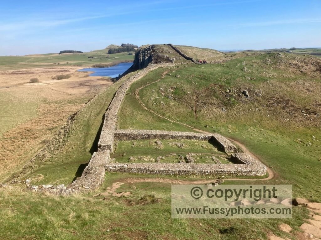
Day 13: Greenhead to Bellingham – 22 miles
A long, dramatic day following Hadrian’s Wall for eight spectacular miles, including Crag Lough and Sycamore Gap, before leaving the crowds for Wark Forest and the final road walk into Bellingham.
Day 14: Bellingham to Byrness – 15 miles
A remote stage across heather moorland and boggy ground towards Padon Hill, followed by long forestry tracks and plantations before reaching the tiny settlement of Byrness.
Day 15: Byrness to Windy Gyle / Auchope Mountain Rescue Hut – 14 miles/19 miles
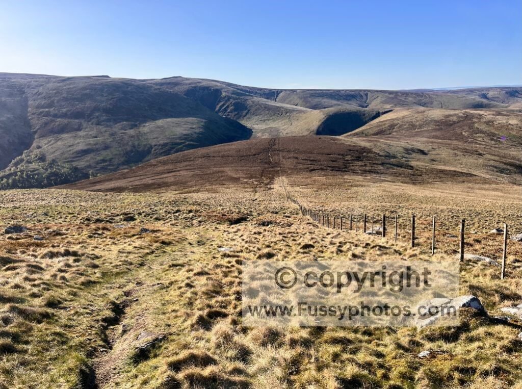
A wild, committing traverse of the Cheviots, passing Chew Green and Beefstand Hill, then following the England–Scotland border fence across remote, boggy ground to Windy Gyle, with many walkers overnighting at the Auchope Mountain Rescue Hut to split the final remote miles between here and Kirk Yetholm.
Day 16: Windy Gyle to Kirk Yetholm – 13 miles
A superb final day over Windy Gyle, past The Cheviot (optional detour), and over The Schill, before the final descent into Kirk Yetholm to complete the Pennine Way.
Days 13–16 are covered in my Greenhead → Kirk Yetholm trip report.
Pennine Way Planning, Logistics & Route Choices
Planning the Pennine Way gets a lot easier once you know where to split the trail, how to reach key access points, which route choices actually change the feel of your walk, and what to pack for multi‑day sections. These guides break down the big decisions — stages, transport, packing and the final miles — so you can shape the Pennine Way around your time, fitness and weather window.
How to Break the Pennine Way into Walkable Stages
A sharp, flexible guide to breaking the 268‑mile Pennine Way into stages that actually work in real life — from fast, three‑part pushes to smart, weekend‑friendly splits built around rail access. It shows the strengths and trade‑offs of each approach and highlights the key access points that make planning the trail far more achievable than its reputation suggests.
How to Access the Pennine Way by Train
A practical guide to reaching the Pennine Way by rail, showing exactly where the trail meets the train network — and where it doesn’t. From easy southern access points like Edale, Marsden and Hebden Bridge to the remote northern miles beyond Greenhead, this breakdown makes planning section hikes far simpler than the maps suggest.
Pennine Way: Essential Packing List for a Section Walk
Pack with confidence for Edale to Malham, Malham to Dufton or Greenhead to Kirk Yetholm with a clear, realistic Pennine Way kit list designed specifically for multi‑day section walkers.
Choosing Your Pennine Way Final Miles: High or Low Finish
A sharp, side‑by‑side look at the Pennine Way’s final decision: the high‑level Cheviots ridge or the low‑level valley finish into Kirk Yetholm. Having walked both routes in different conditions, this guide shows exactly how each option feels — the views, the weather exposure, the speed, and the atmosphere — so you can choose the finale that fits your day.
Pennine Way: Is the Cheviot Summit Detour Worth It?
A clear, energetic look at the 3‑mile Cheviot summit detour — the optional out‑and‑back that appears right when most Pennine Way walkers are at their limit. This guide breaks down what the detour involves, how it feels late in the final push, and what’s happening on the main ridge ahead towards Auchope Cairn and The Schil, so you know exactly what you’re choosing between.
Pennine Way Highlights & Ranked Lists
Explore the Pennine Way’s biggest moments — the standout highlights, the toughest miles, and the most atmospheric sunsets — ranked and distilled into three guides designed to show the trail at its most dramatic.
Top 10 Highlights of the Pennine Way (Ranked)
Discover the 10 standout moments that define the Pennine Way — the big landscapes, iconic landmarks and unforgettable miles ranked from memorable to unmissable.
Hardest Parts of the Pennine Way (Ranked)
Find out which climbs, bogs and exposed miles truly earn their reputation as the hardest parts of the Pennine Way — ranked from “tough” to “trail‑defining”.
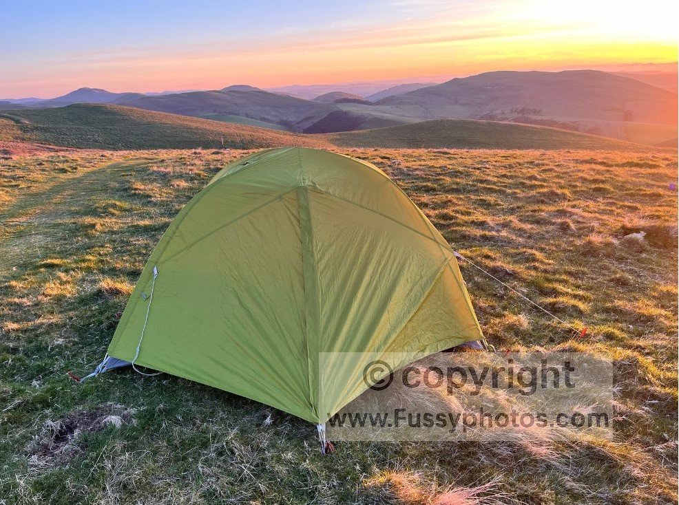
Top 10 Sunset Photos of the Pennine Way
A visual tour of the Pennine Way’s most spectacular sunsets — from moorland glow to reservoir reflections and the wide, open light of the Cheviots. These ten moments capture the trail at its most atmospheric, taken across years of thru‑hikes and circular walks, and show just how dramatic the Pennine Way becomes when the day’s last light hits the landscape.
Pennine Way Circular Walks & Weekend Routes
These Pennine Way day routes include circulars, weekenders and linear high‑level walks, each offering a rewarding way to experience the trail without taking on full stages.
Peak District Circulars on the Pennine Way
Edale to Kinder Downfall: A Dramatic Pennine Way Loop
A fast, dramatic loop from Edale that hits Jacob’s Ladder, Kinder Low and the cliffs of Kinder Downfall before returning across wild Edale Moor to Crowden Brook.
Pennine Way Circular via Crowden & Doctor’s Gate
Discover a standout Pennine Way loop with wild valleys, Roman‑road history and one of the trail’s best viewpoints.
How to Walk Pennine Way Day 2: Crowden–Black Hill
A superb Pennine Way section climbing from Crowden to Laddow Rocks and on to Black Hill, with big moorland views, rocky edges, boggy stretches and some of the best sunset light in the Peak District.
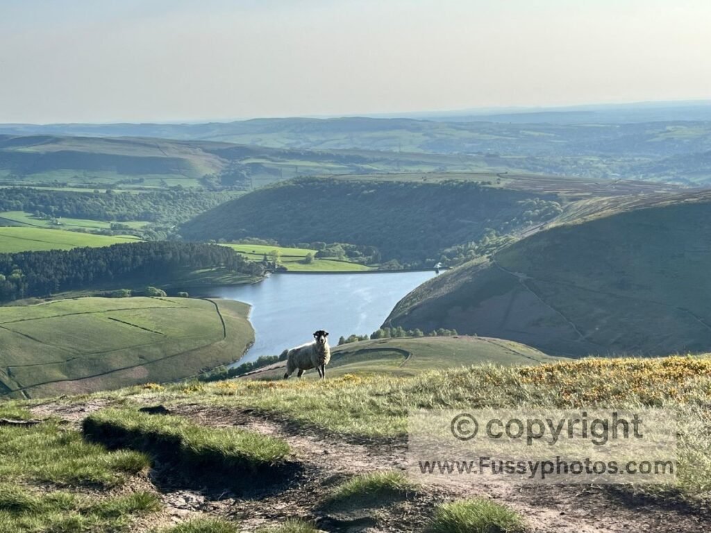
Pennine Way Day 2: How to Walk the Standedge Circular
A flexible Pennine Way loop from Wessenden Head that descends past Wessenden Reservoir, follows high trails above Butterley and Marsden, visits Standedge Tunnel, then returns over moorland via Redbrook and Black Moss Reservoirs.
How to Walk Pennine Way Day 3: Blackstone Edge Loop
A short, rewarding Pennine Way loop that climbs from the M62 footbridge to Blackstone Edge for wide moorland views, passes the Aiggin Stone and Green Withens Reservoir, then returns via easy pavestones and a parallel high‑level trail.
Yorkshire Dales Circulars on the Pennine Way
Why This Malham Circular Is Better Than the Original
A quieter, higher Malham loop that links Janet’s Foss, Gordale Scar, Malham Cove and the superb high‑level path above Ing Scar, with the option to extend to Malham Tarn for even bigger limestone scenery.
Best Pen y Ghent Circular Walk from Horton
Explore one of the Pennine Way’s most iconic climbs with a short, spectacular loop over Pen y Ghent and a detour to Hull Pot.
Swaledale River & Falls Circular via The Pennine Way
Step into one of the Dales’ most beautiful valleys with a loop linking one of the Pennine Way’s best viewpoints above Swaledale, Kisdon Force and the River Swale.
North Pennines & Cheviots Routes
High Cup Nick Circular via Great Rundale
A quieter, more adventurous loop linking Great Rundale with the dramatic U‑shaped cliffs of High Cup Nick, returning to Dufton via the Pennine Way.
Walk the Best of Hadrian’s Wall in 6 Miles
For a linear AD122 bus‑friendly route linking Cawfields, Winshields and Sycamore Gap, explore my 6‑mile Hadrian’s Wall walk.
Pennine Way Weekender: Wild and Beautiful Cheviot Hills Loop
A wild two‑day loop from Wooler that follows St Cuthbert’s Way to a border wild camp, then returns via the High Level Pennine Way Route, climbing The Schill, Auchope Cairn and The Cheviot for some of the most remote and spectacular scenery in the Cheviot Hills.
Pennine Way Circular Walks Video Playlist
Enjoy a growing set of short circular walks filmed along the Pennine Way, covering accessible day routes and key viewpoints.
Explore More Long‑Distance Routes
Coast to Coast
Explore the full Coast to Coast in my dedicated hub — a complete planning resource covering every stage of the 190‑mile route from the Lake District to the North York Moors.
Yorkshire Wolds Way
My Yorkshire Wolds Way hub brings together route guidance, stage notes and accessible day‑walk options along this peaceful 79‑mile National Trail through the rolling chalk hills of the Yorkshire Wolds.