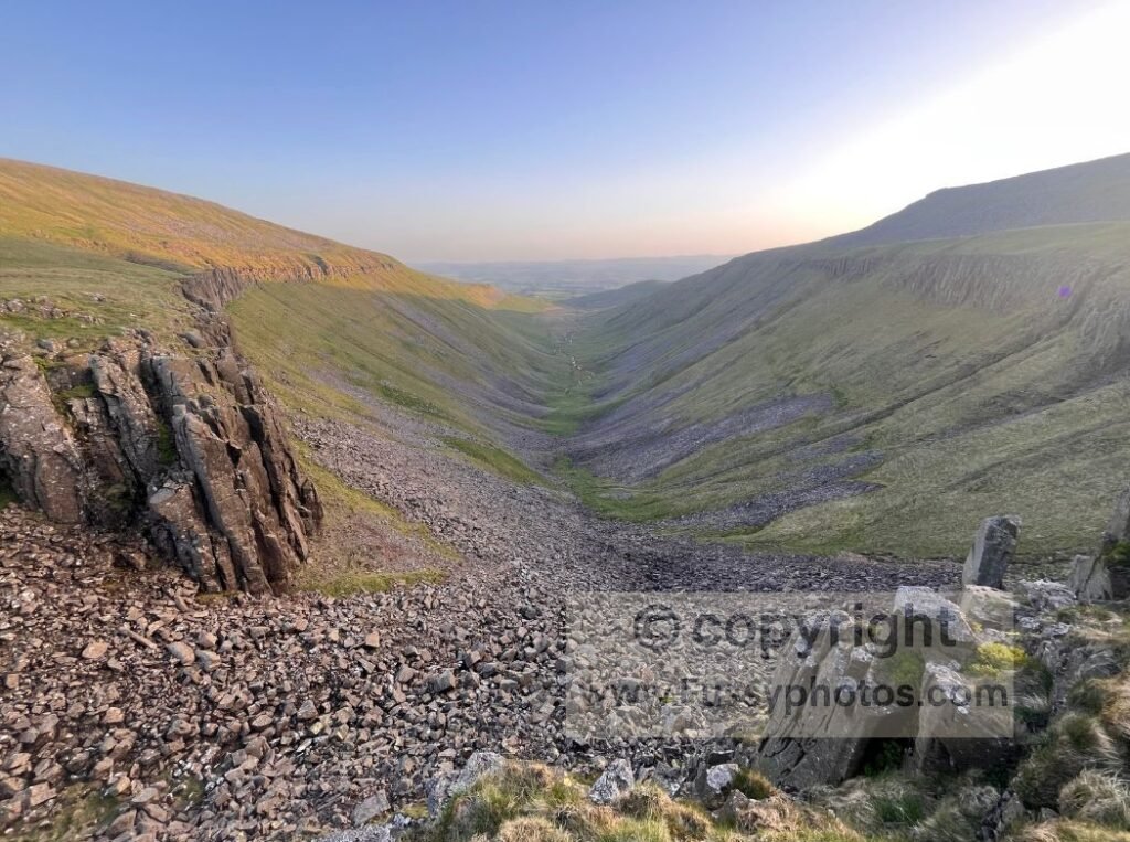
High Cup Nick — a vast U‑shaped glacial valley — is the defining finale of Day 10, so striking that the Aurum guidebook calls the stage “Pennine Way gold”. Earlier in the day you’ve already passed High Force and followed the River Tees, but it’s the long pull towards that dramatic natural amphitheatre that steals the show. In fact, you finish Day 10 further from Kirk Yetholm than when you started — testament to the magnetic pull of High Cup Nick and the determination to thread it into the long‑distance trail.
Also Reached from Dufton either directly or via one of the parallel becks, it’s perfect for a circular day walk, or as I did, a short weekend trip with a discreet, leave‑no‑trace overnight camp on the moor.
Planning a Circular Walk to High Cup Nick
Why choose a circular route?
A simple out‑and‑back to High Cup Nick is superb — but the surrounding fells hide a network of quiet valleys, moorland shelves and rarely‑trodden tracks that reward a more ambitious loop.
Several options exist:
- Scordale — beautiful but largely inaccessible due to the MOD Warcop Training Area
- Gassdale — a promising southern approach, next on my list
- High Cup Gill scree descent — dramatic but steep, loose and not ideal for a relaxed loop
I wanted a route that linked two exceptional valleys rather than one — so I chose Great Rundale, a quieter, less-trodden ascent that delivers a superb approach to the Nick.
Quick Facts
- Location — Northern Pennines, near Dufton, Cumbria
- Distance — ~9.5 miles (circular)
- Ascent — approx. 500m
- Difficulty — Strenuous; steep ascents, off‑trail navigation, boggy moorland
- Terrain — Gravel tracks, open moor, bog, rough ground, Pennine Way flagstones
- Time — 4.5–6 hours depending on conditions
- Best for — Confident navigators seeking a quieter, more adventurous loop
- Start/Finish — Dufton village
- Facilities — Toilets, parking, village green, pub
- Wild camping — Requires landowner permission; see note below
Map: Dufton → Great Rundale → High Cup Nick → Dufton
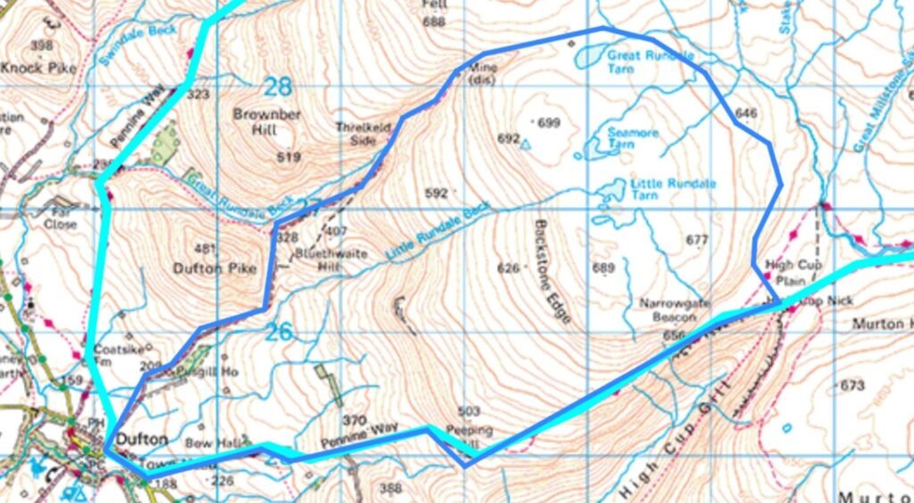
Route Overview: Dufton → Great Rundale → High Cup Nick → Dufton
Starting in Dufton
Dufton is a charming base with:
- off‑street parking
- a voluntary‑donation public car park
- toilets
- a village green framed by Dufton Pike
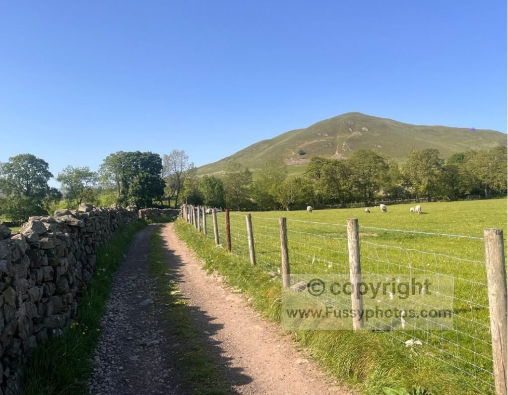
Starting out in Dufton, there’s off‑street parking and the Dufton Public Car Park, which runs on the wonderfully old‑fashioned idea of voluntary contributions — complete with toilets. I was more than happy to chip in before setting off.
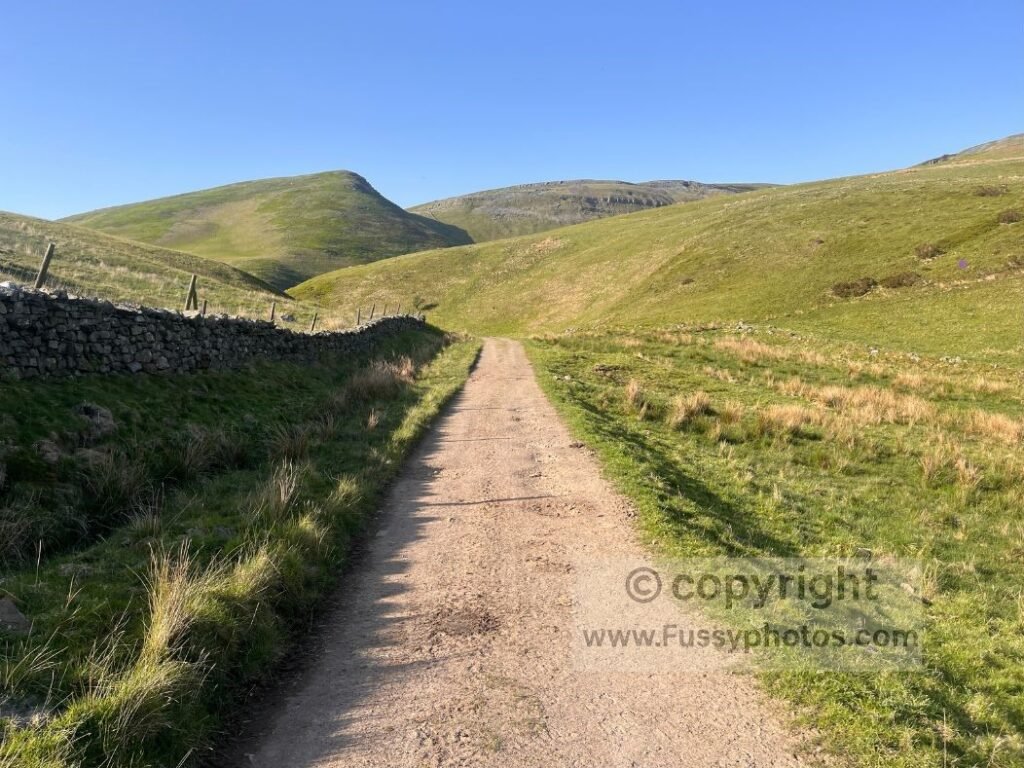
It was already a blazing hot day, the kind that guarantees superb visibility but adds a certain intensity to the first steps of the climb. And the ascent begins immediately, skirting the eastern flank of Dufton Pike.
Dufton to Great Rundale Tarn
The trail follows a gravel farm track all the way to Great Rundale Tarn. Progress was briefly halted while a farmer ear‑tagged his cattle; I waited at the gate until he waved me through, past the rest of the herd queued for their turn. Beyond that, the track rises on a steady, manageable gradient — even with an overnight pack — though the heat was fierce enough that I forced myself to stop every twenty minutes to drink and cool off. It slowed me down, but it was necessary.
Climbing Towards Great Rundale
Dufton Pike, Knock Pike and the Expanding Views
Dufton Pike, always an imposing presence, stayed on my left as I pulled myself along the track. There’s a tempting detour straight up to its summit for panoramic views, but I stayed on the main line as Great Rundale drew closer — its scale partly hidden, but still obvious in the shape of the land. Further ahead, Knock Pike appeared between Dufton Pike and the descending valley, setting my imagination off about future walks in the area.
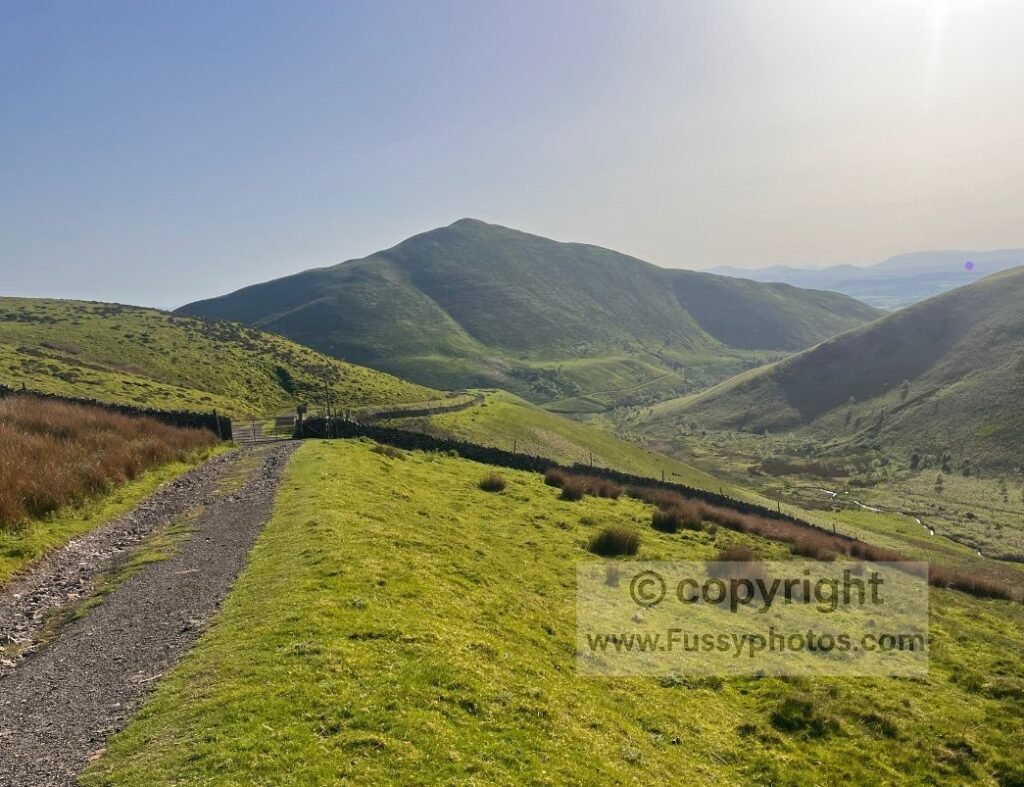
The Pennine Way cuts between Knock Pike and Dufton Pike, but my route stayed on the far side of Dufton Pike, offering fresh views and the promise of a spectacular ascent. A small hanging valley separates Brownber Hill and Rossgill Edge, adding drama to an already dramatic landscape.
Old Mine Workings
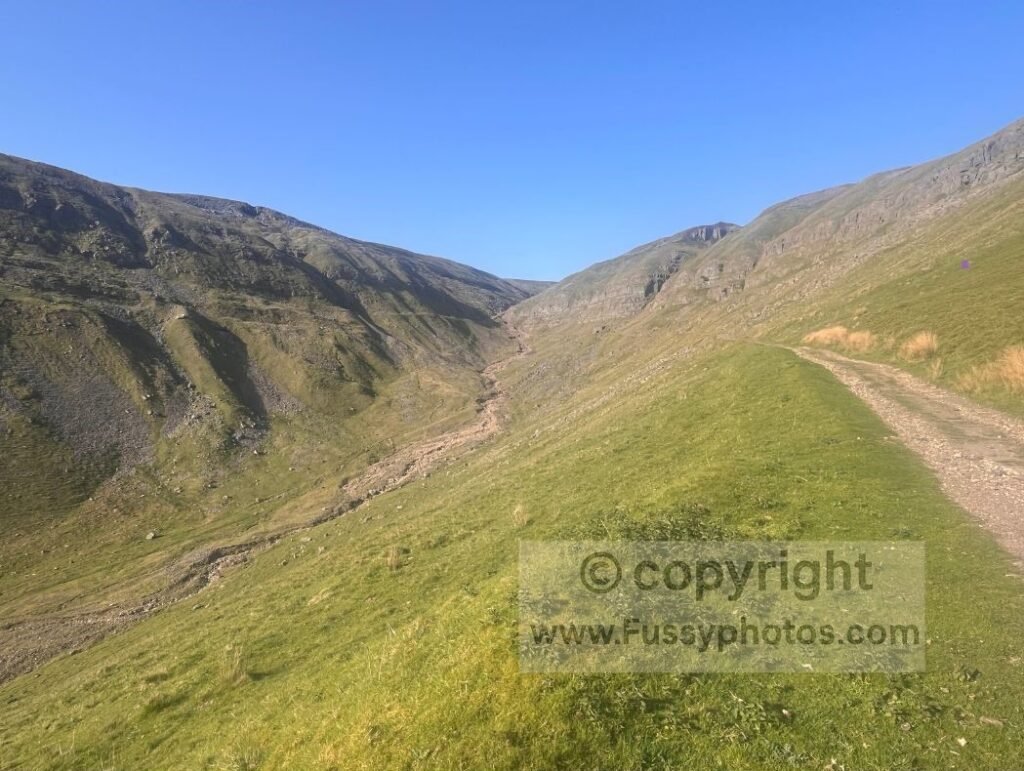
Around 450m the valley narrows, passing old mine workings before crossing a beck — completely dry on my visit, though the bogs higher up still held their usual menace. From above, the track looks particularly impressive, clinging to the eastern side of the valley and carving a clean line into the hillside. The thought that this wasn’t even the most impressive valley I’d see that day was genuinely exciting.
Reaching Great Rundale Tarn
Half a mile before Great Rundale Tarn, the gradient eases and the oppressive heat finally began to lift. I’d worn my “bog‑proof Pennine Way boots”, and despite having a cooler, more comfortable pair in the car, I knew they’d be the right choice once the moorland crossing began — and they were.
End of the Track and the Start of the Moor
An unnamed building marks the end of the gravel track, with the tarn about 50 metres to the east. I’d planned to stop and eat here, but knowing how moorland terrain can grind progress down to that of an asthmatic snail, I pushed on despite my stomach’s protests.
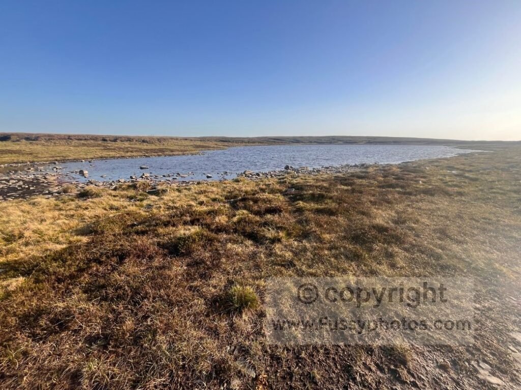
A few minutes of careful bog‑hopping took me to the tarn — and then I spotted a gravel trail looping around from the building. I’ve no idea how I’d missed it earlier, but it was a welcome sight. I’d only found one other trip report for this route, and it wasn’t clear what to expect beyond the tarn, so this lifted my spirits. The trail was marked on my GPS, ending just under a mile short of High Cup Nick, so I knew something existed out there.
Crossing the Moor to High Cup Nick
For the first mile or so, navigation was simple enough: follow the tyre tracks and check the GPS at any junctions used by grouse‑shooting vehicles. After about twenty minutes of straightforward progress, I glanced at the GPS and realised I’d somehow drifted off the mapped line — still on clear tracks, but no longer where I was supposed to be.
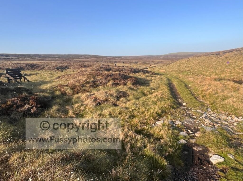
I backtracked for a few minutes, but even standing in the right spot, my eyes still couldn’t pick out anything resembling a junction. All I could see was heather, bog, and a small stream I’d need to cross.
The stream crossing was easy enough, and the moorland — by Pennine Way standards — was pretty tame. My boots disappeared to the ankle a couple of times, but nothing serious enough to threaten wet socks.
Navigation in a Homogenous Landscape
For 200 metres or so I relied entirely on my eyes and GPS before more wheel tracks appeared. The landscape suddenly felt very homogenous — if you replicate this route, make sure you’re confident navigating in this environment.
In truth, I was pleased with my progress. I never felt lost, aside from that brief moment at the stream, and from the higher line Maize Beck stayed visible — a useful landmark in an otherwise featureless landscape.
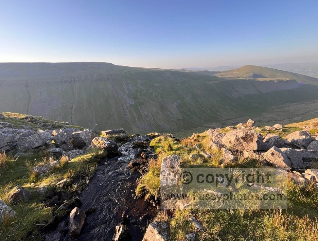
First Sight of High Cup Nick
Half a mile short of High Cup Nick, I spotted the unmistakable gash on the horizon: the top of the valley and that vast U‑shaped amphitheatre I’d come to see again.
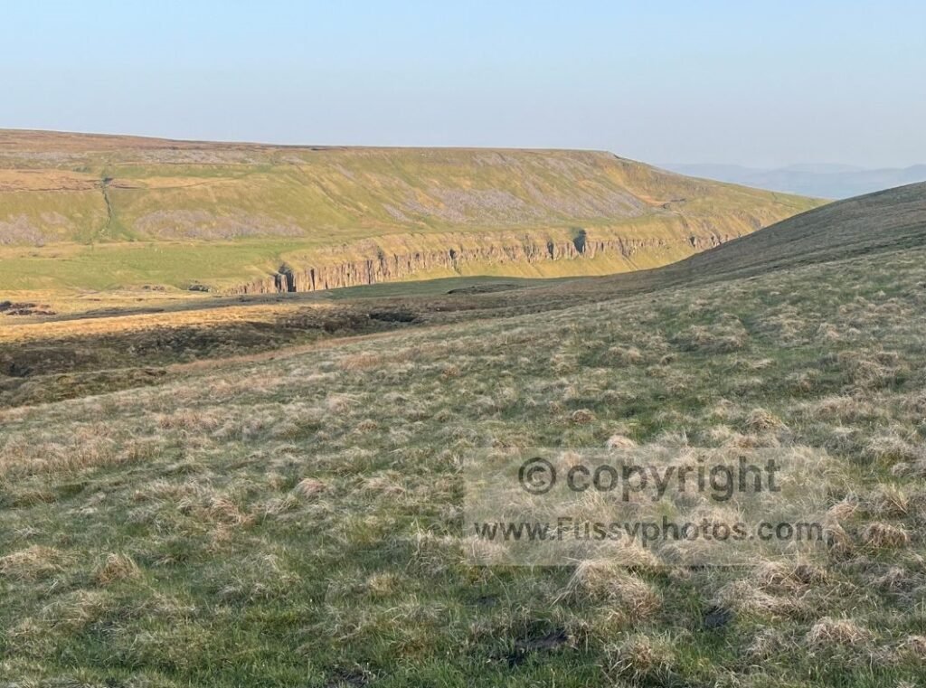
The tyre tracks looped west, no longer heading in my direction, so I braced myself for more bog‑hopping and cut directly towards the two trails that cross Maize Beck — one of them the Pennine Way. Again, I got off lightly: dry feet, firm ground, and I reached High Cup Nick just over three hours after leaving Dufton. Not bad going considering the heat, the route‑finding and the backpack.
Top 10 Highlights of the Pennine Way (Ranked) features High Cup Nick as one of the trail’s standout moments, and you can see where it sits among the most memorable places on the route.
Camping Above High Cup Nick
I’d lingered at High Cup Nick on my Pennine Way thru‑hike, but it never felt long enough. This time I’d resolved to camp above its enormous U‑shaped sides, quietly grateful to have the view entirely to myself.
Wild camping in England requires landowner permission; this was a low‑impact, leave‑no‑trace overnight stop recorded only as part of the narrative.
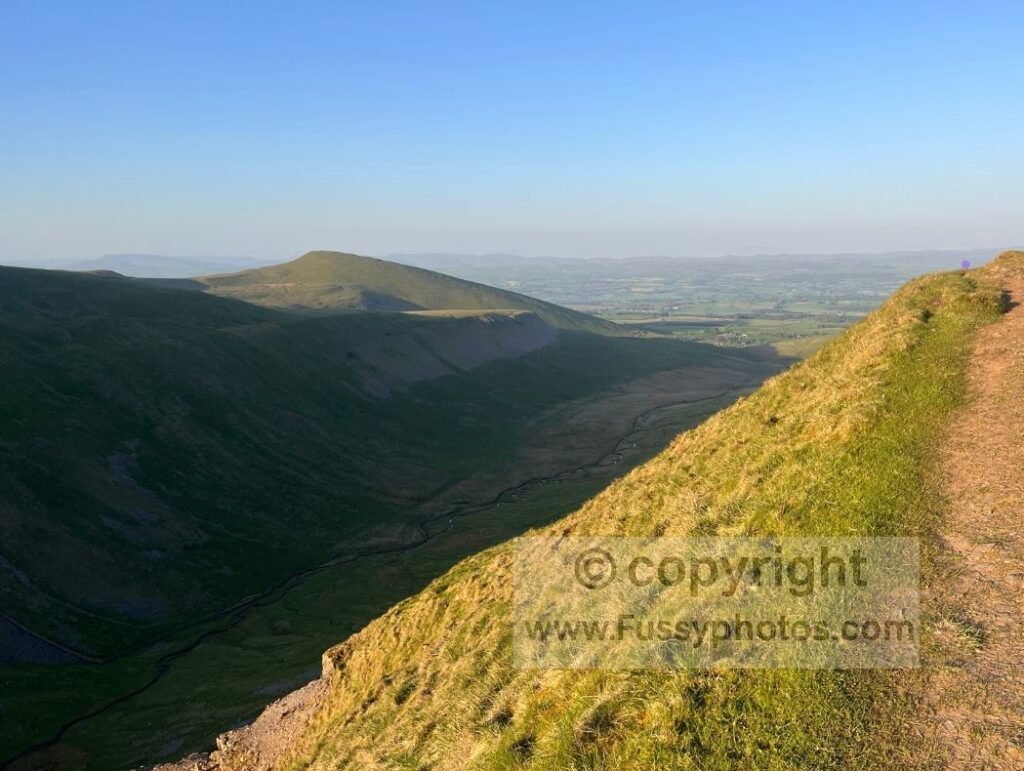
Being south‑west facing, I hoped for a glorious sunset to match some of the ones I’ve seen previously. I’ve collected a few of my favourites in my Top 10 Sunsets on the Pennine Way page, but tonight’s effort was mostly hidden behind Backstone Edge. Despite enjoying the experience, I barely slept and was up at 4:30am, wondering how it could possibly be that light already. Sunrise glowed behind me and the birds — who’d never really stopped through the night — chirped enthusiastically.
Returning to Dufton via the Pennine Way
Along the Northern Rim
After packing up and ensuring I’d left no trace, I followed the northern rim of High Cup Nick via the Pennine Way, which offers excellent views into High Cup Gill for about a mile and a half. The gill was in shade — clear to the eye but difficult to capture on camera with the bright light above.
The Long Descent to Dufton
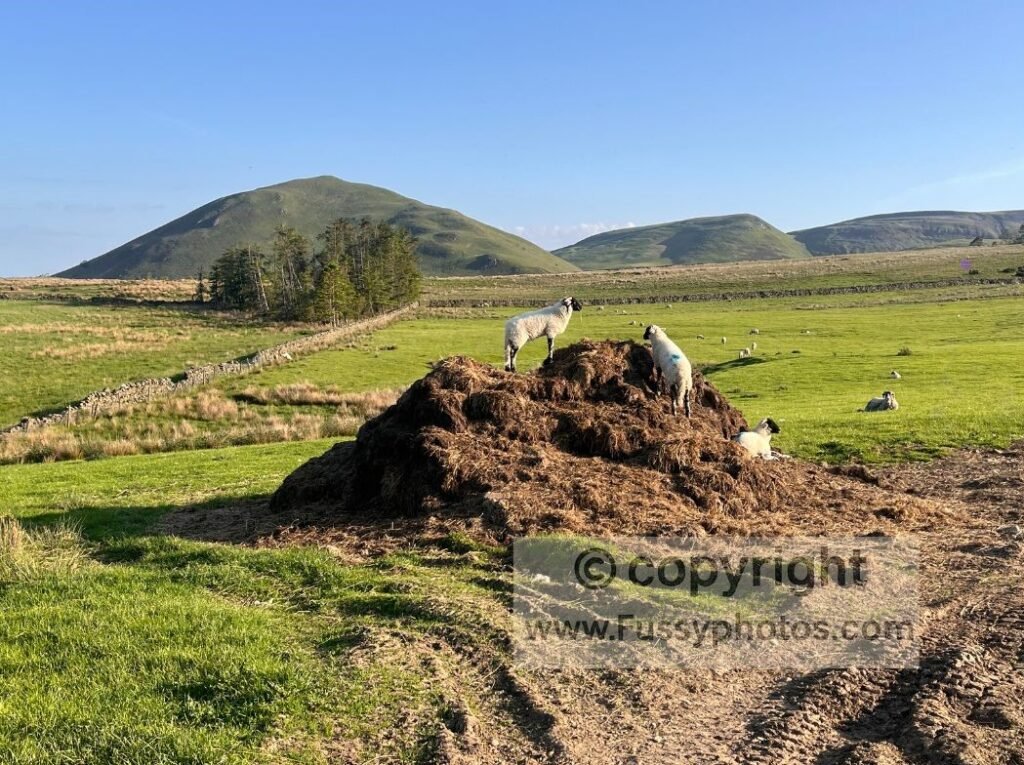
From here, the long descent into Dufton begins, passing cairns, sheep and farm buildings until Dufton Pike reappears ahead, signalling the loop is nearly complete. Thru‑hikers have the pleasure of this descent only to climb back up again a few miles north to even higher ground. It’s a lovely descent, and if you can’t wait for refreshments in Dufton, there’s an honesty box about a mile before the village.
For the full long‑distance context behind High Cup Nick, explore my detailed Pennine Way Stage 10-12 thru‑hike report.
High Cup Nick: The Loop in Motion

FAQs
Where is Dufton?
Dufton is a small village on the western edge of the North Pennines, just north of Appleby‑in‑Westmorland in Cumbria. It sits beneath Dufton Pike and is also the end of Stage 10 on the Pennine Way, making it a popular overnight stop for thru‑hikers as well as day walkers heading to High Cup Nick.8
Is this Great Rundale to High Cup Nick Loop easy to navigate?
The farm track to Great Rundale Tarn is simple, but the moorland section has no obvious junctions and relies on GPS and good judgement. The Pennine Way return is straightforward.
Are there alternative circular routes?
Options include Gassdale (southern approach) and the High Cup Gill scree descent, though the latter is steep and loose. Scordale is often restricted due to the MOD Warcop Training Area.
Pennine Way Hub
For more routes, planning tips and stage guides, head to my Pennine Way hub page.