Bleaklow Head to Torside Reservoir is one of my favourite stretches of the Pennine Way — a superb run of high‑moorland miles followed by one of the best descents on the entire trail. It’s accessible from Crowden, Padfield, Glossop or Snake Pass, but it’s not an easy section to fit into a short circular walk unless you’re comfortable with a bit of Grade 1 scrambling.
This loop avoids all scrambling — it’s a clean, straightforward way to experience this part of the Pennine Way without the hands‑on sections required by some of the shorter approaches.
This circuit is roughly 12.5 miles and takes around 6 hours, and while the whole loop is excellent, it’s those miles from Bleaklow Head down to Torside Reservoir that make it truly special. Other highlights include easy reservoir‑side miles on the Longdendale Trail, and the drama of Doctor’s Gate — all off the Pennine Way, but central to this circular route. There are also opportunities to detour to the Bleaklow B‑29 crash site, but I’ve kept this classic Pennine Way loop as straightforward as possible.
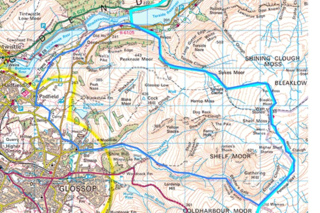
Map of the Route
Start Points for This Circular Route
This loop can be started from Padfield, Old Glossop, Snake Pass or Crowden, giving you several options depending on where you’re travelling from.
My Route: Beginning the Loop in Padfield
In the past, I’ve started this loop from Crowden, where there’s a car park and toilets — that adds around 2.5 miles to the route. This time I began in Padfield, walking anticlockwise to save the superb descent to Torside Reservoir for the end, just as you do on Day 1 of a Pennine Way thru‑walk. There’s also a pub in Padfield, which makes a fitting reward at the end.
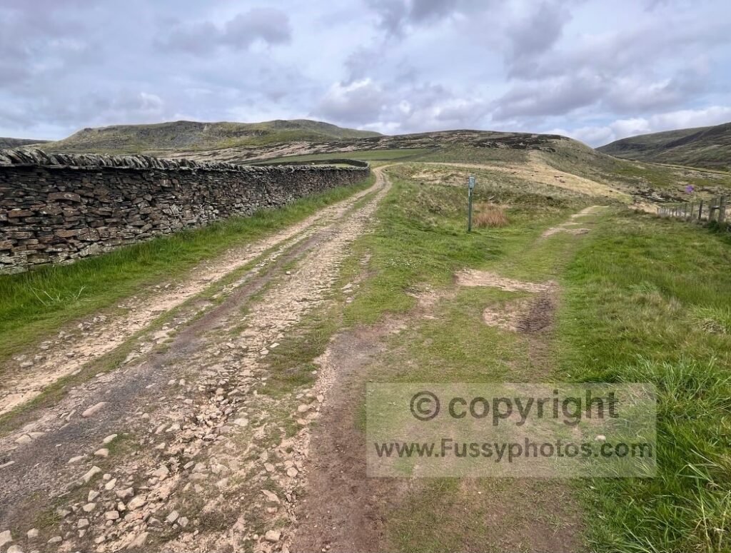
From Padfield, a pleasant trail climbs to a cemetery, where a lane leads to Cemetery Road. Turning right, the pavement along the B6105 brings you into Old Glossop, where there are more pubs if you need an early break.
Old Glossop to Doctor’s Gate
Heading east, Shepley Street leads out of the village and into open countryside — some of the best miles in the Peak District. A bridge to the right crosses the stream and loops around Shire Hill, an attractive 307‑metre rounded hill. If you take this detour, it rejoins the main route at Mossy Lea.
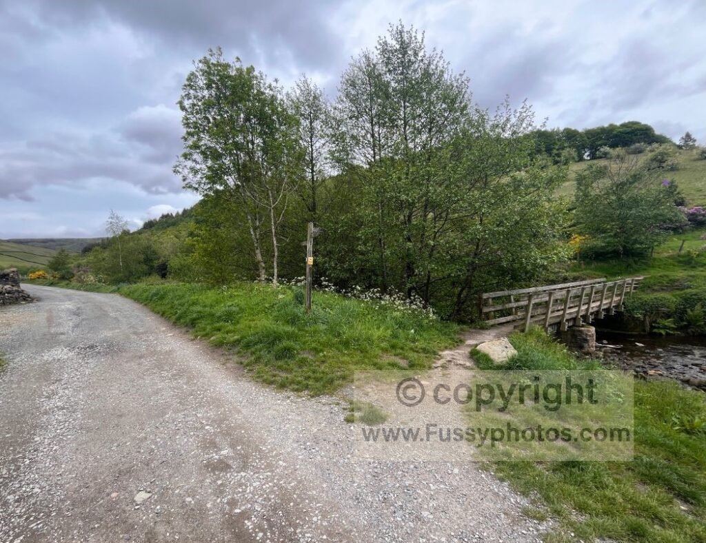
Staying on the main line, continue east along a single‑lane track, passing a farm on your left as the V‑shaped contours of Doctor’s Gate open ahead.
At Mossy Lea, the trail steepens slightly and enters Doctor’s Gate, a Roman road with cobbled sections and a drystone wall. Views widen across moorland and tributary valleys carved by the brooks feeding off the hills.
A little further on, keep right at a Y‑junction unless you want an early detour to the bomber crash site. I recommend saving that for later from the Pennine Way, as the best of Doctor’s Gate is still ahead.
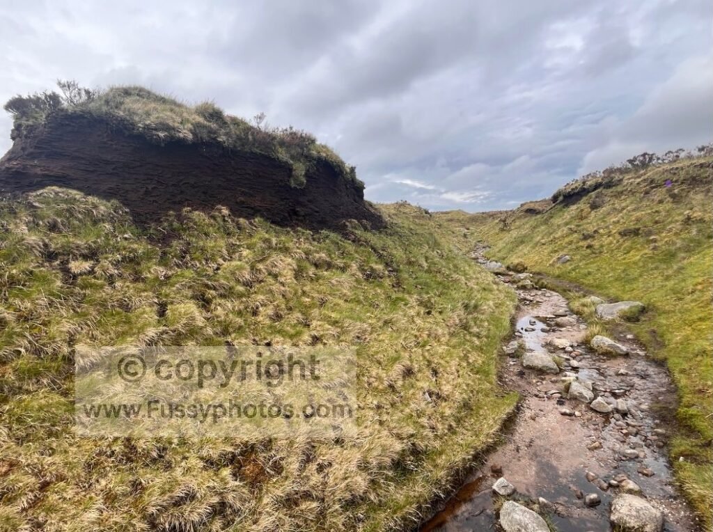
Into the Heart of Doctor’s Gate
The valley narrows and steepens, the trail becoming a narrow line carved into the hillside. Soon you’re walking beside the stream — a serene spot for a break, though boggy in wet weather. An unmarked trail climbs steeply up the valley (another optional route to the crash site), but it’s a breathless, steep ascent.
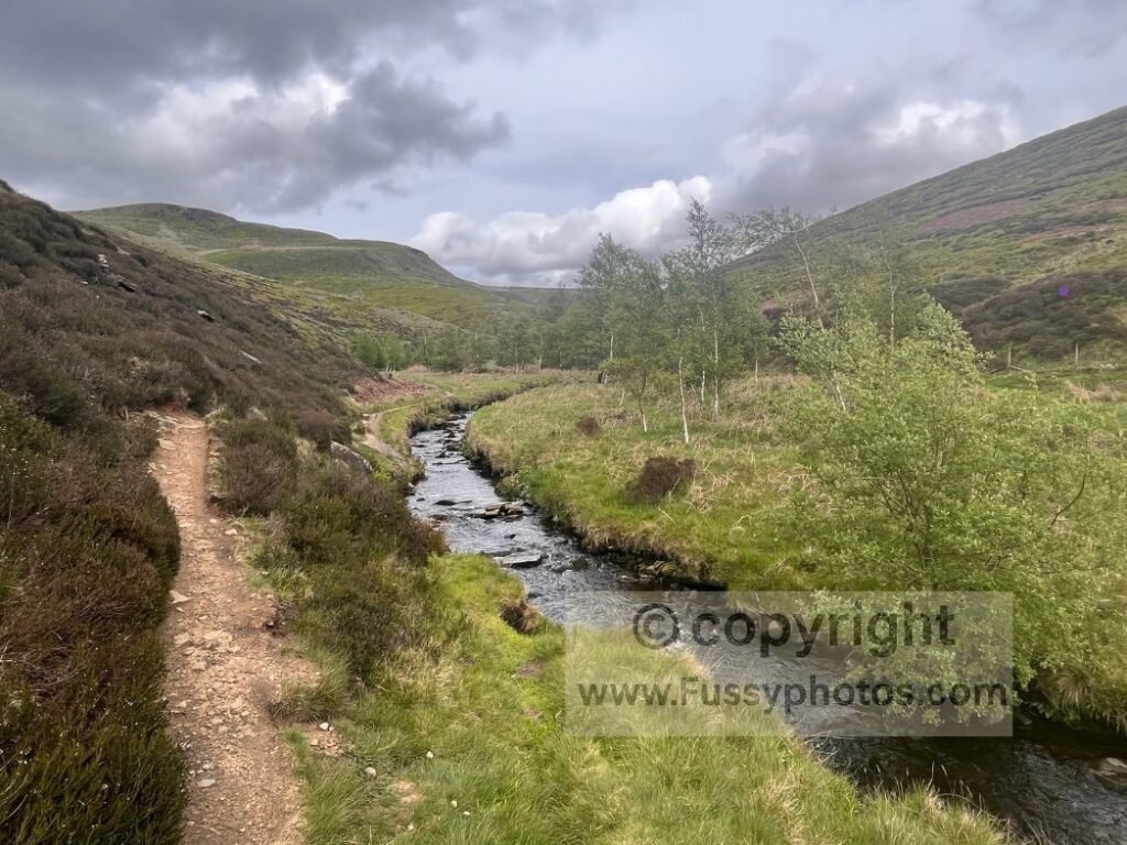
Paving stones cross the stream via a small wooden bridge and begin the long climb from 330m to 530m towards the Pennine Way junction. It’s hard work but well graded, with constant views and even Manchester visible behind on a clear day.
The most dramatic section is Urchin Clough, where the contours steepen and the trail clings to the hillside — dramatic but never dangerously exposed. A fence signals the gradient easing, and soon the paving stones of the Pennine Way cross your path.
Optional Start/End Point: Snake Pass
Snake Pass is within earshot, another possible start/end point.
Joining the Pennine Way to Bleaklow Head
Follow the Pennine Way north. This is often one of the busiest parts of the loop, with walkers taking the shortest route from Snake Pass to the bomber crash site. Today it was quiet, and I met just two Pennine Way thru‑walkers beginning their journey to Standedge.
I reassured them that although this section is briefly barren and featureless, they had the superb ascent to Torside Reservoir, Laddow Rocks, and Wessenden Reservoir to come — all highlights of the trail (see Top 10 Highlights of the Pennine Way).
Navigation to Bleaklow: What to Expect
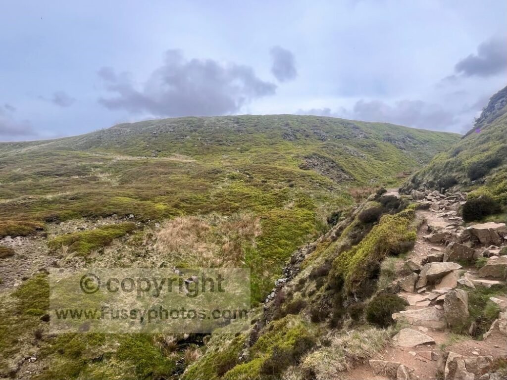
The trail to Bleaklow Head is mostly clear, but the moorland rises sharply on both sides and the erosion channels can be confusing. If you don’t see paving stones fairly quickly, check your GPS — the Pennine Way is a maintained trail and usually gives itself away.
This was at least my fifth time here, and remembering its tricks — submerged slabs, misleading channels and faint trods — I climbed a small mound and easily spotted the correct line. Despite the warm weather, I wore winter boots and kept my feet dry.
Navigation isn’t especially hard in good visibility, but I’ve never encountered this section in poor visibility. See if it earns a place in my Top 10 Hardest Parts of the Pennine Way.
Last Chance to Detour to the Bleaklow Bomber Site
Unmarked tracks lead west from here to the Bleaklow Bomber site. I visited it on my own Pennine Way thru‑hike, but a GPS is strongly recommended — route‑finding off the Pennine Way is not easy, and the trods across the moor are faint, inconsistent and easily confused with drainage channels.
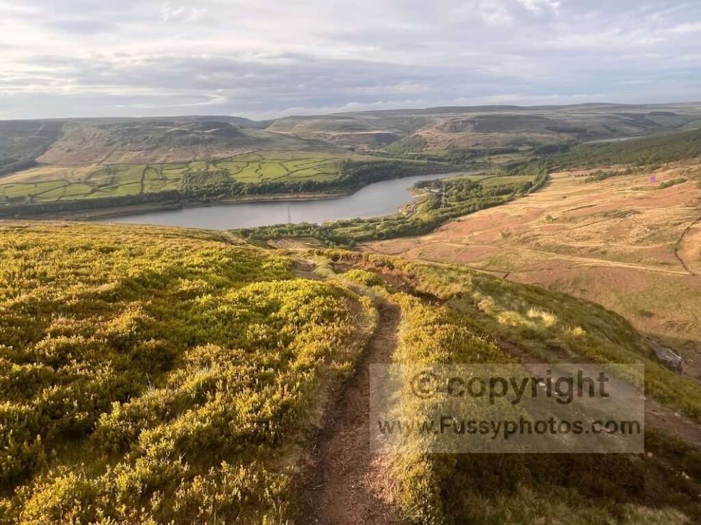
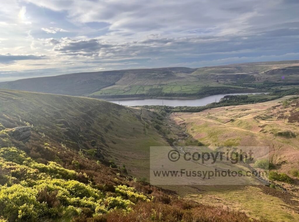
Bleaklow Head to Torside Reservoir — A Superb Descent
Just as I was tiring of the slow, fiddly progress, I reached Bleaklow Head — 633m and the highest point of the loop. It’s a flat, boggy summit, but the surrounding valleys are visible enough to help with navigation. I spotted Laddow Rocks to the north, confirming what my compass already told me.
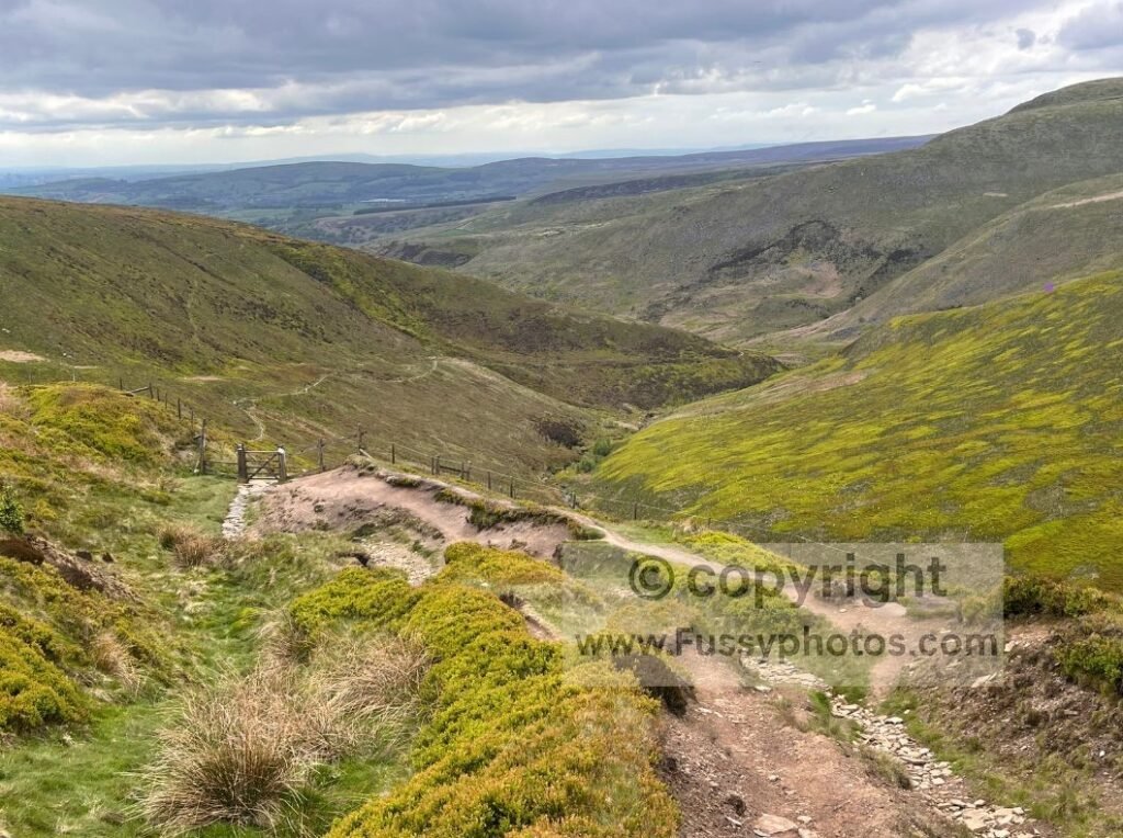
From here, the trail steadily descends to Torside Reservoir, first via eroded moorland tracks, then paving stones and heather, then alongside Wildboar Grain. The convergence of two streams makes an excellent rest spot and marks a change in direction as the Pennine Way veers north.
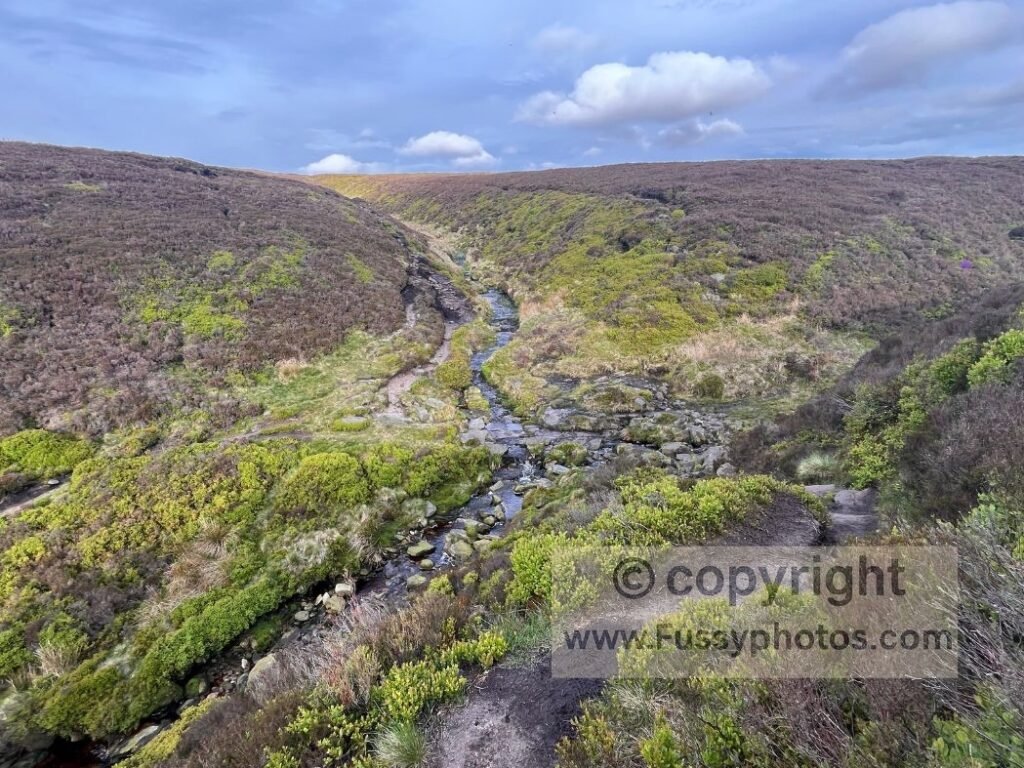
Progress can be slow on the boggy, rocky trail, but the sound of Torside Clough and increasingly dramatic views as the contours fall away to your right offer constant motivation.
Clough Edge: One of the Best Viewpoints on the Route
Clough Edge — one of my favourite parts of the entire Pennine Way — gives superb views of Laddow Rocks, Torside Reservoir, Woodhead Reservoir, and Longdendale. The edge eventually drops steeply, offering views northeast into Clough Edge, before a knee‑jarring descent past a farmhouse leads you to the B6105.
Alternative Start/End Point: Crowden
The Pennine Way continues north across Torside Reservoir, then an undulating path heads west for the final 1.3 miles to Crowden, making it another straightforward start or end point for this circular route.
For a deeper look at this section on a full thru‑hike, see my Pennine Way Days 1–3 Trip Report, covering Crowden, Torside and the surrounding high‑moorland miles.
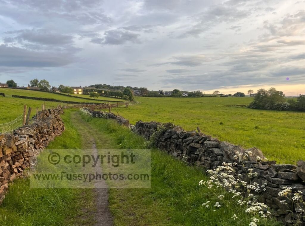
Return via the Longdendale Trail
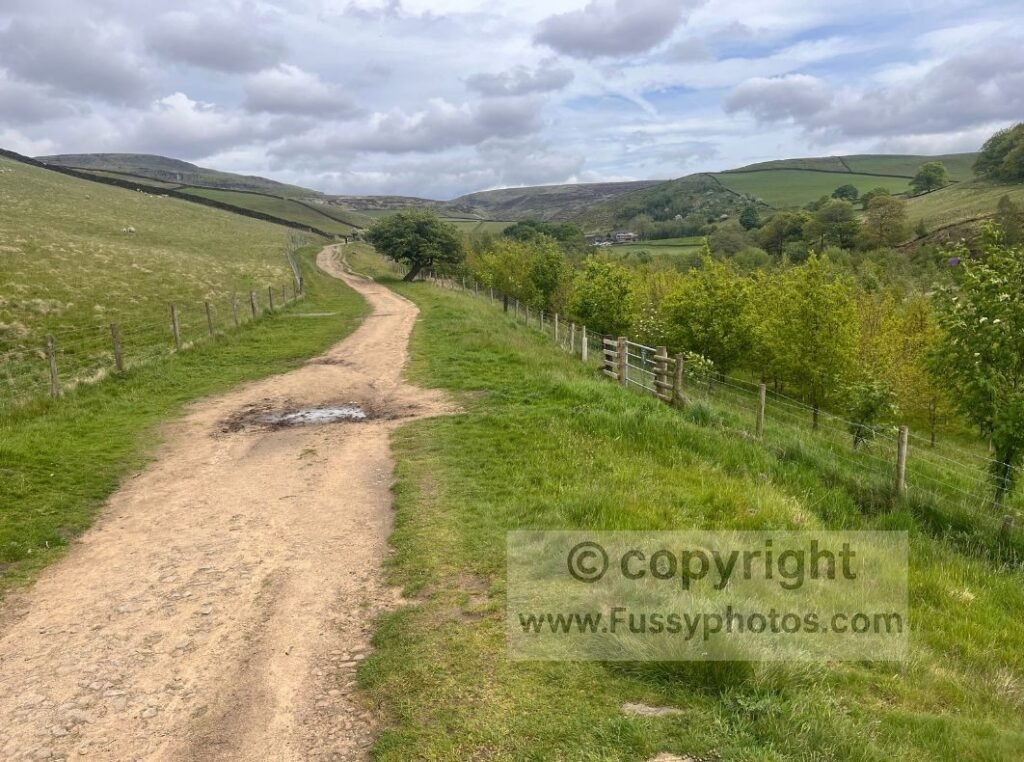
From the B6105, the loop rejoins the wide, flat gravel of the Trans Pennine Trail (also known as the Longdendale Trail along this stretch). This section makes quick, easy progress westwards, passing a chain of reservoirs with long views up and down the valley. After the rougher miles on Bleaklow, it’s a chance to open your stride.
At a trail junction, the route eventually climbs the valley and heads gently back towards Padfield.
If you want to continue exploring Crowden on the Pennine Way, my Crowden–Black Hill Day 2 Loop picks up the trail north with big moorland views and the dramatic climb to Laddow Rocks.
Watch the Route on YouTube

FAQs
How difficult is the Bleaklow Head to Torside Reservoir loop?
It’s a moderate–hard day with long moorland miles, boggy sections, and some tricky navigation on Bleaklow, but no scrambling on this particular loop.
Can I visit the Bleaklow B‑29 crash site on this route?
Yes — there are three points on this loop where you can detour to the Bleaklow B‑29 crash site, each with different levels of effort and clarity:
- Early in Doctor’s Gate, a right‑hand option branches off towards the moor.
- Further up the valley, a steep, unmarked trod climbs directly onto the plateau.
- South of Bleaklow Head, faint tracks leave the Pennine Way for the final and most reliable approach.
All three require a GPS and confident navigation — the trods are faint, the moor is confusing, and none of these lines are waymarked.
Are there pubs or facilities on the route?
Padfield and Old Glossop both have pubs. Crowden has toilets and parking. There are no facilities on the high moor.
How long does the loop take?
Expect 6–7 hours plus breaks, depending on conditions, pace, and how long you spend on the viewpoints and valley sections.
Return to the Pennine Way Hub
For more routes, circular walks and planning guides, head back to the main Pennine Way Hub.