Few places in Britain combine history and landscape as powerfully as Hadrian’s Wall — a Roman frontier running across the wild spine of northern England. From the steep escarpment at Cawfields to the high point at Winshields, the iconic dip of Sycamore Gap, and the sweeping ramparts above Housesteads, this stretch delivers some of the Wall’s most dramatic scenery in a single day.
Walking Hadrian’s Wall on the Pennine Way
From Thirlwall Castle, north of Greenhead, the Pennine Way follows Hadrian’s Wall and the Hadrian’s Wall Path for around 8.5 miles. The Pennine Way leaves the Wall at Rapishaw Gap, half a mile west of Housesteads, turning north towards Bellingham as part of a demanding 22‑mile day from Greenhead (if you’re following the standard 16‑day itinerary).
Key Route Information
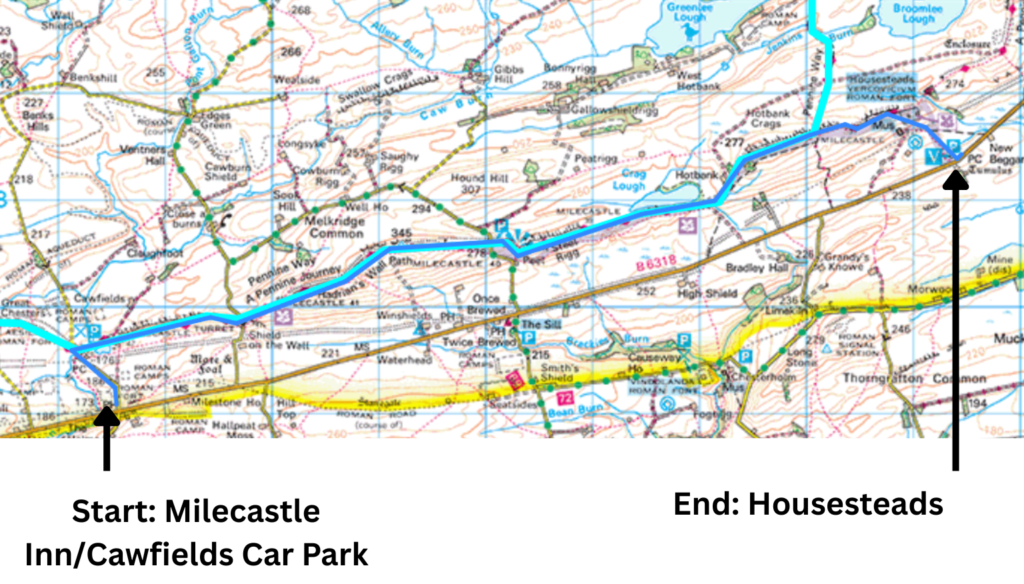
- Route: Cawfields → Winshields → Steel Rigg → Sycamore Gap → Housesteads
- Distance: 6.5 miles (linear)
- Difficulty: Moderate–strenuous — short steep climbs, rocky footing, exposed sections
- Start: Milecastle Inn (via AD122 bus)
- Finish: Housesteads Roman Fort (English Heritage car park)
- Best Direction: West → East for Pennine Way‑style views
- Highlights: Whin Sill, Winshields Crags, Milecastle 39, Sycamore Gap, Housesteads
- Transport: AD122 bus between Greenhead and Hexham
- Ideal For: Day walkers wanting the most dramatic miles of Hadrian’s Wall without repetition
Why Walk This Linear Route?
This linear route is ideal for anyone who wants to experience the most dramatic miles of Hadrian’s Wall — including Cawfields, Winshields, Sycamore Gap and Housesteads — without committing to a full long‑distance stage on the Pennine Way.
Hadrian’s Wall is one of my standout moments on the trail — it’s in my Top 10 Highlights of the Pennine Way if you want the full list.
Should You Visit Housesteads or Continue on the Pennine Way?
For Pennine Way thru‑walkers, the key decision at Rapishaw Gap is whether to detour east to explore Housesteads Roman Fort, or continue north on the main trail towards Bellingham. This question applies only to those completing the full long‑distance route — day walkers can simply enjoy the most dramatic miles between Cawfields, Winshields, Sycamore Gap and Housesteads without needing to choose.
Having chosen the latter on my own thru‑hike, I wanted to return to enjoy this stretch properly — and to take a closer look at Housesteads itself.
Using the AD122 Bus for a Linear Walk
For a day walk, the aim is simple: maximise your time walking alongside the Wall. That rules out both a circular and an out‑and‑back, as both require repetition or deviation away from the Wall. The solution is a point‑to‑point walk, using the AD122 bus which runs between Greenhead and Hexham. At the time of writing, the bus runs five times a day in each direction, making it easy to plan a linear route and either return to your car or, as I did, start with the bus and walk back.
This route covers my favourite parts of those 8.5 miles along Hadrian’s Wall, plus the final mile to Housesteads Roman Fort and the English Heritage car park. I recommend walking west to east to mirror the views you experience on the Pennine Way.
Walk Overview
- End Point: English Heritage car park at Housesteads (parking charges apply)
- Bus: Take the AD122 from Housesteads to Milecastle Inn (approx. 20 minutes)
- Start Point: Milecastle Inn
- Distance: 6.5 miles
Route Map
Route Description
Milecastle Inn to Cawfields
Departing the bus at Milecastle Inn, either sample the inn or walk north along a quiet country road for just under half a mile to Cawfields.
Facilities at Cawfields
There’s a car park here too, so you could begin here and get the bus back from Housesteads. Facilities include toilets, picnic benches and, in busy season, a food truck.
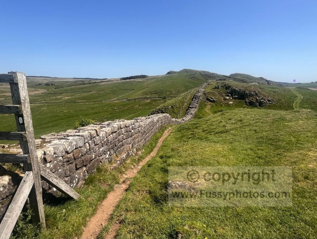
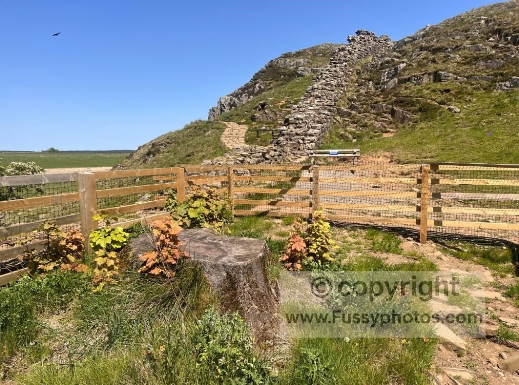
An abandoned quarry has since filled with water — an attractive pool backed by the tall Whin Sill rock, the more resistant band that protrudes across the landscape and forms the natural foundation on which the Romans built the Wall. Just beyond the water is the remains of an impressive milecastle to the left, and steps to the right taking you up the Whin Sill. A short incline gives panoramic views of this linear ridge rising like a naturally formed barrier.
A display board illustrates what the milecastle may have looked like in Roman times. From here, two trails run east: the Pennine Way, clinging tightly to the Wall with constant undulation, or the easier Roman Military Way, a well‑graded grassy trail. They meet at Caw Gap, 0.7 miles east, if you prefer the gentler option.
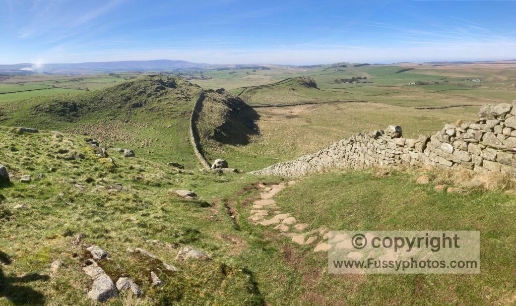
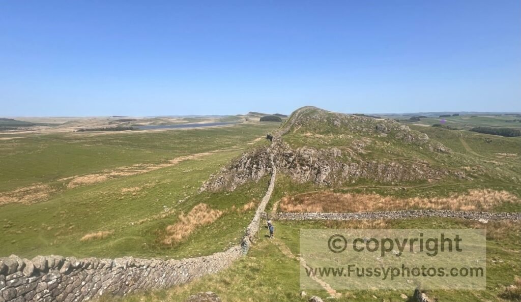
Caw Gap to Winshield Crags
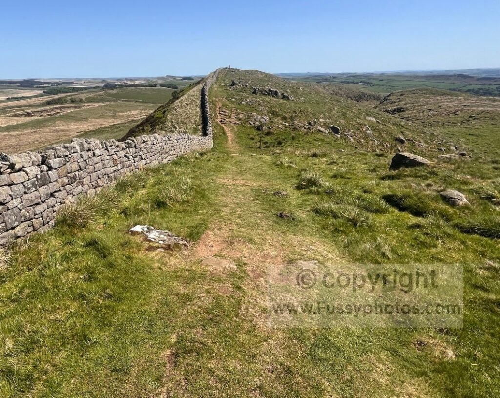
At Caw Gap, the trail drops briefly to the road before rising again. Winshield Crags soon comes into view — the highest point on the entire 73‑mile Wall. Before reaching it, the trail dips steeply and climbs once more, with the landscape falling sharply both north and south too.
Camping at Winshield Farm
A path drops south to Winshield Farm, which offers camping — an option for splitting the long Greenhead–Bellingham day on the Pennine Way, or simply for exploring the area further.
Winshield peaks at 345m, marked by a white trig point. Dropping down the other side, another display board shows how imposing this frontier must have looked in Roman times. The gradient then eases, descending steadily to the busy Steel Rigg car park.
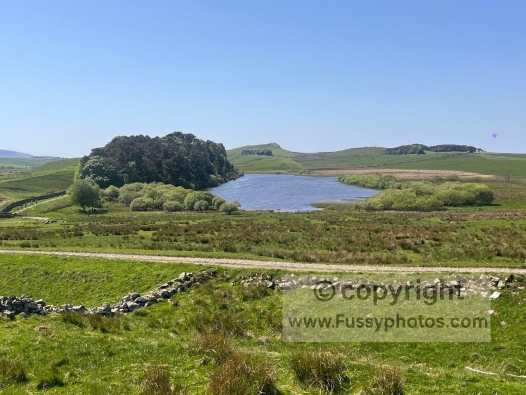
Steel Rigg to Sycamore Gap
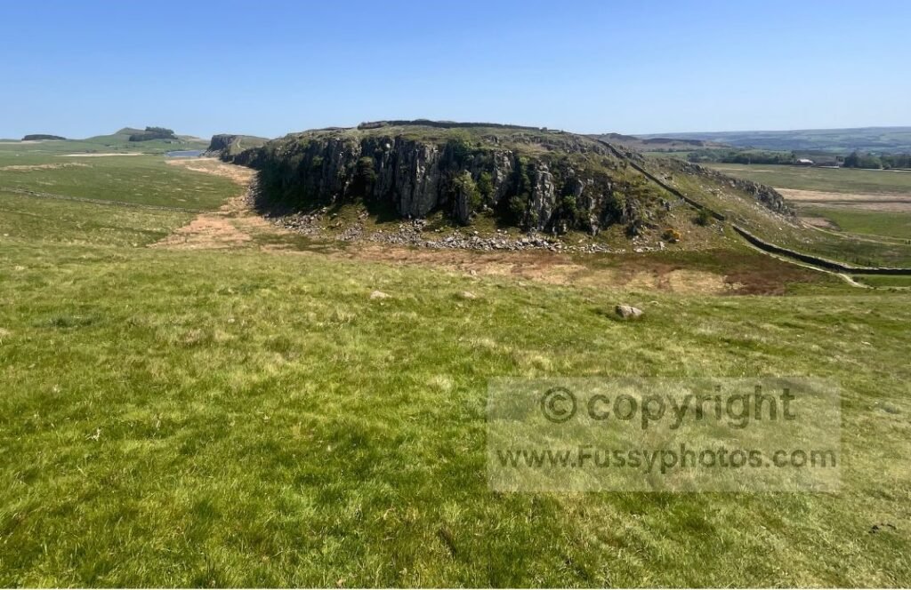
On both occasions I’ve been here, the trail becomes noticeably busier — and for good reason. Steel Rigg is a spectacular crag and viewpoint over Crag Lough and the dip of Sycamore Gap.
Parking at Steel Rigg
The car park here is one of the busiest along Hadrian’s Wall, with direct access to some of the most photographed sections of the route.
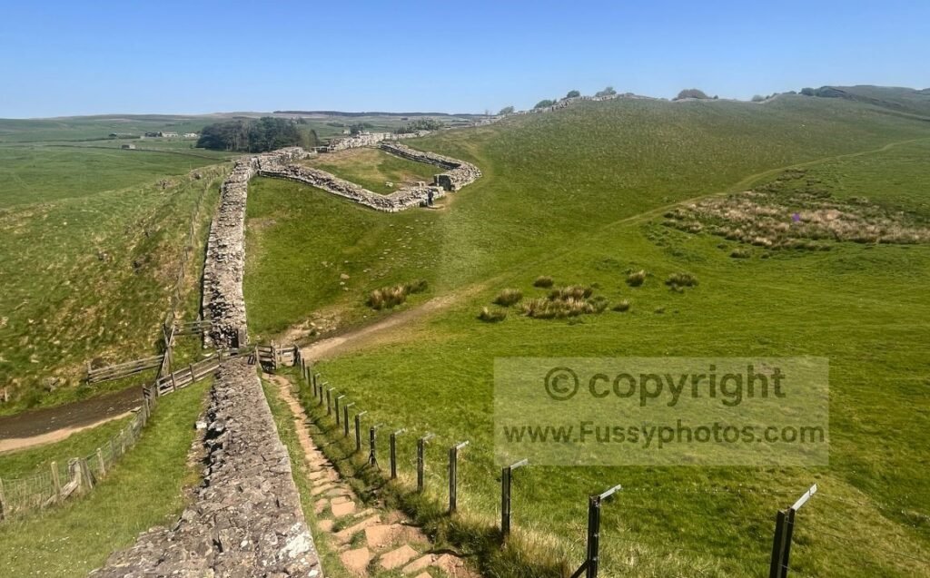
A short but steep ascent lifts you above the surrounding landscape and brings you to my favourite part of Hadrian’s Wall: Milecastle 39, also known as Castle Nick, probably built by the 6th Legion. It sits in a dramatic dip, with views over Crag Lough and the hollow beyond — Sycamore Gap.
The descent to Sycamore Gap is steep and rocky.
I was lucky enough to see the Sycamore Gap Tree on my Pennine Way thru‑hike, just before it was mindlessly vandalised. In many ways it’s still spectacular, but it’s equally a sad sight to see an icon of the north so needlessly destroyed. The tree is still alive, with shoots emerging, but whether it will return to its former shape remains to be seen — and it won’t be quick.
Conditions at Sycamore Gap
The path here is uneven and rocky, with short steep sections. Footing can be slippery after rain, and the dip itself funnels wind — worth bearing in mind when planning your pace.
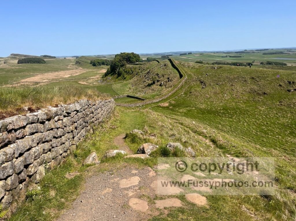
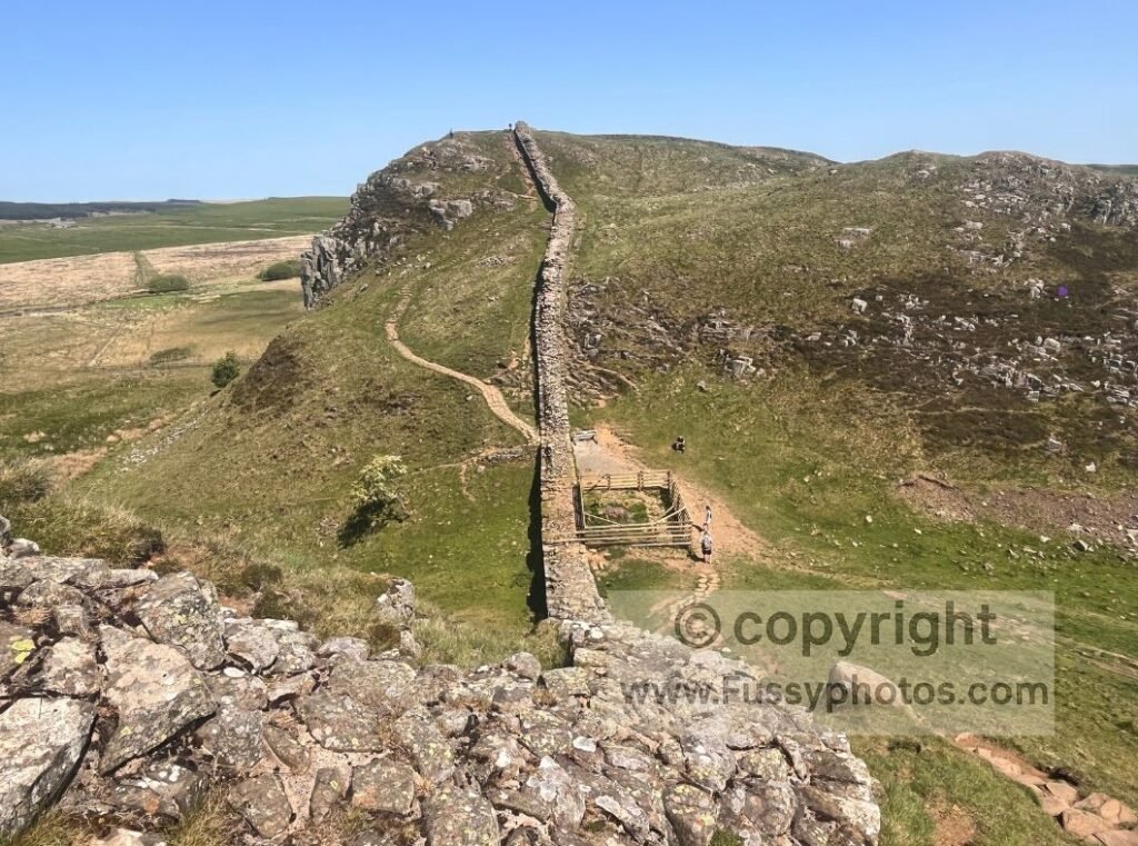
Sycamore Gap to Housesteads
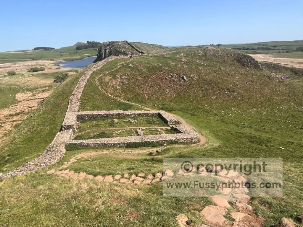
Beyond Sycamore Gap, the trail runs high above Crag Lough before entering the first shaded section of the walk. The path then drops before turning north and rising around 75m, giving the best elevated views of Crag Lough, now to the west. This vantage point sharply illustrates the Whinstone ridge rising above the surrounding landscape.
Where the Pennine Way Leaves Hadrian’s Wall
At Turret 37A (Rapishaw Gap), the Pennine Way leaves Hadrian’s Wall to follow endless plantations towards Bellingham. Housesteads lies another half mile east, with a final stretch of undulation.
For the full story of what lies beyond Rapishaw Gap, my Greenhead → Bellingham thru‑hike notes are here: Trip Report Days 13–15.
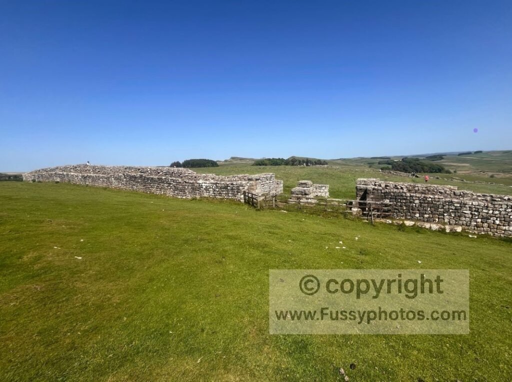
A public footpath heads downhill, with Housesteads Roman Fort to the left. You’ll need to pay or be an English Heritage member to access it directly. Otherwise, its scale — though not its detail — can be appreciated from a distance.
See the Route in Motion

FAQs
How long does this 6‑mile Hadrian’s Wall walk take?
3-4 hours.
Is this Cawfields to Housesteads route difficult?
Short but punchy: expect rocky steps, sharp undulations and exposed crags.
Are there toilets or food on this route?
Yes: toilets and a seasonal food van at Cawfields, plus full facilities at Housesteads.
Is this walk suitable for beginners?
Yes, if comfortable with short, steep climbs and uneven stone steps.
Is public transport available at both ends?
The AD122 bus links major Wall sites; the timetable may vary year‑to‑year.
Do you need a ticket for Housesteads Roman Fort?
Yes, you need a ticket to enter Housesteads Roman Fort, but members of English Heritage and the National Trust get in for free. You can bypass the entrance to the fort if you don’t want to pay.
Return to the Pennine Way Hub
For more Pennine Way day walks, circulars, stage guides and planning resources, head back to the main hub.