There are countless variations of a Malham Cove – Gordale Scar circular, including the popular loop starting in Malham village. I’ve walked that one too, but this variation is better. It still visits the same highlights — Janet’s Foss, Gordale Scar, Malham Cove — but adds a higher, quieter route above the extremely busy classic. It also includes one of the best stretches of the Pennine Way, which the lower circular misses: Ing Scar, as well as the finest viewpoint of Gordale Scar near New Close Knotts, 150 metres above the magnificent valley and waterfall.
Because it starts further north, it’s easily extended to include Malham Tarn, a peaceful glacial lake north of Malham Cove and directly on the Pennine Way. All this for just an extra mile: 6 miles for the shorter loop, or 8 miles if you include the northern shore of Malham Tarn. Few walks in the UK offer so much reward for so little effort. It might just be the best day walk in England — and it’s suitable for families. I’ve taken my own children on it twice.
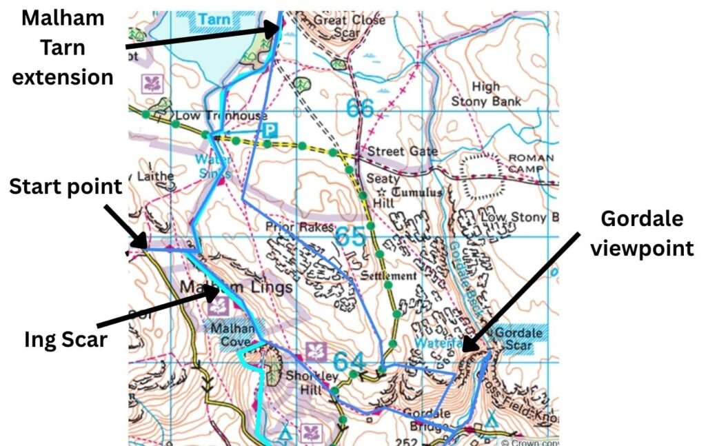
Route Map: Malham Cove, Gordale Scar and Ing Scar Circular
Key Facts
- Distance: 6 miles (short loop) or 8 miles (with Malham Tarn)
- Route Type: Circular
- Highlights: Malham Cove, Gordale Scar, Janet’s Foss, Ing Scar, high viewpoint near New Close Knotts
- Best For: Families, first‑time visitors, limestone scenery lovers
- Terrain: Rocky paths, limestone pavement, valley trails, short steep sections
- Difficulty: Moderate — one steep descent; otherwise steady and manageable
- Start Point: Near Langscar Gate (quiet, free roadside parking) — or Malham Tarn if completing the longer 8‑mile version, or Malham village if you want to start on the Pennine Way towards Malham Cove, joining the loop at Malham Cove
- Key Trails: Dales High Way & Pennine Way
- Features: Caves, dry‑stone walls, glacial lake option (Malham Tarn)
- Time Required: 3–5 hours depending on pace and stops
- Scrambling: None required on this route (Gordale waterfall scramble avoided)
The High Route Above Malham: Full Video Walkthrough
Starting the Walk: A Quieter Approach than Malham Village
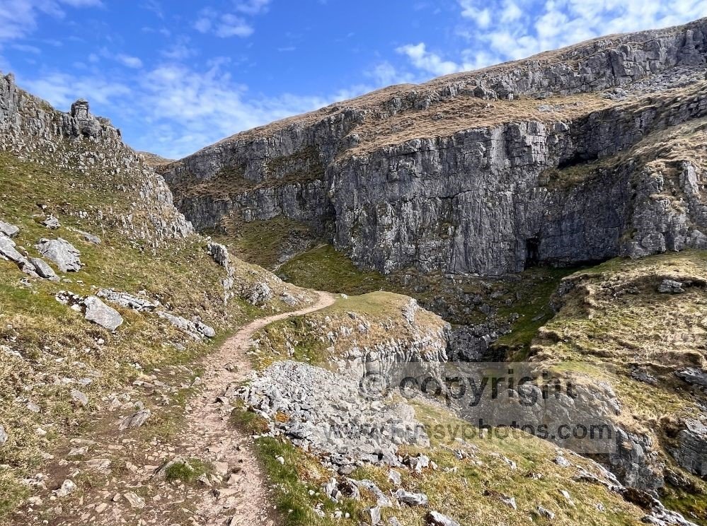
Arriving in Malham on a beautifully sunny day, I wasn’t surprised to find the roads and car parks busy. I was surprised, however, at the £8 fee to leave my car in a field. After circling the village without finding a free space, I drove north towards Malham Tarn, the northernmost point of our day’s route. Quieter — albeit without a pub — this road and those around the tarn offer free parking and a calmer start.
Finding a spot at Langscar Gate, the walk began with a bang: dry‑stone walls, limestone scenery and the distant outline of Ing Scar.
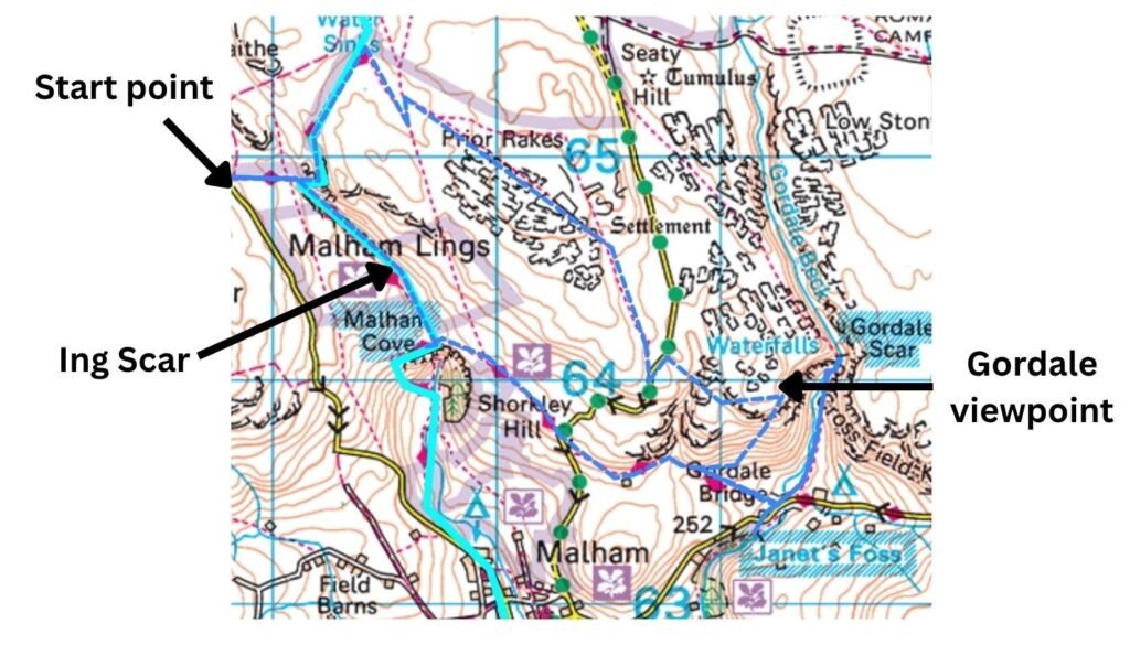
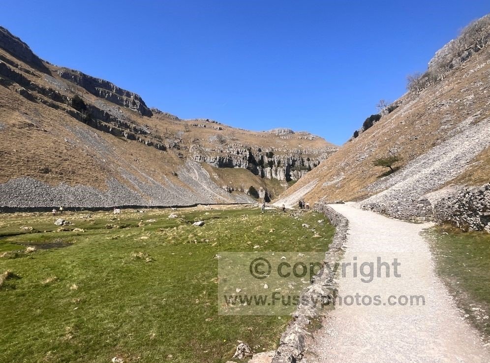
Joining the Pennine Way and the Drama of Ing Scar
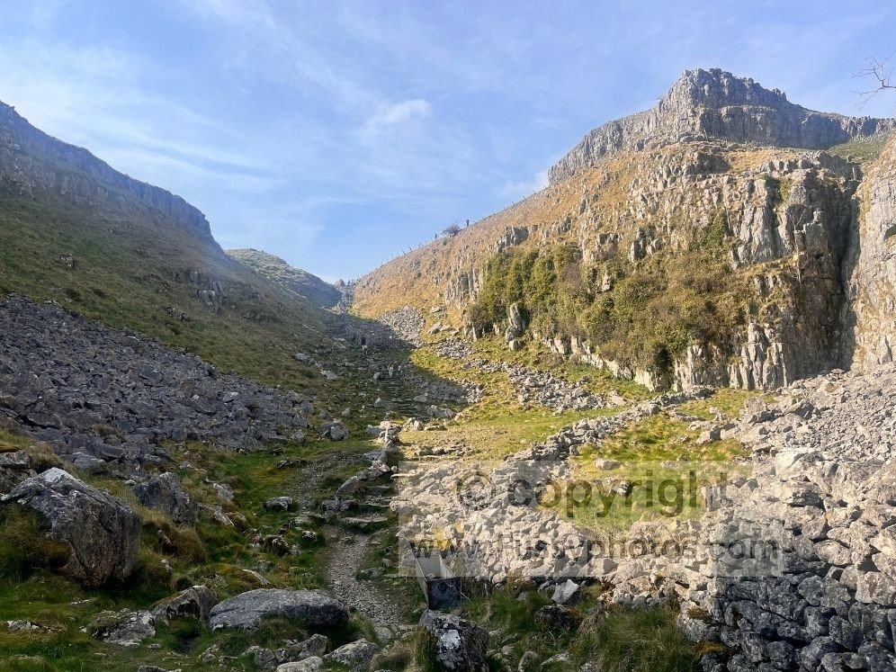
Descending the trail towards the Pennine Way junction, the drama built. Crossing a ladder stile straight onto the Pennine Way, we were greeted with a perfect view south down Ing Scar towards the limestone pavement at Malham Cove.
Resisting the temptation to follow the attractive valley — which we’d return through at the end of the walk — we turned north, following the Pennine Way as it ascends towards Malham Tarn, enjoying the sheer valley walls and the feeling of contouring above them with minimal exposure. Small caves and rock formations here kept the children entertained for as long as I allowed.
Malham Route Options: Adding Malham Tarn or Keeping It Short
Continuing north, the rocky trail comes to the top of the valley where the surroundings flatten, offering the familiar feel of dry‑stone walls and farming. Knowing they had limited miles in their legs, I decided I’d drive my children to the tarn later but strongly recommend the walk if you have the time.
If you’re interested in continuing north from Malham, my 4‑day Pennine Way stage from Malham to Middleton‑in‑Teesdale covers the next 50 miles with detailed notes, photos and route guidance.
Map of the Malham Tarn Extension (8‑Mile Version)
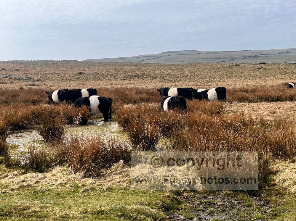
Instead, we took a right, over cantilever stone steps into a field of black cattle with a white streak down their middle. Clearly used to humans, they ignored us as we followed the trail, leading to a steady incline and 410 metres elevation. On the eastern side of the flat peak, distant views of limestone pavement held our interest before another stile brought us onto a single‑lane country road.
Crossing the High Ground to the Gordale Scar Viewpoint
Still enjoying the solitude, we took a left, walking no more than 200 metres along the road before crossing westwards into a field.
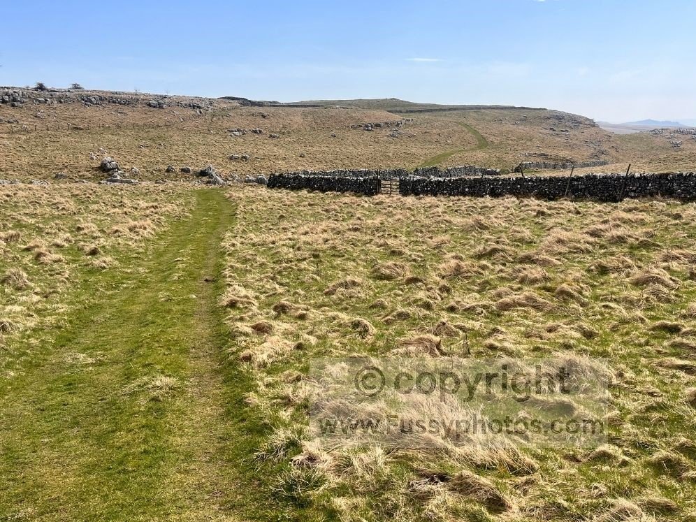
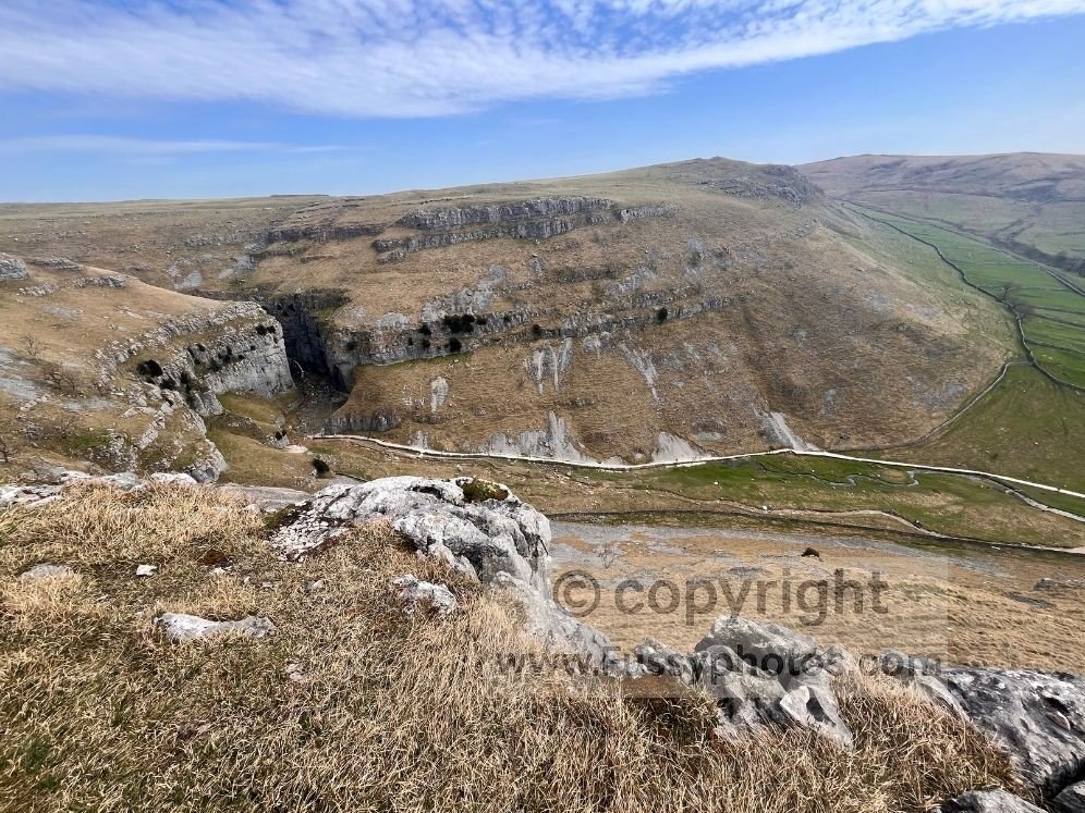
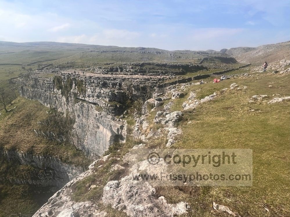
Initially the trail was clear but it soon faded and though I had my sense of direction and wits I followed my GPS to bring us to the high viewpoint over Gordale Scar, with 180‑degree views over the steep river gorge as it widened, spilling into the countryside to the south — exchanging the solitude for superb views and the noise of the running water and excitement in Gordale Scar. We enjoyed a scenic picnic, surrounded by a small number of walkers who’d made the ascent from the steep trail from the Dales High Way below.
Descending to Gordale Scar
Descending the trail our knees winced, switchbacks clearly a concept yet to reach the Dales. At the trail junction with the Dales High Way, take a left, joining the stream of day walkers on their own loops from Malham village. A maintained trail with steps drops you the rest of the way to the flatter surroundings of the road, a seemingly ever‑present ice‑cream van and the trail into Gordale Scar.
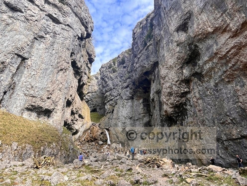
Walking Into Gordale Scar
Surrounded by the sound of families, we followed the trail parallel to the stream with the sound of laughter soon drowned out by the crashing water of the waterfall. The views from within Gordale Scar comfortably matched those from above and my children pointed out to me the high viewpoint where we’d been only 20 minutes earlier.
Adding to the drama of the experience, the waterfall is hidden behind a bend, giving a final dramatic reveal to the end of the gorge. In theory the trail continues up the gorge, but following it would involve a dangerous slippery scramble and if you want to see the gorge beyond the waterfall, the safer way would be to follow the trail from the viewpoint above as it fades into the contours some 150m above.
Although there are no benches here, it’s a great spot for a rest and with the sunny weather and lack of wind, we enjoyed around an hour, the children playing gleefully in the stream whilst I soaked in the views.
The Short Trail to Janet’s Foss
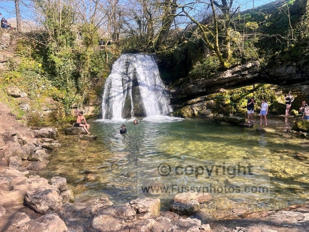
Finally dragging ourselves away, we followed the path back to the road, taking the short detour to the busy Janet’s Foss waterfall — a smaller fall but with a larger plunge pool and with families and swimmers.
You could extend the loop here, continuing on the busy path as it loops to the south of the village, a good option if you want to enjoy one of the two pubs before taking the Pennine Way along Malham Beck and up the 400 or so steps to Malham Cove.
Starting in Malham Village: Alternative Route Map
Returning Towards Malham Cove via The Dales High Way
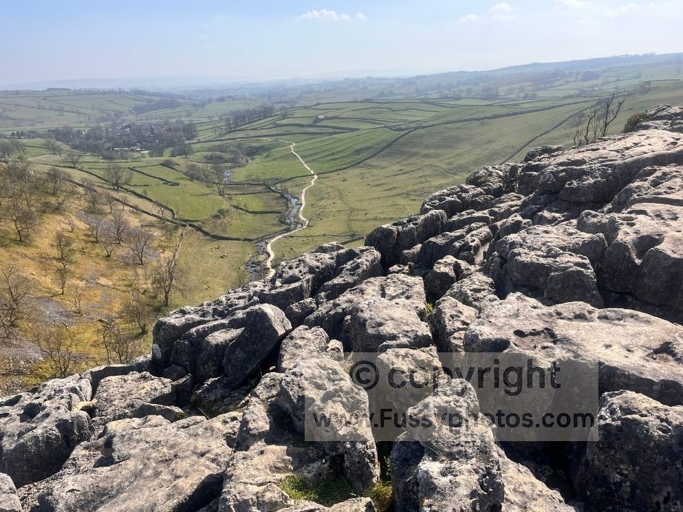
Instead, we followed the Dales High Way — a shorter and slightly less steep alternative route to the cove. Approaching the cove from the west, we were treated to fantastic panoramic views of the village 100m or so below, the beck and the limestone resurgence and the steep cliffs of the cove with the limestone pavement visible slightly below us and a straight‑line view up Ing Scar — our final mile as the route rejoins the Pennine Way.
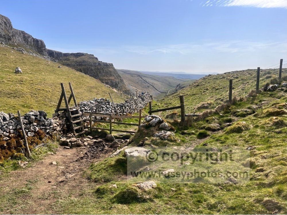
The Ascent Through Ing Scar to Complete the Loop
After a short play on the limestone pavement and warning the children about the sheer drop at the edge, we ascended the valley through Ing Scar, gently at first before final steps and a final ladder stile brought us to the end of our loop. We then drove to the tarn, completing a day of gorgeous limestone scenery.
If you’re exploring more of the Dales, my nearby Grassington and Linton Falls Circular Walk offers another superb mix of limestone scenery, riverside paths and classic Yorkshire views.
Want a classic Pennine Way peak? This Pen y Ghent circular delivers a steep ascent, huge views and a quiet descent.
FAQs: Malham Circular Walk
How long is the Malham circular walk?
The high‑level version is 6 miles, or 8 miles if you extend to Malham Tarn. Both include Gordale Scar, Janet’s Foss and Malham Cove.
Is this walk suitable for families?
Yes — the route is family‑friendly, with varied scenery, caves, limestone features and safe paths. The only caution is the steep descent into Gordale Scar and the sheer drop at the top of Malham Cove.
Does this route include all the classic Malham landmarks?
Yes — it still visits Gordale Scar, Janet’s Foss and Malham Cove, but adds the Gordale Scar viewpoint, Ing Scar, and quieter high‑level paths above the classic loop.
Are there toilets, food or pubs nearby?
Malham village has pubs, refreshments, toilets, shops and a visitor centre. There are no facilities at Langscar Gate or Malham Tarn.
Is swimming allowed at Janet’s Foss?
People often swim in the plunge pool, but the water can be extremely cold and conditions vary. Always check depth and hazards before entering.
Explore More Pennine Way Routes
If you want more day walks, circular routes and planning guides beyond Malham, my Pennine Way Hub brings everything together in one place.