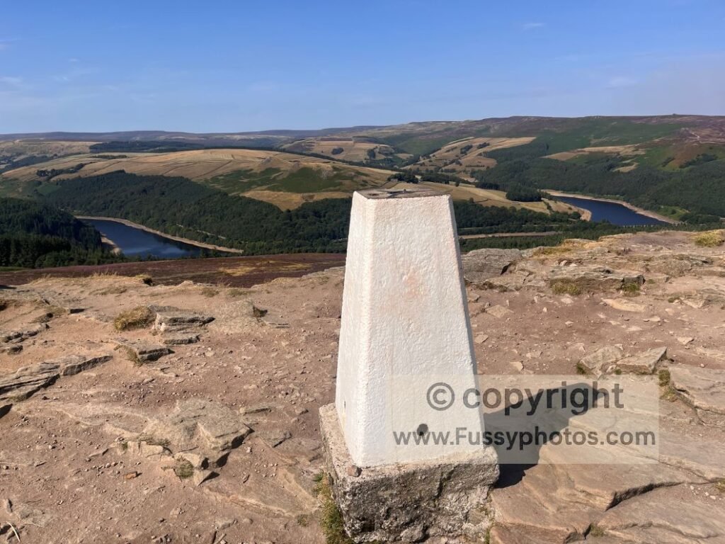
Rarely do I walk less than ten miles, but it’s always useful to have a few short walks up your sleeve — for poor weather, when time is tight, or when you’re walking with people less keen to commit to a full day out. This 3.5‑mile circular is a great option: brief reservoir walking, forestry plantation, a touch of moorland, and possibly the best viewpoint in the Peak District, all for under 300m of ascent.
Key Facts: Win Hill Short Circular
- Distance: 3.5 miles
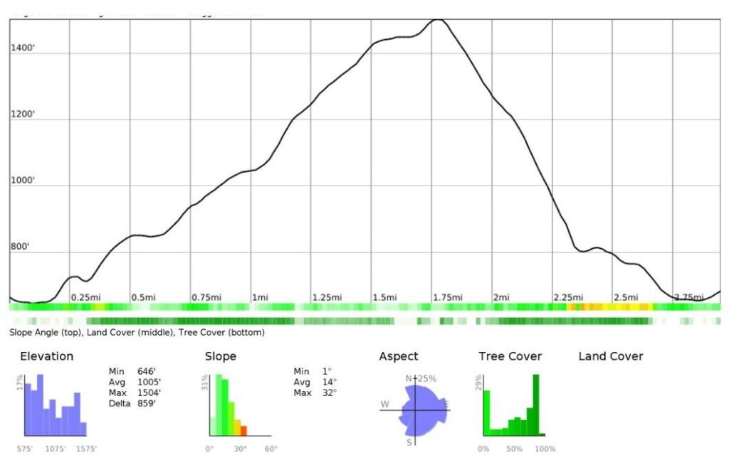
- Elevation gain: under 300m
- Terrain: reservoir paths, forestry plantation, moorland
- High point: Win Hill (463m)
- Difficulty: short, steep in places, excellent reward‑to‑effort ratio
- Best for: short weather windows, limited time, mixed‑ability groups, families
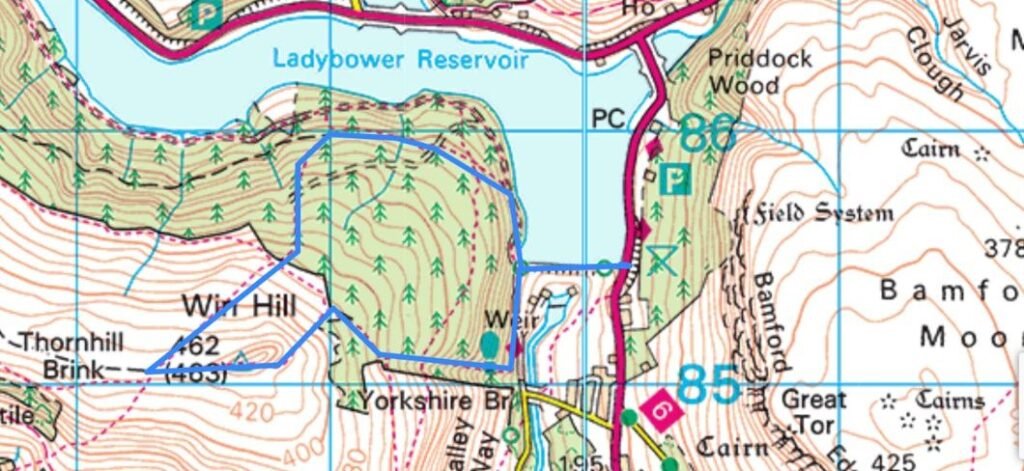
Win Hill 3.5‑Mile Route Map – OS Map Extract
Elevation Profile: Win Hill Short Circular
Video Highlights: Win Hill Short Circular

Parking for Win Hill (Ladybower Reservoir)
Park where you can along the A6013 — there’s on‑street parking if you’re lucky. Otherwise, Heatherdene Car Park offers paid parking and easy access to the reservoir.
Ladybower Reservoir: East–West Crossing
Crossing the reservoir from east to west, the land falls away to the south with views along the River Derwent. To the north, Ladybower stretches into Upper Derwent Valley. The water level was extremely low on our walk — as low as I’ve ever seen it — with the reservoir banks clearly visible and the bellmouth overflows high above the waterline.
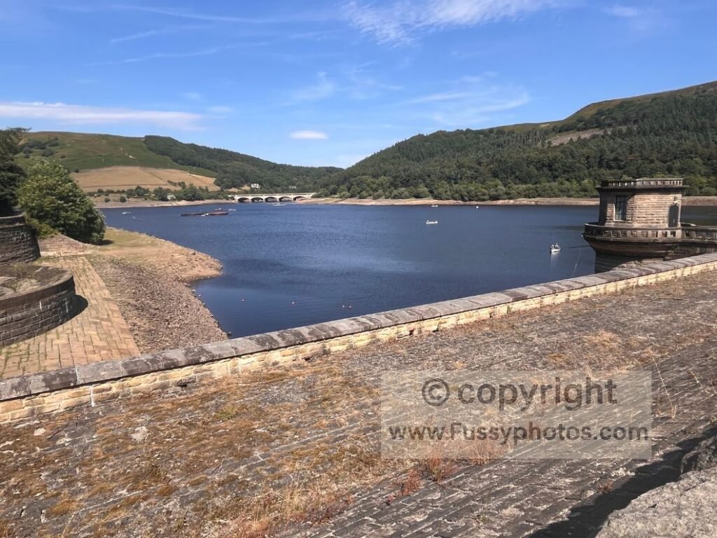
Across the reservoir, paths lead in all directions. You could follow most of them and still complete a loop to Win Hill.
Forestry Plantation Ascent
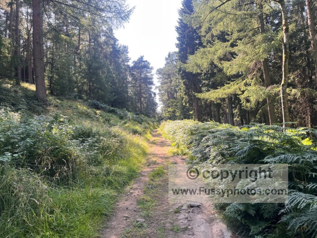
We turned north, briefly following a trail beside the water before taking the first of many side paths upwards through the forest. In wet weather, these tracks are muddy affairs; walking in drought conditions, progress was quick, if hot, humid and dusty.
Views are limited through the plantation. Some trees are packed tightly together, others more dispersed, giving occasional glimpses of Ladybower below. The tracks are signed with symbols rather than fingerposts, and several weren’t shown on my OS map. I’d advise using GPS to keep track of where you are. As a general rule, head uphill: you’ll walk through the trees for about a mile before they end abruptly, bringing you out onto open moorland.
Heather Moorland & Final Ascent to Win Hill
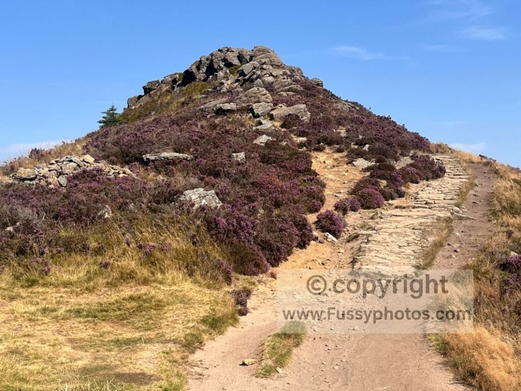
Walking in August, the heather was a glorious purple, giving great colour and contrast to the trees and reservoir below. Another ten minutes of ascent brings you to Win Hill, following a clear line up to the trig point at 463m.
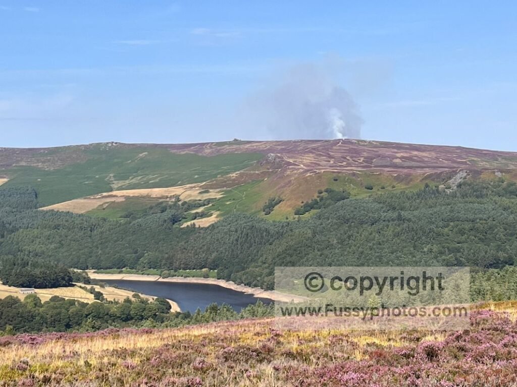
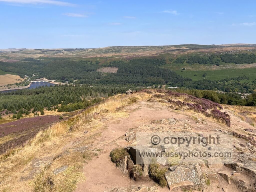
In good visibility, the views are as good as any I’ve seen in the Peak District: panoramic long‑distance vistas of Mam Tor, Castleton and the top of Edale Valley to the west; Alport Dale and Upper Derwent Valley to the north; Bamford Edge and Stanage Edge to the east; and Hathersage just below. Smoke from a wildfire rose into the air — possibly the fire on the Pennine Way near Crowden, possibly a new one in a year of over 1,000 wildfires across England.
Win Hill Route Extensions
From Win Hill, the surrounding Peak District opens up in every direction, giving you multiple options to extend the walk if you want to turn a short outing into a longer day. The summit sits at the centre of several classic routes, making it an easy springboard into neighbouring valleys, ridges and edges.
You can drop west towards Alport Castles, continue into the Vale of Edale for links to Mam Tor, Hollins Cross and Back Tor, or head east towards Bamford Edge and Stanage Edge. It also works well as a short add‑on to my Ladybower & Stanage Edge circular. Whether you prefer gritstone edges, moorland plateaus or long valley traverses, Win Hill gives you options in every direction. For this page, though, I describe only the 3.5‑mile circular in isolation.
Route Variants & Extensions
- Win Hill → Alport Castles — longer, wild, excellent ridge walking
- Win Hill → Vale of Edale — connects to Mam Tor, Hollins Cross, Back Tor
- Win Hill → Bamford Edge — superb gritstone views
- Win Hill → Stanage Edge — easy link from Bamford
- Add Win Hill to the Ladybower & Stanage Edge circular for a longer day
Nearby Peak District Walks for a Longer Day or a Separate Visit
Edale Loop You’ve Probably Never Tried
If you’re planning a longer outing or returning to the area on another day, my Edale Loop You’ve Probably Never Tried is a superb 10‑mile figure‑of‑eight taking in Blackden Brook, Blackden Edge, Golden Clough and the Vale of Edale. It’s a quieter, more adventurous alternative to the classic Mam Tor and Hope routes, and pairs well with a Win Hill day if you’re spending a weekend in the area.
Alport Castles Circular from Ladybower Reservoir
If you prefer dramatic landslip scenery and long ridge views, the Alport Castles Circular starts just a short distance from Ladybower Reservoir and combines reservoir paths, quiet valleys and a spectacular ridge approach. It’s close enough to link into a longer Win Hill day, or to walk separately on another visit.
Stanage Edge Circular Walk
For a contrasting gritstone‑edge day within easy reach of Win Hill, the Stanage Edge Circular Walk offers big views, a crossing of Ladybower Dam, riverside walking near Hathersage, and the famous section of Stanage Edge that includes Robin Hood’s Cave. It’s an excellent separate‑day option if you’re exploring the eastern Peak District or building a longer walk around Win Hill.
Mam Tor Circular Walk (Castleton & the Great Ridge)
For a classic Peak District ridge walk within easy reach of Win Hill, the Mam Tor Circular Walk takes in Castleton, Peveril Castle, Winnats Pass, Mam Tor, Hollins Cross, Back Tor and Lose Hill in a superb 9‑mile loop. It’s an excellent separate‑day option if you want a longer, more dramatic outing nearby, or a contrasting ridge walk to pair with Win Hill on the same day if time and energy allow.
Descent via Winhill Plantation & Parkin Clough
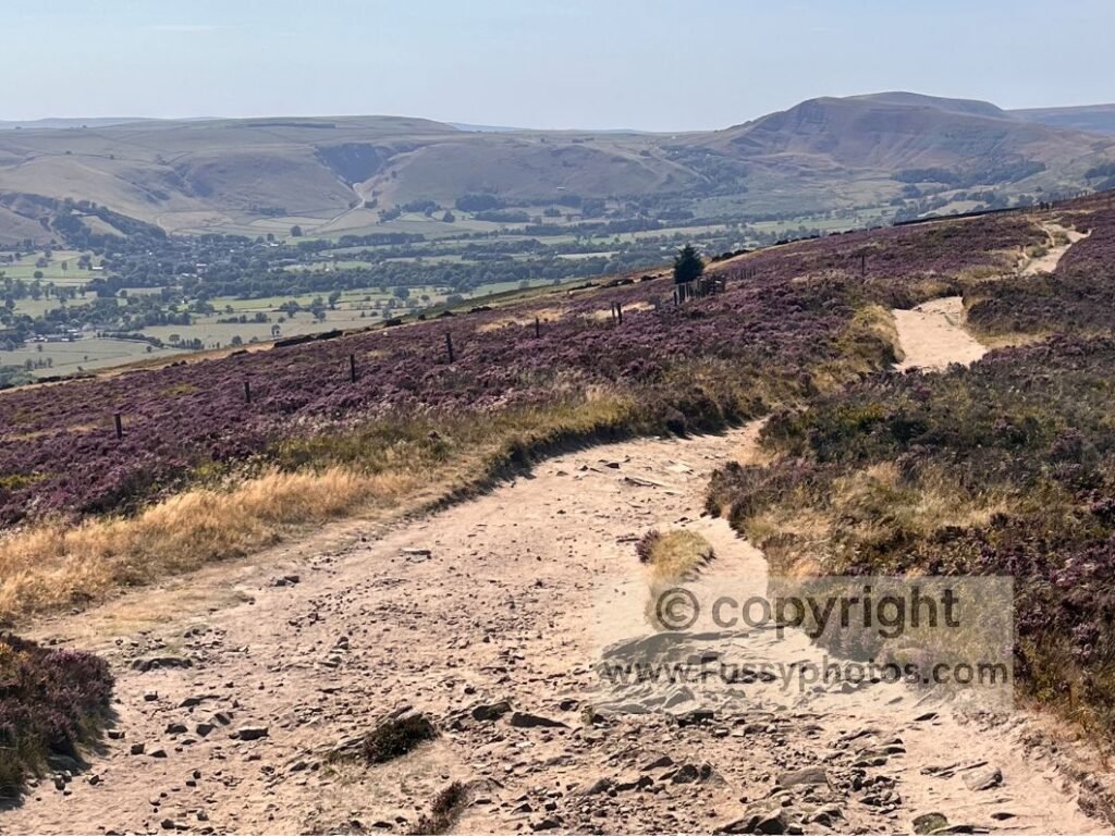
Taking only a short walk, we enjoyed the views before descending via Winhill Plantation and the unusually dry Parkin Clough. If you’re continuing the walk, it’s a great initial route to one of the best viewpoints in the Peak District.
Returning east, the descent is steep and rocky in places, and in wet weather can be slippery. There are gentler alternatives that take a less direct line down towards Ladybower — just don’t get lost.
Food & Facilities Near Ladybower Reservoir
There’s often an ice‑cream van on the A6013 at the reservoir edge, and the Yorkshire Bridge Inn offers food and drink a quarter‑mile south of the water.
FAQs: Win Hill Short Circular
Is the Win Hill circular suitable for beginners?
Yes — it’s short, steep in places, but manageable. The reward‑to‑effort ratio is excellent.
Where’s the best place to park for Win Hill?
On‑street parking along the A6013, or Heatherdene Car Park for paid parking.
How long does the Win Hill circular take?
Most walkers complete the 3.5‑mile loop in 1.5–2 hours, depending on pace and weather.
What can I see from the summit of Win Hill?
Panoramic views of Mam Tor, Castleton, Edale Valley, Alport Dale, Bamford Edge, Stanage Edge, Upper Derwent Valley, and Hathersage.
Explore more of the National Park with my full Peak District Walks Hub — packed with maps, photo‑rich guides, video walkthroughs and routes for every part of the Peak District.