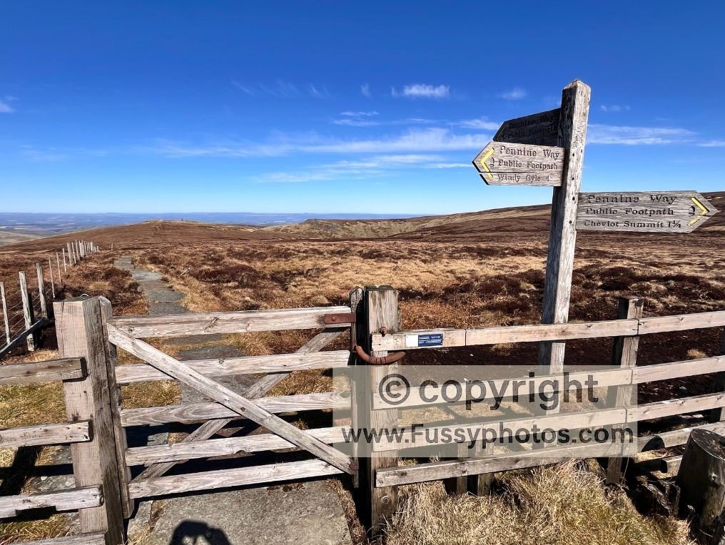
Day 16 on the Pennine Way takes walkers from Windy Gyle to the end of the Pennine Way Kirk Yetholm. Since there are no settlements, amenities or established campgrounds between Bryness and Kirk Yetholm, many, including myself may decide to combine this with day 15 (Day 15 Byrness to Windy Gyle) making for a monsterous 27 mile final slog to the end. Tired, weather-beaten, weary of bogs, heather, moorland and anything remotely with an incline, the question facing Pennine Way walkers 8 miles before the end is: Is the 3-mile Cheviot Summit Detour Worth It?
For some, the Cheviot is a landmark too significant to skip — the third‑highest point on the Pennine Way, a final peak to “complete the set”. For others, pragmatism wins: it’s another climb on a trail full of climbs, and the finish line is finally within reach.
Where the Detour Happens (And Why It Feels Like a Big Decision)
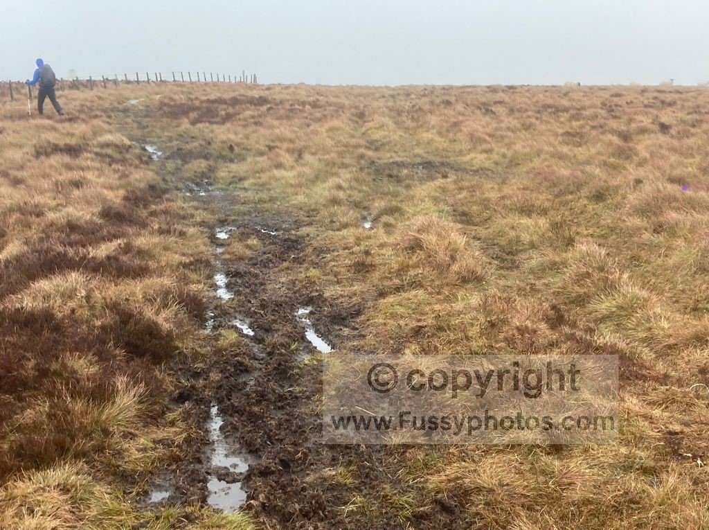
The Cheviot detour appears at a moment when most walkers are running on fumes. If you’ve combined Days 15 and 16, you’ve already crossed miles of moorland, slabs, heather and rolling climbs — including the 190m pull from King’s Seat up to 743m, a section that isn’t paved and often involves a fair amount of bog‑hopping.
By the time you reach the signpost for the summit, your legs are already asking for mercy. It’s a simple choice on paper, but perhaps an emotional one in reality.
This section also appears in my Hardest Parts of the Pennine Way (Ranked), where I explain how weather and fatigue can make the detour feel tougher than expected.
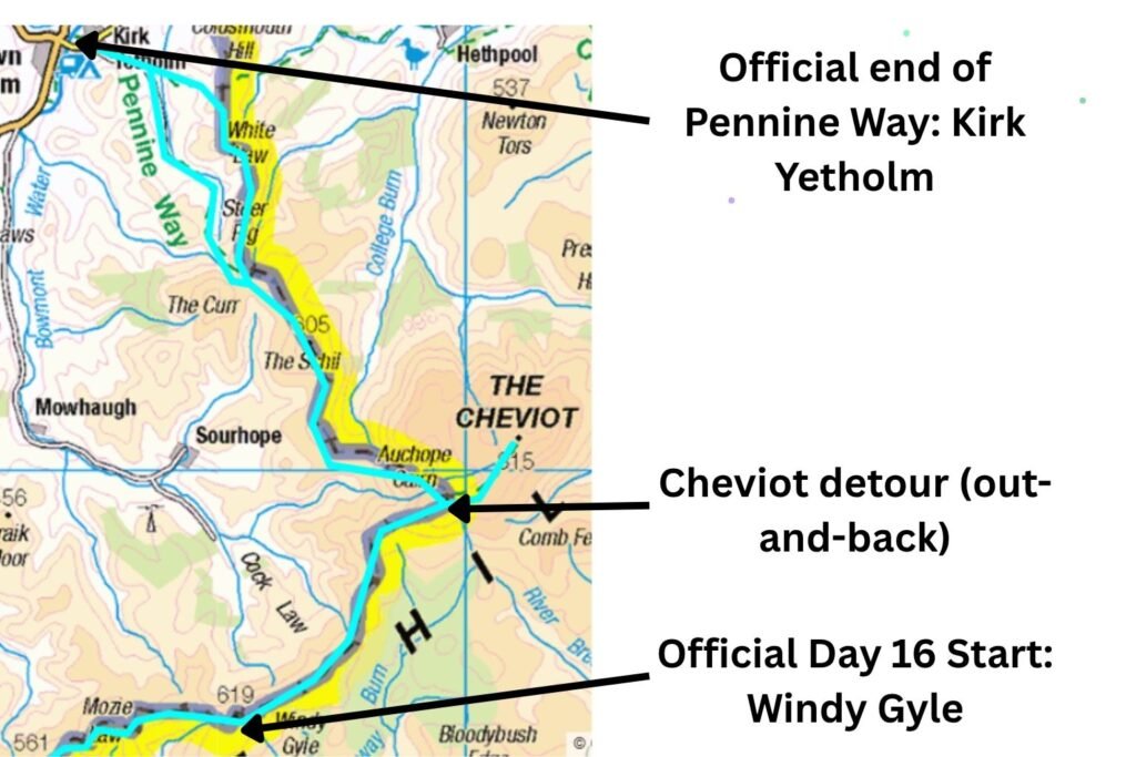
Pennine Way Map: Windy Gyle to Kirk Yetholm With the Cheviot Summit Detour
What the Cheviot Detour Actually Involves
- Distance: 3 miles return
- Additional ascent: around 72m
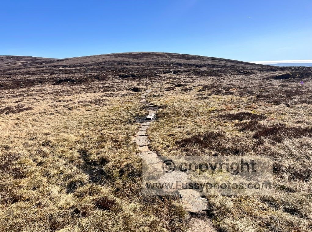
- Terrain: stone slabs the entire way
- Time: roughly 1 hour
- Navigation: straightforward — you can’t go wrong
- Return: you must walk back along the same slabs to rejoin the Pennine Way
It’s not technically difficult. It’s just… extra.
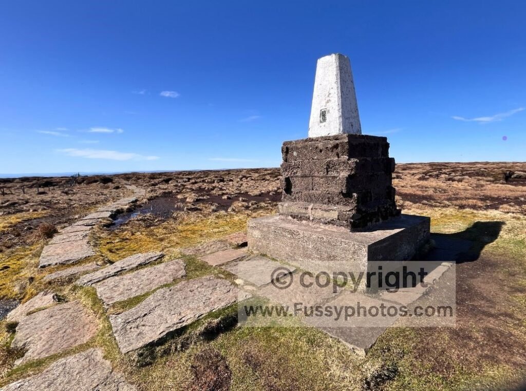
What You’ll See at the Summit
The Cheviot summit is a flat, boggy plateau with a trig point perched on a raised platform. Views are limited, mostly to the southwest, and in poor visibility it becomes a featureless grey expanse. Even in good conditions, it’s not a dramatic summit — certainly not compared to what’s still ahead.
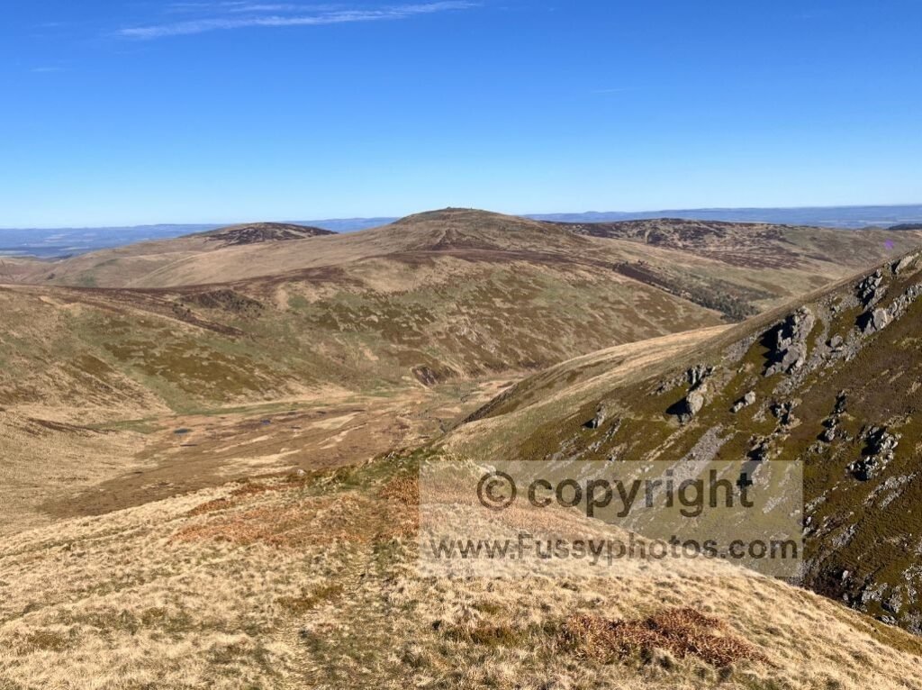
What You’ll Delay by Taking the Detour
This is the part many walkers don’t realise until afterwards: the best views of the northern Pennine Way are still to come.
- Auchope Cairn
- The Schil
- The long descent into the Borders
These are the real highlights of the final day. The Cheviot detour delays reaching them and breaks your momentum at a point where you’re close to the finish and ready for the scenery to open up.
Auchope Cairn and The Schil both feature in my Top 10 Highlights of the Pennine Way, which shows why delaying them changes the feel of the final day.
Who Should Do the Detour?
It’s worth doing if:
- you want to bag every summit
- you’re collecting Nuttalls or Hewitts
- you’re splitting Days 15 and 16
- you care about walking every optional mile
It’s worth skipping if:
- you’re tired
- you’re combining Days 15 and 16
- you’re racing daylight
- you want the best views, not the highest point
- you’re simply ready to finish
To see how this decision plays out in real conditions, my Hadrian’s Wall → Kirk Yetholm trip report shows the moment I reached this junction and chose the low route.
My Honest Take
After 260 miles of bogs, slabs, heather and climbs, the Cheviot detour rarely adds much to the experience. The summit is flat, the views are limited, and the best scenery is still ahead. For most walkers — especially those tackling the long final push — it’s not worth the extra hour. But if reaching every high point matters to you, you may still want to tick it off.
If you’re also weighing up the high‑level traditional route or the low‑level valley finish into Kirk Yetholm, I’ve broken down both options in a separate guide to choosing your final Pennine Way miles: High or Low Finish.
Cheviot Summit Detour: Trail Footage from the Junction to the Top
If you want a sense of what the 1.5‑mile detour actually looks like, this clip shows the slabbed path from the junction all the way to the summit.

Cheviot Summit FAQs:
What are the views like from the Cheviot summit?
Despite its height, the Cheviot’s summit is a triangular, peat‑covered plateau with views that are often limited by the flatness of the top. On a clear day you can see distant uplands — the Lake District, the Pentlands, even the Grampians — but the immediate summit experience is subdued compared to the dramatic ridges ahead.
How was the Cheviot formed?
The Cheviot is the eroded core of an extinct stratovolcano formed over 390 million years ago during the Caledonian orogeny. Millions of years of erosion have reduced it to the broad, peat‑covered plateau that now forms the highest point in Northumberland.
What are the five highest points on the Pennine Way?
The highest points on the Pennine Way are Cross Fell (893m), Great Dun Fell (848m), Little Dun Fell (842m), The Cheviot (815m), and Knock Fell (794m). These form the major high‑level sections of the trail, with only The Cheviot reached via an optional out‑and‑back detour.
How far is Day 16 of the Pennine Way with the Cheviot detour?
The official Day 16 route from Windy Gyle to Kirk Yetholm is 13 miles (21 km), but adding the Cheviot summit detour increases the stage to roughly 16 miles (26 km). Walkers who combine Days 15 and 16 experience this as a much longer day, with the detour sitting late in an already demanding push to the finish.
Explore More Pennine Way Guides
For more planning advice, stage guides and practical tips, head back to my Pennine Way hub.