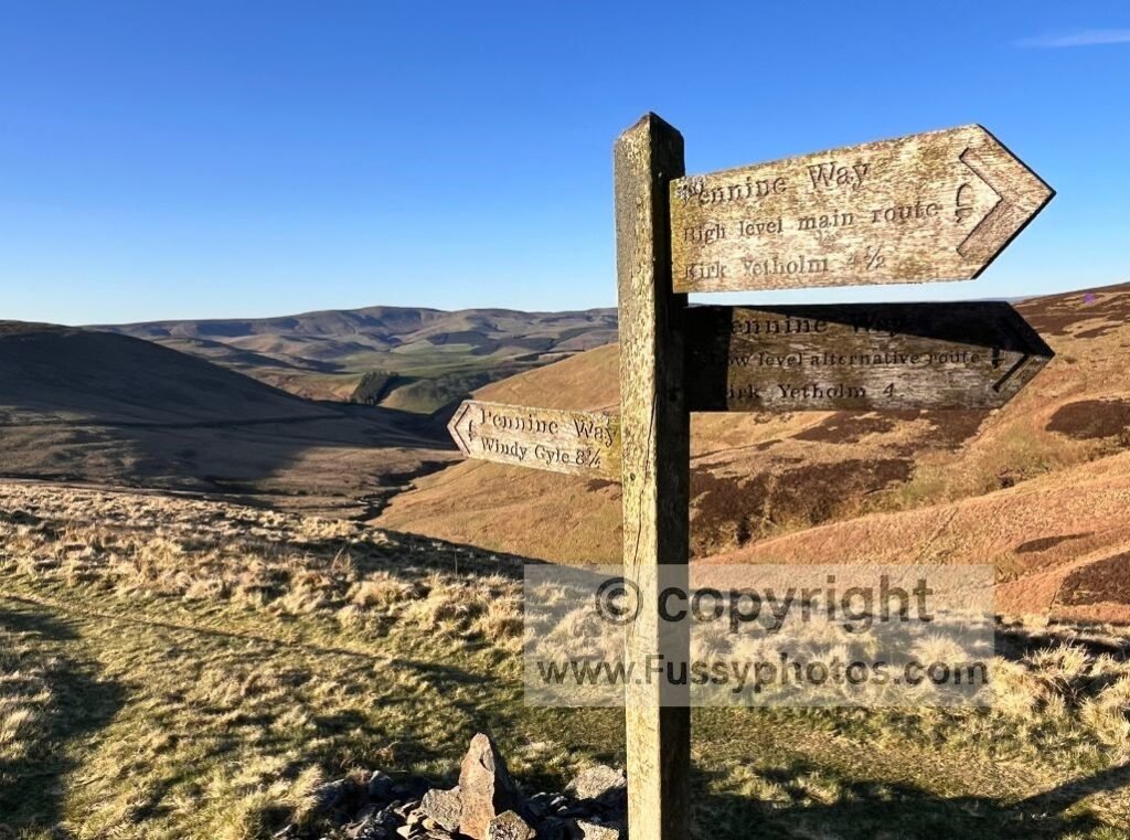
With just 4.25 miles remaining to the warmth and comfort of Kirk Yetholm, Pennine Way walkers face one last decision:
Should you finish via the traditional high‑level route over the Cheviots, or take the low‑level alternative through the valley?
It’s a choice many hikers don’t expect — especially after 260+ miles — and it’s easy to default to “whichever is quickest”. I did exactly that on my thru‑hike, unaware the junction even existed until I reached it. But the two routes offer very different final experiences.
I later returned in better weather to walk a two‑day loop of the final section via the Cheviot summit, this time taking the high‑level route I skipped the first time. Experiencing both options made it clear how different the final miles can feel.
This guide lays out the facts clearly so you can choose the finish that suits your day, your legs, and the weather.
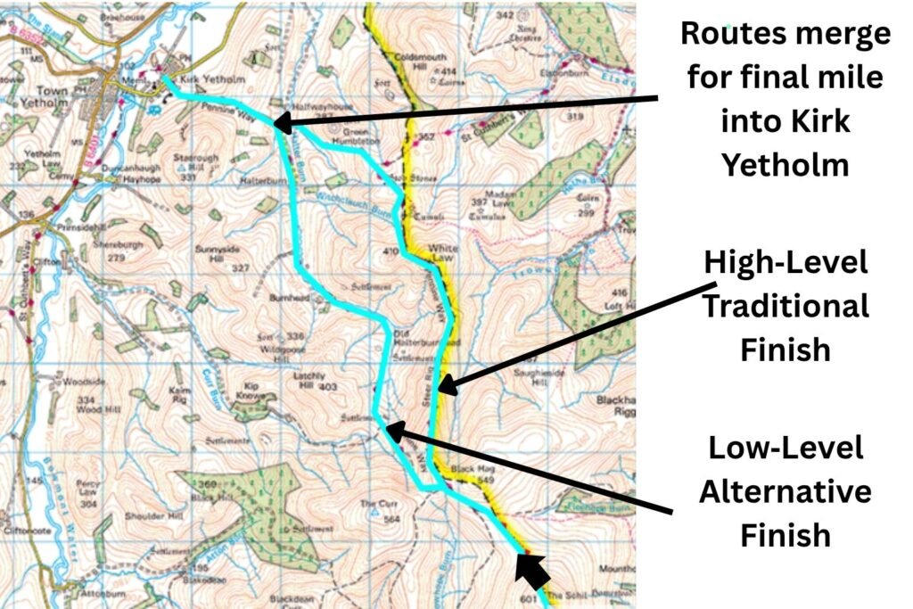
High‑Level vs Low‑Level Finish: Route Map for the Final Miles to Kirk Yetholm
Which Pennine Way Finish Is Best to Kirk Yetholm?
Here’s a quick breakdown of the two final routes into Kirk Yetholm, so you can choose the finish that best suits your day, your legs, and the weather

Overview: How Different Are the Two Routes?
- Distance: Both routes are almost identical at 4.25 miles to Kirk Yetholm.
- Terrain: The high‑level route stays on the ridge, hugging the England–Scotland border. The low‑level route drops into the valley before rejoining the road into Kirk Yetholm.
- Navigation: Both are well‑waymarked and straightforward.
- Time: Similar in good conditions, but the low‑level route can be faster in bad weather.
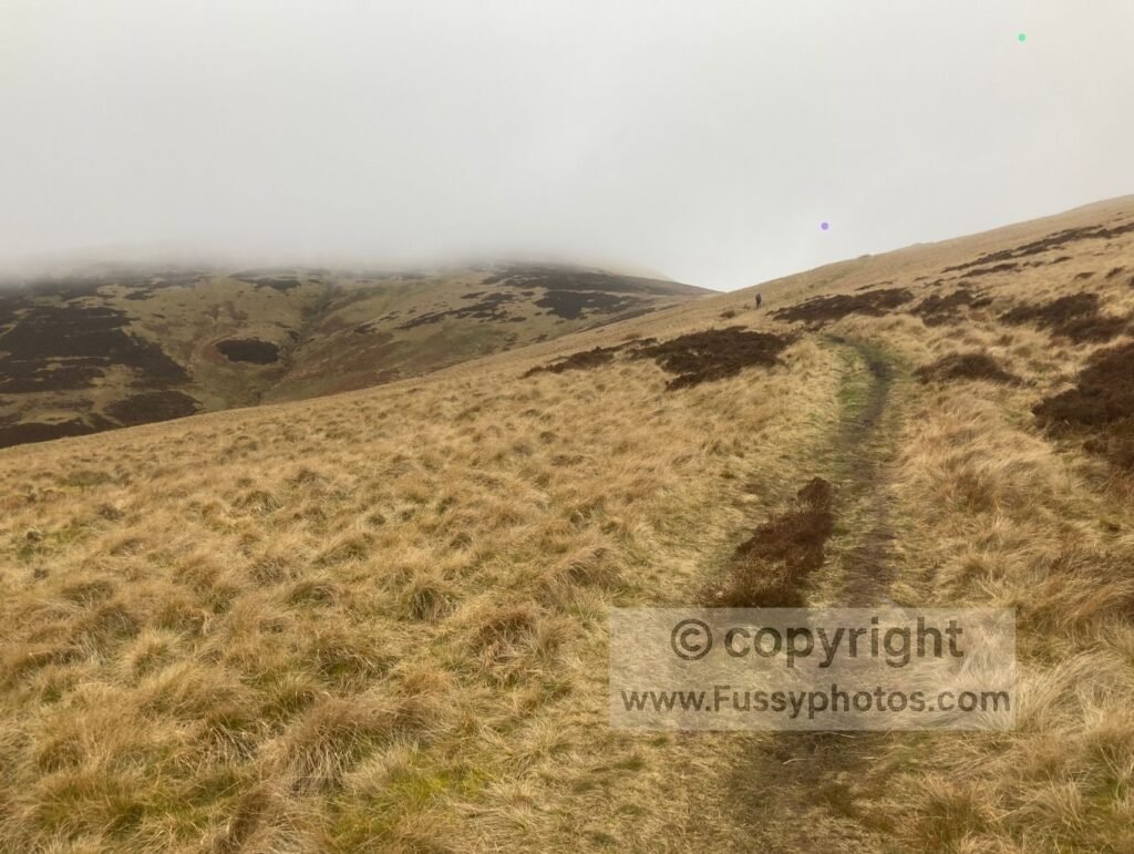
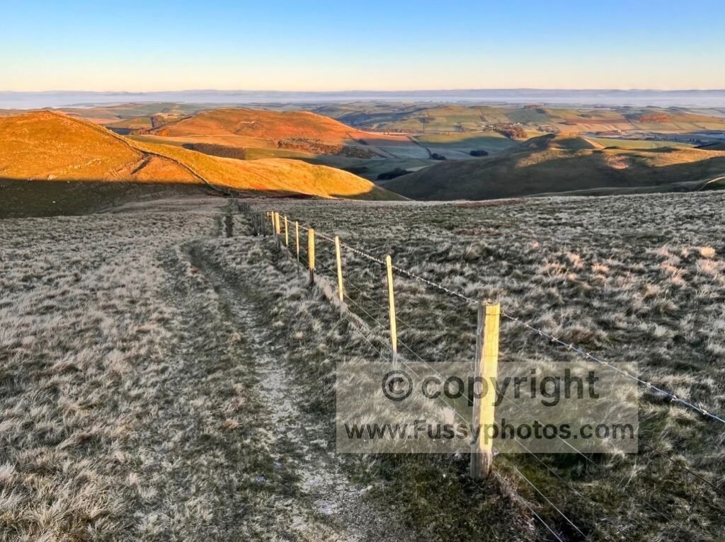
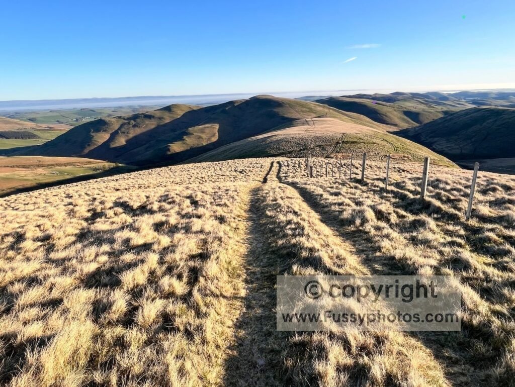
High‑Level Traditional Finish
Elevation & Terrain
- Starts at roughly 500m
- Rises gently to 530m
- Descends gradually to 410m as it passes White Law and White Nick
- Stays on the ridge with wide, open views
This is the classic Pennine Way ending — airy, scenic, and a fitting finale if visibility is good.
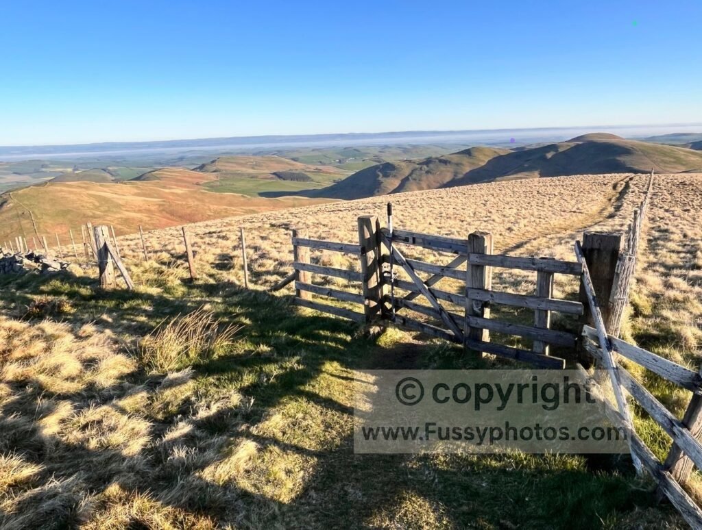
Views
- Outstanding in clear weather
- Panoramic views across the Cheviots, the Scottish Borders, and back towards England
- The sense of finishing “on the high ground” feels symbolic after 268 miles
Pros
- Some of the best views of the entire Cheviot section
- Feels like a true ridge‑top finish
- Less road walking (only the final mile into Kirk Yetholm)
Cons
- Fully exposed to wind, rain, and cloud
- Not ideal if you’re exhausted and just want the quickest descent
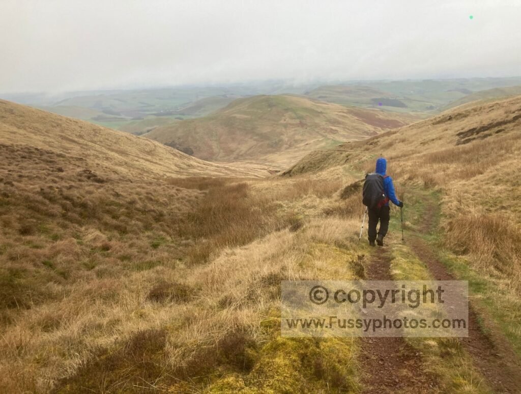
Low‑Level Alternative Finish
Elevation & Terrain
- Drops quickly from 500m to around 170m
- Follows the valley floor
- Rejoins the road for 1.7 miles of tarmac walking into Kirk Yetholm
- 0.75 miles more road walking than the high‑level route
Views
- Good valley scenery, but not the sweeping panoramas of the ridge
- More enclosed, more sheltered
Pros
- Faster and easier in poor conditions
- Gets you out of the wind and cloud quickly
- Ideal if you’re cold, tired, or racing daylight
Cons
- More road walking
- Less dramatic scenery
- Doesn’t feel as “iconic” as the ridge finish
Which Route Should You Choose?
Choose the High‑Level Route If:
- The weather is clear or improving
- You want the classic Pennine Way finish
- You enjoy ridge walking and big views
- You want to avoid extra road walking
- You’re not in a rush and want a memorable finale
Choose the Low‑Level Route If:
- Weather is poor (wind, rain, low cloud, winter conditions)
- You’re exhausted and want the quickest, easiest miles
- You prefer sheltered terrain
- You don’t mind extra road walking
- Visibility is too low to justify the ridge
Want the full story of what the low‑level finish feels like in real conditions? Read my Hadrian’s Wall to Kirk Yetholm trip report.
Quick Comparison Table
| Feature | High‑Level Finish | Low‑Level Finish |
|---|---|---|
| Distance | 4.25 miles | 4.25 miles |
| Elevation | 500m → 530m → 410m | 500m → 170m |
| Exposure | High | Low |
| Views | Panoramic | Valley‑level |
| Road Walking | ~1 mile | ~1.7 miles |
| Best For | Good weather, scenic finish | Bad weather, tired legs |
FAQs
Where does the Pennine Way finish?
The Pennine Way finishes in the village of Kirk Yetholm in the Scottish Borders. Both the high‑level and low‑level routes merge for the final mile of road walking into the village.
Where is the official end of the Pennine Way?
The official end point is the green in Kirk Yetholm, marked by a stone and plaque outside the Border Hotel, where many walkers sign the register and celebrate completing the trail.
What is the difference between the high‑level and low‑level finish?
The high‑level route stays on the ridge with wide, open views across the Cheviots, while the low‑level route drops into the valley for a more sheltered approach. Both are roughly the same distance.
Which route is quicker — high‑level or low‑level?
Both routes are around 4.25 miles, but the low‑level option can be quicker in poor weather because it avoids exposed terrain and descends to easier ground sooner.
Which finish is better for views?
The high‑level finish offers the best panoramas, with sweeping views from White Law and across the Scottish Borders. The low‑level route has pleasant valley scenery but lacks the ridge‑top drama.
All Pennine Way Routes and Resources
Browse the full collection of Pennine Way guides — from day walks to thru‑hike planning and detailed route breakdowns.