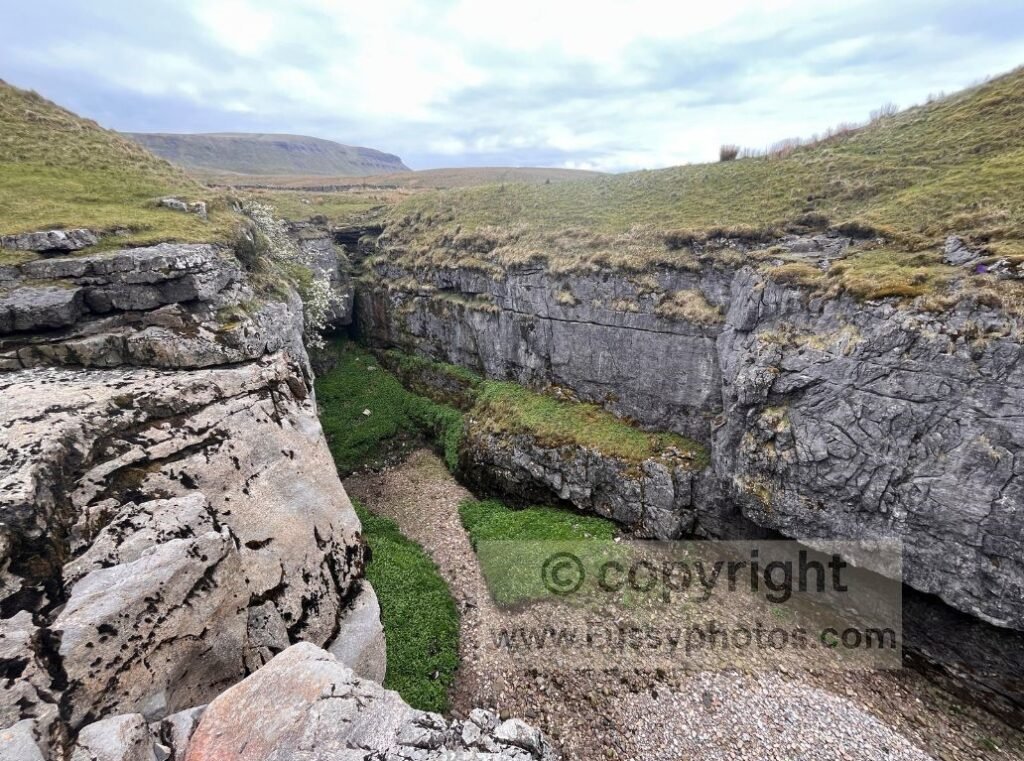
Standing 694m tall, Pen y Ghent is one of the highest peaks on the Pennine Way and a major landmark on the Yorkshire Three Peaks Challenge. This circular walk from Horton in Ribblesdale joins the Pennine Way on its southern slope, follows it to the summit, and returns to Horton with a short detour to Hull Pot — a collapsed cavern with no roof, a waterfall in wet weather, and a resurgence point where underground water re‑emerges at the surface.
At 5.7 miles, the route is short enough to be enjoyable while still offering the long‑distance panoramic views that make Pen y Ghent so iconic. Parking is available in the village (on‑street and in car parks), though it can be busy and paid at peak times.
If you’re walking the long‑distance trail, my Days 6- 9 Pennine Way report covers this section in detail, including the climb over Pen y Ghent on Day 6.
Key Facts: Pen y Ghent Circular
- Distance: 5.7 miles
- Start/Finish: Horton in Ribblesdale
- Highest Point: Pen y Ghent (694m)
- Routes Used: Pennine Way, Yorkshire Three Peaks paths
- Difficulty: Moderate; short steep sections and light scrambling
- Highlights: Summit views, Hull Pot, classic Pennine scenery
- Best For: Half‑day walks, Three Peaks tasters, photography
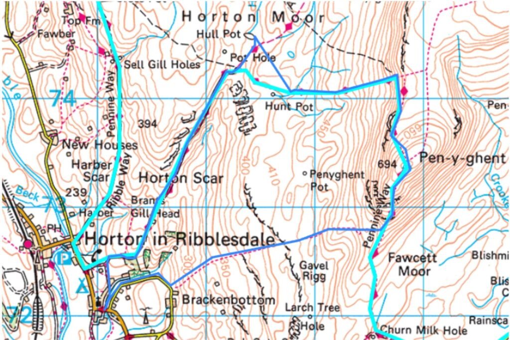
Trail Map
Choosing Your Direction
If you walk anticlockwise (as I did), you follow the Three Peaks crowd and ascend the steeper southern slope of Pen y Ghent. Walking clockwise gives you a more gradual ascent via the western slope and a steeper descent.
Leaving Horton in Ribblesdale
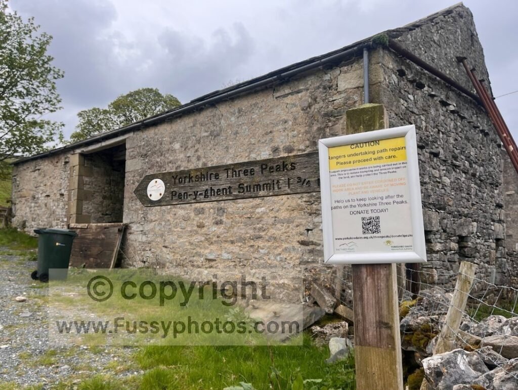
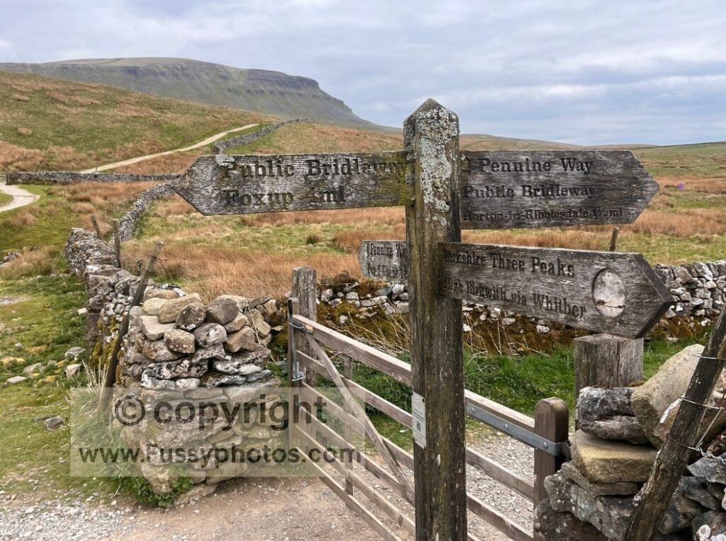
Heading anticlockwise, the walk begins with half a mile of quiet road walking until the footpaths join the road and veer left towards the mountain. Signage is clear, with Yorkshire Three Peaks and Pen y Ghent summit markers pointing the way.
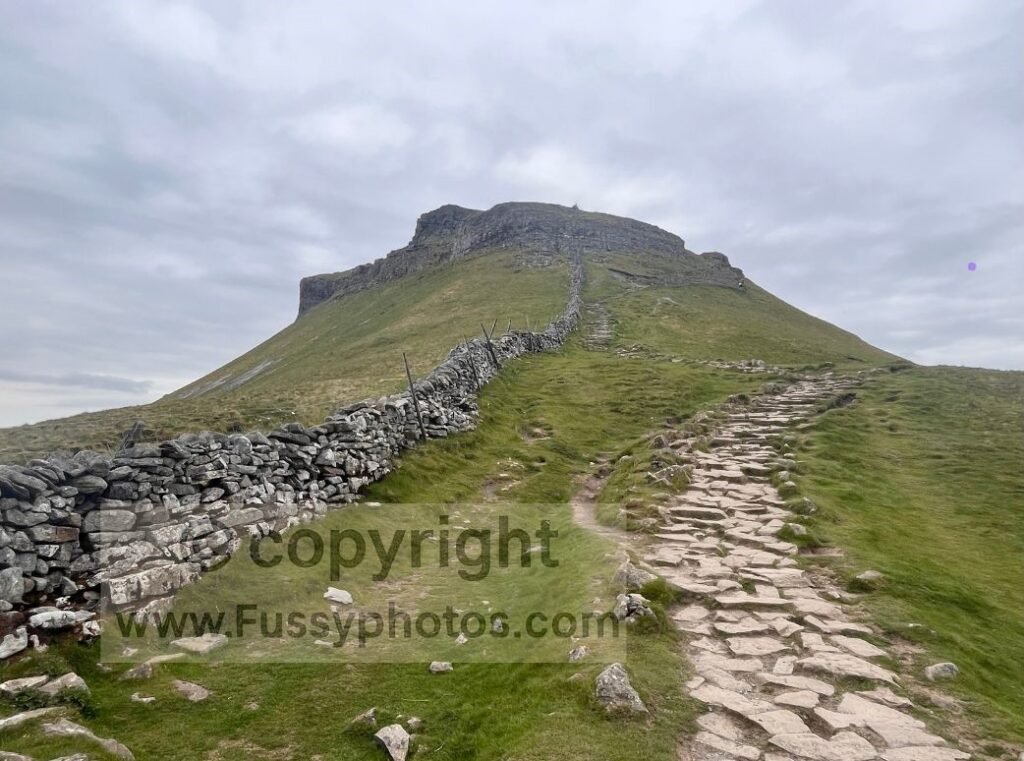
The Steep Southern Ascent
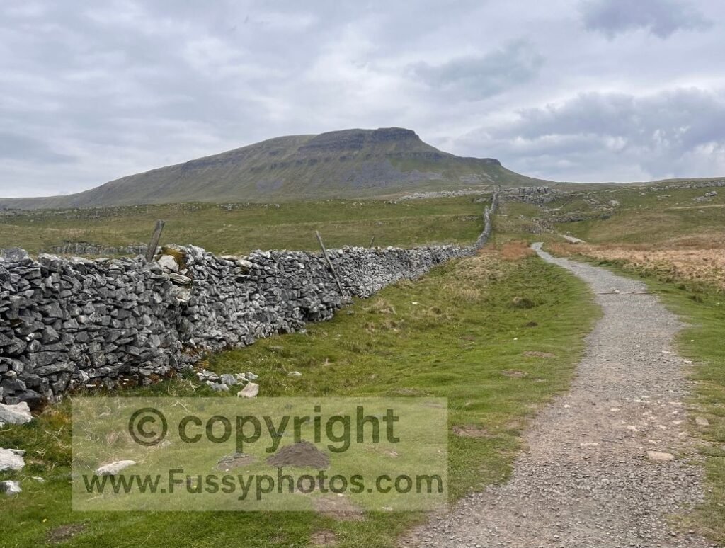
The climb begins with stone steps built from paving slabs — a common feature as the National Park works to reduce erosion from the estimated 200,000 Three Peaks walkers each year. Between the steps, a gravel path heads straight up the slope with no switchbacks.
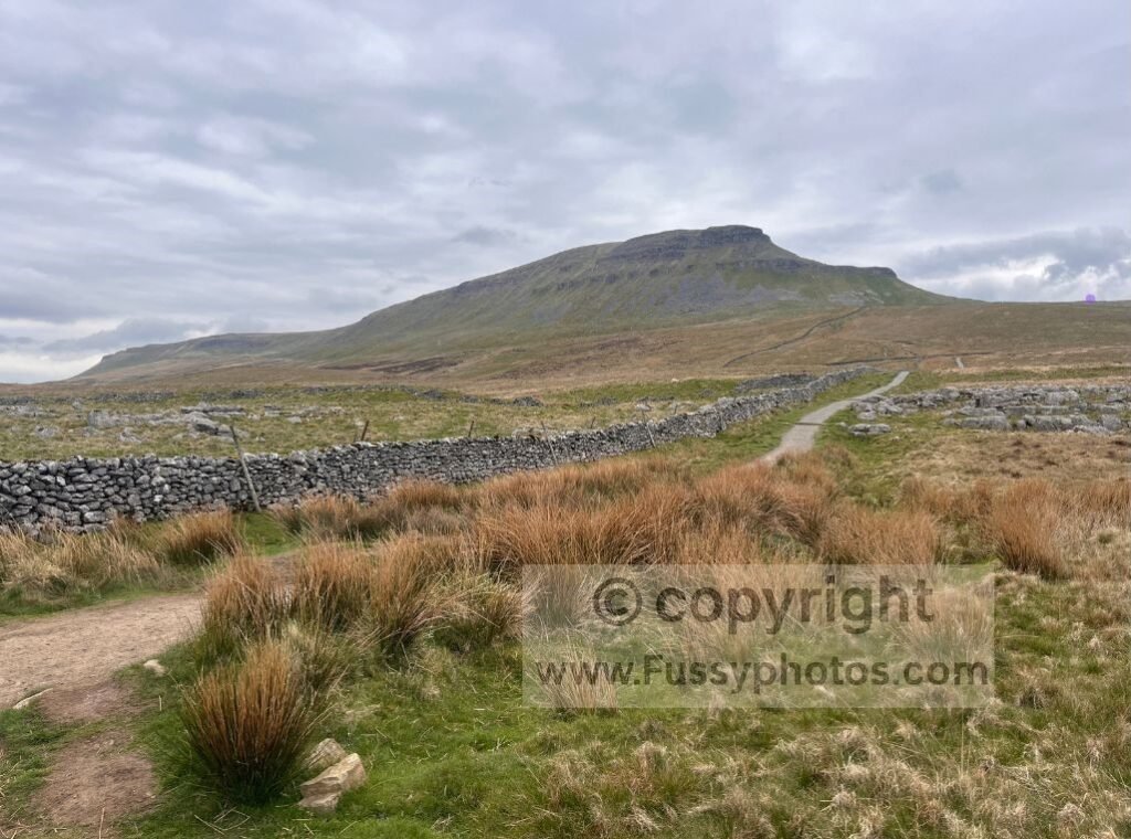
Initially, the best views are behind you, but soon Pen y Ghent appears ahead, showing its asymmetric western face. With no surrounding peaks dominating the skyline, the focus is entirely on the mountain.
After 1.2 miles, you reach the junction with the Pennine Way at around 530m, leaving roughly 167m to the summit.
Joining the Pennine Way
Turning left, the ascent steepens.
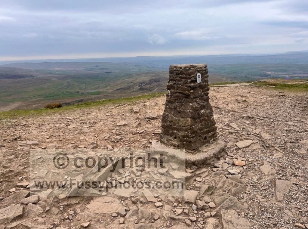
More stone steps lead northwards, opening new views east across the surrounding moorland. A short section of easy Class 1 scrambling brings you to a small plateau at around 660m.
From here, the route is straightforward: follow the stone slabs to the relatively flat summit, where there’s a bench and usually a cluster of Three Peaks walkers taking photos before continuing their challenge.
Descending the Western Slope
The western descent is arguably more interesting, though slightly harder on the knees. Stone paving slabs form steps down the slope as the trail heads north, offering views of the western edge before turning sharply west.
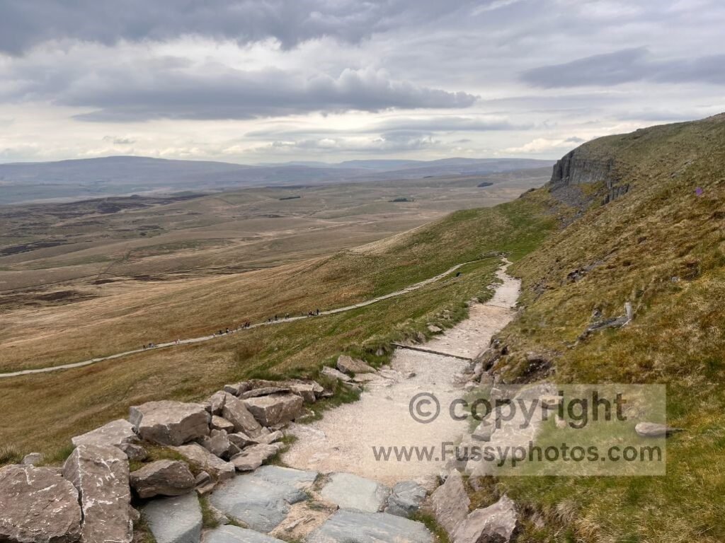
Around 450m, the gradient eases and the walking becomes more relaxed.
Detour to Hull Pot
Hull Pot is a worthwhile five‑minute detour. I followed a faint trail visible on my GPS but not on the OS map. If you prefer a clearer route, continue further down the Pennine Way to the next signed junction — this is the path I used to rejoin the trail after visiting Hull Pot.
Hull Pot is noticeably quieter than the Pennine Way, likely because fewer people know it’s so close to the main route.
If you want to see the same landscape with the waterfall in full flow, it’s shown on my Top 10 Highlights of the Pennine Way (Ranked) page.
Returning to Horton
Continuing west, make sure you follow the Pennine Way signs and avoid the Three Peaks crowd unless you want to add 19 miles to your day.
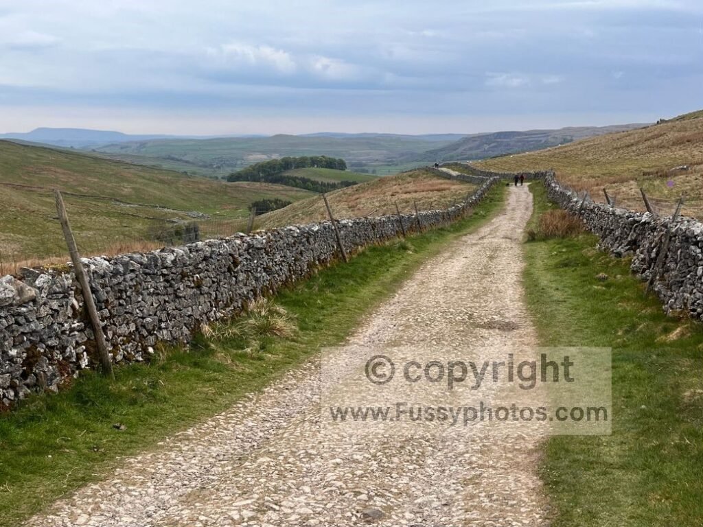
The descent to Horton in Ribblesdale is pleasant, with Pen y Ghent rising behind you and Horton Scar ahead and slightly below, providing a striking focal point as the gravel track leads you back into the village.
If you’d prefer a beginner‑friendly two‑day version of this landscape, my Beginner Weekend in the Dales covers Malham, Malham Tarn, Pen y Ghent and Horton‑in‑Ribblesdale with straightforward logistics and train access.
YouTube Video: Pen y Ghent Circular Walk

Pen y Ghent Circular Walk: FAQs
How long does Pen‑y‑ghent take to walk?
Most people complete the Pen y Ghent circular from Horton in Ribblesdale in 2–3 hours, depending on pace and conditions. The route is 5.7 miles, with a steep ascent and a steady descent, making it a manageable half‑day walk for most hikers.
Is Pen‑y‑ghent a hard walk?
The Pen y Ghent circular is moderate, with one short, steep climb and a small amount of easy scrambling near the top. Good footwear and steady footing are all that’s needed, and navigation is straightforward thanks to clear signage.
Why does Pen‑y‑ghent have a Welsh name?
Pen y Ghent reflects the region’s early Cumbric and Old Welsh linguistic influence, long before modern county borders existed.
Where is the best place to start the Pen‑y‑ghent walk?
The most popular and practical starting point is Horton in Ribblesdale, where there is parking, a train station and direct access to the Pennine Way. Starting here gives you the simplest loop, including the optional detour to Hull Pot.
What is Hull Pot?
Hull Pot is a huge collapsed cavern on the western side of Pen y Ghent, formed when the roof of an underground chamber fell in. In wet weather a waterfall pours into it, and a stream resurges from the base after flowing underground.
Explore More Pennine Way Routes
Want a contrasting Pennine Way‑adjacent walk? This Swaledale circular offers views, waterfalls and a relaxed valley return.
For a bigger limestone landscape, try my Malham circular — Gordale Scar, Janet’s Foss, Malham Cove and a high, quiet Pennine Way stretch
Head back to the hub for every Pennine Way stage, plus linked circular walks and detailed guides to key sections like Pen y Ghent.