Swaledale is one of the northernmost valleys in the Yorkshire Dales, known for its steep green hillsides, drystone walls and the winding River Swale. It sits close to the halfway point of both the Pennine Way and the Coast to Coast walk.
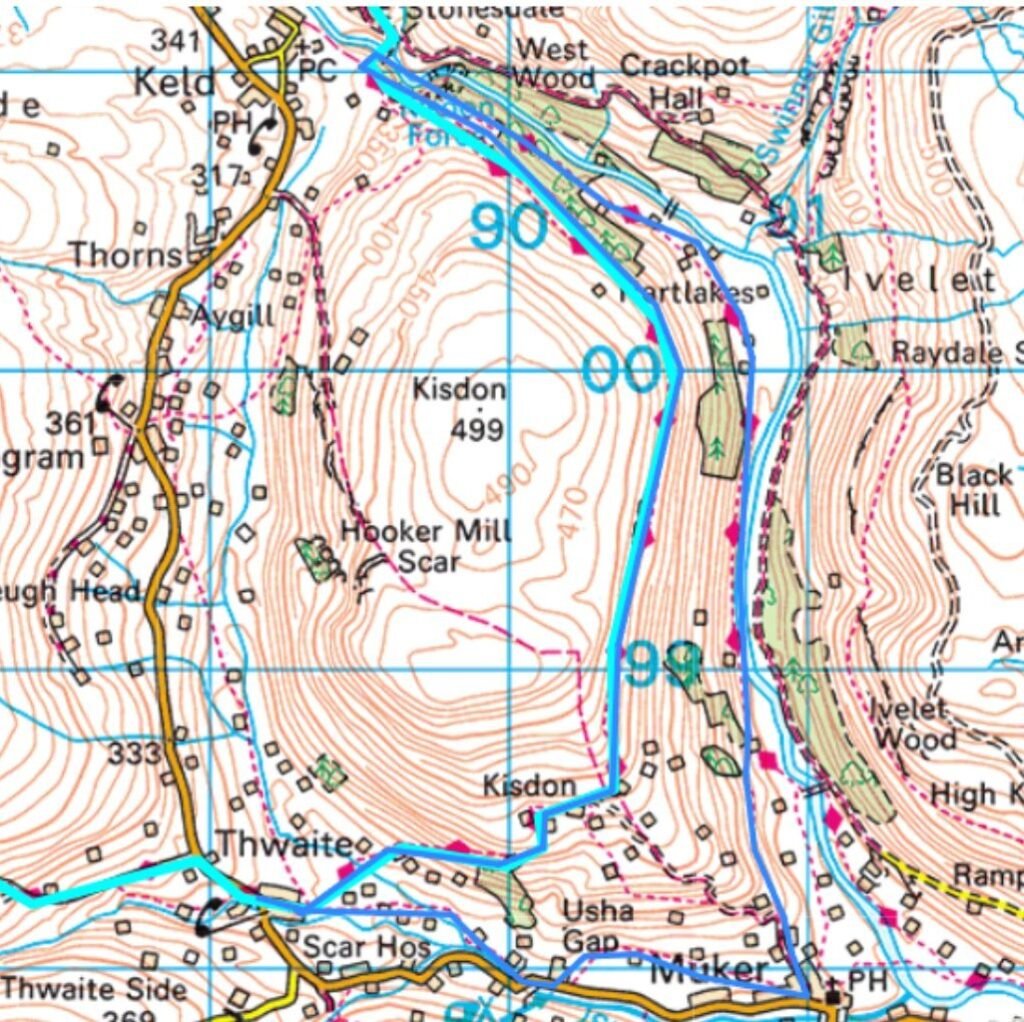
On my own Pennine Way thru‑hike I was impressed by the valley but didn’t have the time to explore it properly — so I returned to design a simple 6.5‑mile circular route using the steep western slope, the Pennine Way between Thwaite and Keld, and a return via the valley trail through Muker.
The loop can easily be extended: you could return on the Coast to Coast path on the opposite side of the River Swale towards Gunnerside, or take a more elevated circular option east via Melbecks Moor after Keld. For most walkers, though, this 6.5‑mile circuit is more than enough — combining elevated views of Swaledale, Kisdon Force, and peaceful riverside walking.
Key Facts
- Distance: 6.5 miles (extendable via Gunnerside or Melbecks Moor)
- Start/Finish: Thwaite
- Terrain: Steep hillside paths, rocky contouring sections, riverside trails, grassy valley floors
- Routes Used: Pennine Way, Wainwright’s Pennine Journey, optional Coast to Coast return
- Highlights: Elevated views of Swaledale, Kisdon Force, Swinner Gill, River Swale
- Difficulty: Moderate — steep initial ascent, rocky contouring, easy valley return
- Facilities: Tearoom and pub in Thwaite; cafés and facilities in Keld and Muker
Swaledale Circular Route Map
Route Overview
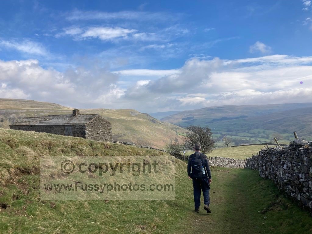
Thwaite to the Western Valley Slope
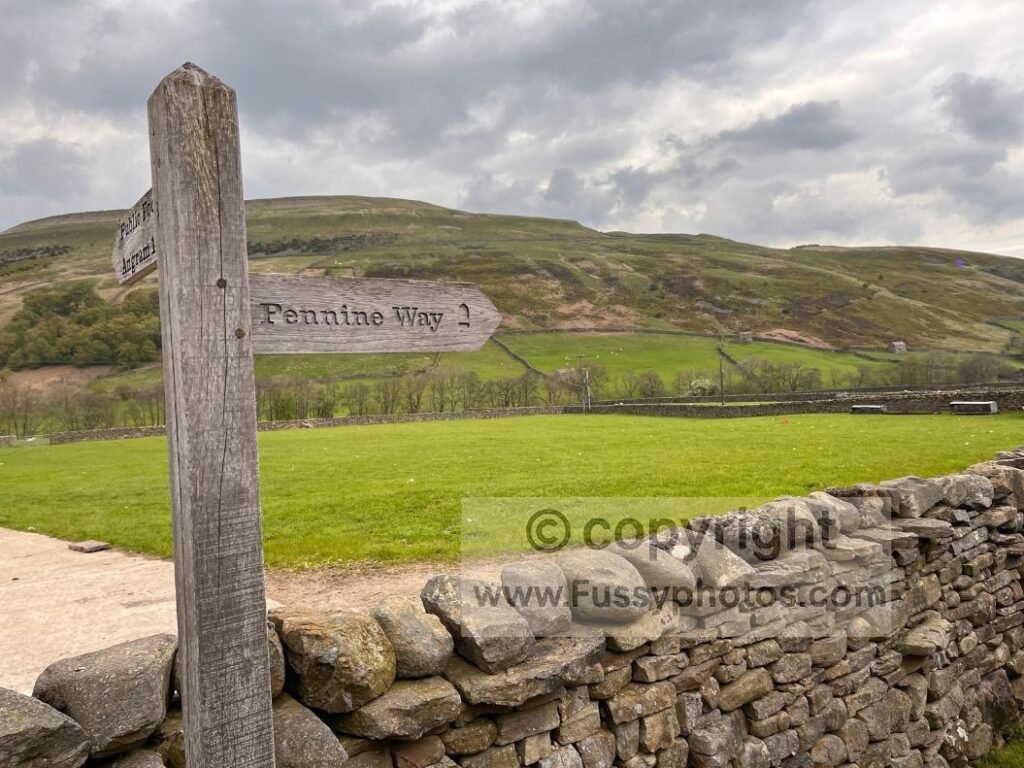
I began in Thwaite, a small village with a tearoom and a pub, heading east into Swaledale. Route‑finding at first requires attention — I drifted off the Pennine Way and followed a farmer’s trail for a quarter of a mile towards Muker before realising I’d missed the left turn up the steep hillside.
The ascent is sharp and quick, taking you to around 400 metres with superb views west towards Great Shunner Fell and south across the drystone walls of Swaledale.
Contouring North: Swinner Gill and the Best Views of Swaledale
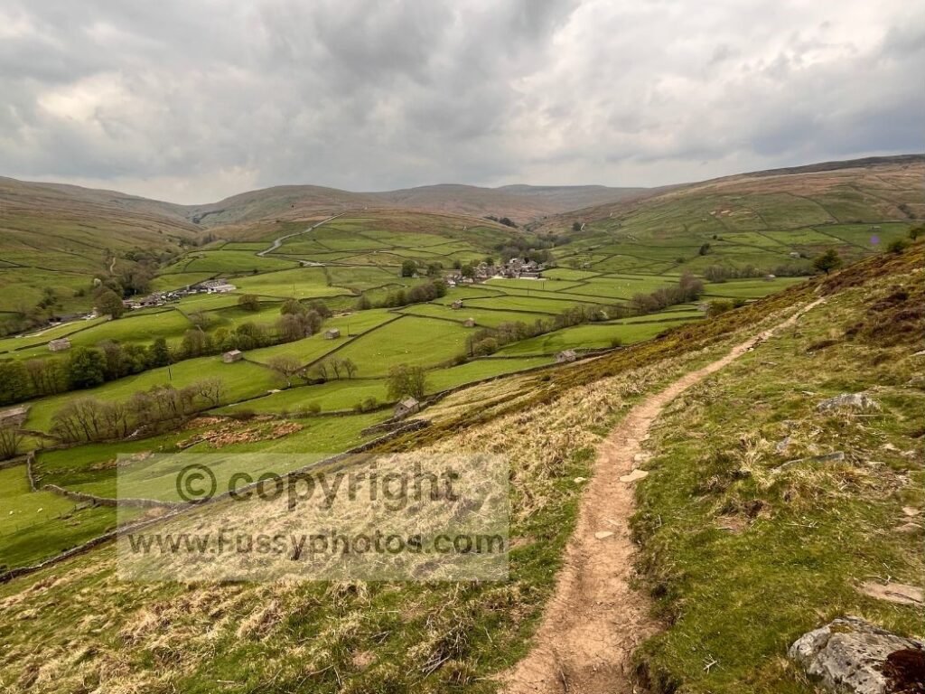
Once the Pennine Way turns north, the best views of Swaledale, the River Swale, and the alternative Coast to Coast line appear.
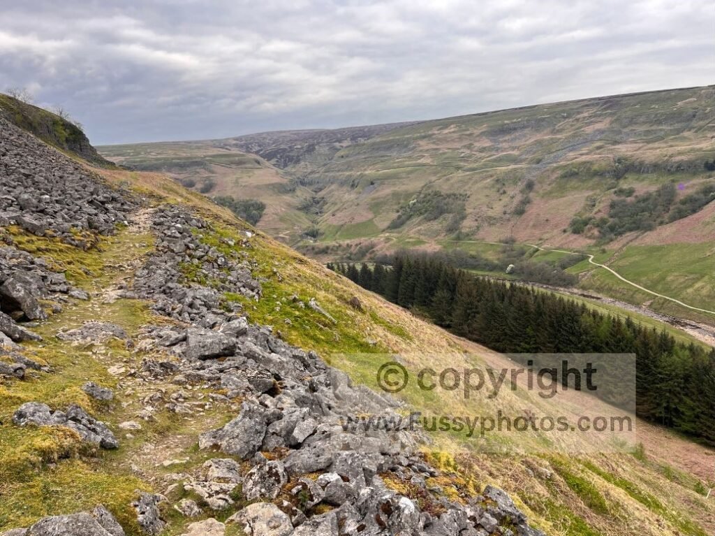
Footing needs care: the trail contours awkwardly along a sloping, rocky path where brisk walking isn’t really possible. Unless you’re in a hurry, there are plenty of places to pause and enjoy the views and the sound of the river far below.
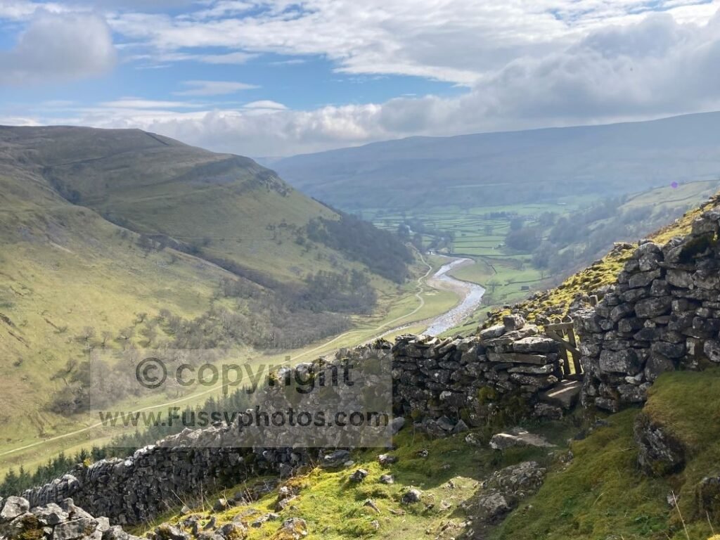
The rocky contouring section lasts for around 1.8 miles. My favourite viewpoint is Swinner Gill, a dramatic V‑shaped valley carved by water pouring off the surrounding moorland into the River Swale.
Swaledale also features in my Top 10 Highlights of the Pennine Way (Ranked), which shows why this valley stands out even on a trail full of big scenery.
Eventually the Pennine Way drops to meet the valley trail.
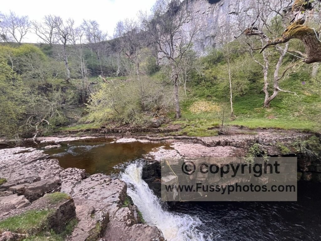
Kisdon Force and Optional Extension to Keld
A short detour west — no more than five minutes — leads to Kisdon Force, a relatively small waterfall with an impressively large plunge pool and gorge. I found a seat‑shaped rock here and took a break.
If you have time, Keld is only half a mile further, with more cafés and even a campsite. East Gill Force, another waterfall, is also close by. If you reach this point, I’d recommend returning southeast to Muker via the Coast to Coast path — I didn’t, having been delayed earlier in the day by two major road closures.
Returning via Wainwright’s Pennine Journey and Muker
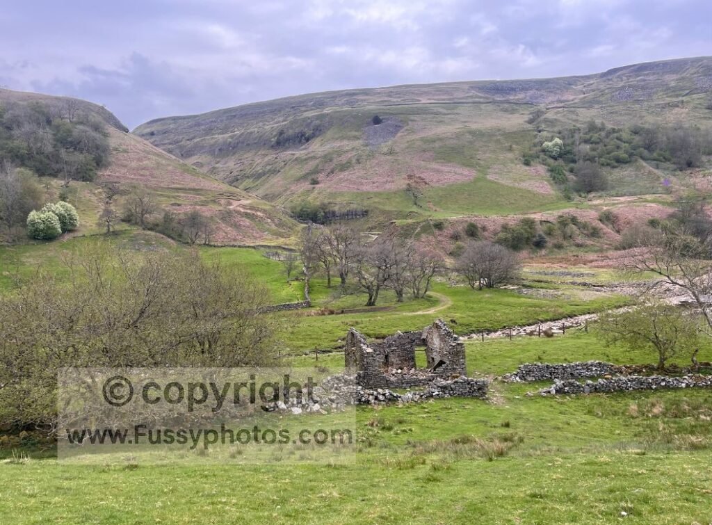
The more direct return follows Wainwright’s Pennine Journey, initially lower in the valley through wide grassy fields and old farm ruins.
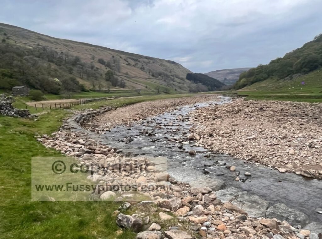
The trail then turns south, soon hugging the River Swale. The alternative Coast to Coast path is only about 50 metres away on the opposite bank, and from this point the two routes feel very similar — although the Coast to Coast is wider and more maintained. I found the grassy valley trail perfectly easy underfoot.
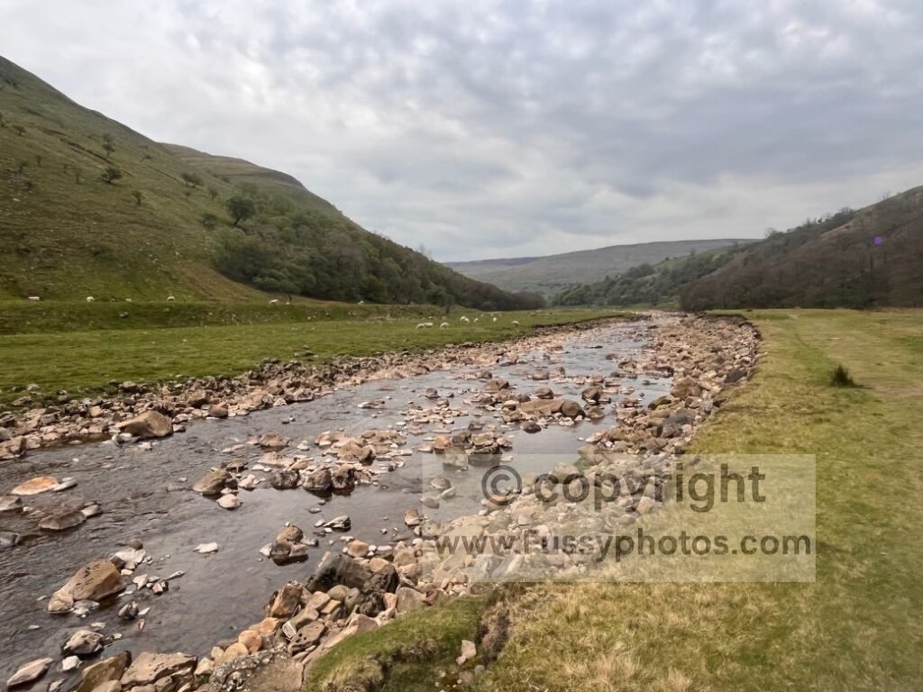
The River Swale was dotted with large exposed rocks, presumably left visible by a period of lower discharge. It made for a beautiful three‑quarters of a mile of riverside walking, reminding me of some of the pristine rivers I’ve seen in America. Birds, flat terrain and the sound of the river gave the whole stretch a relaxing feel. If I hadn’t lost so much time earlier in the day, I’d have happily continued as far as Gunnerside.
From Muker, a right turn leads over a mile back to Thwaite — no longer beside the river, but still offering excellent views and those drystone walls that make the Yorkshire Dales so distinctive.
Watch the Route (YouTube Guide)
A clear, route‑focused walkthrough of the Swaledale, Kisdon Force and River Swale circuit for walkers exploring this part of the Pennine Way.

FAQs About Swaledale, Thwaite, Keld and This Pennine Way Circular
Which dale is Keld in?
Keld sits in the upper reaches of Swaledale, one of the northernmost valleys in the Yorkshire Dales. It’s where the Pennine Way and the Coast to Coast cross, making it a popular point for long‑distance walkers.
Is Keld worth visiting?
Yes — Keld is a compact but scenic hamlet with waterfalls, riverside paths and easy access to both the Pennine Way and the Coast to Coast. Walkers often stop here for East Gill Force, Kisdon Force, and the peaceful valley setting before continuing towards Thwaite or Tan Hill.
Where is Keld Waterfall?
“Keld Waterfall” usually refers to Kisdon Force, a short detour west of Keld on the valley trail. East Gill Force is even closer — just a few minutes’ walk from the village centre.
How difficult is the section between Thwaite and Keld?
The Pennine Way between Thwaite and Keld is rocky, narrow and angled across the hillside, requiring steady footing and attention to wayfinding. In poor weather it can feel exposed, but in good conditions it offers some of the best elevated views of Swaledale.
Is navigation tricky on this circular route?
Only in the early stages. Leaving Thwaite, it’s easy to drift off the Pennine Way if you miss the left turn up the hillside. Once on the main line, the route is clear: contour north to Keld, then return via Wainwright’s Pennine Journey or the Coast to Coast path.
Is this the same section as Pennine Way Day 8?
Partly. Pennine Way Day 8 runs from Hawes to Tan Hill, crossing Great Shunner Fell, descending into Thwaite, and continuing along Swaledale to Keld before climbing back onto the moor. Your circular walk uses the Thwaite → Keld section but loops back via the valley rather than continuing to Tan Hill.
Can I extend the walk?
Easily. Options include:
- continuing to Gunnerside along the Coast to Coast
- climbing onto Melbecks Moor after Keld
- linking with the Hawes → Thwaite section over Great Shunner Fell
- continuing the Pennine Way north towards Tan Hill
Explore More Nearby Routes
For a sharper climb and big summit views nearby, try my Pen y Ghent circular — short, steep and spectacular.
Prefer limestone scenery? This Malham circular adds height, quiet paths and the best Gordale Scar viewpoint in the Dales.
Return to the Pennine Way Hub
Find more stage guides, planning advice and route options in my full Pennine Way Hub.