The Cheviot Hills offer one of the most spectacular endings to the Pennine Way, but on my original point‑to‑point walk the weather turned grey, then damp, then fully mist‑soaked — meaning I missed many of the views that make this final stretch so special. I’d always wanted to return, especially to revisit the last day of the Pennine Way, where despite the bogs that swallowed boots whole and a slightly mad 25‑mile push from Byrness, I remembered glimpses of outstanding scenery through the cloud. It’s the kind of terrain where you start mentally drafting goodbye letters to your footwear.
As part of my wider Pennine Way circular hub, I’m revisiting many of the trail’s finest landscapes — and this one is right up there. The challenge, of course, is that the Cheviots have almost no infrastructure. That makes circular day walks difficult to plan, but it also preserves the sense of remoteness that defines this northern edge of England.
Why This Weekend Loop Works
During a run of excellent weather, I planned a two‑day adventure into this remote region. The key was taking advantage of the Land Reform (Scotland) Act 2003, which allows wild camping where the Pennine Way crosses the border — something it does for many of its final miles to Kirk Yetholm.
Starting Point — Wooler as the Ideal Base
The small village of Wooler, sitting on the eastern edge of Northumberland National Park, became the perfect base. With fewer than 2,000 residents and quick access north–south via the A697 and A1, it’s an easy place to reach yet still feels tucked away. Studying the OS map, I realised St Cuthbert’s Way passes directly through Wooler and merges with the Pennine Way for its final miles to Kirk Yetholm — the ideal link.
Linking Wooler to the Pennine Way via St Cuthbert’s Way
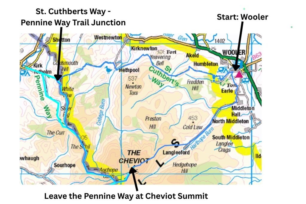
A 10‑mile approach on St Cuthbert’s Way would position me perfectly to wild camp just over the Scottish border at the end of Day 1. That left around 17 miles on Day 2 to complete an anticlockwise loop back to Wooler, taking in the best of the Pennine Way’s final day, including the High Level Routes, The Schill, The Cheviot, and the iconic Mountain Rescue Hut.
Accommodation Options in Kirk Yetholm
If you’re replicating this loop, Kirk Yetholm is just two miles west of my wild camp spot and offers accommodation — though not the glorious sunset and sunrise I enjoyed.
Key Facts
- Water: I carried all my water, but there are streams on both days if you prefer to refill (treat before drinking)
- Distance: 27 miles (43 km) over two days
- Total Ascent: ~1,350m
- Start/Finish: Wooler, Northumberland
- Highest Point: The Cheviot (815m) — optional summit detour
- Day 1 Distance: ~10 miles via St Cuthbert’s Way
- Day 2 Distance: ~17 miles combining the Pennine Way High Level Route, the Cheviot summit detour, and the descent to Wooler
- Wild‑Camping: Legal on the border section (Scotland) under the Land Reform Act
- Best Camp Spot: 100m beyond the England–Scotland border sign
- Navigation: Straightforward in good weather; challenging in mist
- Maps Needed: OS Explorer OL16 (The Cheviot Hills)
- Difficulty: Hard — long distances, steep climbs, remote terrain
Pennine Way Weekender: Cheviot Hills Loop Video Guide

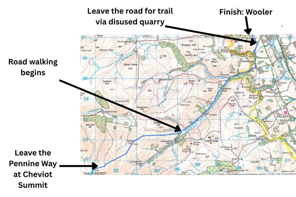
Route Map: Wooler to The Cheviot Circular via St Cuthbert’s Way and the Pennine Way
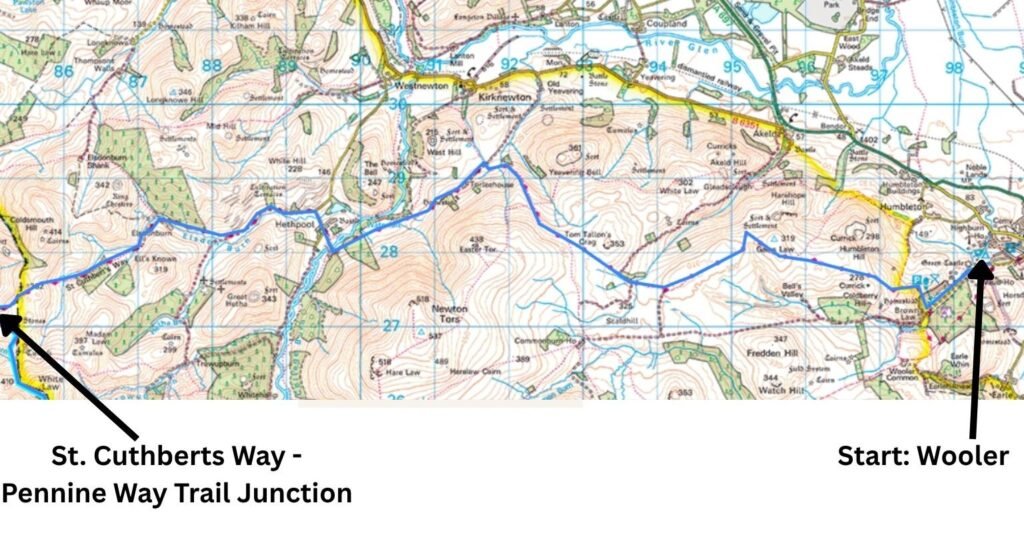
Day 1 Route Map: Wooler to the Pennine Way via St Cuthbert’s Way
Starting the Loop from Wooler
With my multiday pack loaded, I drove north and arrived with around five hours of daylight remaining — enough time, but not at a leisurely pace. There are car parks closer to the hills, but I opted for the security of parking in Wooler, accepting a few extra miles on the loop.
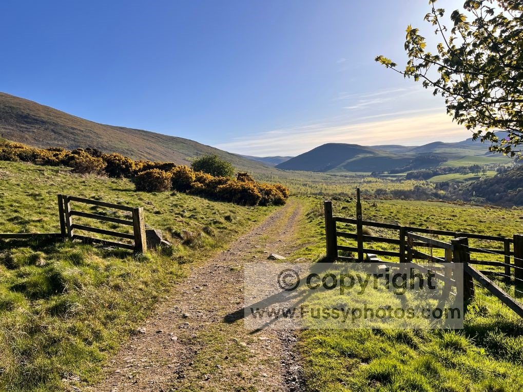
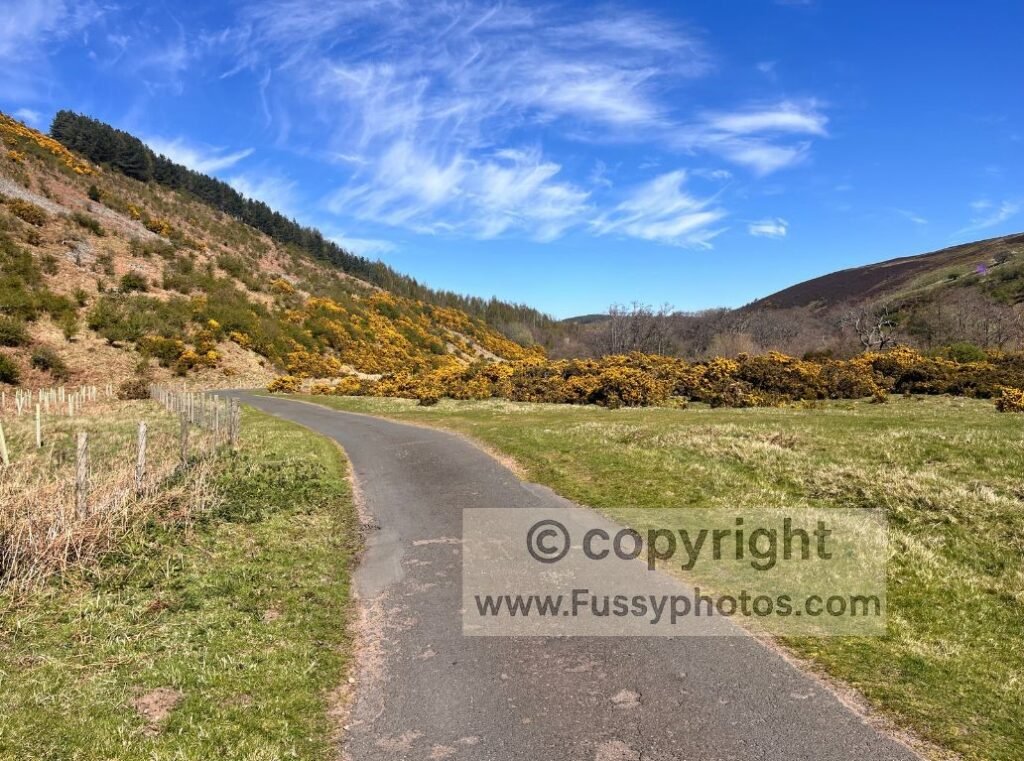
From the village, I road‑walked west to join St Cuthbert’s Way on Wooler Common. The trail climbed through a forestry plantation and onto open moorland, with instant views east towards the North Sea.
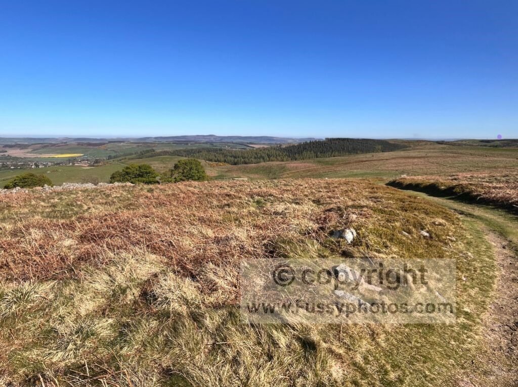
As height was gained, the wide grassy trail revealed a patchwork of multicoloured farmland, and on this clear day the flat summit of The Cheviot (815m) was visible to the southwest.
I passed a few day walkers, all of whom looked at my multiday pack with the polite concern usually reserved for lost tourists.
Crossing the Moors Towards the Border
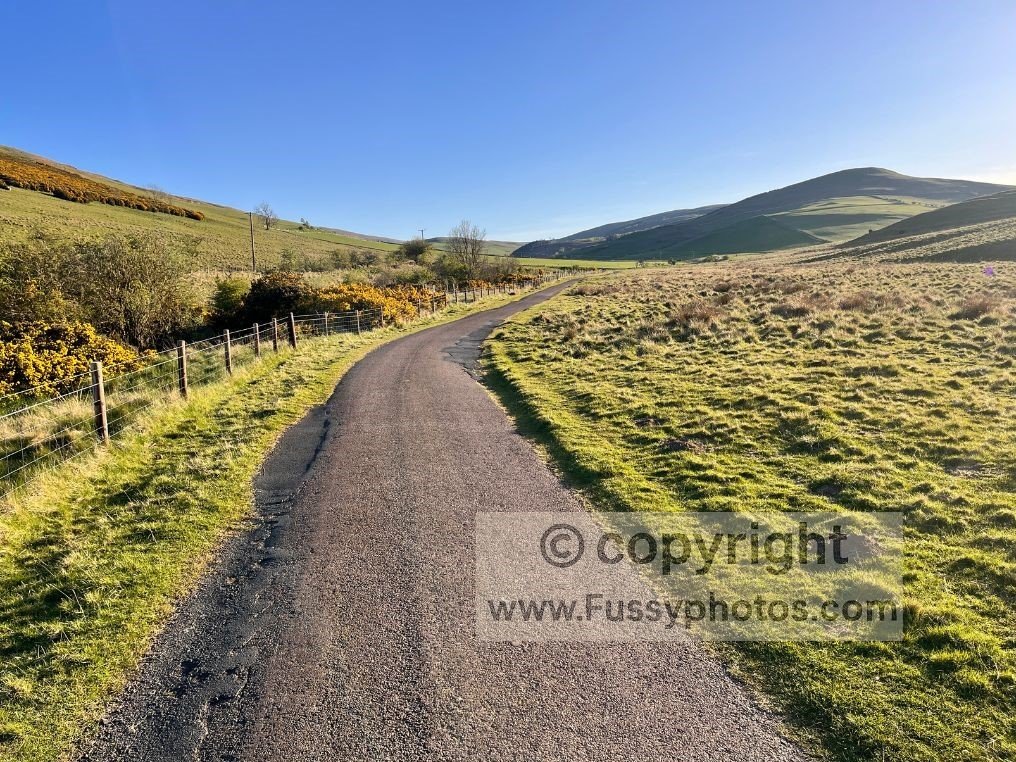
Further west, St Cuthbert’s Way followed a farmer’s track with clear waymarkers. The ground gradually became boggier — nothing troublesome in dry weather, but certainly a soggy affair in the wrong conditions. Passing sheep confirmed I’d moved beyond the usual turnaround point for day walkers; they were clearly unused to human company and trotted away from me with the urgency normally reserved for encountering hikers who haven’t seen a shower in several days.
With Tom Tallon’s Crag to my right, the trail dropped steeply, undoing an hour of climbing in about 90 seconds.
Walking poles helped, and any disappointment was softened by the sense of freedom and the changing scenery. The descent to around 150m led to a sharp turn west along a farm track, before the trail entered a scrubby area with goats and boggy patches.
Soon I crossed College Burn, an attractive river already around 10 metres wide, before road‑walking past Hethpool, a tiny hamlet of just a handful of homes. The valley here is beautiful, and the College Valley Walk is a tempting alternative for another day.
Turning west again, the trail ran parallel to Elsdon Burn, the scenery remaining excellent as I pushed the pace — keen to reach the border with around 90 minutes of daylight left.
The Final Push to the Pennine Way and Border Wild Camp
A GPS proved useful here, as multiple farm tracks branched off and it would be easy to follow the wrong one. A mile short of the border, the return of boggy ground — the curse of Pennine Way walkers — confirmed I was close. The gradient steepened, and a breathless final ascent had me sweating despite the falling temperatures.
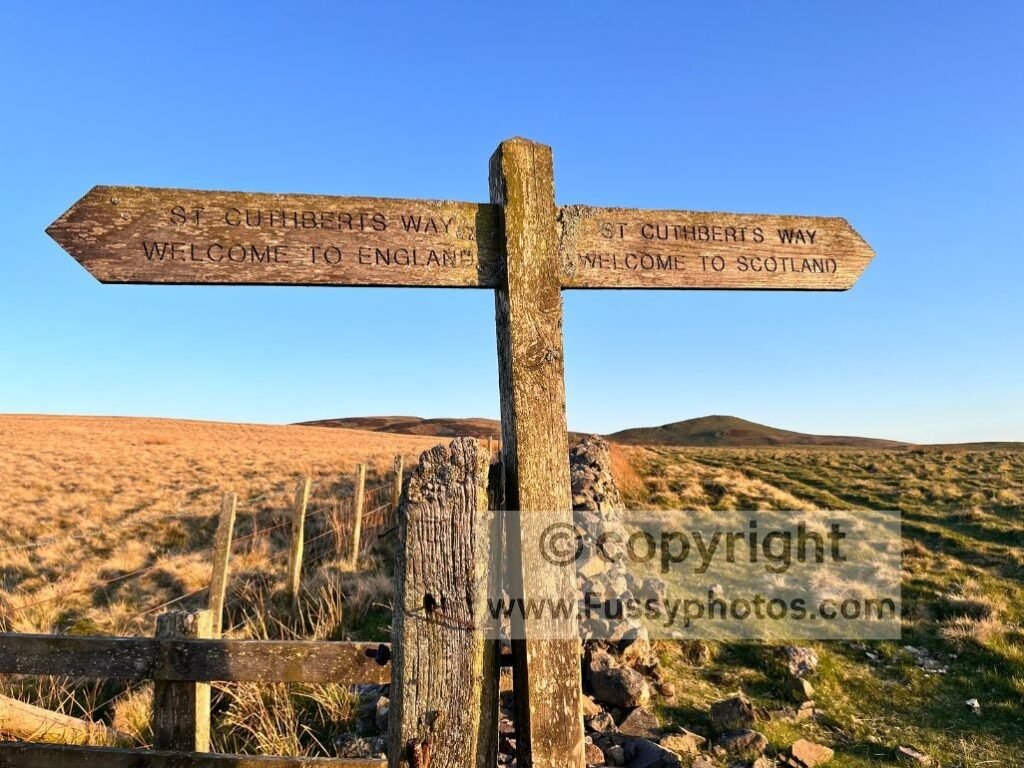
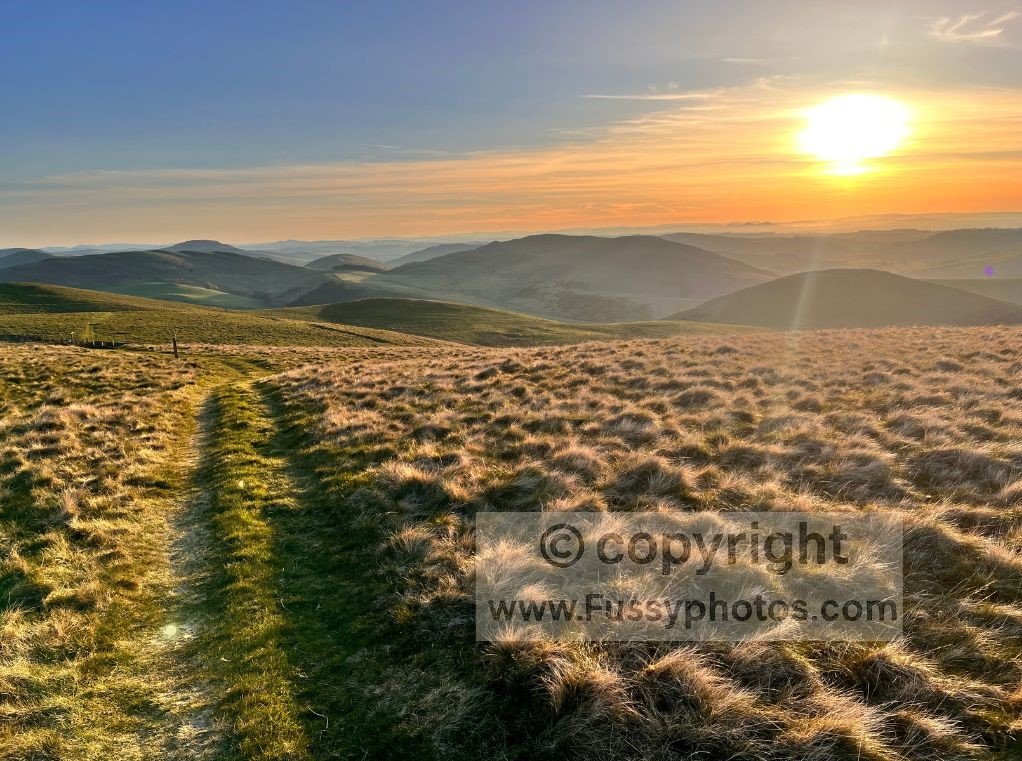
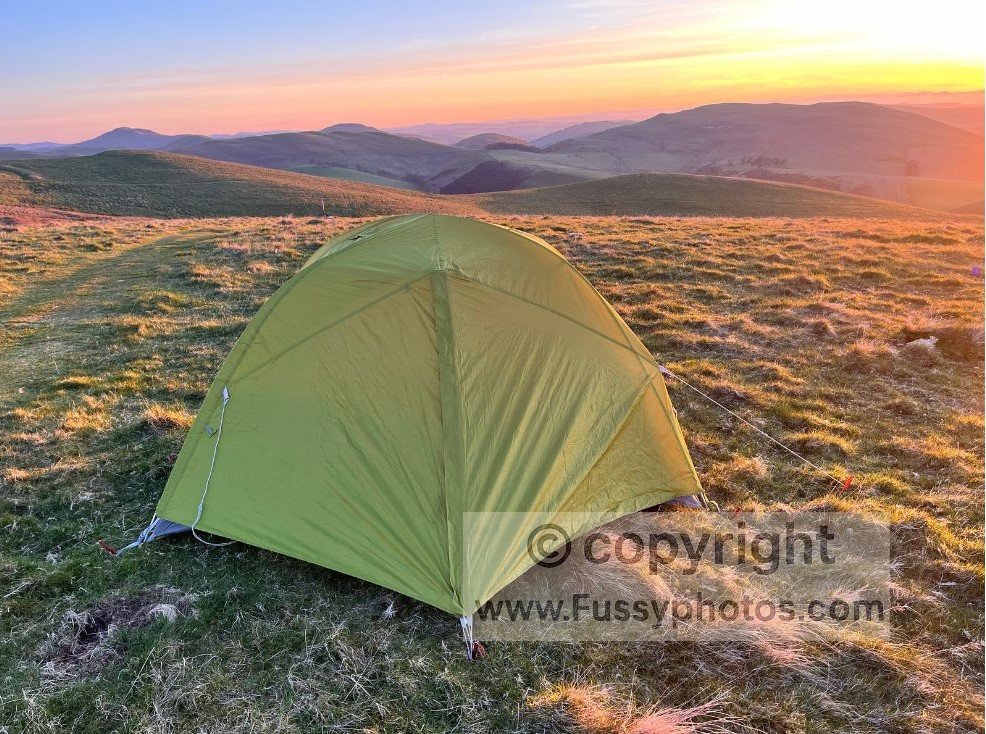
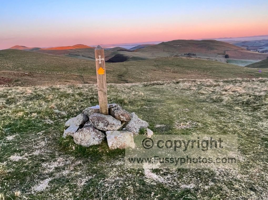
At around 360m, I crested the hill and long views opened westwards, illuminated by a magical sunset. Just 100 metres beyond the border sign, a perfect flat pitch appeared. Despite the temptation to continue walking in the golden light, I stopped for the night as the temperature dropped sharply.
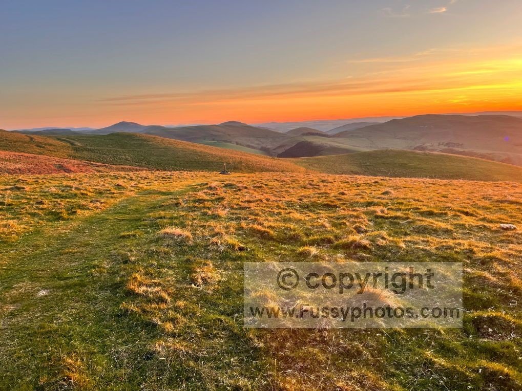
I lit my stove, pitched the tent, and enjoyed one of the most peaceful wild camps I’ve ever had — near‑silence, a glowing sky, and only the occasional birdsong as I layered up against the cold.
A Cold Night and an Early Start on the Pennine Way
The morning light arrived early, ending what could generously be described as a frigid night. I’d slept only in short bursts — a combination of cold, excitement, and the kind of enthusiastic early‑morning birdsong that suggests the birds had slept far better than I had. The sunrise cast a warm glow across the horizon, and by 6am I’d eaten, packed, and was back on the Pennine Way, keen to see what the clouds had hidden on my first visit to these hills.
If you’d like to see what this northern stretch looks like as part of a full thru‑hike, my Pennine Way Days 13–15 trip report follows this exact section from Windy Gyle to Kirk Yetholm with on‑the‑ground notes and photos.
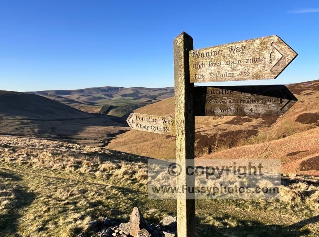
Choosing the High Level Route Over the Low Level Alternative
The Pennine Way splits for 3.5 of its final 4 miles, offering a High Level Main Route and a Low Level Alternative Route into Kirk Yetholm. On my original Pennine Way finish, I’d taken the low route — mainly because visibility was somewhere between poor and imaginative. Today, with clear skies and a second chance, I was determined to see what I’d missed.
If you want a clear comparison of both finish options into Kirk Yetholm, my Pennine Way final‑miles guide breaks down the differences between the high‑level ridge and the low‑level valley route.
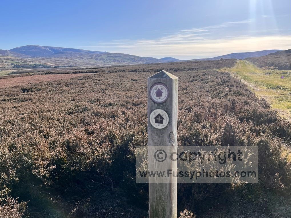
Just 200 metres beyond my wild‑camp spot, I turned south off St Cuthbert’s Way, admiring a beautiful cloud inversion filling the parallel valleys of the Scottish Borders. Frost on the ground confirmed I hadn’t imagined the cold during the night. The solitude was remarkable; I was at least three miles from the nearest road or settlement, deep in one of the remotest parts of England, with open miles entirely to myself.
The High Level Pennine Way Route — Whitelaw Nick to Black Hag
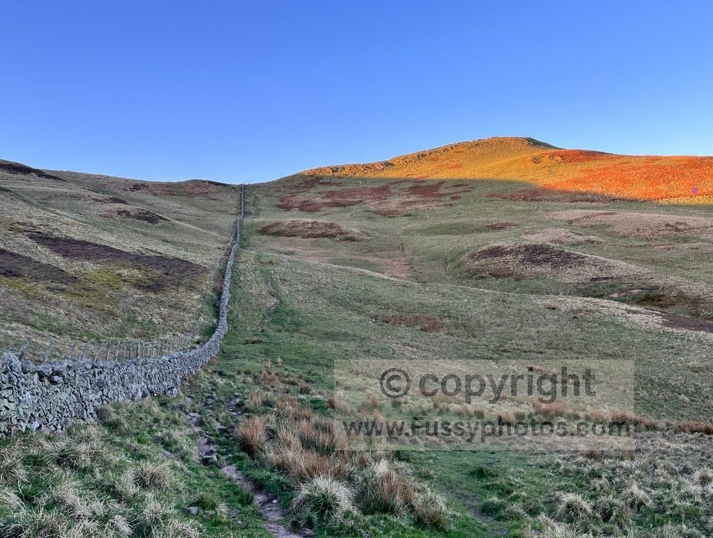
The High Level Route runs parallel to a dry‑stone wall marking the England–Scotland border. The first ascent led to Whitelaw Nick — only 420m, but dramatic in the early light, the wall running straight up the slope like a ruler drawn across the hillside. Golden streaks of sunrise illuminated the ridge as I climbed.
At the top, the trail pivots sharply, revealing endless rolling hills behind me. A short rise brought me to White Law (430m), where panoramic views opened in every direction — some of the finest long‑distance vistas on the entire Pennine Way.
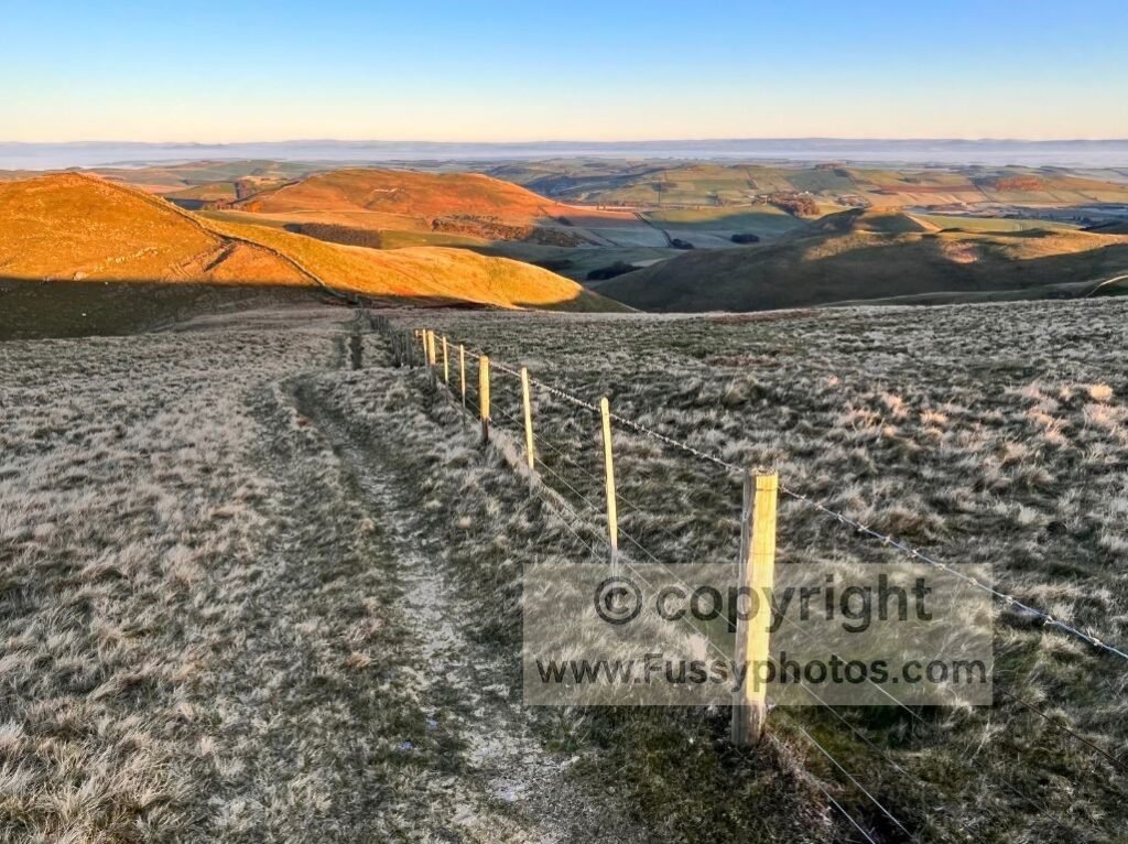
The trail then flattened for an easy mile towards Black Hag (549m). The morning stillness continued, the kind of silence you only experience in places far removed from roads and villages. To the west, the Low Level Route ran parallel, cutting into the valleys hundreds of metres below.
The high‑route trail was easy to follow in good weather, though it wouldn’t be the place to get lost in poor visibility.
Approaching The Schill — A Classic Pennine Way Climb
Beyond the crest, more glorious scenery unfolded, revealing The Schill and the junction where the high and low routes reconverge. I recognised the spot from years earlier, though the weather was far kinder this time.
After 1.5 hours and just 2.6 miles, I paused for a snack, knowing I’d need the energy for the climb ahead. The light was perfect — a golden sweep across the valley, the kind of morning that makes the Cheviots feel endless.
Crossing the dry‑stone wall back into England, I began the southern ascent of The Schill. The final ten minutes are steep enough to make you reconsider your life choices, but the reward is immediate: at 601m, the views back towards Tom’s Knowe, the high‑route junction, and the rolling Scottish Borders are superb. To the north, The Cheviot dominated the skyline, its broad western ridge marking the next major section of the Pennine Way.
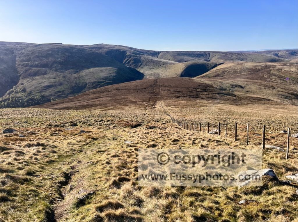
The Bog Between The Schill and The Cheviot
From the summit of The Schill, the trail drops around 100 metres towards what many Pennine Way walkers remember as the bog — a sprawling, boot‑hungry stretch that feels more like a training pool for reluctant long‑jumpers. On my original northbound Pennine Way finish, this section had been a swampy ordeal. Today, in far drier weather and with a proper pair of walking boots, I initially wondered if I’d exaggerated it in my memory.
I hadn’t.
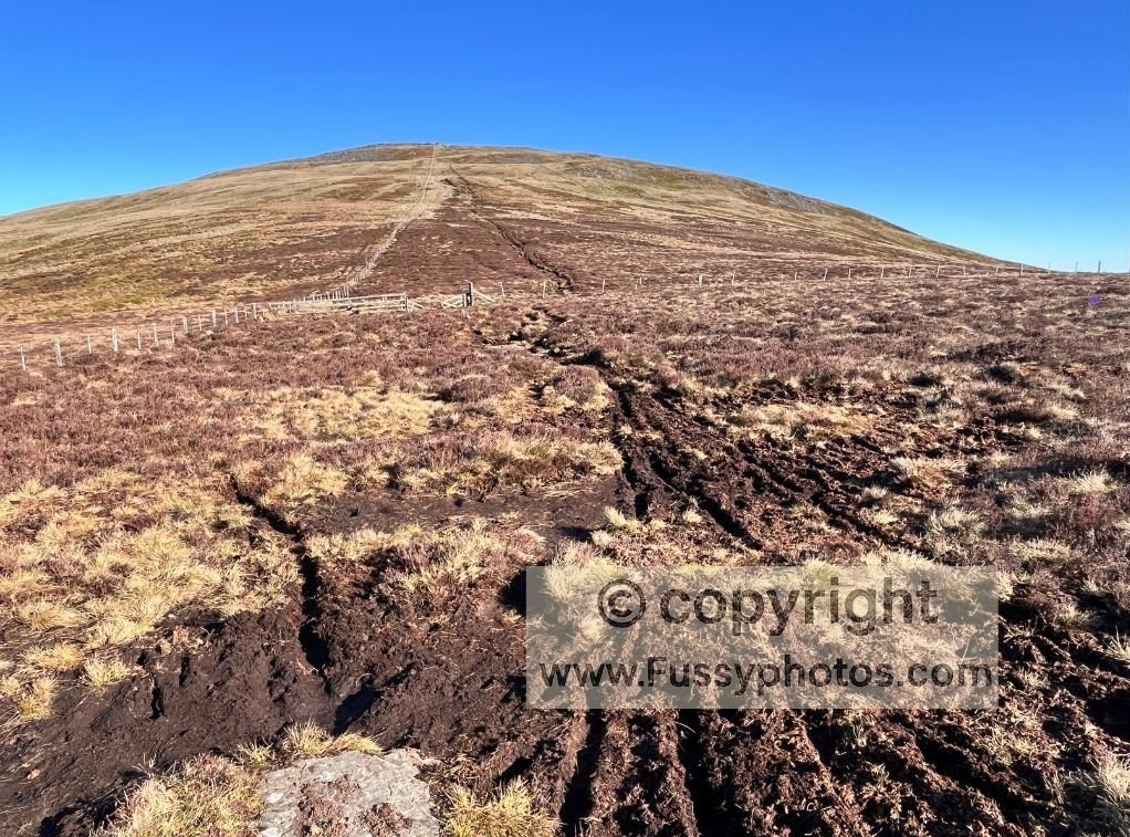
The first detours appeared soon enough, small diversions around the worst of the peat. Intermittent paving stones helped, though you can’t help but wonder why they don’t run the full 1.5 miles between The Schill and the Mountain Rescue Hut. Still, the bog wasn’t too bad this time — I lost a few minutes picking the driest lines and practising my long‑jumping skills, which still need work despite all the practice.
If you want to compare this to the full swamp‑mode version, it appears in my Hardest Parts of the Pennine Way (Ranked) page.
If you’re completing the loop clockwise, it’s worth noting that camping options are extremely limited here. The final two miles approaching The Cheviot from the east are either steep, exposed or simply too boggy to pitch a tent, and the flat summit itself sits at 815m — far too cold and windswept to be a sensible overnight spot. As a result, the next logical and sheltered place to stop is the Mountain Rescue Hut at the base of the mountain — see my YouTube clip for conditions inside.
Auchope Mountain Rescue Hut
Reaching the Auchope Mountain Rescue Hut feels like arriving at a tiny outpost on the edge of nowhere. It sits at the base of The Cheviot, offering emergency shelter and a direct view down the beautiful College Valley, which I’d passed on Day 1.
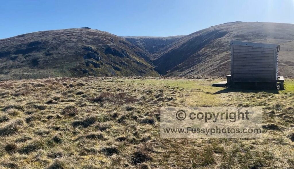
From the hut, the trail turns sharply uphill.
The Steep Climb to Auchope Cairn
The mile from the hut to Auchope Cairn is one of the steepest sustained climbs on the entire Pennine Way. Rising from roughly 490m to 720m, some sections feel close to 45 degrees — a slope that south‑to‑north walkers descend, often with mixed success. On my original Pennine Way finish, I slid and fell three times on this descent, though that probably said as much about my old boots as the lack of switchbacks.
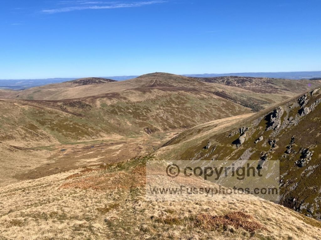
Today, climbing rather than descending, I stopped only for photos and still took 40 minutes to cover the mile. The reward was immediate: Auchope Cairn is arguably the best viewpoint on the entire Pennine Way in clear weather. I took a long break here, soaking in the views of the Scottish Borders and finishing the last of my food despite almost 10 miles still to go.
If you want to see more of the standout scenery that makes this northern stretch so special, my Top 10 Highlights of the Pennine Way picks out the most memorable viewpoints along the full trail.
The Cheviot Summit Detour
A short distance beyond the cairn, the trail meets the junction for the Cheviot Summit Detour — an official but optional out‑and‑back that adds around 3 miles. I’ve written a full breakdown on my page Pennine Way: Is the Cheviot Summit Detour Worth It?
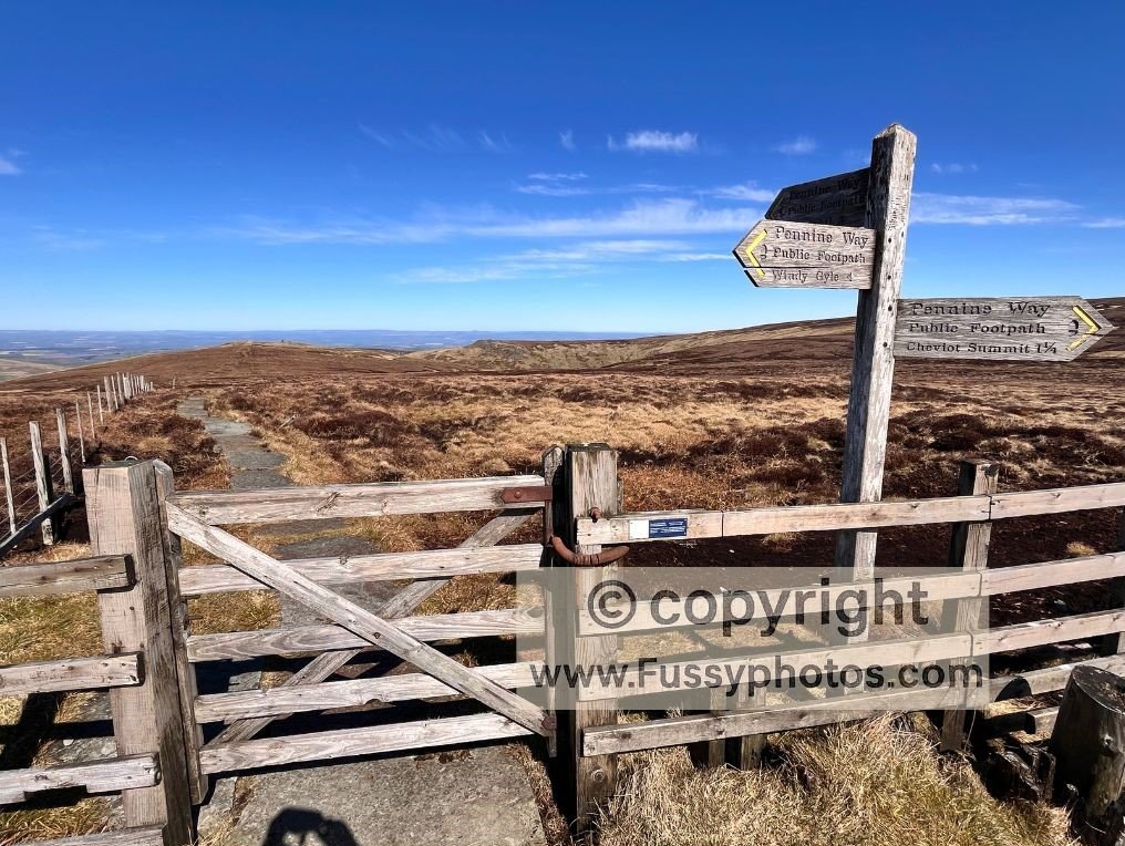
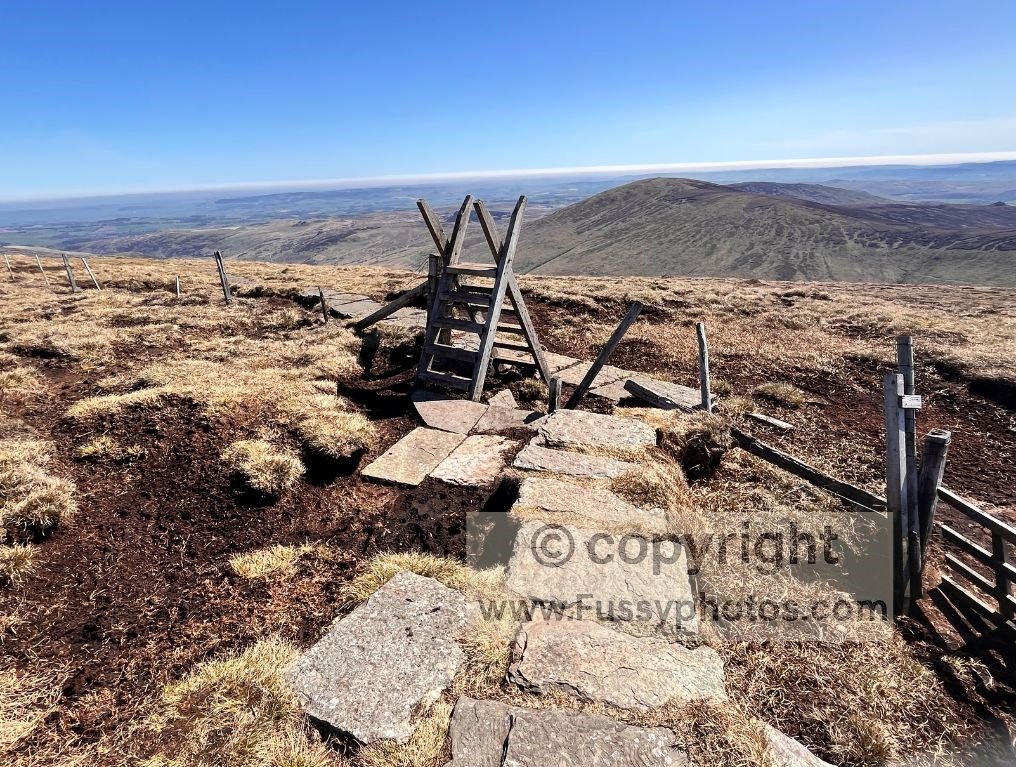
Today, with clear skies and a second chance at the views I’d missed years earlier, I took the detour. The paving stones rise another 70 metres to the broad, flat summit of The Cheviot, the third‑highest point on the Pennine Way. After the climb to Auchope Cairn, it felt almost like a Sunday morning stroll.
Beyond the summit, I left the Pennine Way, keen to return to this northern stretch again soon.
Map: The Cheviot to Wooler (Key Navigation Points Marked)
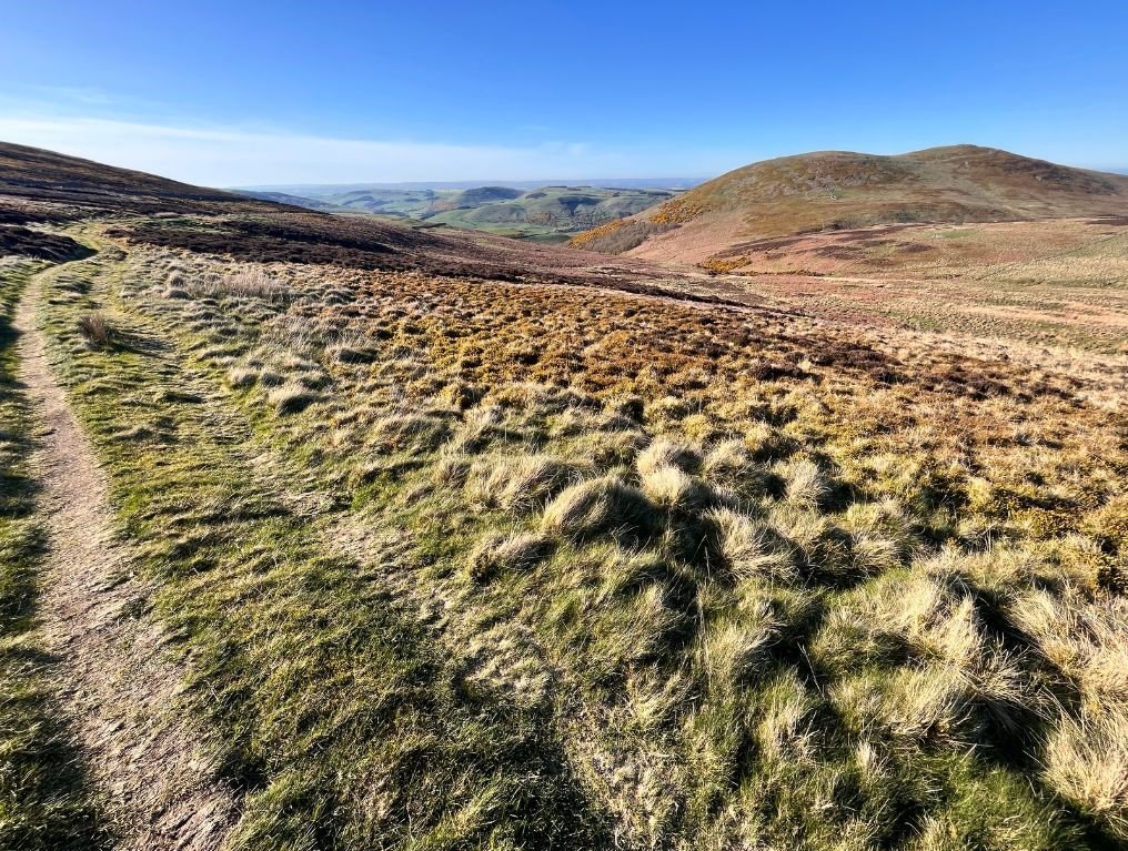
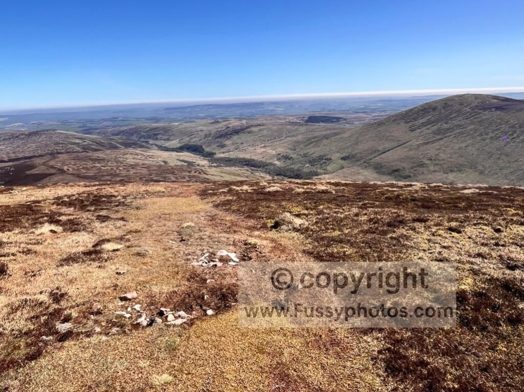
The Descent to Scald Hill and Return to Wooler
From the summit plateau, the trail drops steeply towards Scald Hill (549m), around 1.5 miles away.
It’s a scenic descent, with views north over the moorland and back towards the line of St Cuthbert’s Way from the previous day. To the right, Hedgehope Hill (714m) dominates the skyline — part of a popular Cheviot circular, though not one I was adding to an already 17‑mile day.
Hiking poles eased the pressure on my knees as small groups of walkers appeared, confirming civilisation was close.
The Final Valley Road Walk Back Towards Wooler
At the bottom of the valley, the road runs parallel to Harthope Burn, dropping to around 200m. A local walker mentioned frost in the village that morning, imagining how cold my higher‑elevation camp must have been. Another confirmed that overnight parking in the valley is considered safe — useful if you want a shorter loop with less road walking.
The road walk itself is attractive, a quiet valley with few cars, though after six hours of steady hiking it felt a little torturous.
If I hadn’t needed to be home, I’d have taken advantage of the grassy banks for a rest. Instead, I stuck to the road for the final miles to Wooler, preferring easy navigation over views at this stage, only leaving the tarmac north of Earle to follow a trail around an old quarry and rejoin St Cuthbert’s Way for the final half‑mile back to the village.
FAQs
How hard is the Wooler–Cheviot loop?
It’s comparable to the final miles of the Pennine Way: long, remote and full of big climbs. The ascent is around 1,350m, with steep climbs to Auchope Cairn and The Cheviot. In good weather it’s glorious; in bad weather it’s a character‑building exercise.
For a wider look at why the Pennine Way’s northern stages feel so demanding, my Is the Pennine Way Hard? guide breaks down the main factors that make this terrain such a challenge.
Is navigation difficult on this route?
On the Pennine Way, not so much. St Cuthbert’s Way is well signposted and waymarked, but there are a few side tracks and permissive paths that can confuse you if you’re not paying attention. The off‑PW sections between Wooler, the border, and the Cheviot descent are straightforward in good weather, but a GPS is strongly advised for mist, nightfall, or if you’re new to the area.
If you want a clearer sense of how the Pennine Way is waymarked in these exposed northern miles, my Pennine Way Navigation Guide shows what the trail looks like in good and poor visibility.
Are there any services on the route?
None. Just like the final day of the Pennine Way, it’s remote from start to finish. No cafés, no shops, no taps. Carry everything you need.
If you’re preparing for a remote overnight like this, my Essential Packing List for a Section Walk covers the clothing, safety kit and cold‑weather gear that make these exposed miles far more comfortable.
Are there water sources?
Yes — streams on both days, especially near Harthope Burn and on the approach to the Pennine Way. I carried all my water, but if you prefer to refill, treat it before drinking.
Which map do I need?
OS Explorer OL16 (The Cheviot Hills) covers the entire loop, including Wooler, St Cuthbert’s Way, the Pennine Way High Level Route, and the descent back to the valley.
Is there alternative accommodation in Kirk Yetholm?
Yes. If the Border Hotel is full, there are several reliable alternatives in both Kirk Yetholm and Town Yetholm, which sit opposite each other across the village green. Options include small B&Bs, guesthouses and walker‑friendly inns, all within a short and easy walk of the Pennine Way finish. Availability can be tight in peak season, so booking ahead is recommended, especially if you’re arriving late in the day or walking in a larger group.
Explore More Pennine Way Guides
If you’re planning the Pennine Way or want to explore more of the route, my full hub brings together every stage guide, planning resource, accommodation overview, transport advice, and practical FAQ in one place.