Chrome Hill is a uniquely shaped limestone summit — one of the most recognisable in the Peak District. I first noticed it from the road near Longnor, its profile rising sharply above the surrounding valleys. It’s a popular walk, yet surprisingly quiet, largely because it sits on the Buxton side of the National Park, away from the Manchester and Sheffield corridors where most visitors begin their day. Its distinctive limestone ridge attracts regular walkers, but it never sees the crowds of Mam Tor, Kinder Scout or Stanage Edge. Yet, it’s well worth any extra miles in the car.
Route Variations and Building the Chrome Hill Loop
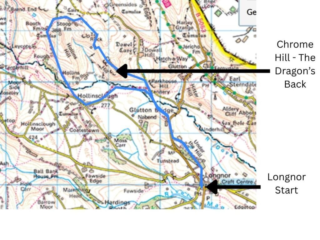
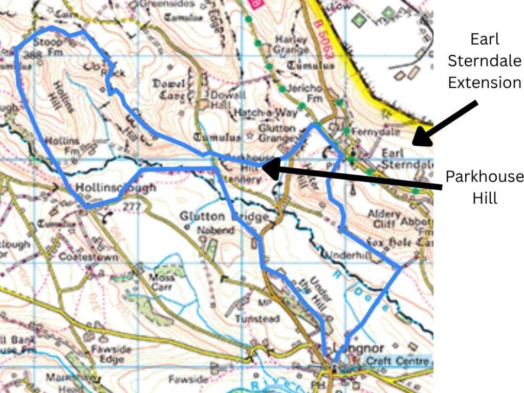
There are several variations of a walk across its ridge, through the surrounding valleys, or continuing onto Parkhouse Hill and Hollins Hill. Preferring to walk my own walk, I studied the OS map and tried to piece together a route on paper. With countless peaks and undulations, I settled on a rough plan: a loop around the southern side of Chrome Hill, then around the western side of Hollins Hill to enjoy views west into the quieter valleys — a contrast to the more famed ridge walking across the Dragon’s Back. From Booth Farm, we’d loop clockwise, observing Hollins Hill from all angles before an epic finale with open views across the River Dove valley framed by Chrome Hill and Parkhouse Hill beyond.
The plan was deliberately vague, giving flexibility to follow enticing terrain and views, but structured enough not to drift too far from the main highlights. I describe and annotate our eventual route below.
Route Map for the Chrome Hill and Hollins Hill Loop in the Peak District
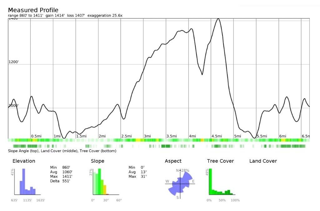
Elevation Profile for the Chrome Hill and Hollins Hill Loop
Video Highlights: Chrome Hill & the Dragon’s Back

Parking & Facilities
Parking is available in Longnor and Earl Sterndale, both with pubs. You can easily walk a variation of this route linking both villages, giving complete flexibility for parking and a mid‑walk pub stop if desired.
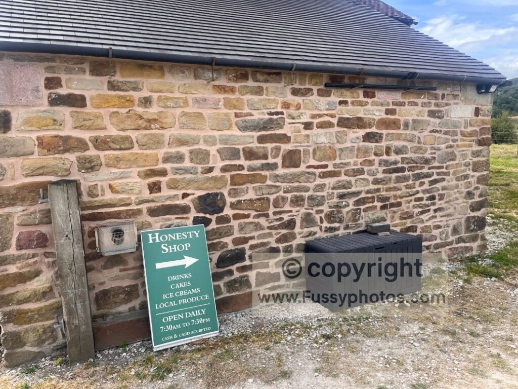
Additionally, there’s an honesty box at the Old School House just east of Hollinsclough, offering a surprisingly broad range of options — including iced lollies.
Longnor Start: Rolling Farmland & Expanding Views
We settled on a Longnor start, following a trail north across rolling farmland. Views quickly opened to the north and east: gentle hills including High Wheeldon (422m), a peak I’d pencilled in for the return south but eventually skipped to save a few miles.
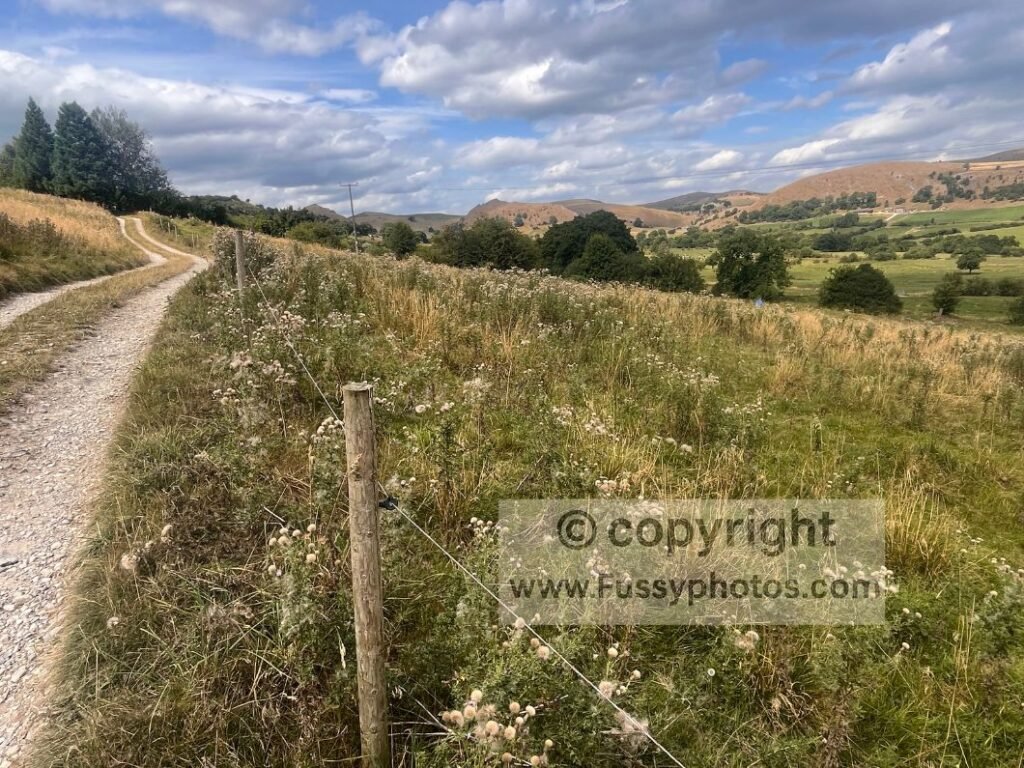
Passing Underhill Farm and Yewtree Grange, the path traverses the valley side, running parallel to the B5053 towards Earl Sterndale. It was a pleasant, if not spectacular, stretch, culminating in a short section of road walking before a left turn and more expansive views north — including a southeast approach towards Chrome Hill and a first glimpse of its dome‑shaped profile.
If you want to get straight to Chrome Hill, Earl Sterndale is slightly closer, but we favoured a broader walk of the area over pure ridge walking.
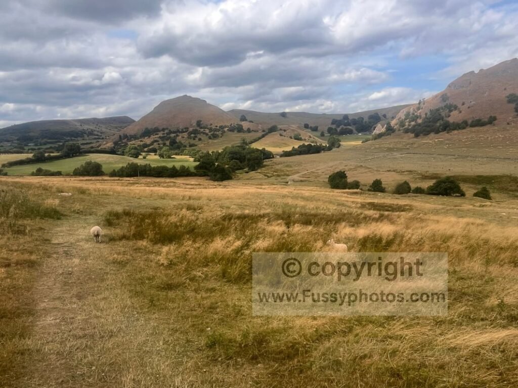
Parkhouse and Chrome Hills
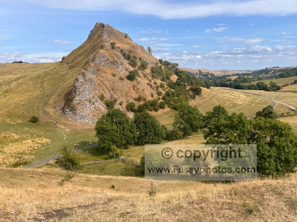
Our trail brought us to the base of Parkhouse Hill, the other famed summit in these parts — steep‑sloped and resembling a dragon’s back from the right angle, but smaller and less celebrated than Chrome Hill.
Skirting Chrome Hill for a Later Summit
Tackling Chrome Hill later rather than at this point gave us more time to settle into the landscape — and enough breathing room for the small crowds on the summit to thin out before we reached it some 60–70 minutes later (including an iced‑lolly stop). So we took the trail west, running parallel to Chrome Hill. Despite only walking two miles to this point, the picnic benches and superb views of Chrome Hill and Parkhouse Hill meant we were never going to turn down the honesty box and a short rest. Hollinsclough was just five minutes further west, but nothing tempted us to stop again.
Looping Hollins Hill: Quiet Valleys & Sweeping Views
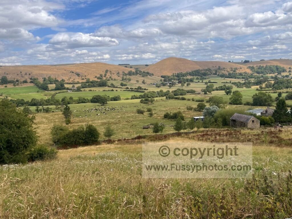
We looped north, descending then climbing across a small valley, beginning our circuit around Hollins Hill. The attractive Moorside valley fell away to our left; to the right, a trail junction offered a shorter, more direct route to Hollins Hill.
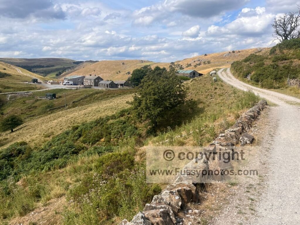
Between Fough and Booth Farm, the scenery was a real highlight — sweeping views west and northwest across quiet limestone country. Just shy of Booth Farm, another trail skirted right, offering a direct, steep line up Hollins Hill. I’d advise staying on the northern line instead, looping around Stoop Farm and Tor Rock via Dragon’s Back Wild Camping, a basic but scenic campground for those wanting a longer stay.
A Westward Approach to Chrome Hill: The Dragon’s Back Revealed
The approach to Chrome Hill from the northwest is superb. The dragon’s‑back shape becomes prominent from this vantage point, rising above dry‑stone walls. The valley drops away and the scale of Chrome Hill comes into full view — a stretch that reminded me of Edale Valley, but without the crowds.
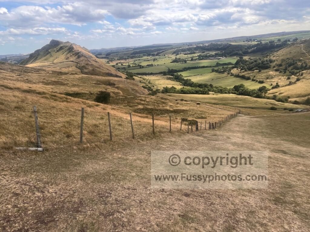
Ridge walking commenced: a western approach to the easy summit of Chrome Hill. The drop‑offs are manageable, not vertigo‑inducing, and there are various side trails if you prefer not to traverse each of the reef‑knoll steps that give the ridge its dragon‑back profile.
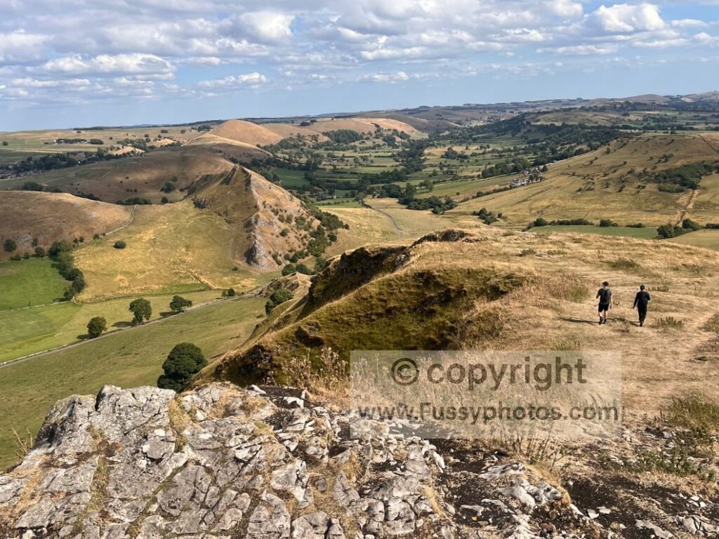
From the top, panoramic views reveal a line of other limestone reef knolls — a miniature mountain range, visible only from this high vantage point.
Eastern Descent & Return
The eastern descent is steep but wide enough to choose your own line all the way to the road. From there, we decided to return to Longnor the way we came, fully satisfied with the views and completing a short but varied 6.5‑mile lollipop‑shaped loop.
Alternative Return Options and Longer Routes
For those wanting a longer outing, there are several options: the Parkhouse Hill ascent and descent, a continuation into Earl Sterndale, or a northern approach back into Longnor via Beggar’s Bridge — all of which extend the day while keeping the character of the walk intact.
If you choose to park in Earl Sterndale, you may prefer not to loop all the way to Longnor, or you can extend the route west of Chrome Hill to create a broader circuit of the surrounding valleys.
Nearby Peak District Walks
Chatsworth House Circular
Enjoy a relaxed 6‑mile Chatsworth House Circular with woodland trails, sweeping Derwent Valley parkland and classic White Peak scenery — an easy, scenic Peak District day walk with heritage landmarks and big views.
How to walk a scenic Dovedale Stepping Stones circular
Around 35 minutes from Chrome Hill, the Dovedale Stepping Stones & Thorpe Cloud Circular offers another superb limestone walk, with gorge paths, caves, river scenery and the steep, panoramic climb up Thorpe Cloud.
Mam Tor Circular Walk: How to Enjoy Dramatic Views
For a contrasting ridge walk with big Edale views, my Mam Tor Circular offers a dramatic 9‑mile loop over Castleton, Peveril Castle, Winnats Pass and the Great Ridge — a classic Peak District day out.
Dragon’s Back & Chrome Hill: FAQs
Where is the best place to start the Chrome Hill walk?
Either:
- Longnor — your chosen start, offering rolling farmland, expanding views, and a broader exploration of the area.
- Earl Sterndale — slightly closer to Chrome Hill if you want a more direct approach.
Both villages have parking and pubs, and you can link them in a loop or extend the route west of Chrome Hill for a longer day.
How long does the Dragon’s Back hike take in the Peak District?
The full loop described is 6.5 miles, including Hollins Hill, Parkhouse Hill views and the return to Longnor. With time for breaks, scenery and flexibility on the route, it fits comfortably into a half‑day outing.
Is the Dragon’s Back walk hard?
The ridge on Chrome Hill is generally easy to follow, with manageable drop‑offs and plenty of space to choose a comfortable line. However, it does involve some fitness and agility. It’s not a demanding climb, but it isn’t ideal for walkers who struggle with uneven ground.
Explore More Peak District Walks
Explore more of the National Park with my full Peak District Walks Hub — packed with maps, photo‑rich guides, video walkthroughs and routes for every part of the Peak District.