The Pennine Way is generally straightforward to follow. Waymarking is consistent, the line of the trail is often obvious, and long stretches use features that naturally guide you. That said, a few moorland sections still need basic judgement, a map, and a GPS on your phone, especially in poor visibility.
A big part of why the Pennine Way is straightforward to follow comes down to its waymarking, which is consistent across much of the route.
Is the Pennine Way well marked?
The Pennine Way uses a consistent set of waymarks from end to end, and these are the signs you’ll see most often along the trail.
National Trail Acorn
- Official name: National Trail Waymark
- Symbol: White acorn
- Where used: Entire Pennine Way
- Purpose: Confirms you’re on a National Trail; appears on posts, gates, fingerposts, and plaques.
This is the primary and official waymark of the Pennine Way.
Public Footpath Arrow
- Official name: Public Footpath Waymark
- Symbol: Yellow arrow
- Where used: England
- Purpose: Indicates a public right of way; used where the Pennine Way follows a footpath.
Not Pennine‑Way‑specific, but you see it constantly.
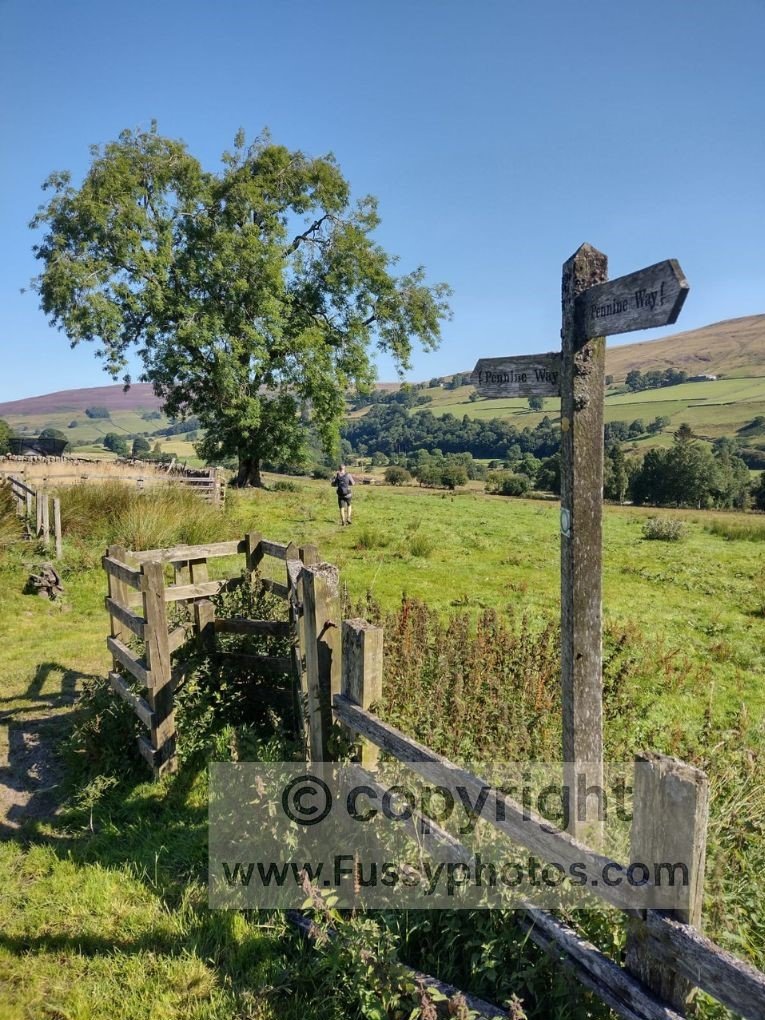
Trail Junctions
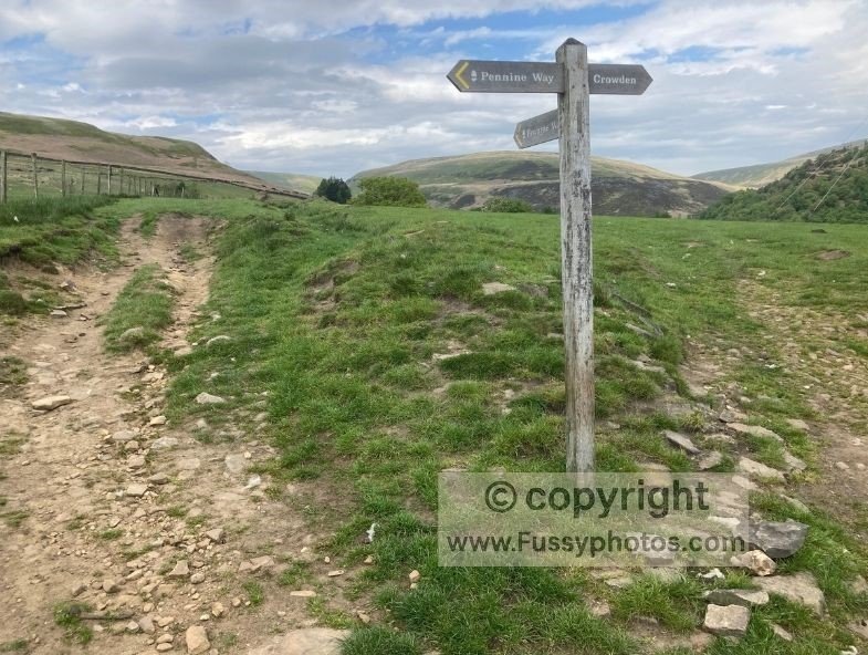
- Official name: Public Rights of Way Junction
- Symbol: None (may include fingerposts, arrows, or multiple path arms)
- Where used: Wherever two or more paths meet on or near the Pennine Way
- Purpose: Indicates a point where the Pennine Way intersects, joins, or leaves another path, often requiring a change of direction or a decision between multiple routes.
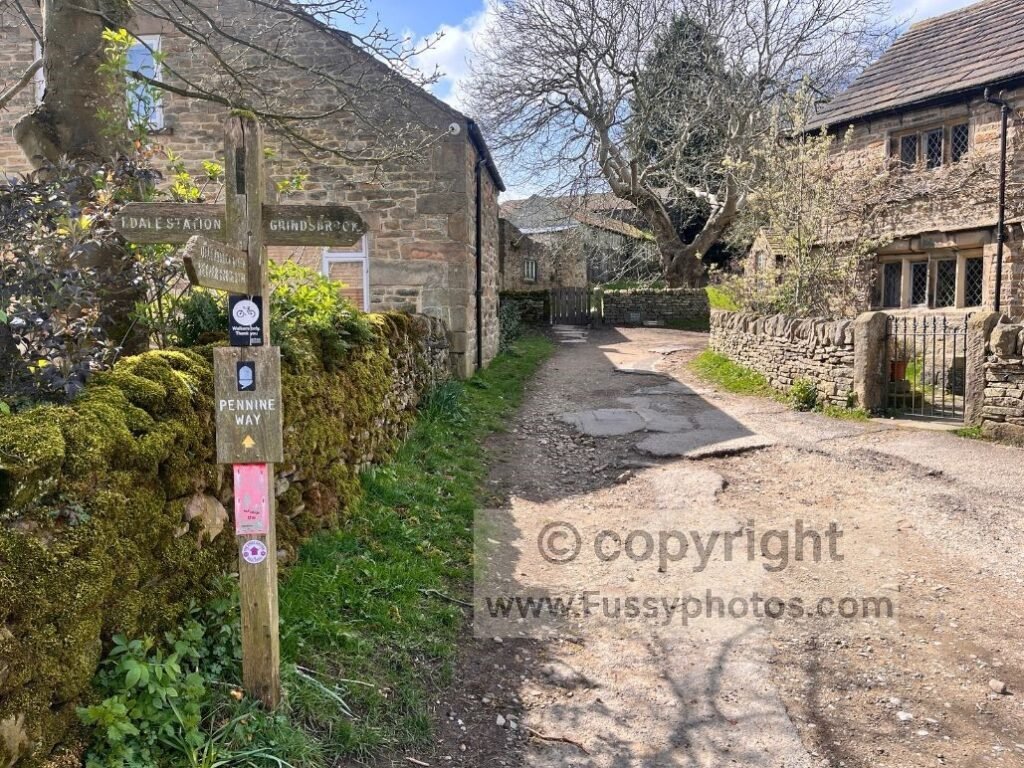
Fingerposts
- Official name: Public Rights of Way Fingerpost
- Symbol: Wooden or metal post with directional arms
- Where used: Road crossings, junctions, villages
- Purpose: Often labelled “Pennine Way”, sometimes with distances.
These are some of the clearest markers on the trail.
National Trail Direction Arrow — Bridleway
- Official name: National Trail Direction Arrow — Bridleway
- Symbol: Blue arrow with white National Trail acorn
- Where used: Sections of the Pennine Way that follow a public bridleway
- Purpose: Shows the Pennine Way continues along a bridleway; used with the acorn on posts, gates and fingerposts
Public Bridleway Arrow
- Official name: Public Bridleway Waymark
- Symbol: Black arrow on blue background
- Where used: England
- Purpose: Indicates a public bridleway; used where the Pennine Way follows or crosses a bridleway.
Walkers see this occasionally on the Pennine Way, especially on wider tracks or estate roads.
Other Features That Make the Pennine Way Easy to Follow
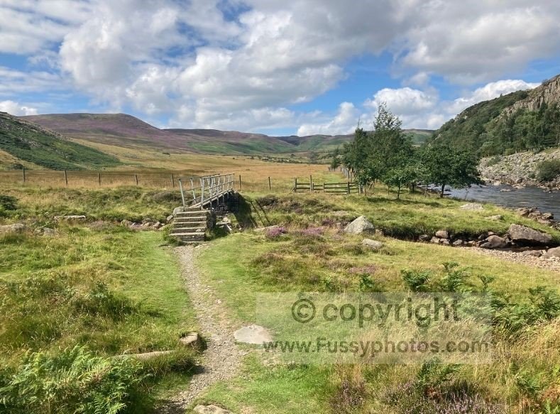
Alongside the formal waymarking, the Pennine Way also uses a range of landscape features and man‑made structures that make the line of the trail easy to follow.
Paving Slabs / Flagstones
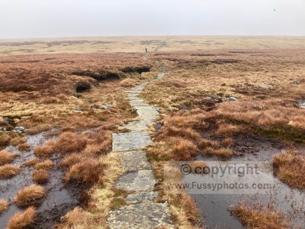
- Official name: Flagged Path
- Where used: Boggy moorland (Kinder, Bleaklow, Black Hill, Fountains Fell, etc.)
- Purpose: Not a “marker”, but a visual navigation cue — if you’re on the slabs, you’re on the Pennine Way.
Walkers treat these as de‑facto waymarking.
Clear Historic Tracks
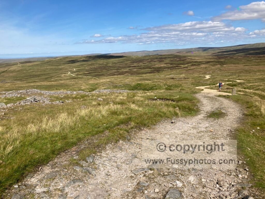
- Official name: Historic Trackway / Miners’ Road (varies by location)
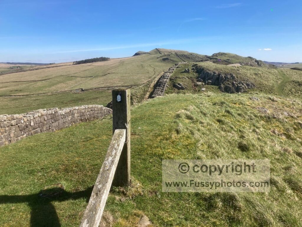
- Where used: Sections such as the long descent to Garrigill on the Corpse Road, estate tracks in the North Pennines, and the stretch where the Pennine Way follows Hadrian’s Wall
- Purpose: Not a formal waymark, but an obvious linear feature that naturally guides you; the track itself becomes the navigation cue, making it very hard to drift off‑line.
Walkers treat these long, established tracks as de‑facto waymarking.
Ladder Stiles and Wall Crossings
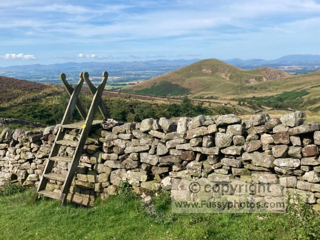
- Official name: Ladder Stile
- Symbol: Often carries a small acorn plaque on one side
- Where used: Dry‑stone wall crossings throughout the Pennine Way, especially in the Dales and North Pennines
- Purpose: Provides a clear, fixed crossing point over walls; the stile itself is visible from a distance and confirms the exact line of the trail across fields.
Walkers treat ladder stiles as reliable confirmation that they’re on the correct route.
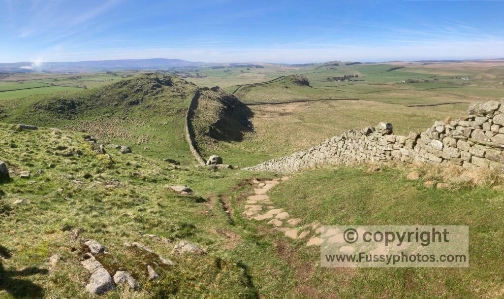
Obvious Landscape Lines
- Official name: None (natural linear features)
- Where used: Sections where the trail follows a clear physical feature — for example the River Tees, the ridge above Kinder Reservoir, or the long crest over Windy Gyle
- Purpose: The landscape itself forms an unmistakable line to follow; the trail simply mirrors the feature, making navigation intuitive even without waymarks.
Walkers treat these natural lines as some of the most reliable cues on the Pennine Way.
Cairns
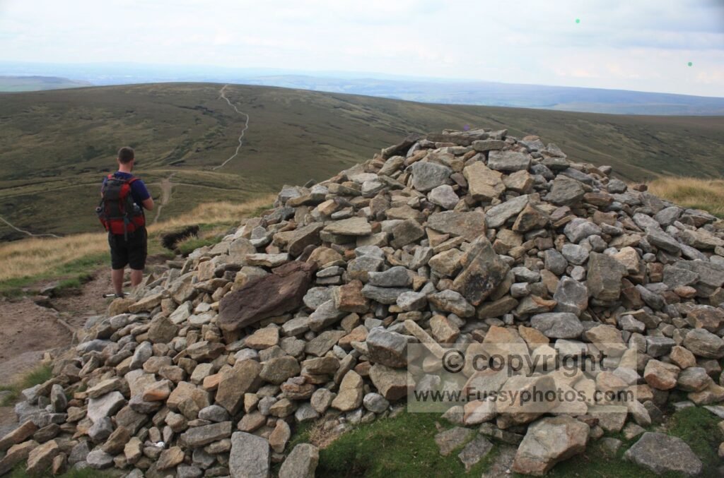
- Purpose: Navigation aids in poor visibility; not official but widely relied upon.
- Official name: Cairns
- Where used: Moorland, especially Bleaklow, Black Hill, Cross Fell
Cairns act as simple, dependable confirmation of the trail line on long, featureless tops.
Trig Points on Key Summits
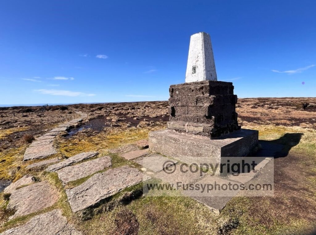
- Official name: Ordnance Survey Triangulation Pillars
- Where used: High summits including Kinder Low, Black Hill, Great Shunner Fell, Cross Fell and The Cheviot
- Purpose: Fixed survey markers that confirm your exact position on high, open ground; not official waymarks but reassuring reference points on long summit sections.
Because these summits are major landmarks in their own right, the trig pillars simply reinforce that you’re exactly where the route expects you to be.
Common‑Sense Tools Still Needed
Even with good waymarking and clear trail features, the Pennine Way still rewards a bit of basic preparation. These are the simple tools that make navigation straightforward in all conditions:
Map (paper or digital)
Useful for confirming junctions, checking distances, and understanding the wider landscape.
GPS on your phone
A quick position check removes any doubt, especially on moorland or in clag.
GPS on your phone
Whether it’s checking a contour, a wall line, or a bearing, a few seconds of verification prevents small errors from becoming big ones.
Power Bank for long days
Essential if you’re relying on your phone for mapping, photos, or emergency contact.
You’ll find a full breakdown of what to carry on a multi‑day section walk in my Pennine Way packing list, covering the essentials for staying safe, warm and self‑sufficient.
Summary — So, Is the Pennine Way Easy to Navigate?
For most walkers, most of the time, yes. The Pennine Way is well marked, reinforced by obvious landscape features, and supported by clear tracks, stiles, and slabs. A few moorland sections still need care in poor visibility, but with a map and a GPS on your phone, it’s very hard to get seriously off‑line.
If you’re new to the Pennine Way and want a simple, confidence‑building starting point before planning anything else, my beginner‑friendly guide to starting is the best place to begin.
And Finally…
Pennine Way Navigation FAQs
Do I need a GPS for the Pennine Way?
Not strictly, but it’s strongly recommended. The trail is well marked, yet moorland sections, forestry edges, and poor visibility can make a quick position check invaluable.
How well signposted is the Pennine Way?
Very well. You’ll see National Trail acorns at gates, stiles, and junctions, supported by fingerposts and other rights‑of‑way markers. Some high or remote sections have long gaps between signs, which is normal.
Can you get lost on the Pennine Way?
You can drift off‑line in mist, on featureless moorland, or where sheep trods split from the main path. With a map and GPS, it’s easy to correct quickly.
If you’d like a full introduction to the trail itself, my Pennine Way: Britain’s Oldest National Trail guide gives a clear overview of the route, its landscapes and what to expect across all 268 miles.
Explore More Pennine Way Guides
The hub page includes stage guides, circular walks, planning notes and practical advice for the full route.