Whichever direction you choose to walk the Coast to Coast, getting to the trailhead is relatively straightforward — if sometimes a little slow. St Bees, the classic western start point, sits on the Northern‑operated Carlisle–Barrow‑in‑Furness line, giving walkers direct rail access to the trail. At the eastern end, Robin Hood’s Bay has no train station, but the X93/X94 bus provides regular links north and south along the Middlesbrough–Guisborough–Whitby–Scarborough corridor. Both Middlesbrough and Scarborough offer national rail connections for onward travel.
At 190 miles in length, many walkers also choose to complete the Coast to Coast in stages. This is a logical solution to several challenges of thru‑walking — reducing cumulative fatigue, managing weather windows, and allowing those with busy lives to complete a 10–16 day trail in sections around work and family commitments. My How to Split the Coast to Coast Into Stages guide outlines practical ways to divide the route based on time, fitness, and public transport access.
Is the Coast to Coast easy to access by public transport?
Partly — but only if you know where the reliable rail and bus links are. This guide covers every access point, with direct links to bus timetables and rail hubs.
Day‑by‑Day Train Access Guide
Day 1: St Bees to Ennerdale Bridge
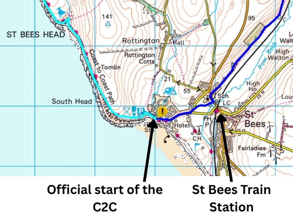
Train access: St Bees Train Station
Whilst the Carlisle and Barrow-in-Furness line is relatively slow and will involve multiple connecting trains for coast to coast walkers from further afar, St Bees station is close to the official beginning of the coast to coast.
Day 2: Ennerdale Bridge to Rosthwaite
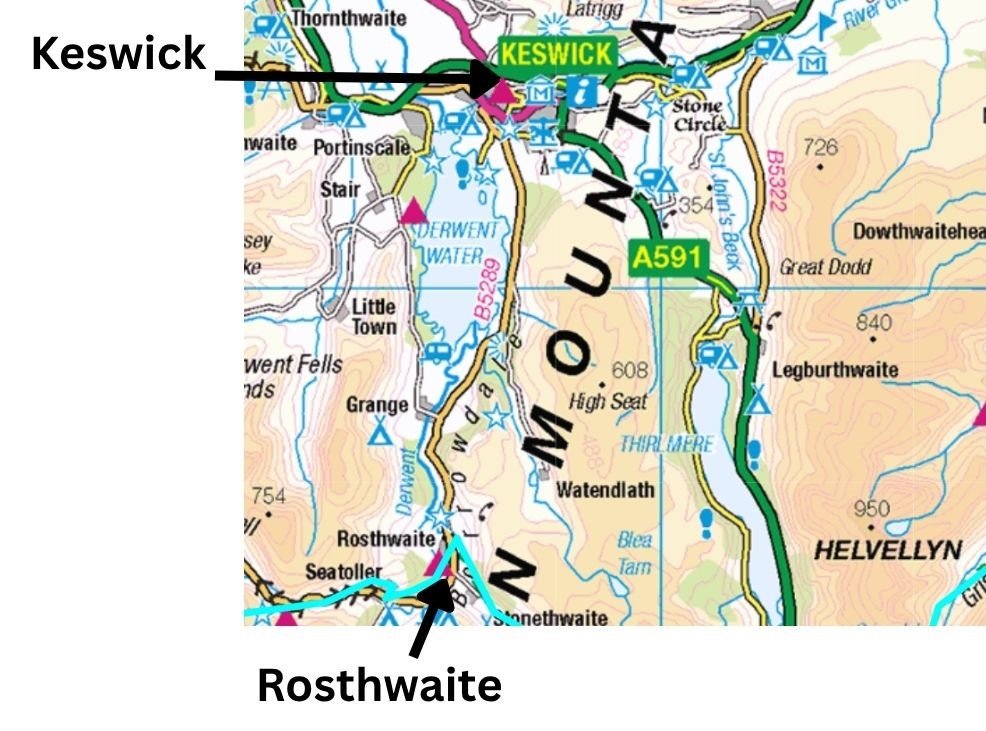
There is no bus service to Ennerdale Bridge. To enter or exit the trail from this point, a taxi is required — either to St Bees or Whitehaven, the nearest local transport hubs. Rosthwaite also has no train station but is served by the Seatoller–Rosthwaite–Keswick Stagecoach service (No. 78). Keswick has no train station, but it does have reliable bus links to Penrith on the West Coast Main Line.
Day 3: Rosthwaite to Patterdale
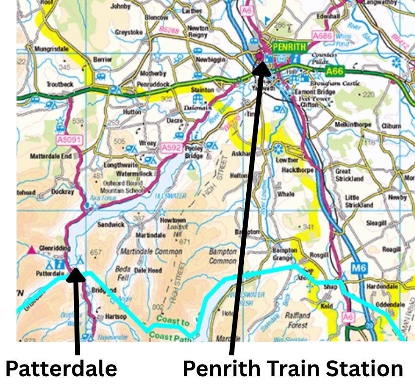
Patterdale is one of the best-connected points on the Coast to Coast for walkers who need to exit or re‑enter the trail. The Stagecoach 508 bus links Patterdale directly with Penrith Rail Station, giving walkers fast access to the national rail network. Penrith is the nearest national rail station to the central Lake District section of the C2C. This makes Patterdale one of the easiest places to break the trail without needing taxis or long detours.
Day 4: Patterdale to Shap
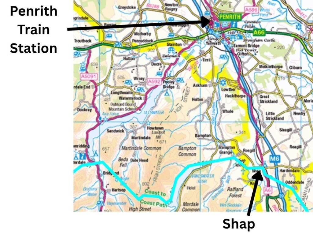
Shap is one of the easiest Coast to Coast villages to access by public transport, thanks to the 106 bus linking it directly with Penrith Rail Station. This makes Shap a reliable point for walkers who need to join the trail, leave early, or restart after a break.
Why Shap works well
- The 106 bus runs several times a day (typically four services in each direction).
- It avoids the need for taxis or long detours — the bus stops right in Shap village, close to accommodation and the C2C route.
Day 5: Shap to Kirby Stephen
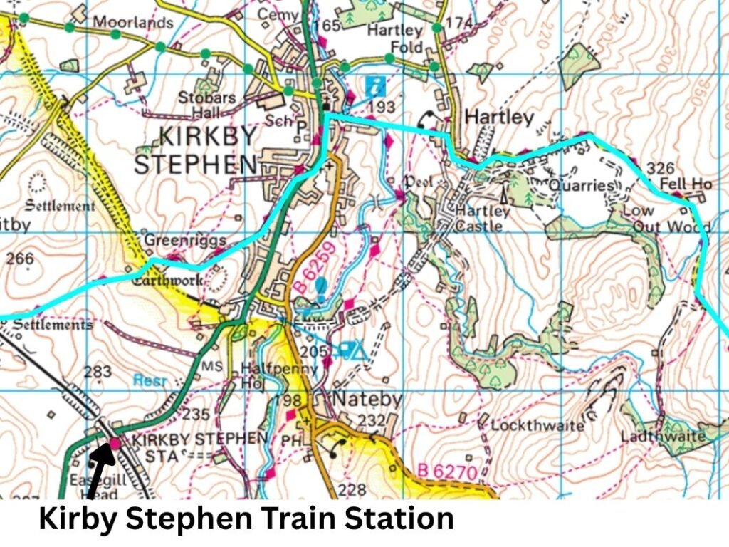
Kirkby Stephen is a useful mid‑route access point on the Coast to Coast, but its train station is not in the town and not directly on the C2C bus route. The station sits 1.3 miles south of Kirkby Stephen, on the Settle–Carlisle line, meaning walkers must plan a short transfer to reach it.
What walkers need to know
- The station is 1.3 miles from the town centre, located on Wiseber Road, well away from the C2C footpath.
- There is no direct bus from the C2C route to the station.
- Walkers must either walk the 1.3 miles, or take a local taxi from the town centre.
- The station is unstaffed, with basic facilities (shelter, ticket machine, help points).
- It offers national rail connections via the Settle–Carlisle line, including trains to Carlisle, Leeds, and onward connections to Manchester, York, London, and Scotland.
Why it’s still a good entry/exit point
- Kirkby Stephen is a major resupply town on the C2C.
- Accommodation, shops, and food options are all in the town, not at the station.
- The station’s location makes it a quiet but reliable rail access point for walkers who want to:
- join the trail at Kirkby Stephen
- leave the trail after the Nine Standards section
- break the route into shorter stages
- avoid long rural bus journeys
Day 6: Kirby Stephen to Keld
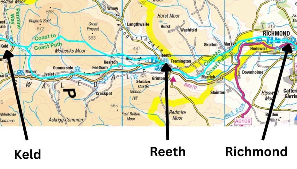
Keld is one of the most remote points on the Coast to Coast, but it is served by the Swaledale Shuttle (Service 30), which gives walkers a reliable way to leave or re‑join the trail without needing a taxi.
The bus runs Monday to Saturday (no Bank Holidays), with multiple services per day in both winter and summer timetables. There is no Sunday service, so walkers should plan accordingly.
Why this matters for walkers
- Keld is remote, but the Shuttle provides a direct link to Reeth and Richmond, making it the easiest way to exit the trail after the Nine Standards or to re‑join the route from the south.
- The service is affordable, far cheaper than heritage rail or long-distance taxis.
- It connects you to Richmond, where you can access onward buses to Darlington, Northallerton, and national rail services.
Day 7 keld to reeth
The Swaledale Shuttle (Service 30) connects Reeth with Keld and Richmond, but Reeth itself has no direct rail access and no direct bus to a rail station.
Walkers must:
- Take the Shuttle from Reeth to Richmond, then
- Change buses in Richmond for onward travel to Darlington, Northallerton, or other rail hubs.
This makes Reeth a two‑bus journey for anyone trying to exit the Coast to Coast by train.
Day 8: Reeth to Richmond:
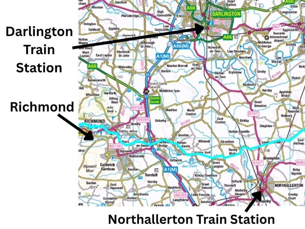
Richmond is the main transport hub for the central section of the Coast to Coast. It is the first large town east of the Pennines, and the place where walkers have the best choice of buses for onward travel. Richmond does not have a train station, but it has multiple bus routes linking directly to national rail at Darlington and Northallerton.
Richmond is served by 14 bus routes, including:
- Service 29 — Richmond → Gilling West → Melsonby → Aldbrough St John → Darlington
- Service 34 — Richmond → Brompton-on-Swale → Catterick Village → Scotch Corner → Darlington
- Service 55 — Richmond → Scorton → Bolton-on-Swale → Northallerton
- Service 30 — Keld → Reeth → Richmond (your C2C feeder bus)
These routes make Richmond the best place for walkers to exit or enter the trail east of the Pennines.
Day 9: Richmond to Ingleby Cross
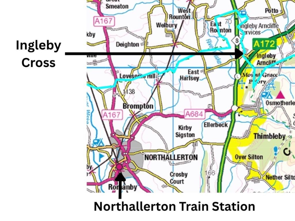
Ingleby Cross sits directly on the Coast to Coast route, but it has limited public transport. For walkers who need to get home, Northallerton is the only practical onward connection — it’s the nearest town with national rail services.
The relevant bus is:
- Service 80/89 — Ingleby Cross → Northallerton (and vice versa)
This is the only route that matters for C2C walkers entering or exiting the trail.
Day 10: Ingleby Cross to Clay Bank Top
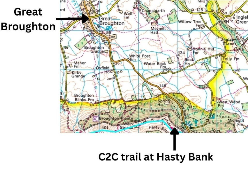
Clay Bank itself has no public transport, no village, and no facilities. The nearest access point for Coast to Coast walkers is Great Broughton, which sits about 2.5 miles north of the C2C route on the Cleveland Hills. Walkers must descend from Clay Bank to the road, then continue down into Great Broughton to reach the bus network.
The relevant bus is:
- Service 80/89 — Great Broughton ↔ Stokesley ↔ Northallerton
This is the only practical route for walkers who need to get home, because Northallerton is the nearest national rail station.
Day 11: Clay Bank Top to Glaisdale
Glaisdale is one of the best‑connected villages on the eastern end of the Coast to Coast because it offers both a train station and local bus services. This makes it a practical point for walkers to enter or exit the trail before the final push to Grosmont, Littlebeck and Robin Hood’s Bay.
Train: Esk Valley Line (Northern Rail)
Glaisdale Station sits directly in the village and is served by the Esk Valley Line, running between:
- Whitby
- Middlesbrough
This gives walkers access to:
- Whitby (for onward bus links to Scarborough, York, Leeds)
- Middlesbrough (for national rail connections across the UK)
Glaisdale is served by three bus routes, but only one is genuinely useful for walkers:
Service 96 — Whitby ↔ Lealholm ↔ Glaisdale ↔ Egton Bridge ↔ Grosmont
This is the practical bus option for Coast to Coast walkers.
It links Glaisdale with:
- Whitby (major onward transport hub)
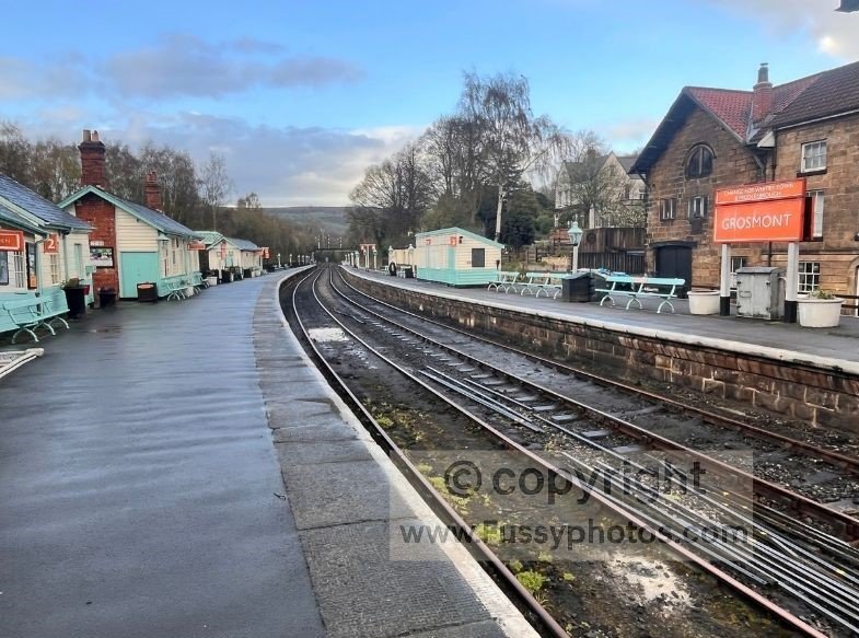
- Grosmont (NYMR heritage railway + village services)
- Egton Bridge / Lealholm (Esk Valley villages)
Why Glaisdale is a strong entry/exit point
Direct rail access
You can finish your day in Glaisdale and immediately board a train to Whitby or Middlesbrough.
Bus + train flexibility
Walkers can combine the 96 bus with the Esk Valley Line to reach Whitby or Grosmont without needing taxis.
Useful for itinerary adjustments
Glaisdale is ideal for:
- breaking the long moorland section
- avoiding the steep descent/ascent into Littlebeck
- restarting the trail after a rest day in Whitby
- exiting the route before the final coastal section
Practical notes
- Train frequency is moderate, not hourly — check ahead.
- Bus frequency is limited, but reliable.
Day 12: Glaisdale to Robin Hood’s Bay
Robin Hood’s Bay has no train station, and there is no rail access anywhere near the finish of the Coast to Coast. Walkers must use the X93/X94 bus to reach either Whitby or Scarborough, both of which connect to national rail.
This makes the X93/X94 the only practical way to get home after completing the trail.
Coast to Coast Transport FAQs
Can you access the Coast to Coast at multiple stages using trains?
Partly. The Coast to Coast crosses two major rail lines — the Settle–Carlisle line and the East Coast Main Line — and begins at St Bees, which has its own station. Other sections of the trail rely on bus links, not direct rail access.
What is the best train station to start the Coast to Coast?
St Bees. It is the classic starting point, with a station close to the trailhead and frequent services from Carlisle.
Where is the last train station on the Coast to Coast?
The Coast to Coast has no train station on its final section, and Robin Hood’s Bay has no rail access. Walkers can leave the trail by train shortly before the end, depending on whether they want heritage or national rail:
Grosmont — the last station close to the trail (heritage line)
Grosmont is the final rail‑access point near the C2C, sitting just off the route in the North York Moors. It is served by the North Yorkshire Moors Railway, a heritage steam/diesel line.
- More expensive than national rail (Day Rover typically £34–£38)
- Less frequent, seasonal services
- Ideal for a scenic exit, but not for onward travel home
Whitby — nearest national rail station to the finish
Whitby is the closest proper train station to Robin Hood’s Bay. You reach it by:
- X93/X94 bus
- Taxi (10–15 minutes)
Whitby offers:
- National Rail services to Middlesbrough, York, Darlington, Sunderland
- Cheaper fares than heritage rail
- More frequent, year‑round timetables
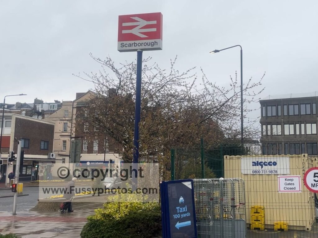
Scarborough — best onward connections after finishing
Most walkers finish at Robin Hood’s Bay and take the bus south to Scarborough, which offers:
- Direct trains to Hull and York
- Frequent services
- Lower fares
- Year‑round reliability
Scarborough is the most practical national rail exit for anyone finishing the trail.
Can you break the Coast to Coast into train‑friendly sections?
Key rail‑linked break points include St Bees, Penrith (via Patterdale), Kirkby Stephen, Northallerton (via Ingleby Cross), Glaisdale, Whitby, Middlesbrough and Scarborough — but each of these varies in how directly they connect to the trail.
- St Bees — direct rail access, right at the western trailhead.
- Penrith (via Patterdale) — direct national rail, reached by the frequent 508 bus.
- Kirkby Stephen — direct national rail, but the station is 1.3 miles south of the town and requires a short walk or taxi.
- Northallerton (via Ingleby Cross) — direct national rail, reached by the 80/89 bus; the only meaningful exit point in the Vale of Mowbray.
- Glaisdale — direct rail access via the Esk Valley Line; one of the few places where the trail meets a train.
- Whitby — not on the trail; requires the X93/X94 bus from Robin Hood’s Bay or Hawsker.
- Grosmont — on/near the trail, but served only by the NYMR heritage railway, which is scenic but not suitable for onward national travel.
- Middlesbrough — not on the trail; reached by the X93/X94 bus from Robin Hood’s Bay, Whitby or Guisborough.
- Scarborough — not on the trail; reached by the X93/X94 bus from Robin Hood’s Bay, and offers the strongest onward national rail connections after finishing.
These access points allow walkers to break the Coast to Coast into logical stages — but only St Bees, Penrith, Kirkby Stephen, Northallerton and Glaisdale offer direct rail access from the trail itself. All other rail hubs require a bus connection.
Is the Lake District section of the C2C accessible by rail?
Partly. The Lake District section of the Coast to Coast has no rail stations on the trail itself, but there are two practical rail gateways walkers use:
- St Bees — the official western start of the Coast to Coast, with direct national rail access on the Carlisle–Barrow line.
- Penrith — the nearest national rail hub for the central Lakes, reached by the 508 bus to Patterdale and Glenridding, making it the best access point for walkers entering or leaving the route around Helvellyn, Grisedale, and the central fells.
Together, these give walkers reliable rail access before entering the Lakes (St Bees) and after leaving the high fells (Penrith), even though the Lake District section itself has no stations.
Is the North York Moors accessible by train?
Partly — but only in very specific places. The Coast to Coast crosses the North York Moors, but the trail itself has almost no rail access. The only meaningful train connection for C2C walkers inside the Moors is:
- Glaisdale — directly on the Esk Valley Line, and directly on the C2C
This makes Glaisdale the only true rail-access point on the Moors section of the Coast to Coast.
What about the other North Yorkshire Train stations?
- Egton Bridge — not on the C2C, requires detours
- Whitby — not on the C2C, requires the X93/X94 bus or a taxi
- Grosmont — on/near the C2C, but served only by the NYMR heritage railway, not national rail
- Scarborough — not on the C2C, reached only by the X93/X94 bus from Robin Hood’s Bay
Conclusion — Using Public Transport on the Coast to Coast
Public transport on the Coast to Coast is varied, local, and often limited, but it can be used strategically to make the walk smoother, safer, and more flexible. The key is understanding where the reliable exit points are — and where they aren’t.
Most walkers rely on a combination of national rail hubs (Penrith, Northallerton, Middlesbrough, Scarborough) and local feeder buses (508, 106, Swaledale Shuttle, 80/89, X93/X94). These links allow you to break the walk into sections, avoid poor weather windows, and manage accommodation more easily.
Practical tips for walkers
- Check Sunday timetables — many rural services do not run at all.
- Book accommodation early in pressure points like Patterdale, Grasmere, and Clay Bank, where demand is high and transport options are limited.
- Use trains to avoid bad weather windows — rail access at Penrith, Northallerton, Middlesbrough and Scarborough lets you pause the walk safely.
- Combine rail + bus for maximum flexibility — most C2C access points require one short bus connection before reaching national rail.
- Use rail to split the walk across seasons — many walkers complete the Lakes in summer and return for the Moors in autumn or spring.
The overall takeaway
The Coast to Coast is not a rail‑connected trail, but it is a trail you can manage intelligently with public transport. If you plan around the strong hubs — Penrith, Northallerton, Middlesbrough, Scarborough — and use the local buses to reach them, you can enter or exit the route almost anywhere without needing taxis or complicated detours.
For a full planning guide, including staging, accommodation strategy, and seasonal timing, see Coast to Coast: How to Plan Your Best Walk.
Your Coast to Coast Resource Centre
From big Lake District passes to quiet Dales valleys, the hub page brings together every guide, highlight and trip report to help shape your own walk.