Short Answer — Yes, but the Difficulty Varies by Section
The Pennine Way is hard, but not because of technical scrambling or specialist skills. Its difficulty comes from the cumulative effect of long distances, exposed moorland, unpredictable weather and the logistics of linking remote sections together. Some stretches are straightforward; others demand stamina, resilience and a willingness to keep going when the weather turns.
There’s also a shared, slightly weary humour among Pennine Way walkers — the kind that comes from long days, wet feet and the knowledge that everyone else is battling the same terrain. The difficulty is real, but it’s also part of the trail’s character. And with sensible planning, realistic expectations and a few practical strategies (which I’ll cover later in this guide), the Pennine Way is entirely achievable and genuinely enjoyable.
Watch: Is the Pennine Way Hard?
A quick overview of what makes the Pennine Way challenging — and how to make it easier.

Why the Pennine Way Has a Reputation for Being Hard
The Pennine Way’s toughness isn’t defined by any single factor — it’s the combination that wears people down. Long days, steep climbs, boggy ground, high‑level weather and awkward endpoints all play their part. Add in the sheer length of the trail and the limited services in some areas, and it becomes clear why the Pennine Way has a reputation for being one of Britain’s most demanding National Trails. The sections below break down the main reasons walkers find it challenging.
If you’re new to the Pennine Way and want a simple, confidence‑building starting point before diving into the details, my beginner‑friendly guide to starting is the best place to begin.
268 Miles Is a Long Way
The Pennine Way is the third‑longest National Trail in the UK, and 268 miles across remote upland terrain is a serious undertaking. Many walkers complete it in around 16 days, averaging almost 17 miles per day. Walked as one continuous point‑to‑point journey, that’s a huge amount of fatigue to accumulate over time. With long, isolated stretches, persistent bogs and full exposure to the worst of the UK weather, it’s not unusual to meet Pennine Way walkers who are very ready for the finish line.
A summary of the main challenges:
- A sustained multi‑week endurance effort, with little opportunity for genuine recovery
- Long consecutive days that gradually wear down legs, feet and morale
- Fatigue that accumulates relentlessly, especially on exposed, weather‑beaten ground
- Motivation that becomes harder to sustain, particularly when conditions turn poor
Total Elevation Gain Exceeds the Height of Everest
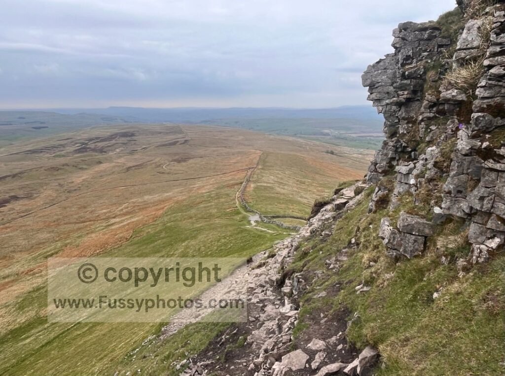
With over 11,000 metres of ascent — more than the height of Mount Everest — the Pennine Way’s total elevation gain far surpasses that of most other UK long‑distance trails. Unlike many routes that contour around hills or take the line of least resistance, the Pennine Way deliberately seeks out summits, linking one high point to the next. The result is a trail that feels consistently elevated, with frequent steep climbs such as Jacob’s Ladder, Pen‑y‑Ghent, Cross Fell and The Cheviots. On some days, the ascent alone can exceed 1,000 metres. That said, with a decent level of fitness, the overall difficulty remains lower than many international long-distance routes.
A summary of the main challenges:
- Repeated steep ascents across major summits and high‑level sections
- Daily elevation gains that can exceed 1,000 metres, especially in the central and northern stages
- Cumulative strain on legs and joints, amplified by long days and heavy packs
- High‑level exposure to wind and weather, making climbs feel harder than the numbers suggest
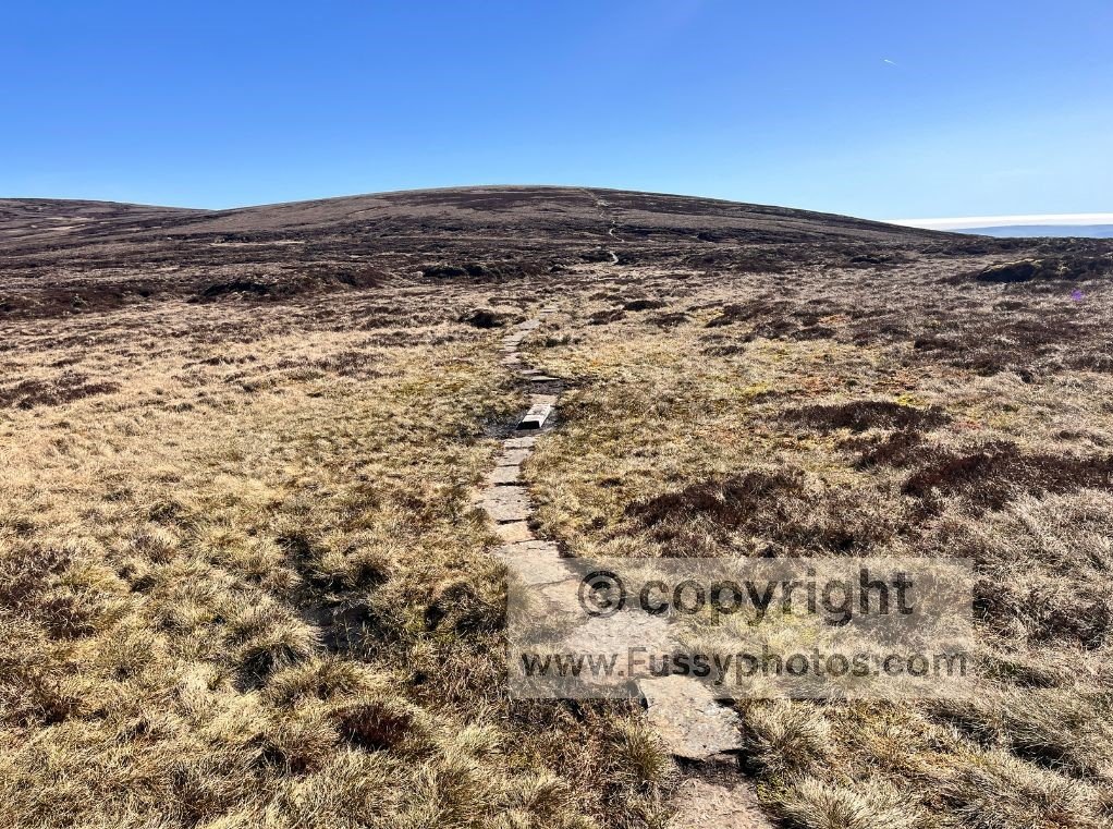
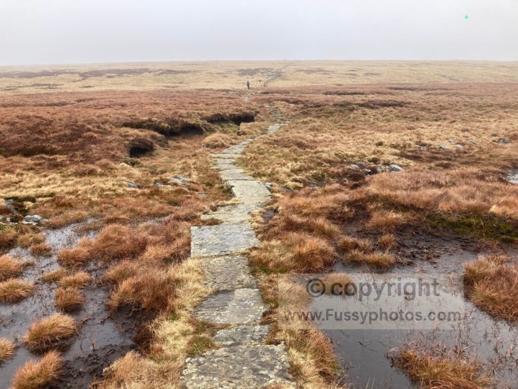
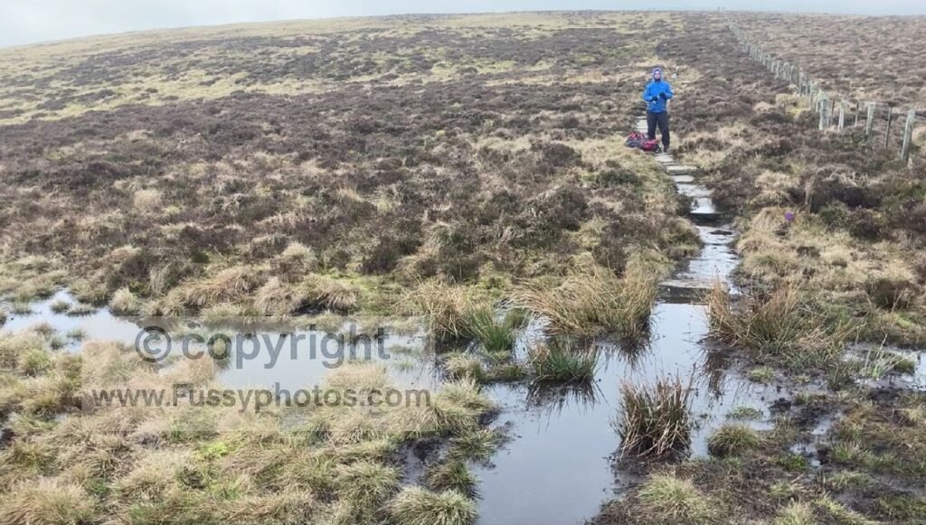
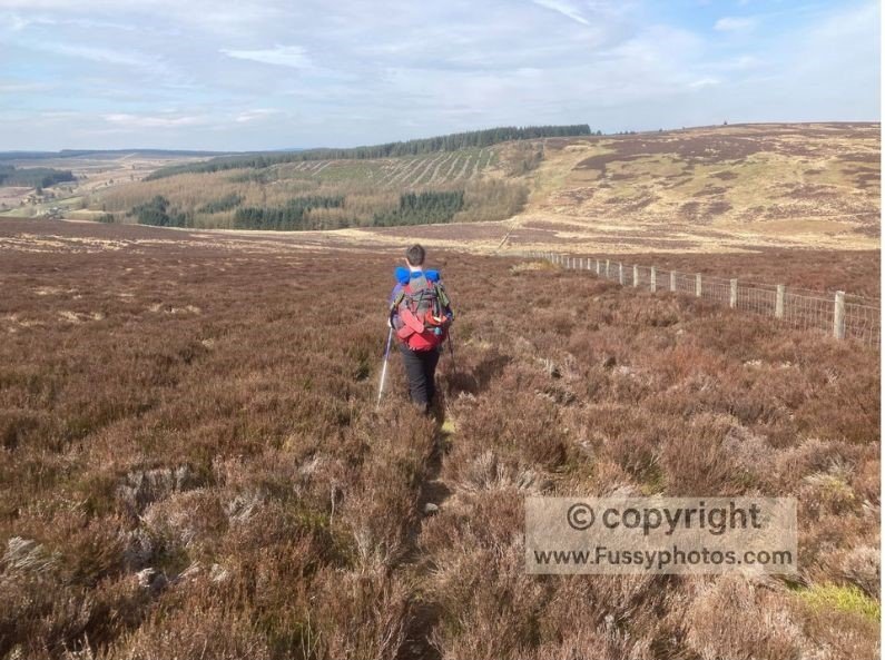
Bogs, Peat and Slow Ground Underfoot
The cumulative mental effort of navigating yet another bog definitely wore me down on my Pennine Way thru‑hike. Fifteen‑ to twenty‑five‑mile days feel noticeably longer when progress slows to a cautious hop across places like Bleaklow, Great Shunner Fell, Sleightholme Moor and the Cheviots — some of the most notoriously wet and energy‑sapping sections of the trail. Decent footwear is essential, and wet feet are almost guaranteed in less favourable weather. I must have walked at least half of those 268 miles with wet socks (or perhaps I’ve exaggerated it in my memory).
A summary of the main challenges:
- Energy‑draining terrain that demands constant attention and balance
- Slow progress even on modest mileage, making long days feel longer
- Wet feet and route‑finding frustrations, especially in poor visibility
- Morale dips when every step becomes a negotiation with the ground
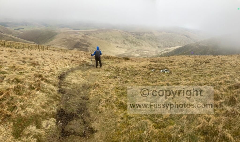
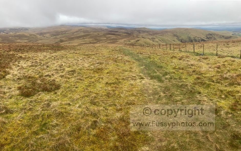
High, Exposed Terrain Means Tough Weather
Because the Pennine Way follows the spine of the Pennines from south to north, much of the trail sits above 500 metres, with long stretches fully exposed to the elements. Combined with its position on the wet western side of the UK, this creates classic relief‑rainfall conditions: more wind, more cloud, more rain, and ground that stays boggy long after the weather improves. Even on dry days, it’s common to spend time walking in the cloud, only seeing the views once you descend.
With roughly every 100 metres of elevation, the temperature can drop by 0.65–1°C, so summits often feel noticeably colder than the valleys below. Conditions can also change abruptly. When I ascended Pen‑y‑Ghent, the weather 300 metres below the summit was calm and perfectly manageable — but as I climbed the southern ridge, the wind strengthened so suddenly and so violently that I was literally blown off the trail.
In settled summer weather, little of this matters — but for much of the year, it can mean walking through clag, wind and low visibility. On my final day on the Pennine Way, many of the Cheviot peaks were wrapped in cloud. As the trail rose from Windy Gyle, we climbed straight into the mist, losing the superb scenery around us. It wasn’t until we dropped towards the Mountain Rescue Hut beneath Auchope Cairn that the views finally opened. I’ve since returned in clear weather, and the difference was night and day.
A summary of the main challenges:
- Much of the trail sits above 500–700 metres, increasing exposure
- Frequent rainfall from relief uplift, keeping the ground wet and slow
- Mist, clag and poor visibility, especially on high plateaus
- Strong winds on Cross Fell, Great Shunner Fell and the Cheviots
- Cold, cloud‑covered summits, even during summer
Navigation Can Be Difficult in Poor Conditions
For most walkers — and in my own experience — the Pennine Way is generally straightforward to navigate. The waymarking is consistent across much of the trail, and with a map and GPS as backup, it’s rare to go seriously wrong. However, in more exposed areas without paving stones, the monotonous, featureless landscape can make the line of the trail harder to pick out, especially in mist or clag.
There are also occasional sections where the path feels less well trodden. Between Bellingham and Byrness, the ascent of Padon Hill and the traverse alongside the forest plantation were particularly vague — at times little more than faint trods through thick undergrowth. A GPS was invaluable here, not because the navigation was complex, but because it prevented us drifting onto sheep tracks and losing time.
Overall, navigation isn’t a major barrier for most walkers, but poor visibility and indistinct moorland paths can still catch people out.
A summary of the main challenges:
- Inconsistent waymarking in a few remote stretches
- Featureless moorland where the trail can fade into the landscape
- Long gaps without signage, especially on high plateaus
- GPS and map skills still essential, particularly in mist or low visibility
If you’d like a clearer sense of what the waymarking, trail cues and navigation actually look like on the ground, my Pennine Way navigation guide explains how the route is marked and why most walkers find it straightforward in normal conditions.
Logistics Are Surprisingly Tricky
One of the biggest challenges of the Pennine Way isn’t the terrain — it’s the logistics. These are the factors that can shape your entire thru‑hike before you’ve even taken a step.
Days That End Without a Settlement
On the official 16‑day itinerary, only a handful of stages — Middleton‑in‑Teesdale, Alston and Greenhead in particular— finish in places with a good range of amenities. Several others end in locations with little to no facilities at all. Standedge and Windy Gyle, for example, officially finish at trig points miles from the nearest accommodation, food or transport. This forces walkers to get creative: detouring off‑route to nearby villages, arranging taxis, or — in the case of Byrness → Windy Gyle → Kirk Yetholm — combining Days 15 and 16 into a 27‑mile final push.
This matters because it’s impossible to carry 16 days of food, and while many walkers are happy to camp, there are days when you’ll want a hot meal, a shower and a roof over your head. Outside the summer season, the challenge increases: sparsely populated end points may have one pub or B&B, and some close entirely outside peak months.
One practical solution — which I’ll expand on later — is to break the route into shorter sections of 2–5 days, depending on your time, fitness and tolerance for nights without a pub meal. Even then, the remoteness of some stage endings means you’ll still need to plan carefully. My Pennine Way stage‑planning guide sets out several practical ways to split the trail into shorter, more manageable sections.
A summary of the main challenges:
- Standedge — summit finish, no facilities
- Windy Gyle — summit finish, no facilities
- Several stages end far from accommodation or transport, requiring detours or taxis
Villages With Limited or No Services
Even on days that finish in or near a village, services aren’t always guaranteed. Some settlements on the Pennine Way have accommodation but very limited resupply, seasonal opening hours, or no shop at all. This matters when you’re trying to plan food, rest days or simple comforts like a pub meal — especially outside the summer season.
A summary of the main challenges:
- Byrness — no shop and very limited food options
- Crowden — no services, just a seasonal campground
- Middleton‑in‑Teesdale — some resupply, but limited for a full thru‑hike
- Malham and Hawes — busy, often full, and more expensive in peak season
Sparse Public Transport
If you’re stepping off the trail for a night of home comforts, or planning to return later to continue your thru‑hike, public transport becomes an important part of the equation. Inevitably, a route that follows the Pennines is often remote, and with that comes limited bus services and few convenient connections. It’s manageable, but it does require checking timetables carefully — and occasionally paying for a taxi when you need more flexibility.
A summary of the main challenges:
- Some sections require taxis or long detours to reach accommodation or transport
- Bus services often run only once or twice a day, especially outside summer
If you want to see every practical rail link along the route, my Pennine Way train‑access guide sets out all the stations and transport options from Edale to Kirk Yetholm.
Long, Remote Stretches With No Escape Points
One of the appeals of the Pennine Way is that it takes you onto trails and into landscapes you’d rarely reach on a simple out‑and‑back or circular day walk. The flip side is that some sections are extremely remote, with no escape points if the weather turns or if a problem arises. You’re often committed for many miles before the next road, building or settlement appears.
Northumberland National Park is the clearest example. The stretch from Byrness to Kirk Yetholm is a 27‑mile traverse with no villages, no shops and no roads beyond the occasional deserted farm track. It’s superb for solitude, but in poor conditions it leaves you with very few options.
Other sections share the same character: long, high, committing miles where you’re fully exposed to the weather and entirely self‑reliant.
A summary of the main challenges:
- Cross Fell → Garrigill — long, exposed descent with no shelter other than a mountain rescue hut
- Dufton → Alston — remote moorland with limited escape options
- Byrness → Kirk Yetholm (The Cheviots) — 27 miles with no settlements or resupply
- Weather exposure + no resupply + no shelter, requiring full self‑sufficiency
The Mental Challenge Is as Big as the Physical One
If you walk the Pennine Way as one continuous point‑to‑point journey without stepping off the trail, the psychological weight of everything you’ve faced so far can build up. Long consecutive days, persistent weather, bogs, solitude and tiredness — or a combination of all of them — can leave you questioning why you didn’t just book a beach holiday instead. It’s a normal part of a three‑week trail, and one that many walkers experience at some point.
A summary of the main challenges:
- Consecutive long days with little mental reset
- Solitude on the northern sections, especially in poor weather
- Motivation dips when conditions turn against you
- The psychological weight of a three‑week trail, with no easy shortcuts
How to Make the Pennine Way More Manageable
Walking the Pennine Way doesn’t have to mean three unbroken weeks of long days, remote stages and psychological pressure. With a bit of planning, you can shape the trail around your family and work commitments, your fitness and the weather, turning a demanding national trail into something far more enjoyable and achievable. The strategies below are the most effective ways to reduce exhaustion, avoid awkward endpoints, build confidence and give yourself the flexibility the Pennine Way often denies you if tackled in one continuous push.
Walk the Pennine Way in Sections, Not One Long Push
For most walkers, breaking the Pennine Way into stages is the most practical and enjoyable way to complete it. Instead of committing to three continuous weeks, you can shape the trail around work, family life, weather windows and transport — whether that’s a simple south/middle/north split, a four‑ or five‑stage version, or a weekend‑friendly itinerary built around train stations.
Walking in sections reduces exhaustion, gives you time to recover between trips, and removes the pressure of tackling long, remote stretches when the weather isn’t on your side. For detailed options, see my guide to How to Break the Pennine Way into Walkable Stages.
A summary of the main benefits:
- Reduces exhaustion by avoiding three continuous weeks on the trail
- Allows recovery between stages, making the walk more enjoyable
- Lets you choose weather windows, especially for exposed northern miles
- Fits around work and family life, using flexible 2–5 day sections
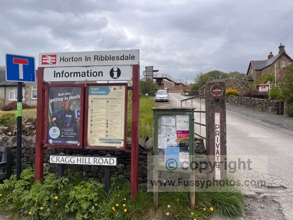
Use Train Stations to Build Logical, Shorter Sections
Several parts of the Pennine Way link neatly with the rail network, making it possible to break the trail into shorter, more manageable point‑to‑point sections without needing a car. Stations such as Edale, Hebden Bridge, Horton‑in‑Ribblesdale, Appleby‑in‑Westmorland and Haltwhistle are just some of the rail access points either on or close to the trail.
Even the far north can be reached with a little planning, with Kirk Yetholm accessible via connecting buses. Using train access lets you shape your stages around weekends, weather windows and real‑life commitments, and helps reduce the mental and physical load of long, continuous days. For a full breakdown of every rail‑friendly access point, see my Pennine Way Train Access Guide.
A summary of the main benefits:
- Helps manage tiredness by breaking the trail into shorter, flexible stages
- Supports weather‑window planning, especially for exposed high‑level days
- Reduces the mental load of long, unbroken stretches
- Fits around work and family life far more easily
- Uses stations on or near the trail, including Edale, Hebden Bridge, Horton, Appleby, Haltwhistle and Kirk Yetholm
Try Short, Accessible Pennine Way Weekend Sections
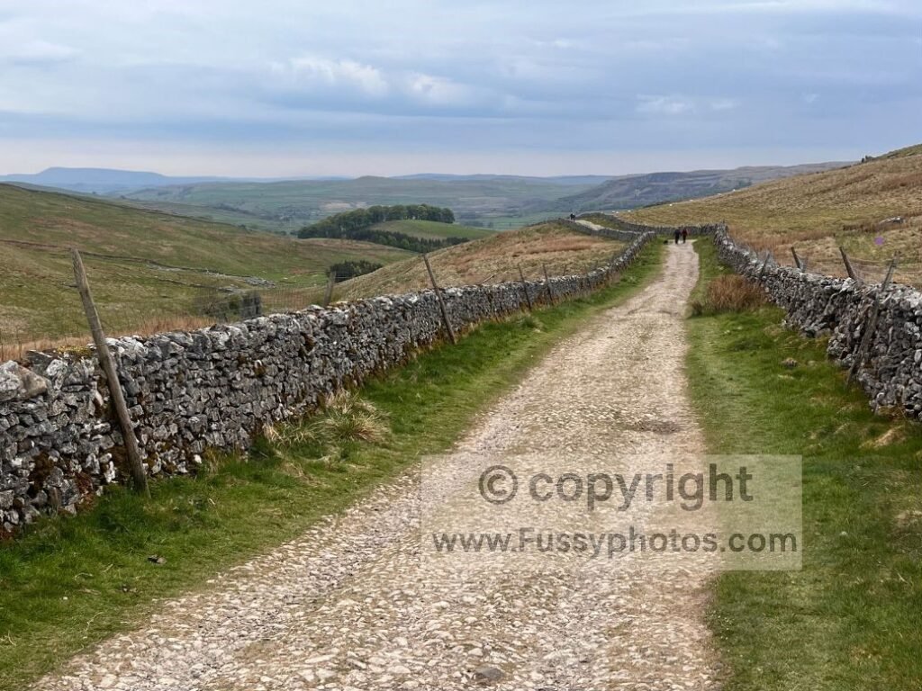
If you’re new to the Pennine Way — whether you’re a complete beginner or an experienced long‑distance walker trying the trail for the first time — short weekend sections are the best way to get a feel for it. Routes like Edale → Crowden → Marsden in the Dark Peak and Gargrave → Malham → Horton‑in‑Ribblesdale in the Yorkshire Dales offer classic Pennine Way scenery with clear paths, simple logistics and train stations at both ends.
These weekends are confidence‑building without being overwhelming. They let you test your fitness, practise carrying a pack, and get used to moorland navigation, all without committing to the full 268 miles. For detailed route guides, see my Edale → Crowden → Marsden weekend and my Gargrave → Malham → Horton‑in‑Ribblesdale beginner‑friendly Dales itinerary.
A summary of the main benefits:
- Confidence‑building, even for experienced walkers new to the Pennine Way
- Clear paths and good logistics, with rail access at both ends
- Ideal for testing fitness, pack weight and navigation
- A realistic way to decide whether the full Pennine Way is for you
Choose Stages With Accommodation at the End
- Avoid summit finishes
- Plan around villages with food and beds
- Use taxis or short detours when needed
- Section walking gives you this flexibility
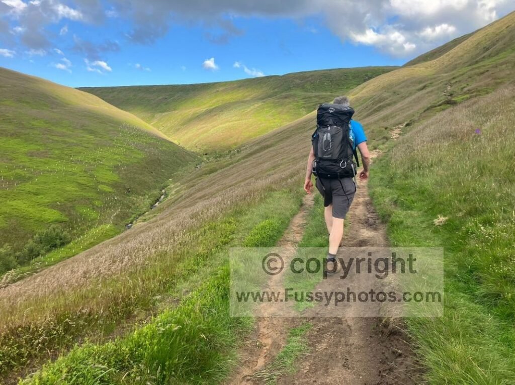
Carry the Right Kit for Long, Remote Days
The Pennine Way crosses exposed moorland, remote valleys and long stretches with no services, so carrying the right kit makes a huge difference to how safe and comfortable your day feels. Waterproofs, warm layers, a power bank, an OS map and a GPS app are essential year‑round, and you should always carry enough food and water for the full day — especially on long moorland crossings where you can’t rely on streams or shops.
Section walkers don’t need the ultralight setups used by full thru‑hikers, but you still need to be self‑sufficient between towns like Hebden Bridge, Malham, Dufton or Bellingham. For a full breakdown of what to pack — including navigation tools, clothing, safety kit and overnight gear — see my Essential Packing List for a Section Walk.
A summary of the main essentials:
- Waterproofs for rapid weather changes
- Warm layers for exposed summits and windy ridges
- Power bank to keep your phone and GPS running
- Map + GPS for reliable navigation in poor visibility
- Enough food and water for long, remote moorland crossings
FAQs
Is the Pennine Way suitable for beginners?
Yes — but only with realistic expectations. The Pennine Way is long, exposed and often remote, so it’s not an easy first long‑distance trail. However, beginners or walkers new to the Pennine Way can start with shorter, manageable sections such as Edale → Crowden → Marsden or Gargrave → Malham → Horton‑in‑Ribblesdale, which offer classic scenery with clear paths and good logistics.
What is the hardest part of the Pennine Way?
Different walkers struggle with different sections, but the toughest miles are usually the long, exposed upland stretches such as Cross Fell, Sleightholme Moor, Great Shunner Fell, and the 27‑mile Cheviots traverse from Byrness to Kirk Yetholm. These combine distance, weather exposure and limited escape points.
If you want a full breakdown of the most challenging climbs, bogs and weather‑beaten miles, see my Hardest Parts of the Pennine Way (Ranked) guide.
How fit do I need to be to walk the Pennine Way?
You don’t need to be an athlete, but you do need solid hill‑walking fitness. Most walkers average 15–18 miles per day with a pack, often in wind, rain or boggy conditions. If you can comfortably walk back‑to‑back 12–15 mile days on hilly terrain, you’re in a good starting place.
How long does it take to walk the full Pennine Way?
Most walkers complete the 268‑mile trail in 14–16 days, though slower itineraries of 18–21 days are common and often more enjoyable
What is the weather like on the Pennine Way?
Expect rapid changes, strong winds on exposed summits and boggy ground after rain. Much of the trail sits above 500–700 metres, so conditions are often harsher than in the valleys. Waterproofs and warm layers are needed year‑round.
Do I need to carry all my food and water?
Not for the whole trail, but you must be self‑sufficient on long moorland crossings where there are no shops, pubs or water sources. Many upland streams are peaty or livestock‑affected, so treat water as a bonus, not a plan. Carrying 2–3 litres is typical.
What kit do I need for the Pennine Way?
You’ll need waterproofs, warm layers, a power bank, map + GPS, and enough food and water for long remote stretches. For a full breakdown of clothing, safety gear and overnight kit, see my Essential Packing List for a Section Walk.
Return to the Pennine Way Hub
Find more stage guides, planning advice and route options in my full Pennine Way hub.