The Pennine Way is famed as much for it’s difficulty and being England’s first long distance trail as it is for it’s highlights. For all it’s tough moments, it’s also full of memorable places for the right reasons. If you’re planning the Pennine Way or choosing which sections to walk, these ten highlights capture the places where the landscape opens up, the history deepens, or the sense of scale becomes unmistakable. Here are the top 10 highlights of the Pennine Way every thru walker remembers.
10. Pen y Ghent
Pen y Ghent rises to 694m above Ribblesdale and is one of the most recognisable peaks on the Pennine Way, as well as a defining landmark of the Yorkshire Three Peaks. Approached late in a 14.5‑mile day from Malham, it’s often the descent that stays with you. Seen early from Darnbrook Fell, the long southern approach builds anticipation before the climb steepens into stone steps and light scrambling, opening onto a broad summit with far‑reaching views.
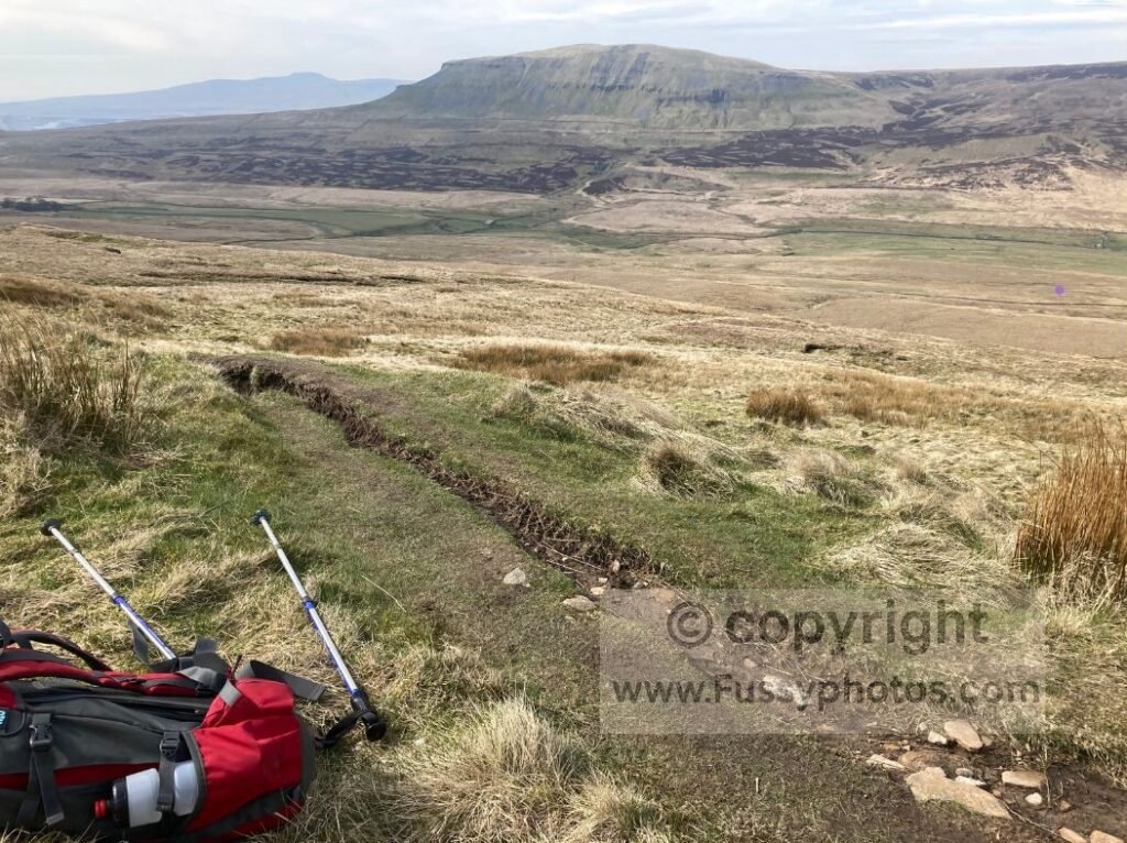
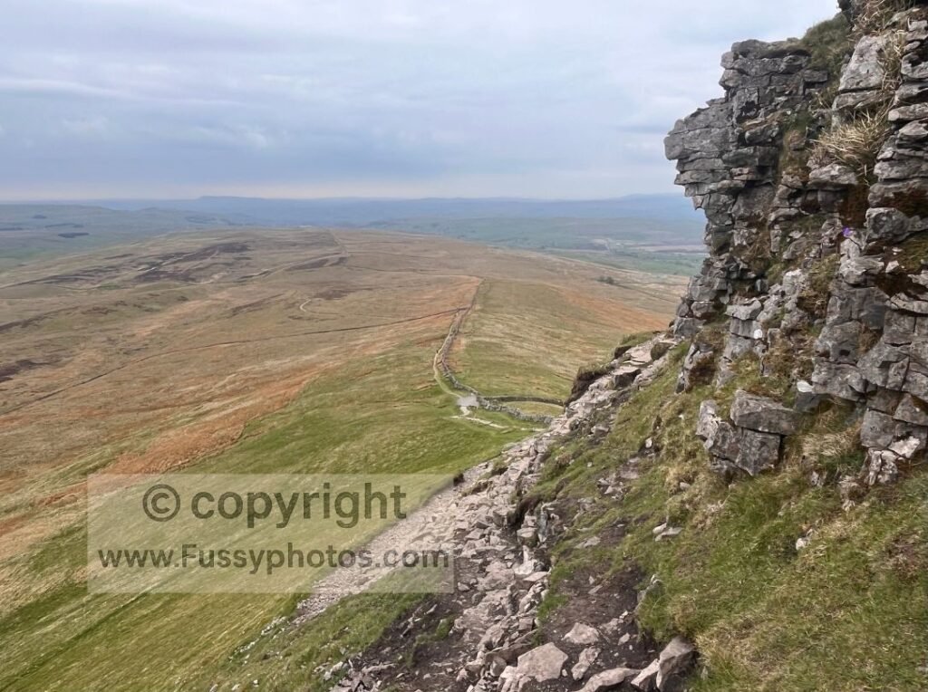
The descent swings north, offering a long view down Ribblesdale before cutting across the steep western flank.
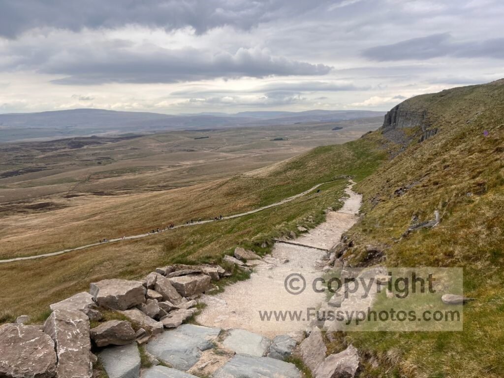
The final hour into Horton feels long but rewarding, and Hull Pot, just off the trail, is an excellent detour if you’ve still got the energy.
For a focused mountain day, see my Best Pen y Ghent Circular Walk from Horton.
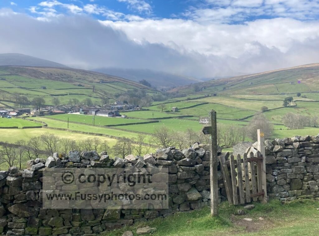
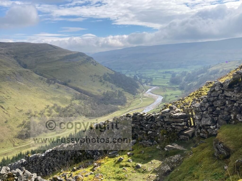
9. Swaledale
Tackled after the long, isolated moorland stretch over Great Shunner Fell, Swaledale offers a welcome change of scenery. Gone are the heather, the desolate plateau, and probably the worst of the rain — replaced with initial valley‑floor walking and the tiny village of Thwaite, complete with a café and a pub.
Of course, rather than letting you settle into the serenity, the Pennine Way does what it always does and sends you back uphill. The payoff is immediate: atmospheric farm buildings, dry‑stone walls, and west‑to‑east views that open out as you gain height.
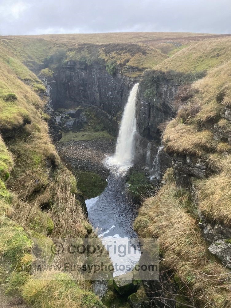
Soon the trail delivers elevated views of the River Swale gently meandering towards Keld.
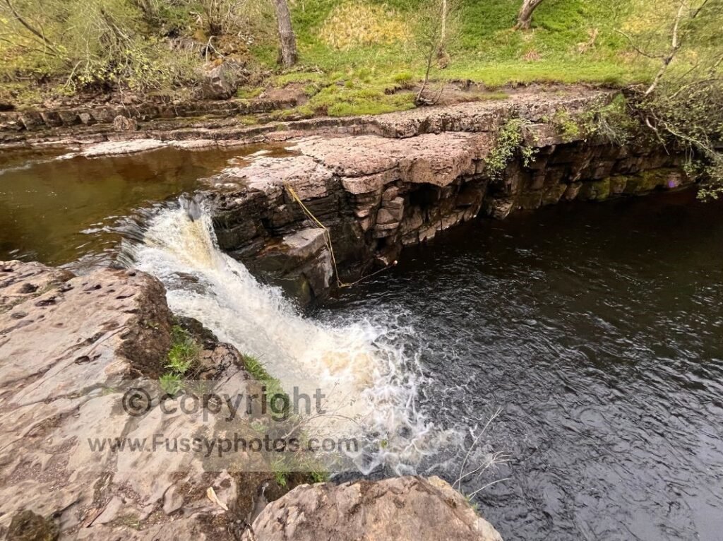
The terrain is a nuisance — loose scree, awkward footing, and a jagged contouring path — but Swinner Gill and Kisdon Force (a short detour from the trail) are genuinely memorable.
And there’s cake in Keld, plus a campsite, unless you’re chasing 25‑mile days — in which case, see my Day 8: Hardraw to Bowes trip report.
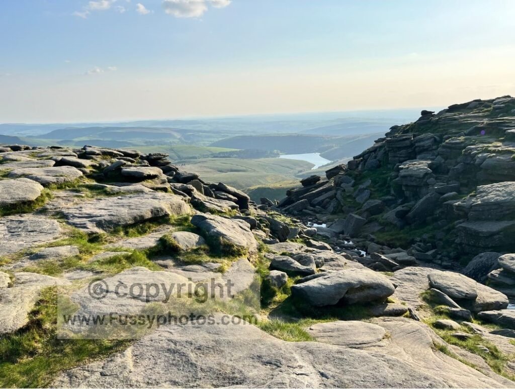
8. Kinder Downfall
Day 1 on the Pennine Way is a belter, featuring twice in these top 10 highlights. Following the iconic Jacob’s Ladder and climb out of Edale, Kinder Low to Kinder Downfall brings equally scenic elevated views this time westwards towards Manchester in the distance and Kinder Reservoir just below you. Still only a few miles into the beginning your journey, you’ve passed none of the hardest parts of the Pennine Way yet, only views, views and lots of company with Peak District day walkers.
The walk to Kinder Downfall is every bit as good as the waterfall itself, but the moment the valley sides drop 330m in front of you to the north and away to the west was my first real wow moment on the trail.
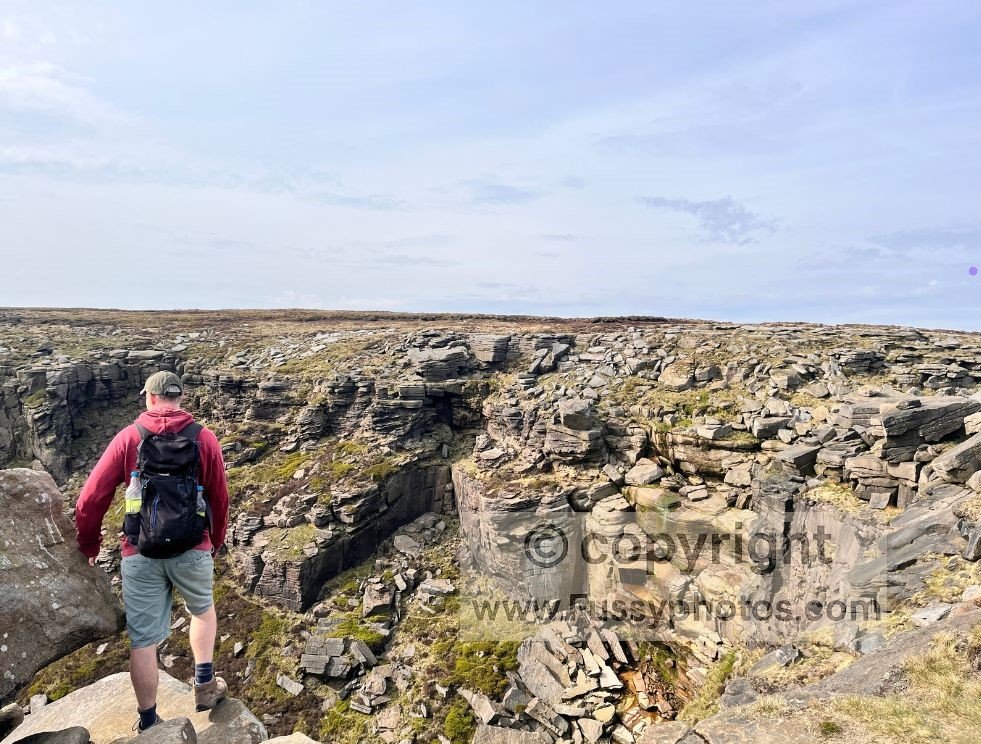
It’s a part of the Pennine Way I’ve returned to many times, making numerous circular day walks where Kinder is always the highlight.
You can read the full account of this section in my Days 1–3 Pennine Way Trip Report, which covers the climb out of Edale and the approach to Kinder Downfall in detail. If you’re looking for a standalone Peak District day walk, my Edale to Kinder Downfall Circular Walk follows the same dramatic escarpment.
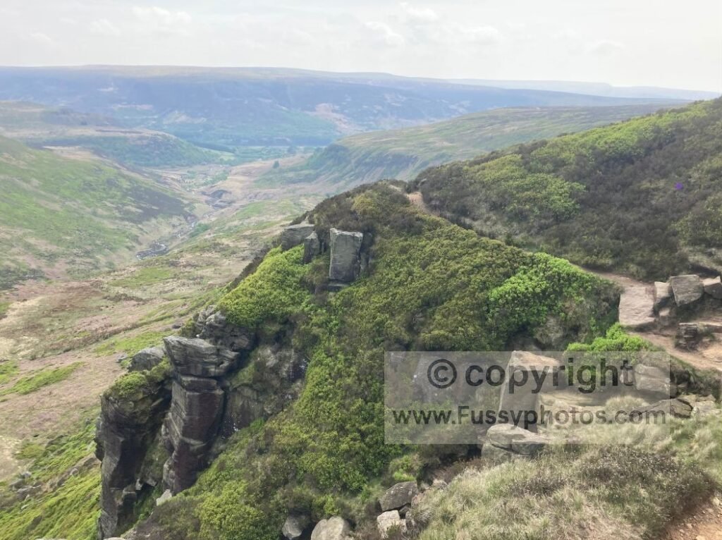
7. Laddow Rocks
Another early highlight, this time at the start of Day 2. The first 3–4 miles of this excellent and short day (if you stop at Marsden or the official Day 2 end point of the isolated Standedge trig point) are all uphill. Like Pen y Ghent, it also features in my Hardest Parts of the Pennine Way (Ranked), yet despite sore calves leaving Crowden and a near one‑hour ascent to Laddow Rocks, the views wipe out any negative memories as the trail ascends to 530m and the valley walls tighten around you.
The trail hugs the ridgeline, offering a little exposure but not so much that it will put you off or cause alarm — just enough to feel like you’re peering over the top towards the attractive Crowden Great Brook and back towards Crowden and Torside Reservoir. It was so good we took an early lunch here on Day 2 to savour the views a little longer.
You can also explore this stretch as a standalone day walk — my Crowden to Black Hill Circular covers the same dramatic ascent before returning via an almost equally dramatic valley.
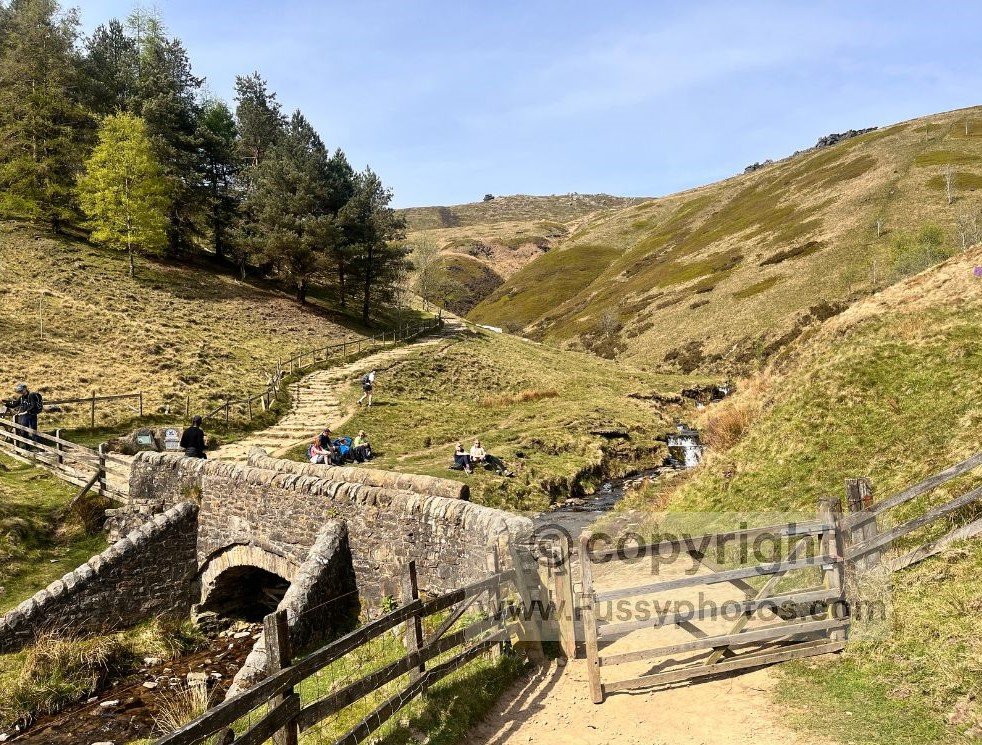
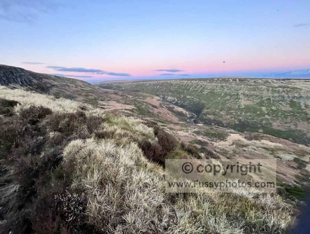
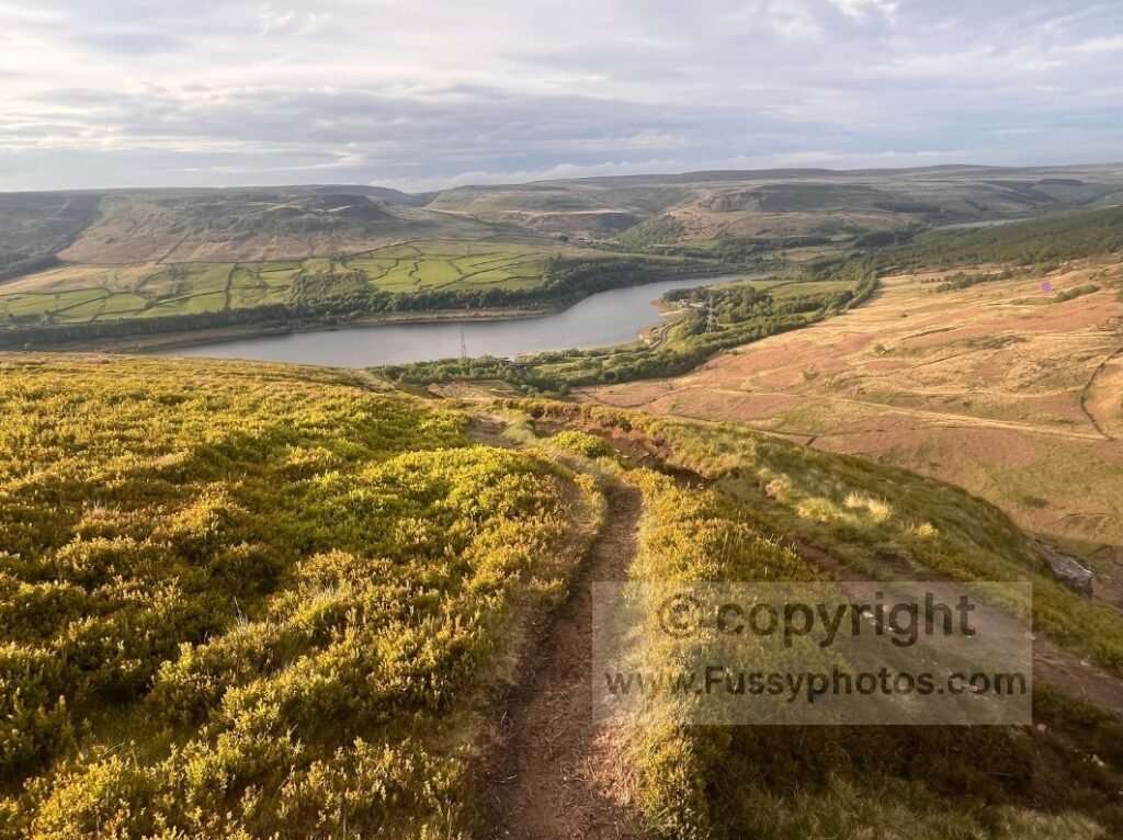
6. Clough Edge (Crowden)
The final Peak District entry is the glorious descent into Crowden via Clough Edge — a superb reward after a challenging first day on the trail and the moorland ascent to Bleaklow Head. The descent alongside Wildboar Grain and then Torside Clough guides you off the high ground to a dramatic viewpoint before dropping steeply towards the valley. Torside Reservoir, Woodhead Reservoir, and Longdendale glimmer some 240m below, and the views onwards to Laddow Rocks offer a glimpse of the excitement waiting on Day 2.
I particularly like the way the trail bends slightly northwards, giving you a final, sweeping look back into the enormous valley you’ve just spent the last mile walking above and parallel to. It’s a knee‑jarringly steep descent, but a spectacular one — and if you want to explore this area as a standalone outing, my Pennine Way Circular via Crowden & Doctor’s Gate follows the same dramatic high‑level scenery.
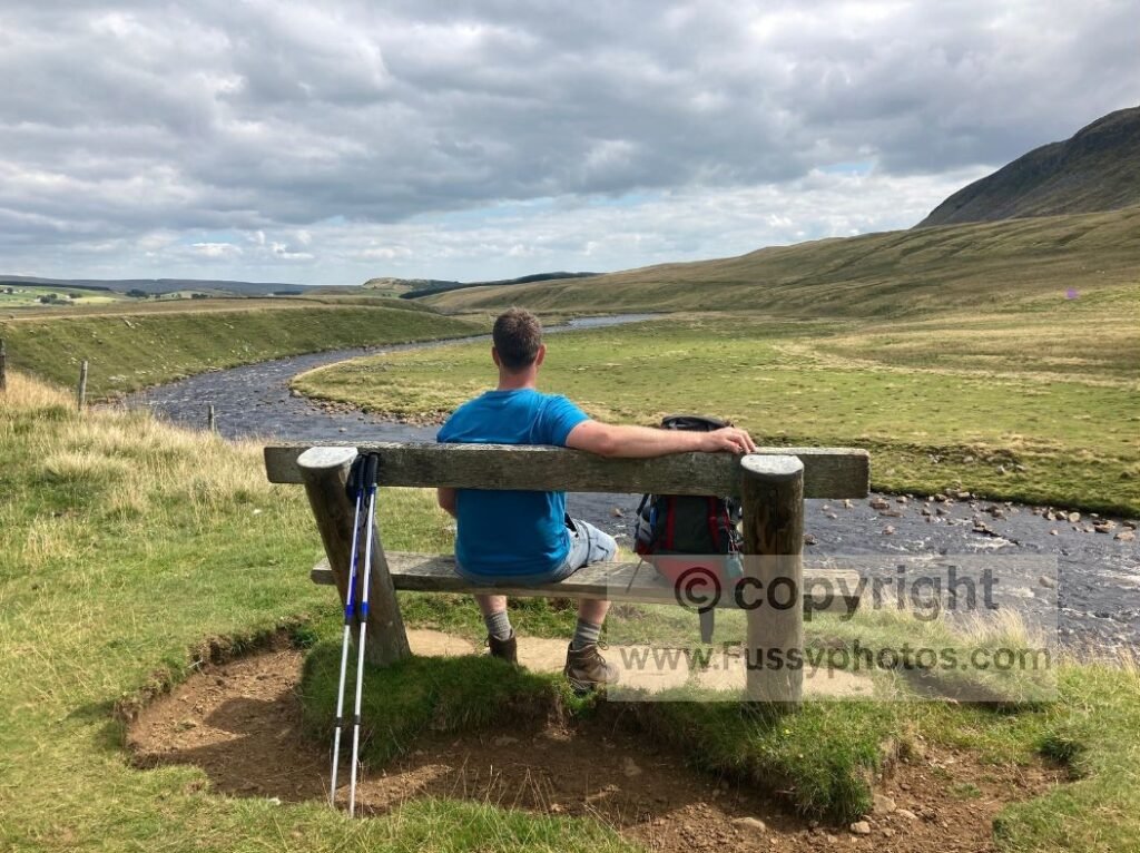
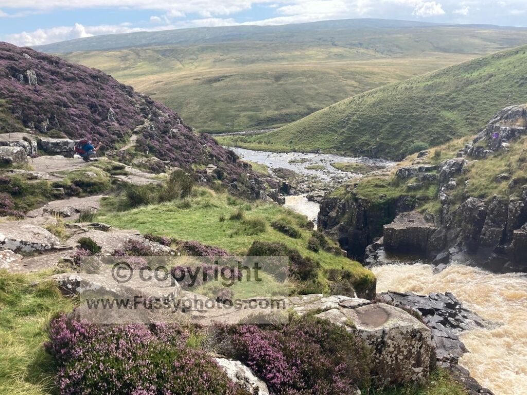
5. The River Tees
Pennine Way Gold is how the Aurum official guidebook describes Day 10: Middleton‑in‑Teesdale to Dufton, and it’s hard to argue. Experienced in August, with blooming purple heather and a heatwave rolling through the valley, the River Tees offered a cool breeze, a constant roar, and superb early waterfalls such as High Force and Low Force, plus a worthwhile minor detour to Bleabeck Force.
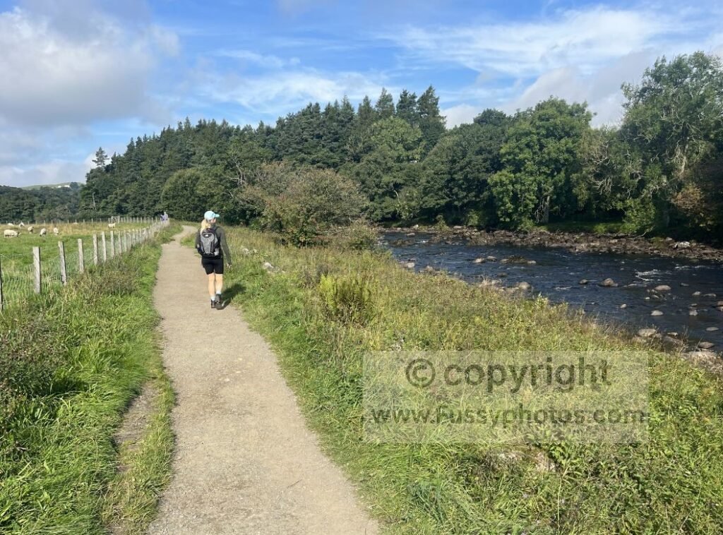
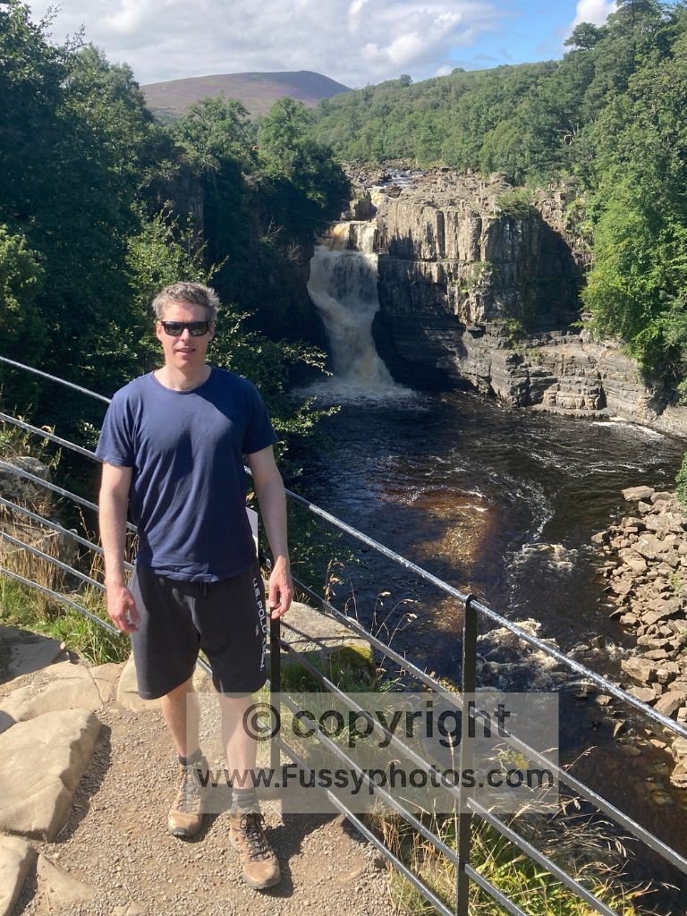
The trail then rises gently as the river meanders through a narrowing valley and into attractive farmland — a stretch so good I’ve returned twice.
It continues into a tight, V‑shaped valley where, if you didn’t already have it, you’ll finally find solitude. Cauldron Snout was in full, noisy force on my thru‑walk, finishing off a rare and memorable piece of Pennine Way river walking.
If you want the full account of this section, it’s covered in my Days 10 -12 trip report.
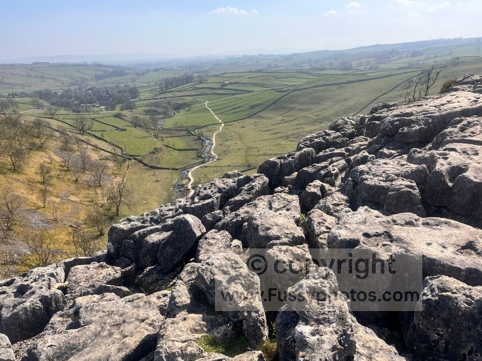
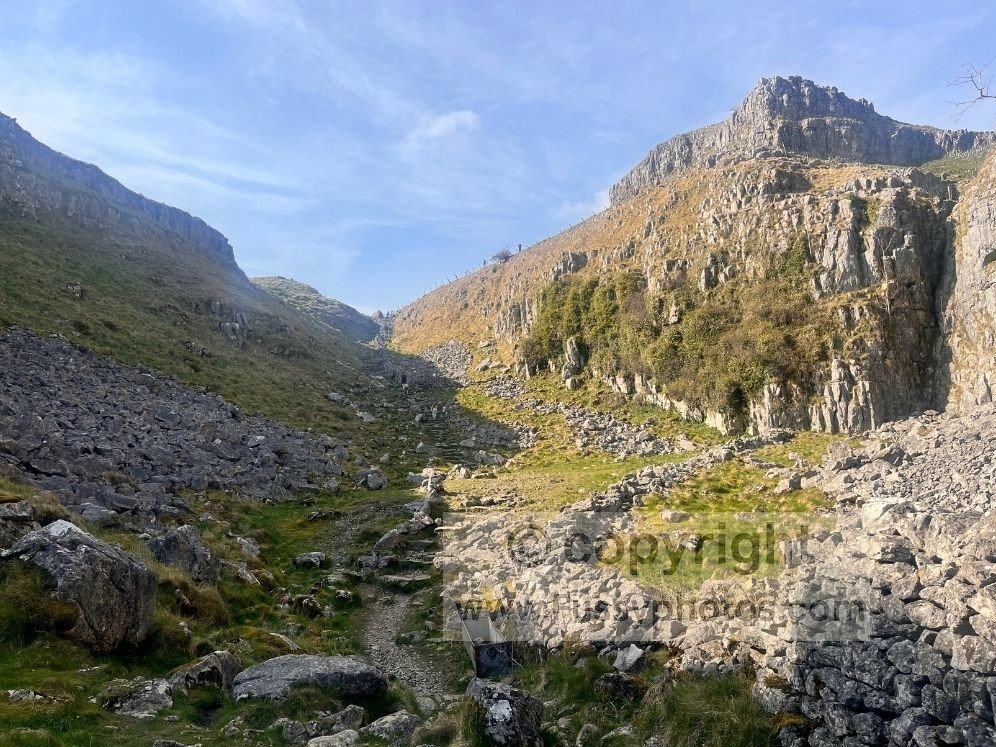
4. Malham’s Limestone Highlights
Malham marks the beginning of the Yorkshire Dales section and kicks things off with a bang. Even if you skip the optional detour to Janet’s Foss and Gordale Scar, there are still four major highlights — five if you count the only village on the trail I can remember with more than one pub.
Leaving Malham, Malham Cove, an 80‑metre‑high limestone cliff, dominates the skyline. Here, via a resurgence, water from underground appears to form Malham Beck. Steps then give you a greater sense of scale, lifting you onto the limestone pavement — another distinctive geographical feature, created by chemical weathering dissolving the joints around the limestone blocks and leaving what looks like a giant’s jigsaw of clints and grikes. It’s a superb place to explore and to peer back down towards Malham.
Then comes the impressive Ing Scar, a rugged dry valley leading you northwards before the trail switches back on itself, offering excellent views southwards down the valley.
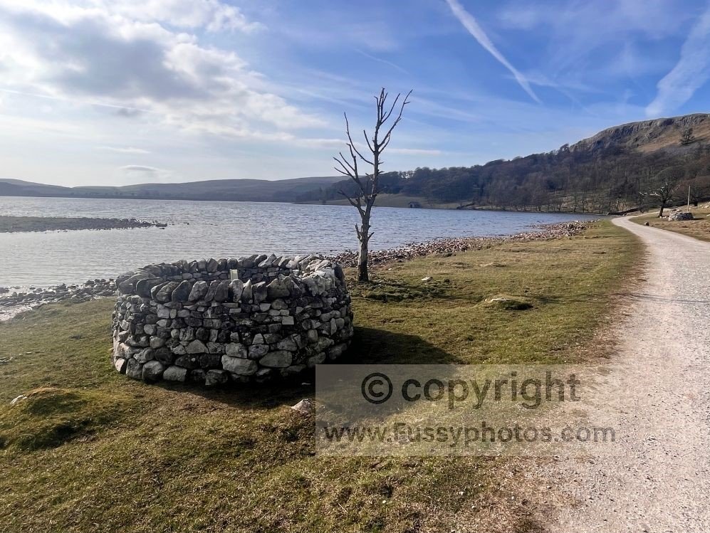
The route eventually flattens onto grassy moorland as it circumnavigates Malham Tarn, a lake left behind by the last ice age. With all that packed into the opening miles, you’re almost halfway to your first views of Pen y Ghent.
For a day walk featuring these highlights — plus Janet’s Foss and Gordale Scar — see my page Why This Malham Circular Is Better Than the Original.
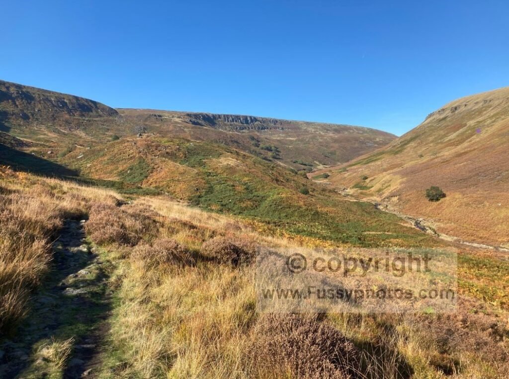
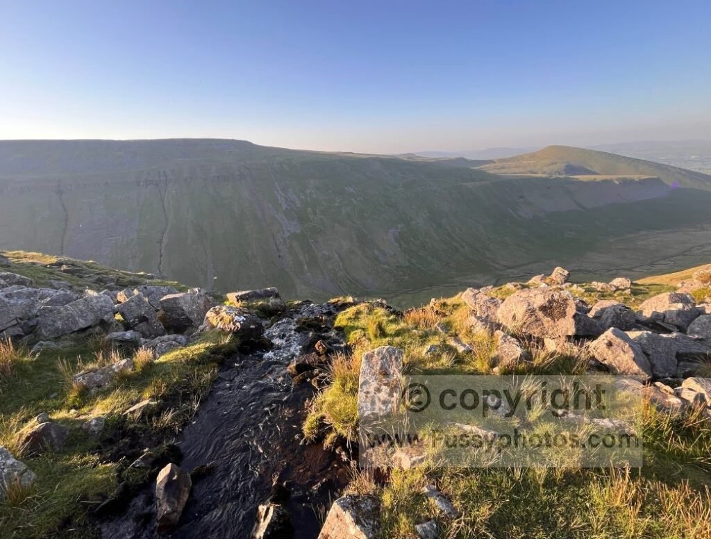
3. High Cup Nick
Reached towards the end of the 21‑mile Day 10, this vast U‑shaped valley is a fitting finale to a superb day and beautifully marks the transition from the remote moorland walking between the River Tees and this impressive glacial relict. Partially visible from afar, it’s only when you draw close that the sheer scale of the valley becomes apparent.
Despite the scree, it forms a near‑perfect U shape, made even more dramatic by the tiny misfit stream running through its centre, its straight line, and the flat farmland waiting at its end.
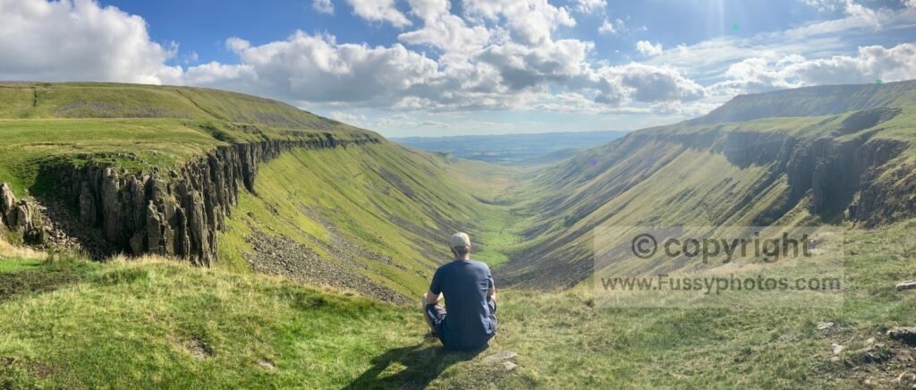
The Pennine Way then skirts along its northern edge for 1.7 miles, prolonging the moment and allowing the hanging valley to be appreciated from both top to bottom and bottom to top.
For a shorter day walk that features this dramatic hanging valley — along with the smaller but still striking Rundale Beck — see my High Cup Nick Loop via Great Rundale walk.
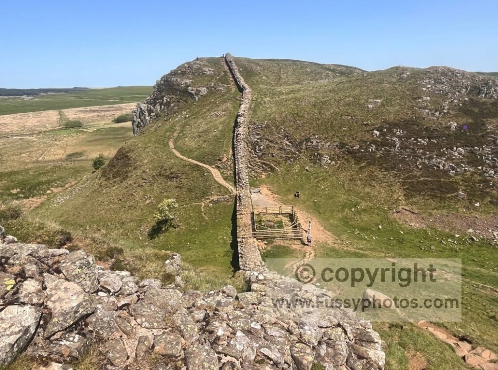
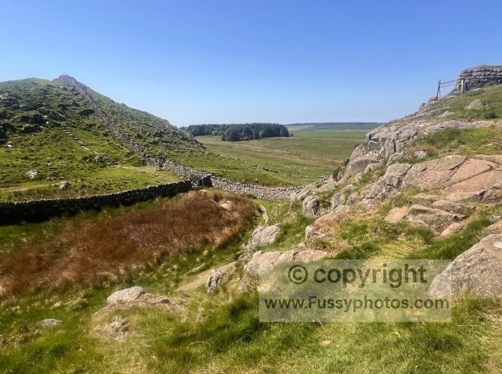
2. Hadrian’s Wall
Few places in Britain combine history and landscape as powerfully as Hadrian’s Wall — a Roman frontier running across the wild spine of northern England. From the steep escarpment at Cawfields to the high point at Winshields, the iconic dip of Sycamore Gap, and the sweeping ramparts above Housesteads, this stretch delivers some of the Wall’s most dramatic scenery in a single day.
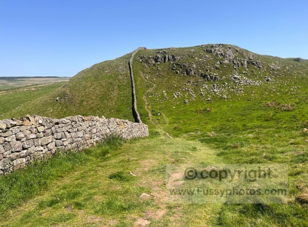
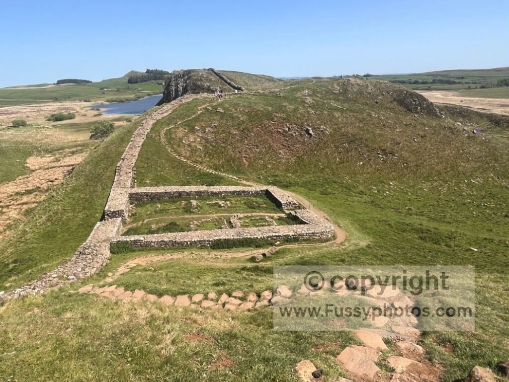
It’s a route where every mile reveals something new: rugged crags, perfectly sited milecastles, long views over Crag Lough, and the unmistakable line of the Whin Sill guiding you eastwards. It’s a section that stays long in the memory — a rare blend of history, drama and scenery that leaves a lasting impression.
If you want to see how this section fits into the final push of the trail, my Pennine Way Days 13–15 Trip Report covers the last miles from Greenhead to Kirk Yetholm in full. And if you’d prefer a shorter outing that still captures the Wall’s finest miles, my 6.5‑mile linear walk uses the AD122 bus to link Cawfields, Winshields, Sycamore Gap and Housesteads without any repetition.
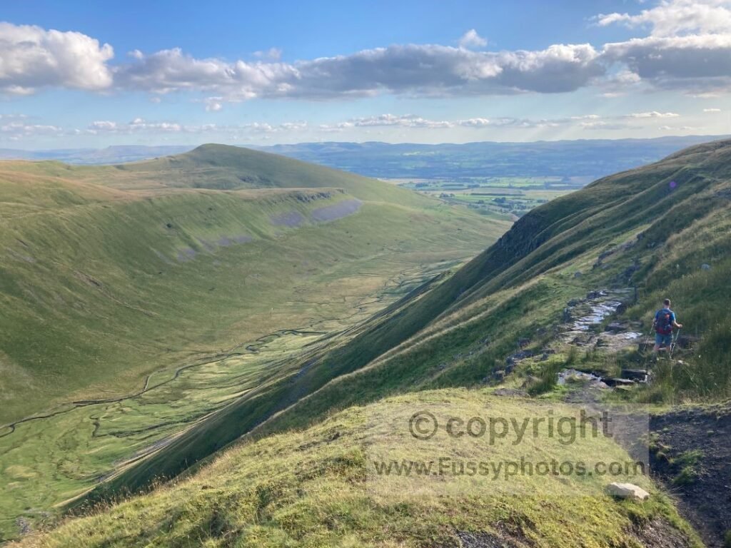
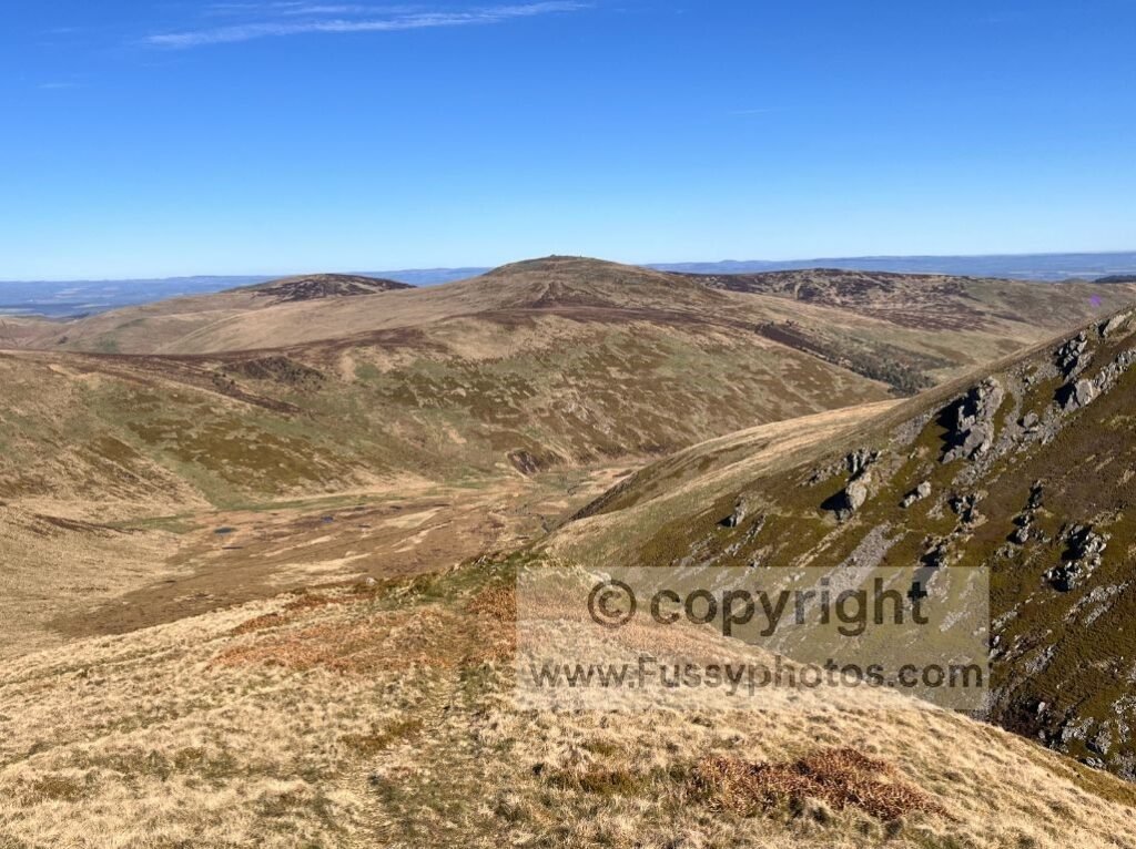
1. The Cheviots
It had to take something truly special to beat Hadrian’s Wall. Even in abysmal weather — and despite featuring strongly in my Hardest Parts of the Pennine Way (Ranked) — the final miles through the Cheviots stood out. Towards the end of a sodden 25‑mile day, with only intermittent views and the faintest hints of what beauty lay behind the cloud, I have it on film saying that this and Hadrian’s Wall were the highlights of the Way.
A recent return in fine weather, combining St Cuthbert’s Way with the last day of the Pennine Way, only confirmed it. Mile after mile of unspoilt views, rolling hills, and not another soul around. It’s hard to convey the remoteness, beauty and solitude of this little‑visited corner of northern England. The logistical challenges and sparse population make it one of the hardest parts of the Pennine Way — but they’re also its greatest strength, ensuring visitation remains minimal.
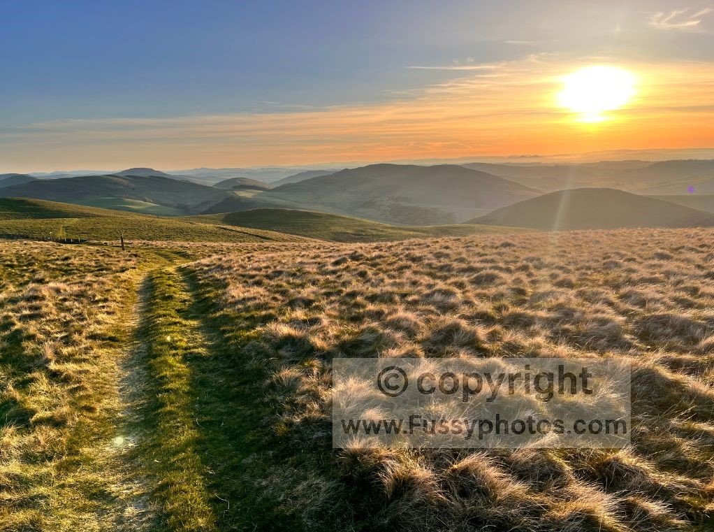
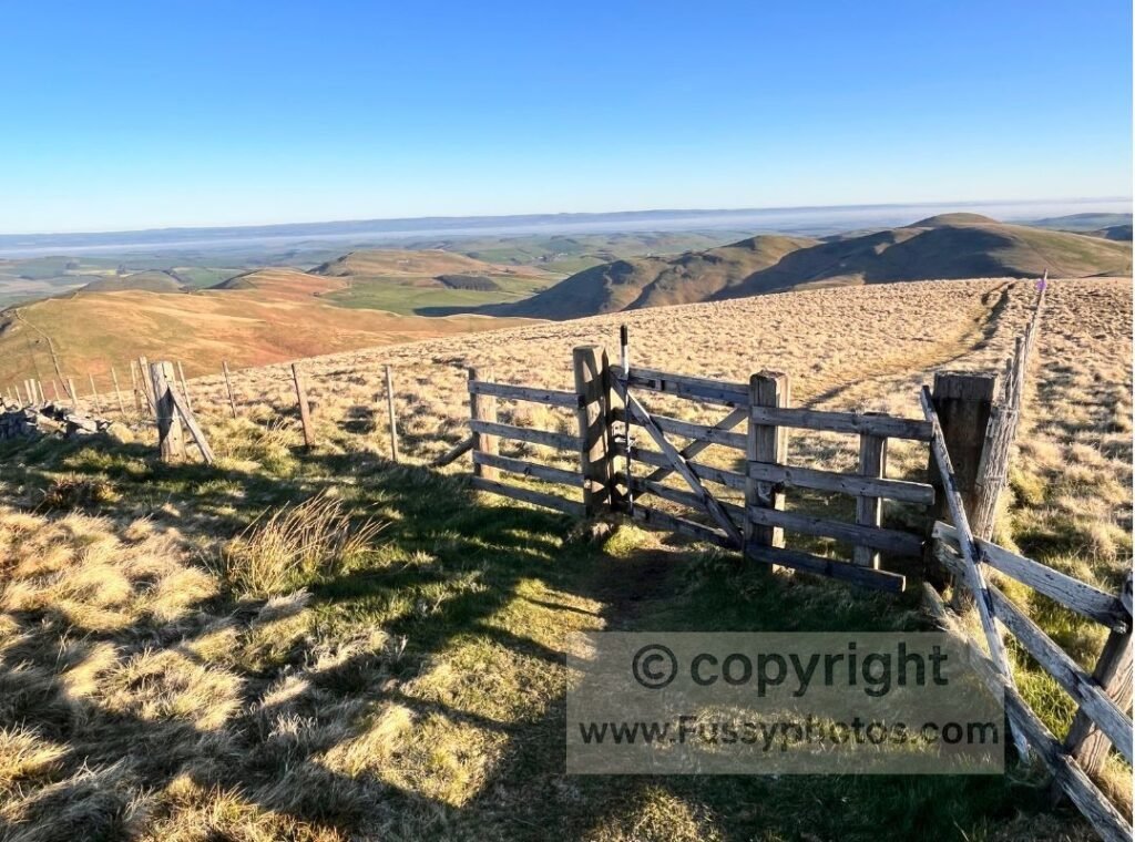
As remote an area as I’ve walked in the UK, roads are scarce, and there are no settlements for 27 miles between Byrness and Kirk Yetholm — and it’s all the better for it. A superb end to the Pennine Way. My advice is simple: pack your tent and savour the experience with a wild camp. After all, much of this stretch sits just over the border in Scotland, where the access laws mean you can settle in for the night with a clear conscience.
For a dedicated two‑day adventure in this same landscape — complete with a superb border‑ridge wild camp — see my Cheviot Weekender.
Final Word
The Pennine Way is full of tough miles, long climbs and weather that rarely behaves — but it’s also a trail overflowing with moments that stay with you long after you’ve finished. From limestone cliffs and Roman ramparts to vast glacial valleys and the quiet, rolling solitude of the Cheviots, these highlights show why the Pennine Way remains England’s most iconic long‑distance walk. Whether you’re planning the full 268 miles or picking out the sections that speak to you most, there’s no shortage of unforgettable days waiting along the spine of the country.
If you’re deciding how to tackle it, my How to Break the Pennine Way into Walkable Stages guide lays out the simplest ways to turn this legendary trail into something that fits your time, pace and ambition.
See the Top 10 Pennine Way Highlights in Motion

More Pennine Way Guides
If you’re ready to plan your own journey, my Pennine Way Hub brings everything together — beginner guides, train access, stage breakdowns, packing lists, navigation advice and even beginner‑friendly weekend tasters to help you shape the walk that suits you best.