Overview of Day 6
A long, quiet and scenic reverse‑direction day from Keld to Sunbiggin, climbing through Whitsun Dale, crossing the moors to Nine Standards Rigg, descending into Kirkby Stephen, then pushing west over farmland and open moorland to reach the honesty‑box rest point and walker‑only camping at Sunbiggin Farm.
Key Facts
- Distance walked — 21 miles total, combining moorland, valley, farmland and town sections.
- Time on trail — 11 hours of continuous movement with minimal rest.
- Start point — Keld
- Whitsun Dale section — Quiet, scenic valley forming the warm‑up to the moorland.
- Route choices above Nine Standards — Full details offered for the paving‑stone ascent, White Mossy line, and Rollinson Gill alternative.
- Weather window — Rare Lake District conditions influencing the decision to continue the trail.
- Kirkby Stephen stop — Lunch at The Mulberry Bush
- Final miles — Quiet farmland, Smardale, Settle–Carlisle railway, finishing at Sunbiggin accommodation.
Route Map Keld – Sunbiggin
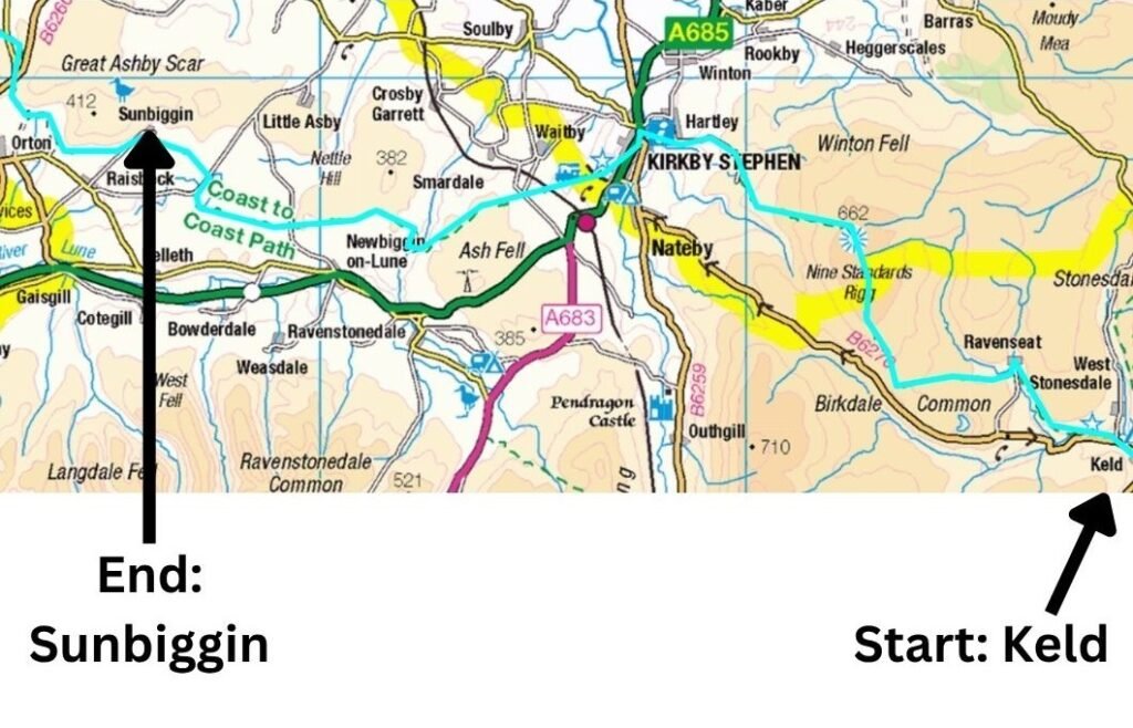
If you’d like to explore the official route in more detail, you can view the interactive National Trails map here
Coast to Coast (Reverse) — Stage Index
This guide is part of my reverse Coast to Coast series — you can follow every stage using the index below.
- Day 1: Robin Hood’s Bay → Egton Bridge
- Day 2: Egton Bridge → Charlton Bank
- Day 3: Charlton Bank – Danby Wiske
- Day 4: Danby Wiske – Richmond
- Day 5: Richmond – Reeth – Keld
- Day 7: Sunbiggin – Angle Tarn Camp
- Day 8: Angle Tarn to Rosthwaite
- Day 9: Rosthwaite to Ennerdale Bridge
Deciding Whether to Stick or Twist
Leaving Keld, I knew the next ten miles to Kirkby Stephen would force a decision: stay on the Coast to Coast Path for the remaining 77 miles, or leave the trail and return to the Lake District for a final finale. The trail crosses very few train lines, and Kirkby Stephen would be my last realistic exit point until St Bees.
For a full guide to reaching every stage of the Coast to Coast, including the strongest rail and bus links, see Coast to Coast Transport: How to Reach Every Stage. And if you’re planning to walk the route in sections, see How to Split the Coast to Coast Into Sections.
Fitness wasn’t the issue — my legs felt fresh — but my feet were beginning to protest. I rarely get blisters, yet the intense heat combined with my usual thick winter socks meant my feet were overheating daily. That or eleven to twelve hours of tarmac, rock and pebble under a full pack were beginning to make their presence felt.
Watch Day 6: Keld – Sunbiggin

Breaking Camp in Keld
I woke early, as I always do when camping, and began packing immediately. Thick swarms of midges descended, and being the only person awake, I was their sole target. Later, while filling my water bottles, another early riser approached, laughing. She’d seen me dancing around like someone attempting a one‑man ceilidh without any of the rhythm and suggested I pick up bug spray in Kirkby Stephen.
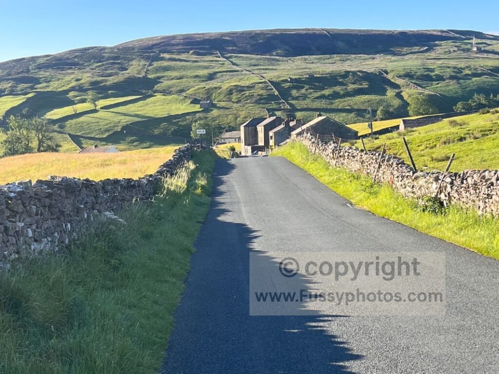
Keld was already in full sunshine as I set off. The day began with inevitable road walking through a side of Swaledale I’d never seen before, until the trail left the road and climbed sharply west at right angles to a steep slope. Ironically, I found myself pining for the parallel road below — half a mile of easy walking I’d willingly have taken over the awkward trail.
Towards How Edge Scars
The trail curved northwest, leaving the River Swale for the final time and heading towards How Edge Scars. The scenery was calm and quintessentially Yorkshire Dales on the left, while the valley ahead rose gently. It felt like the perfect moment to stop and cook breakfast.
Beyond this, the trail briefly turned boggy — my first real bog experience on the Coast to Coast, despite the dry conditions. The valley narrowed, the brook rose to just below trail level, and its presence was a welcome companion for the final half‑mile to Whitsun Dale and flatter ground.
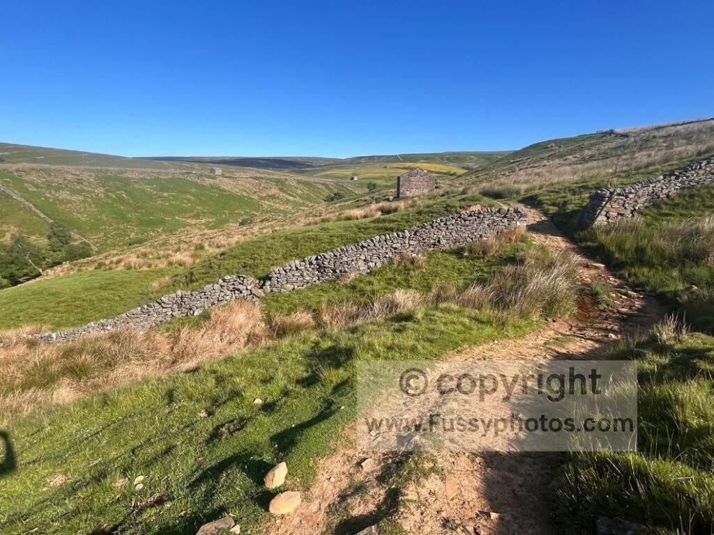
Again, I reflected on the solitude my early start and east‑west direction had given me.
A Quiet Valley Pause
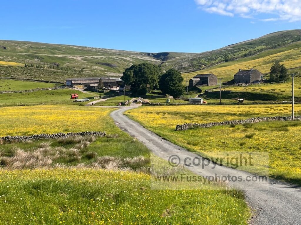
At the end of the valley, the route pivoted southwest along the flat upper section past a farm. A stone arched bridge and picnic benches appeared — unclear whether they belonged to the farm or were intended for walkers. I assumed the latter and sat down to soak it all in.
Continuing, the road remained the correct route. I briefly confused myself looking for the westbound trail, but it’s signposted and leaves the road about five minutes south of the farm.
Choosing a Route to Nine Standards Rigg
This section offers alternative routes to Nine Standards Rigg, though you’d never know it from signage. My guidebook explained the choices — mainly to manage erosion, though some are preferable in poor visibility.
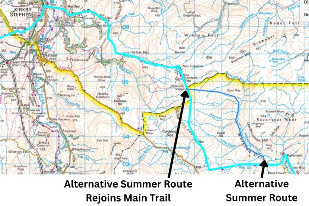
Option A (my preference):
Leave the trail almost immediately northwards along Whitsundale Beck, merging later with a second route across the moorland before a sharp turn north along newly installed paving stones towards White Mossy Hill and Nine Standards Rigg .
Route A Map Extract — Whitsundale Beck Line to Nine Standards Rigg
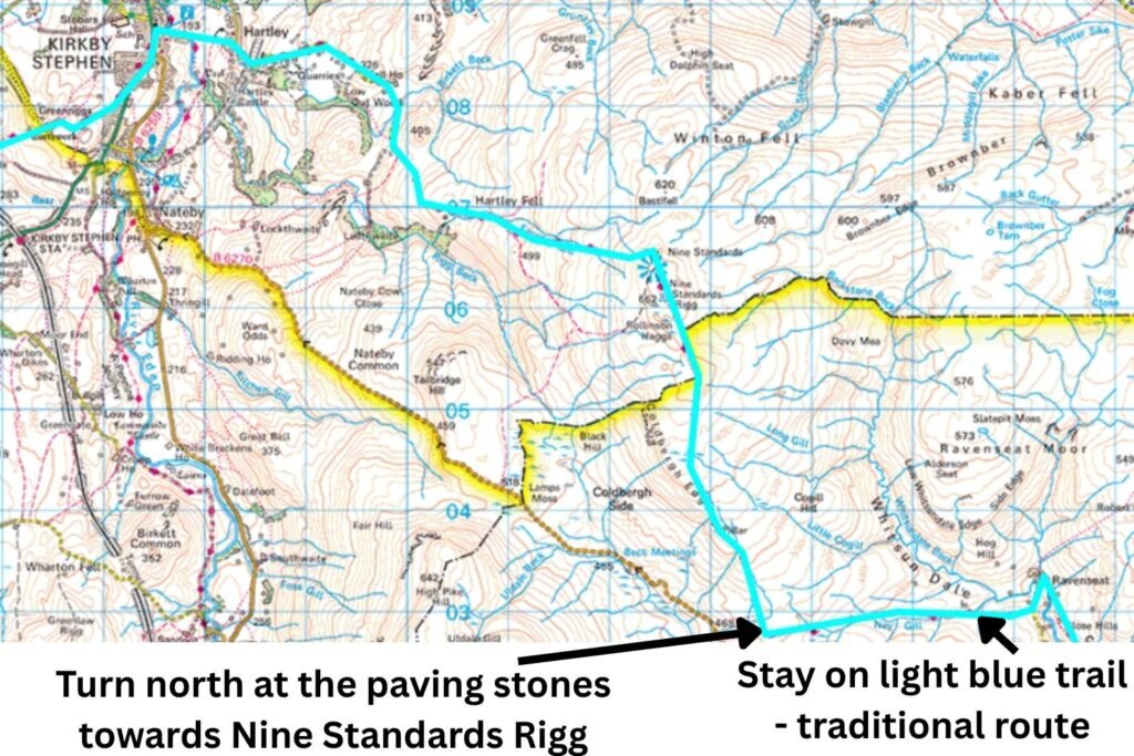
Option B — Paving‑stone ascent
Continue westwards, then take the new paving stones north towards Nine Standards Rigg and White Mossy.
Route B Map Extract — Birkdale Common Line to Nine Standards Rigg
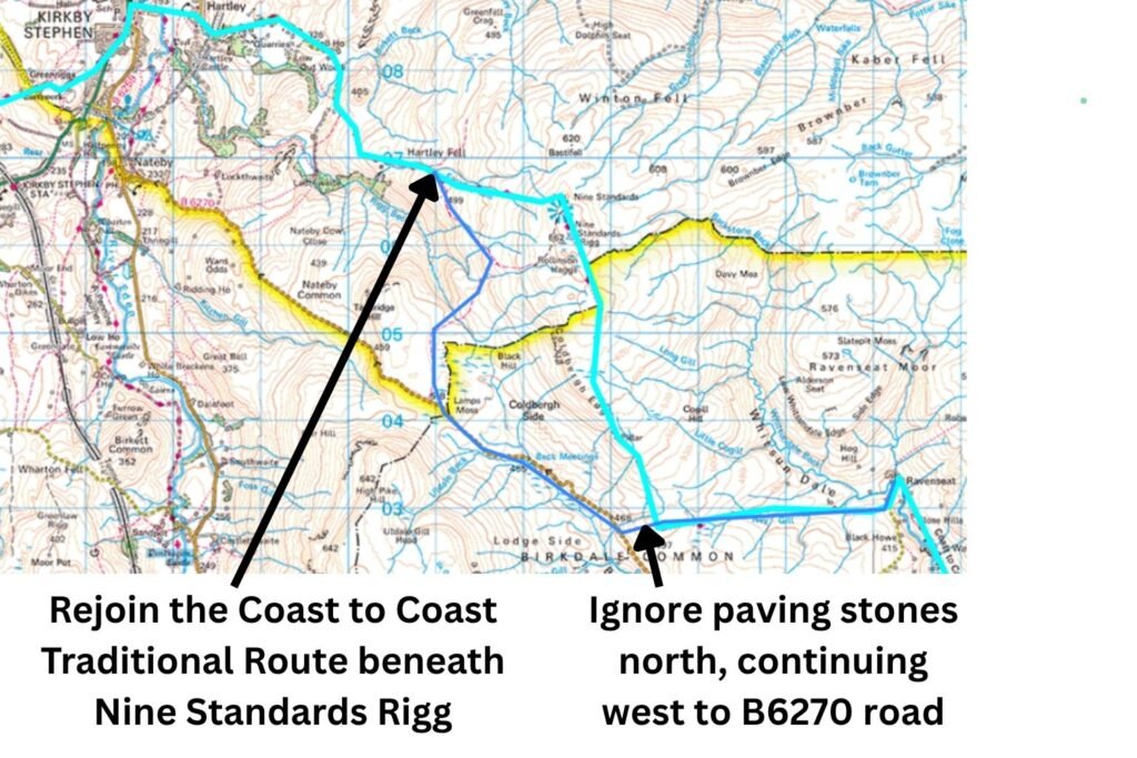
Option C — Rollinson Gill alternative
Continue westwards, ignore the paving stones, reach the B6270, then follow Rollinson Gill northwards — avoiding Nine Standards Rigg entirely.
I was so lost in thought, and later concentrating on bog‑hopping, that I completely missed my preferred right turn. I didn’t see signage or even the faintest hint of a trail.
Route C Map Extract — Hartley Fell / Rollinson Hag Line to Nine Standards Rigg
What Route B Looks Like on the Ground
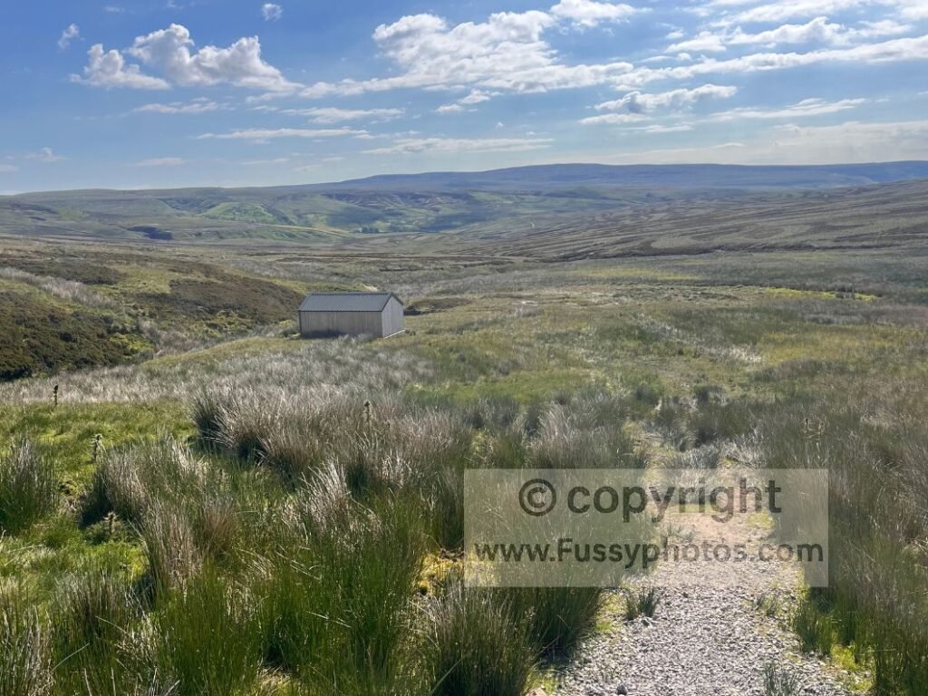
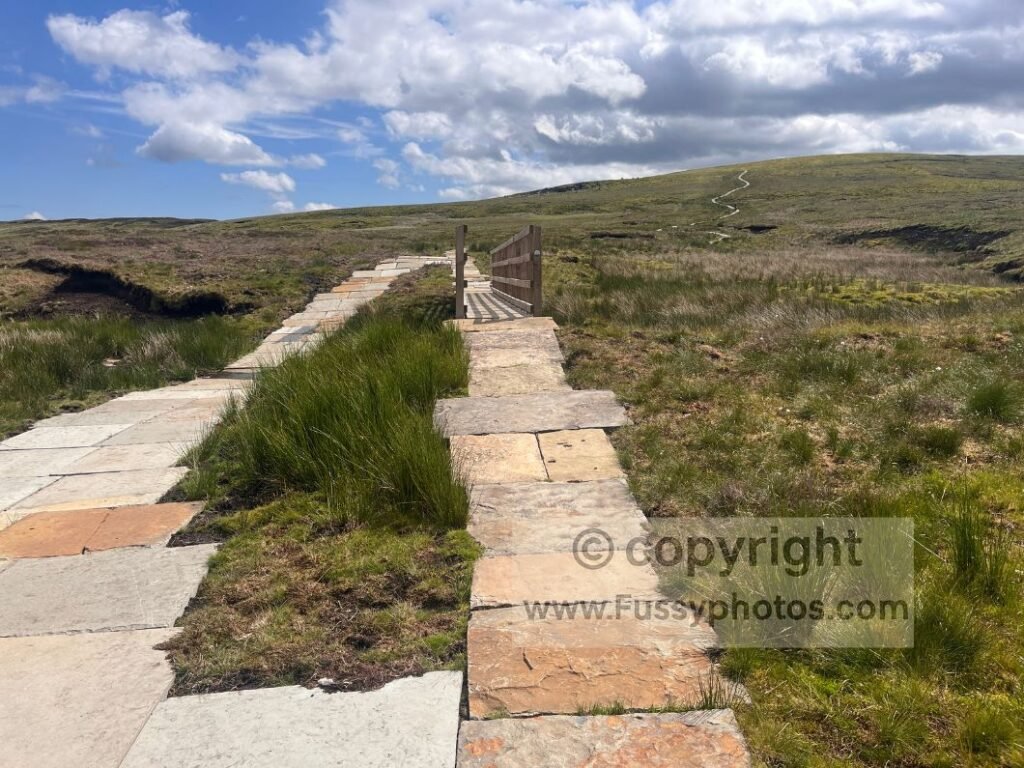
Only when I reached the right turn for the paving stones 1.6 miles later did I realise my mistake. After 50 minutes of bogs, the sight of paving stones was a relief — faster miles and easy navigation so I had little regret.
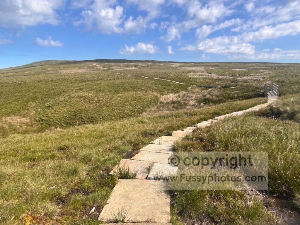
Lady Dyke Head and First Views of the Lakes
I reached Lady Dyke Head (620m) quickly, dropped my pack, and sat on a rocky outcrop overlooking Birkdale Common, pondering where that missed junction must have been. Visibility was excellent, and to the west I thought I could make out the peaks of the Lake District, another day’s walk away.
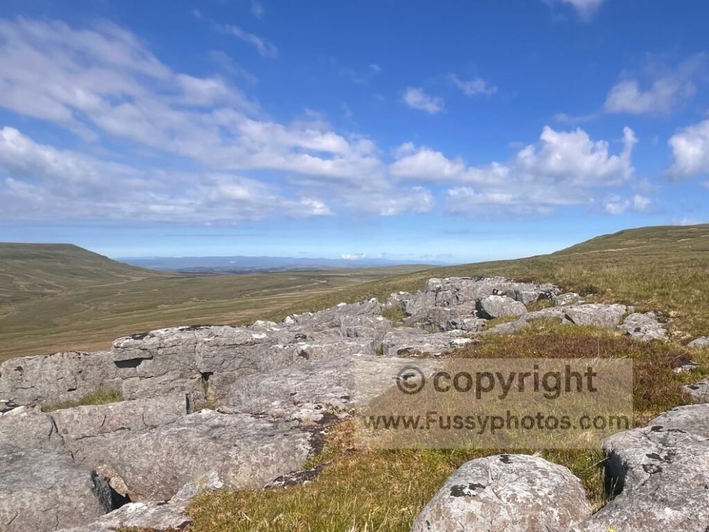
Here I met my first west‑east walker of the day — another lone walker. She’d started in heavy rain and poor visibility, missing out on the great views across the Lakes, mirroring my own experience months earlier when I’d summited Helvellyn in 30‑metre visibility, shuffling around like someone hoping the mist might eventually take pity and reveal a ridge.
I mentioned my feet and my possible plan to leave the trail; she suggested a rest day in Kirkby Stephen — two nights in a hotel doing nothing but sleep and read. It’s a great idea for walkers doing the full trail in one continuous stretch, but having already completed the Yorkshire Moors in spring and this being only my third day on the Coast to Coast, I knew it was good advice I wouldn’t take. Conversely, it shifted the dial in favour of finishing the trail rather than heading home — I’d been watching the weather in the Lake District for the best part of half a year, and I’d never get a window like this again.
Approaching Nine Standards Rigg
Continuing north, I reached the junction where the Whitsundale Beck alternative would have rejoined the paving stones — another example of west‑east navigation proving easier than the reverse.
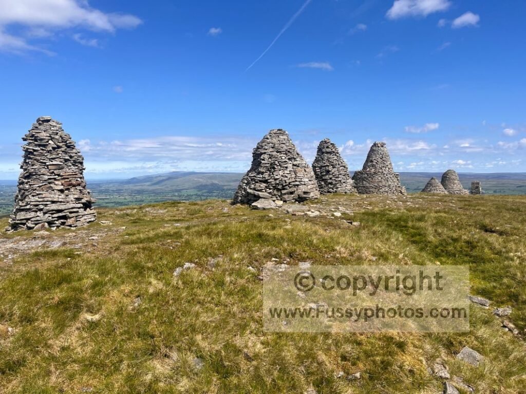
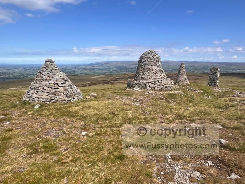
Five minutes later, the terrain dropped away to the west, revealing long north‑south views between the Lake District and the Pennines. Nine Standards Rigg (662m) appeared on the horizon. The sense of freedom and visibility lifted my spirits and reaffirmed my gut feeling to finish the trail in this superb weather window.
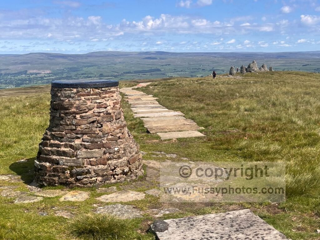
On first sight, I assumed the cairns were ancient industrial relics. In fact, the Nine Standards have stood above Kirkby Stephen for at least 500 years and probably closer to 800, appearing in 16th‑century maps long before modern surveying. Their true origin remains unknown — theories range from medieval waymarkers to far older pre‑Conquest boundary cairns — but no archaeology has ever confirmed a definitive story.
If you’d like to see how Nine Standards Rigg fits alongside the trail’s other standout moments — from the Lake District passes to the Cleveland Hills ridge — you’ll find them all in my Top 10 Highlights of the Coast to Coast.
Descent to Kirkby Stephen
At the cairns, I paused for photos just as a stream of eastbound walkers arrived, having climbed the 3.5 miles from Kirkby Stephen. I chatted to one who confirmed there were plenty of lunch options in town and recommended The Mulberry Bush café.
The descent to Kirkby Stephen is long. Paving stones help initially, but soon a knee‑jarring drop leads to a farmer’s track. It reminded me of descending Pen y Ghent to Horton on the Pennine Way — the hard work done, but the long walk out still ahead. Even with paving stones and road walking, it took me over an hour and a half. Again, the thought of rolling down the hill on a bike crossed my mind.
Food Choices in Kirkby Stephen
In town, a dog walker noted I wasn’t local (the 10kg backpack and exhausted expression probably gave it away) and directed me to the centre. I wanted a pub lunch, but his recommendation felt soulless, so I quickly left and headed straight for The Mulberry Bush. The food was mediocre, but the atmosphere lively — full of walkers, bikers and locals. After demolishing a three‑course meal, I felt human again.
Planning the Evening: Orton or a Wild Camp?
I studied my map for places to stay. Continuing with 20‑mile days would get me to St Bees within the weather window and before family commitments. But ten miles west of Kirkby Stephen offered little. The guidebook breaks this section into a 20‑mile stage from Shap to Kirkby Stephen for eastbound walkers. Orton lay 11.5 miles west, but I hadn’t booked accommodation — and I was carrying full camping gear. I was determined that all that weight wouldn’t be for just a night or two.
Smardale Bridge and Scandal Beck
The trail west left town through alleyways and a housing estate before climbing farmland and passing under the Settle–Carlisle railway.
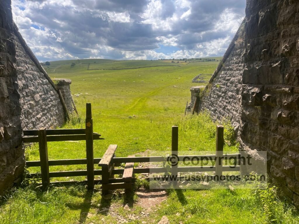
The mountains to the west looked impressive. The trail ran between endless fields of sheep before reaching Smardale Bridge and Scandal Beck — a picturesque valley of dry‑stone walls, stone bridges and the hidden Smardalegill Viaduct. The scenery made the up‑and‑down worthwhile.
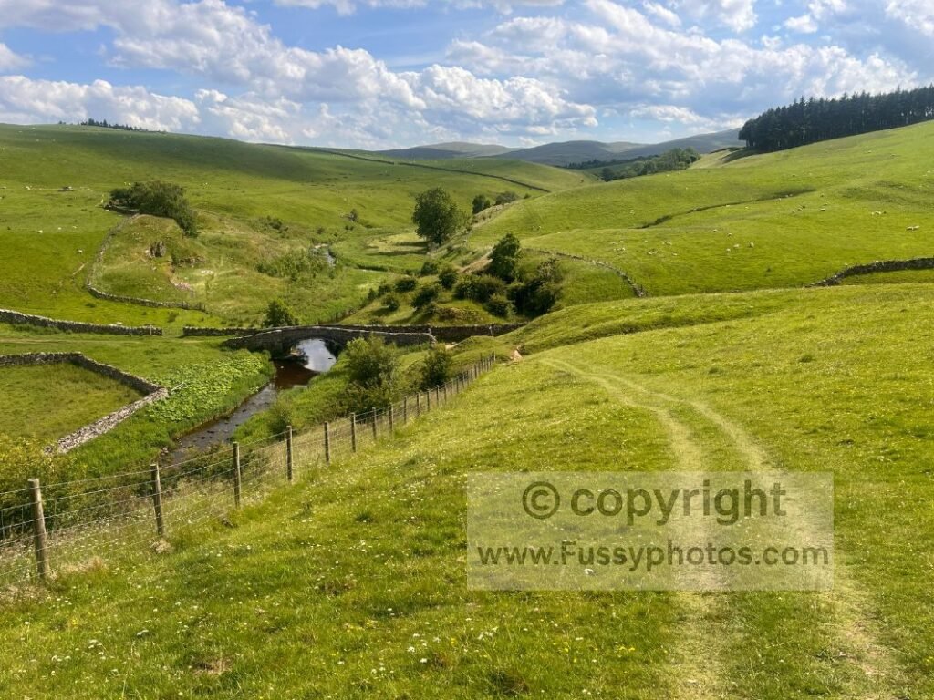
I sat to rest and a couple walking the Coast to Coast joined me for a chat. I assured them the valley ahead was scenic and that after a short uphill it was downhill all the way to Kirkby Stephen. In return, they told me about Sunbiggin Café, a rest point on a working farm with an honesty box — and importantly, a sign advertising camping. Perfect: halfway between Kirkby Stephen and Shap, with water available.
Towards Sunbiggin Tarn
I power‑walked as much as my feet allowed, covering mile after mile of moorland and sheep — terrain that flies by with company but feels endless alone. Just before Sunbiggin Tarn, I passed what looked like a fly‑tipped fridge. Tutting loudly, I discovered an honesty box inside — a useful top‑up spot in an otherwise empty landscape.
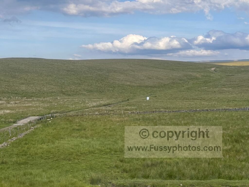
The trail doesn’t get close to Sunbiggin Tarn, and with mountain tarns ahead in the Lakes, I moved on quickly. About 1.5 miles remained to the farm. A short stretch of signed road walking led to Tarn Moor, where my map showed one trail but my eyes saw three. Despite using GPS, a little moor‑hopping was needed — more fiddly navigation that clearer signage could solve.
Camping at Sunbiggin Farm
I reached the farm at 7pm. The rest point had chairs and a table, and the honesty box sat inside a large unlocked shed. But camping wasn’t obvious. I found a sign with a phone number, rang it, and reached a bizarre voicemail service. I left a message, but my hopes dropped. I sat at the table, drank my drink, and scoured the internet for options — Orton now tempting or a wild camp becoming a real possibility.
Twenty minutes later, a farmer walked past. I called out, asked about camping, and long story short — there is camping.
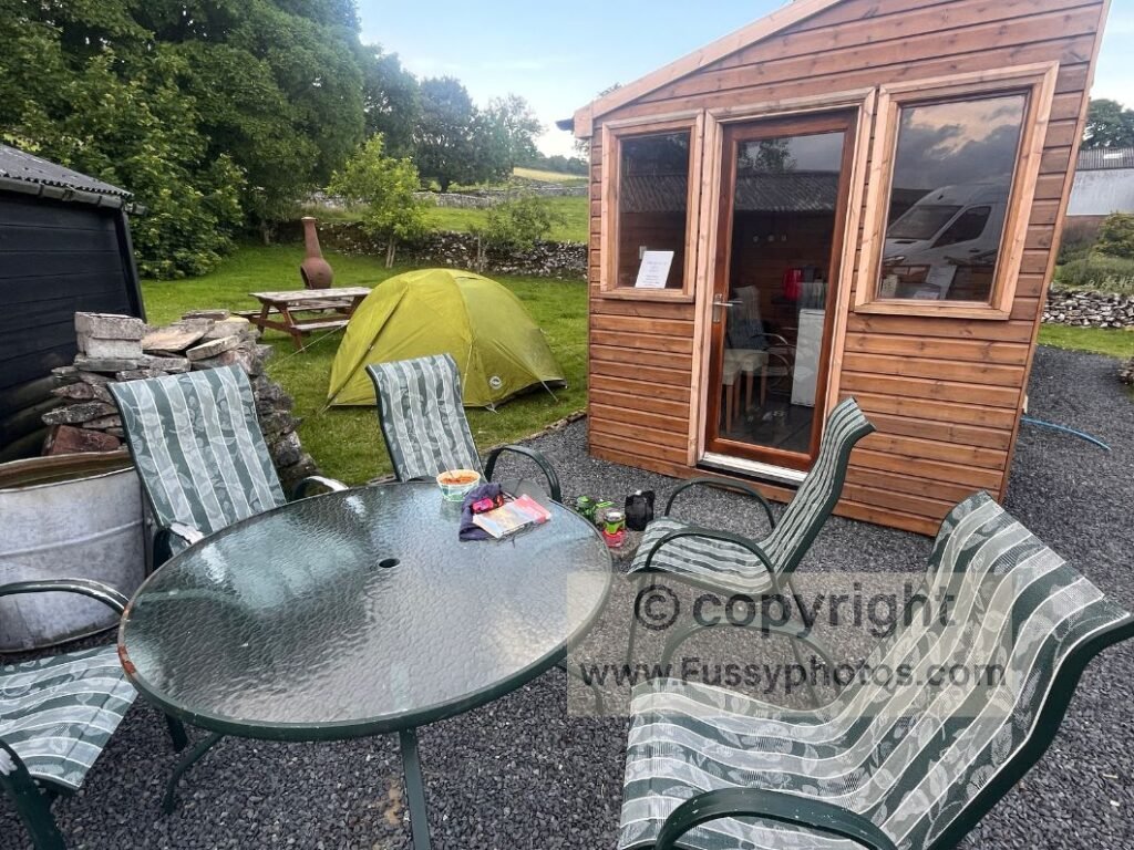
Andrew, the farm owner, was extremely helpful. He answered my questions about the trail ahead, then showed me a communal kitchen with a washing machine, dryer, sink, kettle, freezer meals and a microwave. He also offered a wake‑up call and explained he only allows through‑walkers to camp. Andrew also gave great advice about looking after my feet — more on that on Day 7.
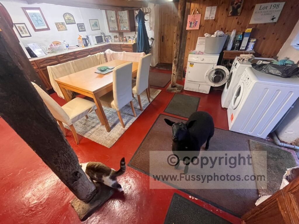
I cooked some of my own food, lightened my pack, took a shower and pitched up. It’s a real gem — one I’m happy to recommend (no commission): Sunbiggin Farm Camping & Bunkhouse
If you’re preparing for long mixed‑terrain days like this — especially if you’re camping, managing pack weight, cooking at rest points or dealing with midges, heat and long mileage — you’ll find a full breakdown of what to bring in How to Pack for the Coast to Coast.
Silly FAQs
Do the midges in Keld give a warm welcome?
Warmly is one word. Enthusiastically is another. I was the only warm object in the valley, so they held a small festival.
Was choosing between three Nine Standards routes straightforward?
Only if you enjoy standing on a moor debating whether you prefer bog, more bog, or slightly different bog.
Did I really need a rest day in Kirkby Stephen?
Probably. But the weather was good, and I’m powered almost entirely by poor decisions.
Was The Mulberry Bush the best food in town?
No. But it was the nearest place serving calories, which is all I required at that point.
Was finishing the day satisfying?
Absolutely. Nothing beats arriving at Sunbiggin knowing you’ve earned every calorie you’re about to consume.
Continue to Day 7 on the Coast to Coast
Next →
Coast to Coast Guides & Trip Reports
All Coast to Coast guides, highlights and stage reports are collected on the main hub page.